|
State Of Mysore
Mysore State, colloquially Old Mysore, was a state within the Dominion of India and the later Republic of India from 1947 until 1956. The state was formed by renaming the Kingdom of Mysore, and Bangalore replaced Mysore as the state's capital. When Parliament passed the States Reorganisation Act in 1956, Mysore State was considerably enlarged when it became a linguistically homogeneous Kannada-speaking state within the Republic of India by incorporating territories from Andhra State, Bombay State, Coorg State, Hyderabad State, and Madras State, as well as other petty fiefdoms. It was subsequently renamed Karnataka in 1973. History The Kingdom of Mysore was one of the three largest princely states in British India. Upon India's independence from Britain in 1947, Maharaja Jayachamarajendra Wadiyar signed the instrument of accession, incorporating his realm with the Union of India, on 15 August 1947. The territories of the erstwhile princely state of Mysore were then rec ... [...More Info...] [...Related Items...] OR: [Wikipedia] [Google] [Baidu] |
Princely State
A princely state (also called native state or Indian state) was a nominally sovereign entity of the British Raj, British Indian Empire that was not directly governed by the British, but rather by an Indian ruler under a form of indirect rule, subject to a subsidiary alliance and the suzerainty or paramountcy of the the Crown, British crown. There were officially 565 princely states when India and Pakistan became independent in 1947, but the great majority had contracted with the viceroy to provide public services and tax collection. Only 21 had actual state governments, and only four were large (Hyderabad State, Mysore State, Kashmir and Jammu (princely state), Jammu and Kashmir State, and Baroda State). They Instrument of accession, acceded to one of the two new independent nations between 1947 and 1949. All the princes were eventually pensioned off. At the time of the British withdrawal, 565 princely states were officially recognised in the Indian subcontinent, apart from t ... [...More Info...] [...Related Items...] OR: [Wikipedia] [Google] [Baidu] |
Madras State
Madras State was a state of India during the mid-20th century. At the time of its formation in 1950, it included the whole of present-day Tamil Nadu (except Kanyakumari district), Coastal Andhra, Rayalaseema, the Malabar region of North and central Kerala, Bellary, South Canara and Kollegal. Coastal Andhra and Rayalaseema were separated to form Andhra State in 1953, while South Canara and Bellary districts along with the Kollegalam taluka of Coimbatore district were merged with Mysore State, and Malabar District with the State of Travancore-Cochin to form Kerala in 1956. Post State Reorganization in 1956, the remaining Madras State was renamed to Tamil Nadu on January 14, 1969. History After Indian Independence, the Madras Presidency became the Madras Province on 15 August 1947. On 26 January 1950, it was formed as Madras State by the Government of India. As a result of the 1956 States Reorganisation Act, the state's boundaries were re-organized following linguistic line ... [...More Info...] [...Related Items...] OR: [Wikipedia] [Google] [Baidu] |
South Canara
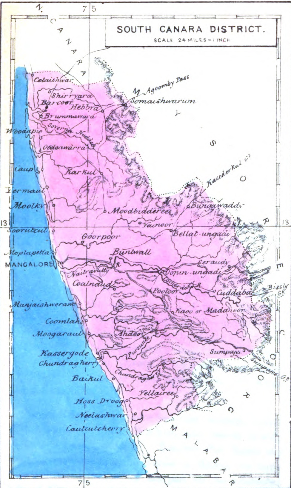
South Canara was a district of the Madras Presidency of British India, located at . It comprised the towns of Kassergode and Udipi and adjacent villages, with the capital in Mangalore city. South Canara was one of the most heterogeneous areas of Madras Presidency, with Tulu, Malayalam, Kannada, Konkani, Marathi, Urdu, and Beary languages being spoken side by side. It was succeeded by the Tulu-speaking areas of Dakshina Kannada district, the Malayalam-speaking area of Kasaragod district and the Amindivi islands sub-division of the Laccadives, in the year 1956. Geography Mangalore was the administrative headquarters of the district. The district covered an area of . South Canara District was bordered by North Canara to north, the princely state of Mysore to east, Coorg state to southeast, Malabar District to south, and Arabian Sea to west. South Canara was one of the two districts on the western coast (Malabar coast) of Madras Presidency along with Malabar District (otherwi ... [...More Info...] [...Related Items...] OR: [Wikipedia] [Google] [Baidu] |
Bellary District
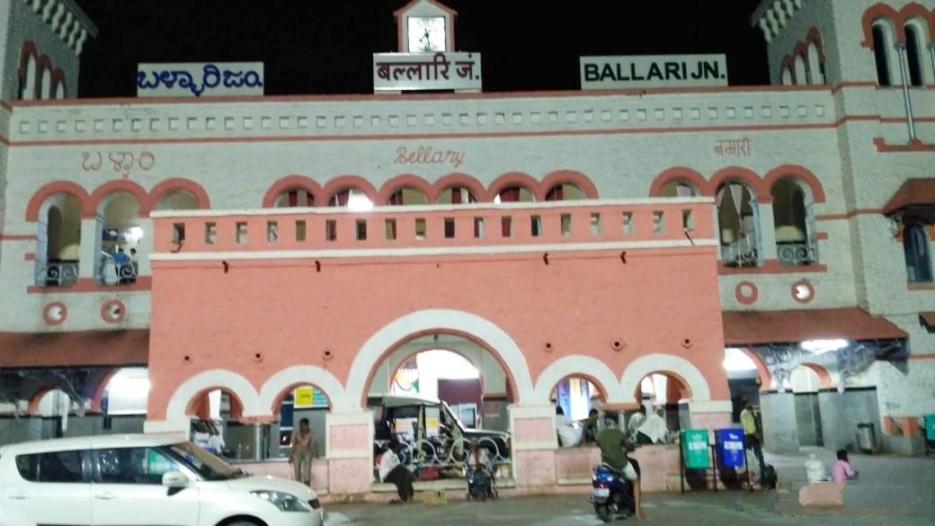
Bellary, officially known as Ballari (pronounced ), is a major district in Karnataka. It is located at north-eastern part of Karnataka. This district belongs to Kalyana-Karnataka. This district was one of the biggest districts in Karnataka until the Vijayanagara district was carved out of Ballari district in 2021 officially. This district has the highest deposits of iron ore in India. Historical sites, farm land and rich minerals characterize Ballari district. Recently making headlines with mining industry, Ballari, the district's capital, is known as Steel City and Gani Nadu (City of Mining). History Earlier Ballari district was part of Madras presidency. The area was severely affected by the Great Famine of 1876–78. After Indian independence, when the Indian states were reorganized along linguistic lines, Ballari became part of the Kalyana-Karnataka region of the state of Karnataka, now renamed as Kalyana-Karnataka. In 1882, Anantapur District was formed by carving ou ... [...More Info...] [...Related Items...] OR: [Wikipedia] [Google] [Baidu] |
Uttara Kannada
Uttara Kannada is a district in the Indian state of Karnataka. Uttara Kannada District is a major coastal district of Karnataka, and currently holding the title of the largest district in Karnataka. It is bordered by the state of Goa and Belagavi districts to the north, Dharwad District and Haveri District to the east, Shivamogga District, and Udupi District to the south, and the Arabian Sea to the west. Karwar is the district and headquarters, Kumta & Sirsi are the one of major commercial centers in the district. The district's agroclimatic divisions include the coastal plain (consisting of Karwar, Ankola, Kumta, Honnavar and Bhatkal taluks) and Malenadu (consisting of Sirsi, Siddapur, Yellapur, Haliyal, Joida, and Mundgod taluks). History The first known dynasty from Uttar Kannada District are Chutus of Banavasi. Uttara Kannada was the home of the Kadamba kingdom from the 350 to 525. They ruled from Banavasi. After the subjugation of the Kadambas by the Chalukya ... [...More Info...] [...Related Items...] OR: [Wikipedia] [Google] [Baidu] |
Dharwad District
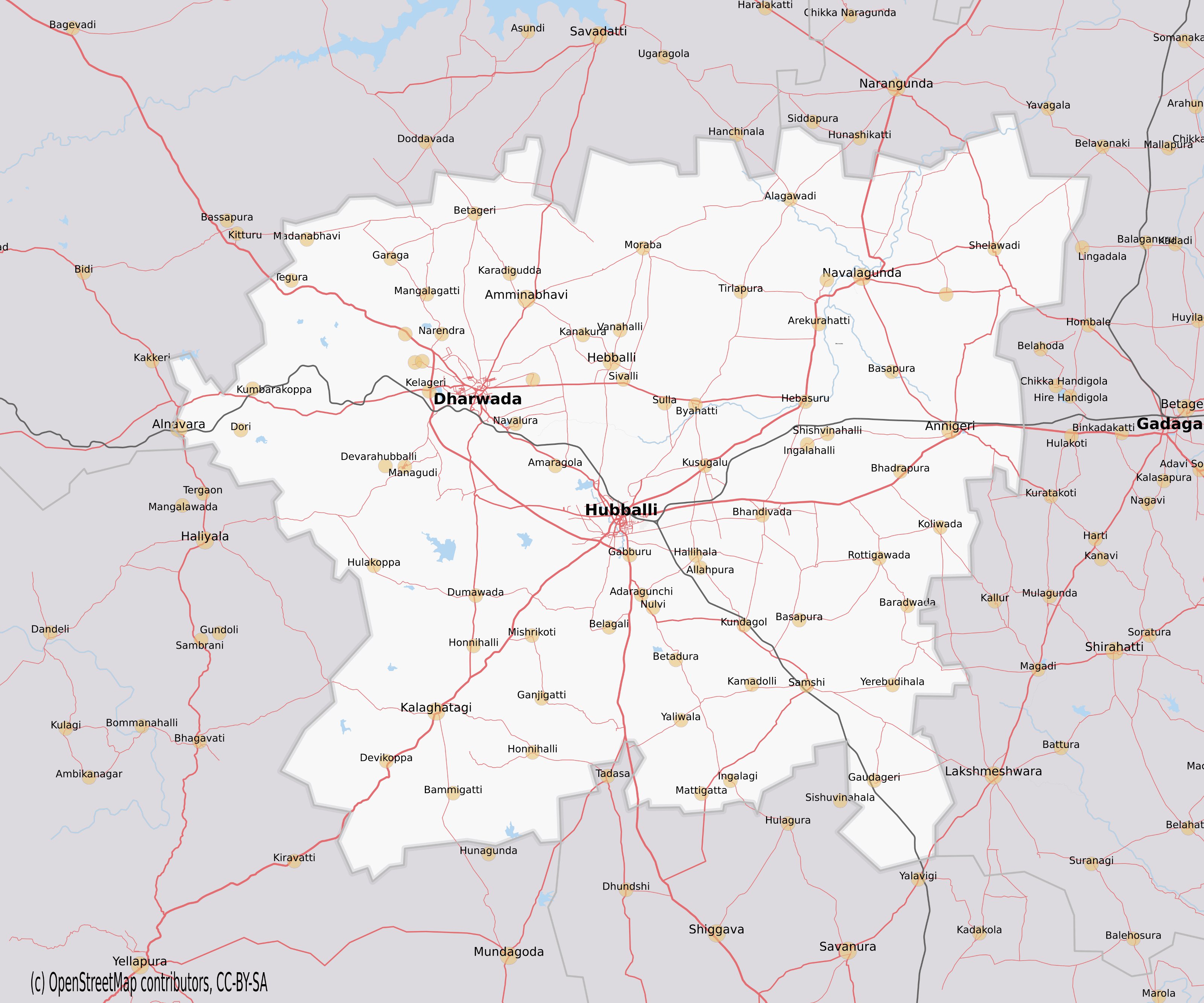
Dharwad is an administrative district of the state of Karnataka in southern India.The administrative headquarters of the district is the city of Dharwad, also known as Dharwar. Dharwad is located 425 km northwest of Bangalore and 421 km southeast of Pune, on the main highway between Chennai and Pune, the National Highway 4 (NH4). Before 1997 the district had an area of 13738 km2. In 1997, the new districts of Gadag and Haveri were carved out of Dharwad's former territory, and a portion of Dharwad district was combined with lands formerly part of three other districts to create the new district of Davanagere. History Historical studies show that people from early Paleolithic age inhabited Dharwad district. The district was ruled by various dynasties from the 5th century onwards, Important among them are Badami and Kalyan Chalukyas, Rastrakutas, Vijayanagar, Adilshahi, Mysore kingdom and Peshawas of Pune. Due to the rule of Peshwas, influence of Marathi is s ... [...More Info...] [...Related Items...] OR: [Wikipedia] [Google] [Baidu] |
Bijapur District, Karnataka
Bijapur district, officially known as Vijayapura district, is a district in the state of Karnataka in India. The city of Bijapur is the headquarters of the district, and is located 530 km northwest of Bangalore. Bijapur is well known for the great monuments of historical importance built during the Adil Shahi dynasty. History While archaeological evidence indicates that the area was settled by the late Paleolithic, the legendary founding of the city of Bijapur was in the late 900s under Tailapa II, who had been the Rashtrakuta governor of Tardavadi, and after the destruction to the empire caused by the invasion of the Paramara of Malwa, declared his independence and went on to found the empire of the Chalukyas of Kalyani, where the city was referred as ''Vijayapura'' ("City of Victory"). By the late 13th century, the area had come under the influence of the Khalji Sultanate. In 1347, the area was conquered by the Bahmani Sultanate of Gulbarga. By this time the city was bein ... [...More Info...] [...Related Items...] OR: [Wikipedia] [Google] [Baidu] |
Chandgad
Chandgad is a Small city and tehsil headquarters of chandgad taluka, of Kolhapur district that is in the Indian state of Maharashtra. This is a small city having a population of about 12,000. This place is 110 km from Kolhapur but only 36 km from Belgaum City. Chandgad is located on the Belgaum-Vengurle state highway. Amboli hill station is the only 32 km from Chandgad. People of Chandgad town and taluka are reliant on Belgaum and Gadhinglaj cities for their major needs. Villages in Chandgad Kanadi-Padatewadi, also known as Kanadi village, is a village on the bank of the Ghatprabha river. History There are a number of forts in Chandgad, out of them killa Pargad was importantly used by Marathas to resist the attack of the Portuguese from Goa; sardar of this fort were rayaba malusare, Gaikwad, Pednekar gharane, and Sawant. Kille Kalanandigad is protected by Gaikwad families of Halkarni and kille Pargad is protected by Pednekar. There are a substantial numbe ... [...More Info...] [...Related Items...] OR: [Wikipedia] [Google] [Baidu] |
States Reorganisation Act
The States Reorganisation act, 1956 was a major reform of the boundaries of India's States and territories of India, states and territories, organising them along linguistic lines. Although additional changes to India's state boundaries have been made since 1956, the States Reorganisation Act of 1956 remains the single most extensive change in state boundaries after the independence of India. The Act came into effect at the same time as the Constitution (Seventh Amendment) Act, 1956, which (among other things) restructured the constitutional framework for India's existing states and the requirements to pass the States Reorganisation Act, 1956 under the provisions of Part I of the Constitution of India, Part I of the Constitution of India, Article 3. Political integration after independence and the Constitution of 1950 British Raj, British India, which included present-day India, Pakistan, Bangladesh and Myanmar, was divided into two types of territories: the British India, ... [...More Info...] [...Related Items...] OR: [Wikipedia] [Google] [Baidu] |
Government Of India
The Government of India (ISO: ; often abbreviated as GoI), known as the Union Government or Central Government but often simply as the Centre, is the national government of the Republic of India, a federal democracy located in South Asia, consisting of 28 union states and eight union territories. Under the Constitution, there are three primary branches of government: the legislative, the executive and the judiciary, whose powers are vested in a bicameral Parliament, President, aided by the Council of Ministers, and the Supreme Court respectively. Through judicial evolution, the Parliament has lost its sovereignty as its amendments to the Constitution are subject to judicial intervention. Judicial appointments in India are unique in that the executive or legislature have negligible say. Etymology and history The Government of India Act 1833, passed by the British parliament, is the first such act of law with the epithet "Government of India". Basic structure The gover ... [...More Info...] [...Related Items...] OR: [Wikipedia] [Google] [Baidu] |


.jpg)


