|
Solar Power In The Netherlands
Solar power in the Netherlands has an installed capacity of around 14,249 megawatt (MW) of photovoltaics as of the end of 2021. Around 3,299 MW of new capacity was installed during 2021. Timeline 2008 Subsidies of 33 euro cents per kWh were introduced but initially failed to attract much development, but when they were curtailed, the Dutch banded together to make large purchases at discount instead. 2011 A 500-kilowatt solar array was added to the roof of Rotterdam's central train station. 2012 Solar capacity more than doubled to 321 MW with new added capacity of 175 MW. 2013 According to the Dutch grid operators, solar capacity grew to a cumulative power of 655.4 MW at the end of 2013 2014 By August 2014, the total had reached 1 GW mark for the first time. 2015 The Netherlands saw its capacity grow by around 357 MW during 2015, the fourth highest in Europe in that year, its installed capacity per inhabitant remained low at 83.1 Watts per inhabi ... [...More Info...] [...Related Items...] OR: [Wikipedia] [Google] [Baidu] |
Texel
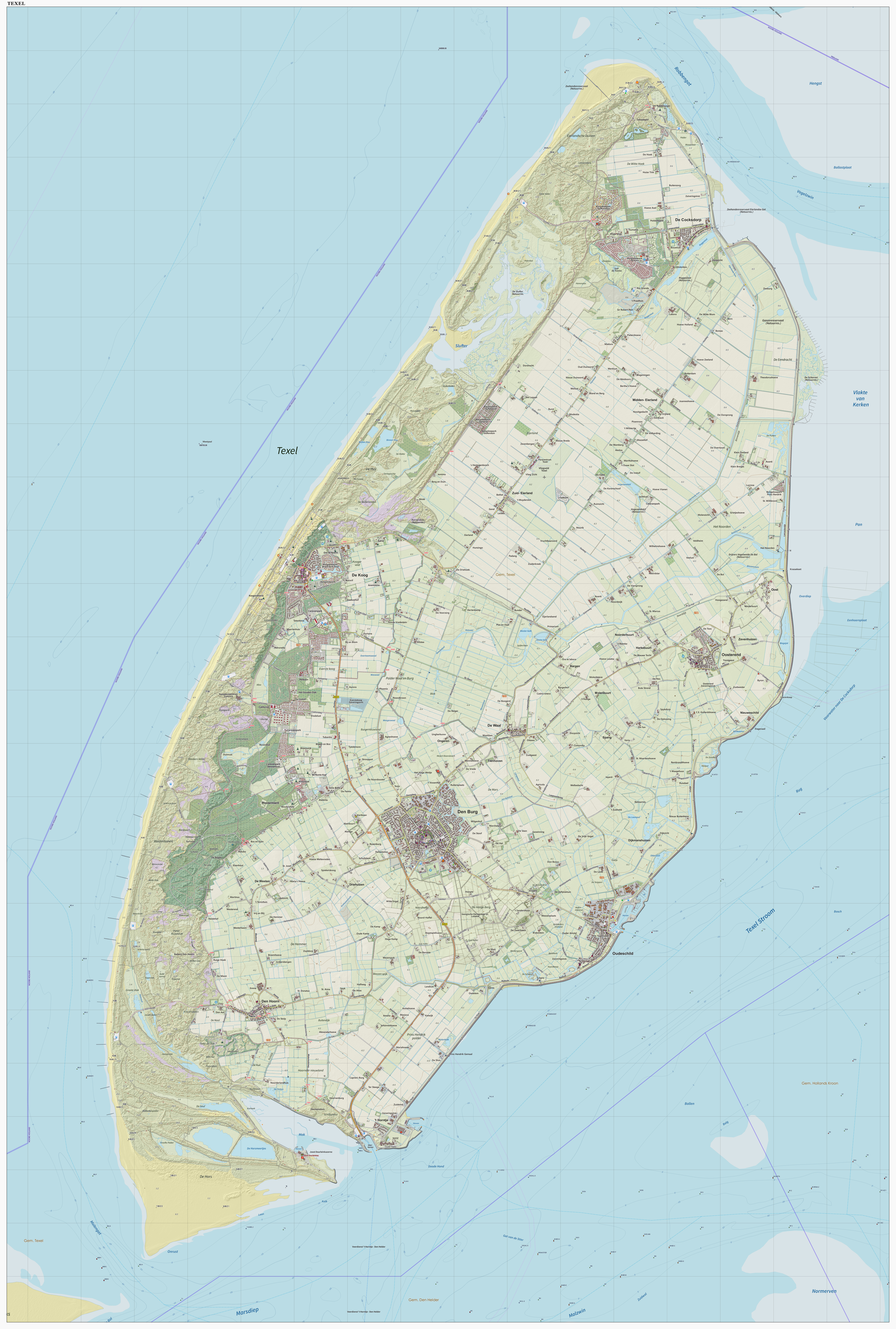
Texel (; Texels dialect: ) is a municipality and an island with a population of 13,643 in North Holland, Netherlands. It is the largest and most populated island of the West Frisian Islands in the Wadden Sea. The island is situated north of Den Helder, northeast of Noorderhaaks, and southwest of Vlieland. Name The name ''Texel'' is Frisian, but because of historical sound-changes in Dutch, where all -x- sounds have been replaced with -s- sounds (compare for instance English ''fox'', Frisian ''fokse'', German ''Fuchs'' with Dutch ''vos''), the name is typically pronounced ''Tessel'' in Dutch. History The All Saints' Flood (1170) created the islands of Texel and Wieringen from North Holland. In the 13th century Ada, Countess of Holland was held prisoner on Texel by her uncle, William I, Count of Holland. Texel received city rights in 1415. The first Dutch expedition to the Northwest Passage departed from the island on the 5th of June, 1594. Texel was involved in the Battl ... [...More Info...] [...Related Items...] OR: [Wikipedia] [Google] [Baidu] |
Den Burg
Den Burg is a town in the Dutch province of North Holland. It is a part of the municipality of Texel on the island of the same name, and lies about 12 km north of Den Helder. Overview Located in the middle of the island, Den Burg is the largest town of Texel. It features a historic centre and also the town hall. Outdoor markets are held each week in the main square. Nevertheless, Den Burg is the island's least tourist settlement. The town was first mentioned between 918 and 948 as Osterburghem, and means "castle" which refers to a castle built to defend against the Vikings. Notable sites The Dutch Reformed church is a three aisled basilica-like church with 11th century elements. The tower dates from the mid 15th century. After a lightning strike in 1537, it was enlarged. The Oudheidkamer was built in 1599 as guest house and nowadays contains a museum. A monument to the constructed language, Esperanto, is on the corner of Kogerstraat and De Zes. It was constructed in 1935 ... [...More Info...] [...Related Items...] OR: [Wikipedia] [Google] [Baidu] |
Grave, Netherlands
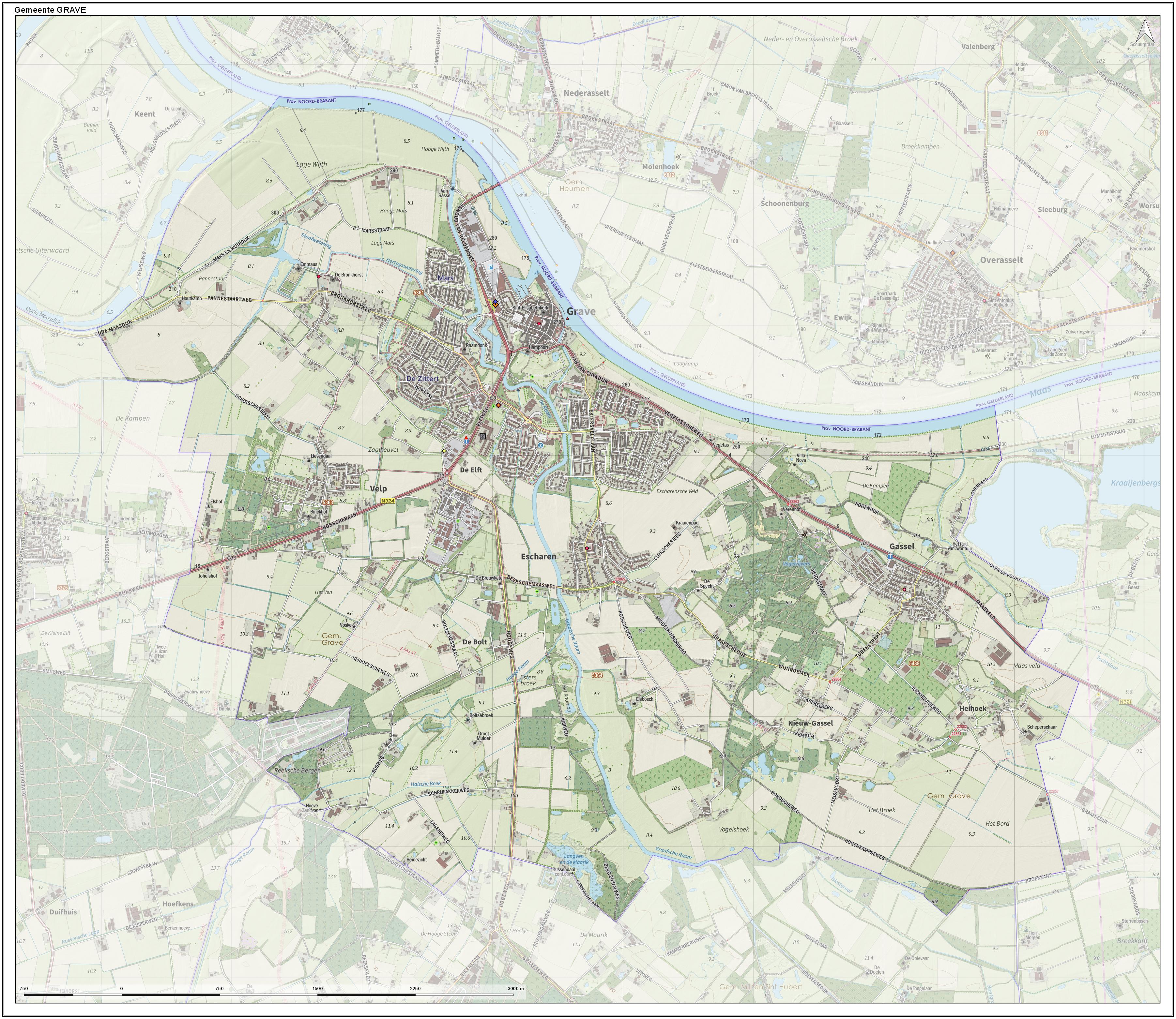
Grave (; formerly ''De Graaf'') is a city and former municipality in the Dutch province of North Brabant. The former municipality had a population of in . Grave is a member of the Dutch Association of Fortified Cities. The former municipality included the following towns : Grave (capital), Velp, Escharen and Gassel. Grave, Boxmeer, Cuijk, Mill en Sint Hubert, and Sint Anthonis merged into the new municipality of Land van Cuijk on 1 January 2022. History Grave received city rights in 1233. The former municipality of Grave was formed in the Napoleonic era (1810) and coincided with the fortified Grave and immediate surroundings. The history of the town was thus linked to that of the place. This changed in 1942. Then there was a reclassification place where the municipality Grave was expanded with the previously independent municipalities Velp and Escharen. Moreover, in 1994 the neighboring municipality of Beers was abolished and a part thereof, the parish Gassel, wa ... [...More Info...] [...Related Items...] OR: [Wikipedia] [Google] [Baidu] |
Hengelo, Gelderland
Hengelo is a town in the eastern part of The Netherlands, province of Gelderland (not to be confused with the much larger city of Hengelo, Overijssel). The predominantly rural area it is situated in is known as the Achterhoek. Hengelo (Gelderland) is famous for various horse-related activities (markets, horse-jumping, etc.). Once a year a motorbike race takes place just outside the town on a streetcircuit. It used to be a separate municipality and is now part of the municipality of Bronckhorst. Gallery Image:Hengelo Gld, de Sint-Willibrorduskerk RM514915 IMG 4836 2020-04-19 14.06.jpg, Church: de Heilige Wilibrordkerk Image:Hengelo, de Remigiuskerk RM21506 in straatzicht foto4 2015-08-20 15.52.jpg, Church: de Remigiuskerk File:Hengelo Gld, sculptuur Paardendorp Hengelo door JeanMarianne Bremers IMG 5310 2020-05-05 15.11.jpg, Sculpture Paardendorp (horse village) Hengelo Population centres Prior to 2005, Hengelo (Gld) was a municipality with approx. 8500 residents, living ... [...More Info...] [...Related Items...] OR: [Wikipedia] [Google] [Baidu] |
Amsterdam Airport Schiphol
Amsterdam Airport Schiphol , known informally as Schiphol Airport ( nl, Luchthaven Schiphol, ), is the main international airport of the Netherlands. It is located southwest of Amsterdam, in the municipality of Haarlemmermeer in the province of North Holland. It is the world's third busiest airport by international passenger traffic in 2021. With almost 72 million passengers in 2019, it is the third-busiest airport in Europe in terms of passenger volume and the busiest in Europe in terms of aircraft movements. With an annual cargo tonnage of 1.74 million, it is the 4th busiest in Europe. AMS covers a total area of of land. The airport is built on the single-terminal concept: one large terminal split into three large departure halls. Schiphol is the hub for KLM and its regional affiliate KLM Cityhopper as well as for Corendon Dutch Airlines, Martinair, Transavia and TUI fly Netherlands. The airport also serves as a base for EasyJet. Schiphol opened on 16 September 1916 ... [...More Info...] [...Related Items...] OR: [Wikipedia] [Google] [Baidu] |
South Holland
South Holland ( nl, Zuid-Holland ) is a province of the Netherlands with a population of over 3.7 million as of October 2021 and a population density of about , making it the country's most populous province and one of the world's most densely populated areas. Situated on the North Sea in the west of the Netherlands, South Holland covers an area of , of which is water. It borders North Holland to the north, Utrecht and Gelderland to the east, and North Brabant and Zeeland to the south. The provincial capital is the Dutch seat of government The Hague, while its largest city is Rotterdam. The Rhine-Meuse-Scheldt delta drains through South Holland into the North Sea. Europe's busiest seaport, the Port of Rotterdam, is located in South Holland. History Early history Archaeological discoveries in Hardinxveld-Giessendam indicate that the area of South Holland has been inhabited since at least c. 7,500 years before present, probably by nomadic hunter-gatherers. Agriculture and perman ... [...More Info...] [...Related Items...] OR: [Wikipedia] [Google] [Baidu] |
Spijkenisse
Spijkenisse () is a city in the province of South Holland, Netherlands. Following an administrative reform in 2015, it is part of the municipality of Nissewaard, and has a population of 72,500. It covers an area of of which is water. It is part of the Greater Rotterdam area. History Archaeological evidence suggests that the area around Spijkenisse has been inhabited for several thousand years. The area's prehistoric inhabitants depended on fishing in the Maas and hunting in the surrounding swamps for sustenance. Spijkenisse also has an anthem, the song is called "Spijkenisse" by Rik Hoogendoorn. The song was released in 2012 and is very popular amongst people who live in Spijkenisse. The oldest known reference to the name ''Spickenisse'' is in a source from 1231. Spijkenisse is a portmanteau of the words ' ( spit) and ''nesse'' (nose) meaning "pointy nose." The name is a reference to the settlement's location on a spit of land protruding into the river. Spijkenisse formed as ... [...More Info...] [...Related Items...] OR: [Wikipedia] [Google] [Baidu] |
Maarssen
Maarssen () is a town in the middle of the Netherlands, in the province of Utrecht, along the river Vecht and the Amsterdam–Rhine Canal. The west of Maarssen is called Maarssen-BroekStatistics are taken from thSDU Staatscourant whereas the east is called Maarssen-Dorp. Both put together and joined by other small towns around provide the area of Maarssen. On 1 January 2011 Maarssen merged with the councils of Breukelen and Loenen to become Stichtse Vecht. Population centres The former municipality of Maarssen consisted of the following cities, towns, villages and/or districts: * Maarssen (colloquially "Maarssen-dorp") and Maarssen-Broek * Maarssenbroek * Maarsseveen * Molenpolder * Oud-Maarsseveen * Oud-Zuilen * Tienhoven Transportation * Maarssen railway station Maarssen is a railway station in Maarssenbroek and on the opposite side of the Amsterdam Rijnkanaal to Maarssen, Netherlands. The station opened on 18 December 1843 and is located on the Amsterdam–Arnhem rail ... [...More Info...] [...Related Items...] OR: [Wikipedia] [Google] [Baidu] |
Haaksbergen
Haaksbergen () is a municipality and a town in the eastern Netherlands, in the province of Overijssel, in the Twente region. The ''Buurserbeek'' flows through the municipality of Haaksbergen. Population centres Topography ''Dutch Topographic map of Haaksbergen (town), June 2014.'' Haaksbergen monstertruck accident On 28 September 2014 a monster truck crashed into the attending crowd. Three visitors were reported dead, amongst them one child. According to Hans Gerritsen, mayor of Haaksbergen at the time, twelve people were injured. Notable residents * Paul Ulenbelt (born 1952) a Dutch politician and former trade unionist and academic * Angelien Eijsink (born 1960) a Dutch politician * Han ten Broeke (born 1969) a Dutch politician * Thomas Berge (born 1990) a Dutch singer Sport * Andy Scharmin (1967–1989) a Surinamese-Dutch footballer * Erik ten Hag (born 1970) former footballer with 336 club caps and current manager of Manchester United * Niki Leferink, (born ... [...More Info...] [...Related Items...] OR: [Wikipedia] [Google] [Baidu] |
Kockengen
Kockengen is a village in the Dutch province of Utrecht. It is a part of the municipality of Stichtse Vecht, and lies about 11 km northeast of Woerden. The name of the village is a reference to Cockaigne, a medieval fictional land of plenty. Until 1989, Kockengen was a separate municipality. From then until 2011 it was part of the municipality of Breukelen. History The village was first mentioned around 1307 as Cokanghen. It started as a 12th-century as a cultivation concession, and the name was probably chosen to attract farmers. Many of the early settlers were serfs from France. In the 14th century a church was built. The tower dates from 1635. During the 17th century, it was prosperous village, due to good water connections to Amsterdam and Utrecht. In 1840, Kockengen was home to 677 people. The is a polder mill, a pumping station to drain the excess water from the polder, which was constructed in 1653. In 1675, it was redesigned. The wind mill remained in service ... [...More Info...] [...Related Items...] OR: [Wikipedia] [Google] [Baidu] |


