|
Shire Of Tambo (Victoria)
The Shire of Tambo was a local government area about east of Melbourne, the state capital of Victoria, Australia. The shire covered an area of , and existed from 1882 until 1994. History Tambo was first incorporated as a shire on 6 January 1882, splitting away from the Shire of Bairnsdale. On 30 May 1892, it lost three-quarters of its land area when the Shire of Orbost was incorporated. A small amount was re-annexed as Cunninghame Riding on 3 January 1913. Accessed at State Library of Victoria, La Trobe Reading Room. On 2 December 1994, the Shire of Tambo was abolished, and along with the City of Bairnsdale, the Shires of Bairnsdale and Orbost, parts of the Shire of Omeo and the Boole Boole Peninsula from the Shire of Rosedale The Shire of Rosedale was a local government area stretching between the towns of Traralgon and Sale, in the Gippsland region of Victoria, Australia. The shire covered an area of , and existed from 1869 until 1994. History Rosedale was incorp ... [...More Info...] [...Related Items...] OR: [Wikipedia] [Google] [Baidu] |
East Gippsland
East Gippsland is the eastern region of Gippsland, Victoria, Australia covering 31,740 square kilometres (14%) of Victoria. It has a population of 80,114. Australian Bureau of Statistics2006 Census Community Profile Series: East Gippsland (Statistical Division). Released at 29/02/2008. LOCATION CODE: 250 STATE: VIC/ref> History The Shire of East Gippsland, also called Far East Gippsland, covers two-thirds (66%) of East Gippsland's area and holds half (50%) of its population. Australian Bureau of Statistics2006 Census. Community Profile Series: East Gippsland Shire (Statistical Subdivision). Released at 29/02/2008. LOCATION CODE: 25005 STATE: VIC/ref> The Shire of East Gippsland is confusingly also referred to simply as East Gippsland. It excludes the Shire of Wellington (Central Gippsland). This article (currently) refers mainly to "Far East Gippsland". East Gippsland's major towns include, from west to east, Bairnsdale (the largest town and administrative centre), Paynesville ... [...More Info...] [...Related Items...] OR: [Wikipedia] [Google] [Baidu] |
Brunswick, Victoria
Brunswick is an inner-city suburb in Melbourne, Victoria (Australia), Victoria, Australia, north of Melbourne's Melbourne city centre, Central Business District, located within the City of Merri-bek Local government areas of Victoria, local government area. Brunswick recorded a population of 24,896 at the 2021 Australian census, 2021 census. Traditionally a working class area noted for its large Italian Australians, Italian and Greek Australians, Greek communities, Brunswick is currently known for its Bohemianism, bohemian culture and strong arts and live music scenes. It is also home to a large student population owing to its proximity to the University of Melbourne and RMIT University, the latter of which has a campus in the suburb. Brunswick's major thoroughfare is Sydney Road, one of Melbourne's major commercial and nightlife strips. It also encompasses the northern section of Lygon Street, synonymous with the Italian community of Melbourne, which forms its border with Bruns ... [...More Info...] [...Related Items...] OR: [Wikipedia] [Google] [Baidu] |
Nowa Nowa, Victoria
Nowa Nowa is a small town in the Australian state of Victoria. It is in East Gippsland, near Lakes Entrance. At the 2006 census, Nowa Nowa and the surrounding areas including Toorloo Arm had a population of 194. History Nowa Nowa Post Office opened on 11 March 1893, though closed for about five years from 1895 to 1900. Nowa Nowa railway station on the former Orbost railway line opened in April 1916, with the line closing in 1987. Commercial area Nowa Nowa has been a timber town relying on local mills for income, however this is no longer the case. There is currently only one mill operating. There are two caravan parks, one general store, one hotel/motel, one healthcare clinic and art galleries. Nowa Nowa is the home of the Nowa Nowa Nudes Art Show held in November each year. Each month there is a Pony Club meet up that draws large numbers of contestants and viewers. There is also a kindergarten, which in 2017 was taught by the Early Childhood Teacher of the year who was assis ... [...More Info...] [...Related Items...] OR: [Wikipedia] [Google] [Baidu] |
Nicholson, Victoria
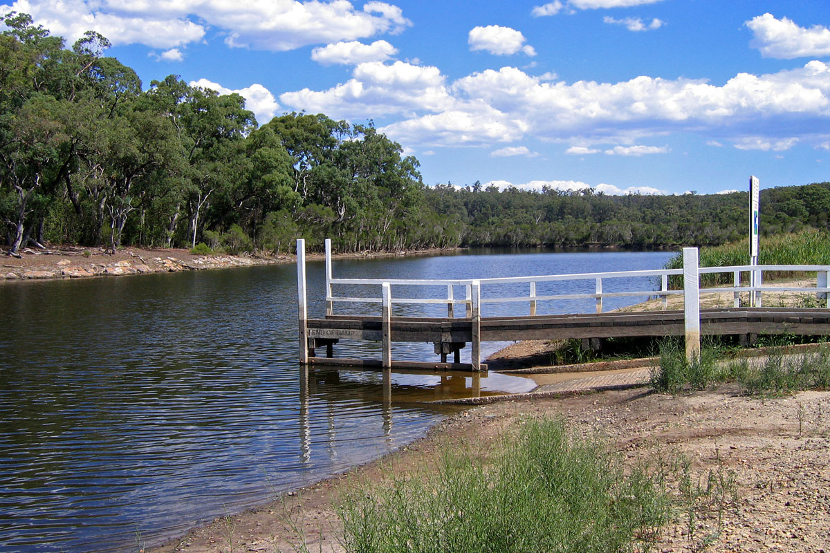
Nicholson is a small town in East Gippsland, Victoria, Australia, 295 km east of the state capital Melbourne. It is situated between the larger towns of Bairnsdale and Lakes Entrance. At the 2006 census, Nicholson and surrounds had a population of 1,504. Nicholson is located on the Princes Highway and lies on the banks of the Nicholson River. Nicholson Post Office opened on 1 August 1885. The town has a substantial boat ramp on the west bank of the river, to the south of the highway, where picnic, toilet, and barbecue facilities are also available. The East Gippsland Rail Trail The East Gippsland Rail Trail is a rail trail located in East Gippsland in Victoria, Australia. The trail is a popular cycling route, beginning in Bairnsdale and extending to Orbost, following the route of the former Orbost railway line. The ... passes across the north section of the town, with the site of the former Nicholson Railway Station identified by a sign. References Tow ... [...More Info...] [...Related Items...] OR: [Wikipedia] [Google] [Baidu] |
Metung, Victoria
Metung is a town in East Gippsland region of Victoria, Australia. The town is east of the state capital Melbourne and between the larger towns of Bairnsdale and Lakes Entrance. It is on a small peninsula south-east of Bairnsdale, separating Lake King and Bancroft Bay on the Gippsland Lakes. Metung Post Office opened on 2 June 1879. Metung is a popular holiday spot, near to larger towns but off any main routes itself. Many of the permanent inhabitants commute to work at Bairnsdale or Lakes Entrance. Golfers play at the course of the Kings Cove Metung Golf Club on Kings Cove Boulevard. Legend Rock The original inhabitants of the area—the Aboriginal Gunai or Kurnai people—tell a story about an unusual group of rocks now found alongside the boardwalk in the Metung Marina on Bancroft Bay. This legend or fable Fable is a literary genre: a succinct fictional story, in prose or verse, that features animals, legendary creatures, plants, inanimate objects, or forces ... [...More Info...] [...Related Items...] OR: [Wikipedia] [Google] [Baidu] |
Johnsonville, Victoria
Johnsonville is a town in the East Gippsland region of Victoria (Australia), Victoria, Australia. It is located on the Princes Highway 18.9 km east from the city of Bairnsdale and 18.3 km west from the tourist resort and fishing port of Lakes Entrance. The town encompasses an area of approximately 5,617 hectares, 56 square kilometres or 13,879 acres. Johnsonville forms one of the 224 cities, towns, villages and localities included within the scope of the East Gippsland Shire directive. The local member for the East Gippsland Region is Tim Bull. At the 2016 Australian census, 2016 census, Johnsonville had a population of 327. History The original inhabitants of the land were the Indigenous Australians, in particular the Gunai people who inhabited the region as far east as the Snowy River. The township got its name from John Johnson, a man of Scandinavian origins, who purchased the nearby Swan Reach, Victoria, Swan Reach run in 1857 which also encompassed Johnsonvill ... [...More Info...] [...Related Items...] OR: [Wikipedia] [Google] [Baidu] |
Gelantipy
Gelantipy is a rural locality 49 km. north of Buchan in the East Gippsland region of Australia. There are also two adjoining parishes, Gelantipy East and Gelantipy West, that cover portions of the locality. Wulgulmerang, W Tree and Brumby localities are nearby. Mount Gelantipy, notable for its old growth alpine ash forests is 12 km. east within the Snowy River National Park . The Karoonda Park hostel on Gelantipy Road includes a local bus stop and petrol service. The Gelantipy Cemetery, Public Hall and Reserve are several kilometres south, alongside Butchers Creek. History The traditional owners of the lands that are now called Gelantipy are the Gunai people. The Scot Edward Bayliss established the Gelantipy pastoral run in 1839 for his employer Edward Lord, a merchant. Gelantipy was a mining area in addition to timber milling and livestock production. The East Gippsland Shire Thematic Environmental History (2005) says: "Traces of silver and lead were found as e ... [...More Info...] [...Related Items...] OR: [Wikipedia] [Google] [Baidu] |
Buchan, Victoria
Buchan ( ) is a town in the east Gippsland region of Victoria, Australia. The town is situated adjacent to the Buchan River, in the Shire of East Gippsland, upstream from the river's junction with the Snowy River. At the 2011 census, Buchan and the surrounding area had a population of 385. The town is probably best known for the limestone Buchan Caves. Buchan Buchan is a rural town, consisting largely of farming land and native vegetation. It is surrounded by the localities of Black Mountain, Buchan South, Butchers Ridge, Canni Creek, Gelantipy, Gillingall, Glenmore, Murrindal, Suggan Buggan, Timbarra, W-Tree, and Wulgulmerang. Buchan is the main town and is located on the Buchan River, approximately 75 kilometres from Bairnsdale and 350 kilometres from Melbourne. While Buchan is best known for its caves, its history as one of the oldest townships in Victoria goes back further than the discovery of the caves. It also has fossils that depict the mega fauna that existed in the r ... [...More Info...] [...Related Items...] OR: [Wikipedia] [Google] [Baidu] |
Bruthen, Victoria
Bruthen is a small town located alongside the Tambo River between Bairnsdale and Ensay on the Great Alpine Road in East Gippsland, Victoria, Australia. At the 2016 census, Bruthen had a population of 814. Bruthen is east of Bairnsdale and east of the state capital Melbourne. History The origin of the name Bruthen is disputed. One version has it as an anglicisation of the Scotts-gaelic word 'Sruthán' meaning 'creek' or 'small stream', given to the location where Deep Creek flows into the Tambo River by Angus McMillan in 1840. Another version has it as named after one of the last of the indigenous traditional elders of the GanaiKurnai Brabiralung tribe of the immediate area, Bruthen-munji, who died in approximately 1862. The area was later renamed Tambo, and changed again to Wiseleigh when the township of Bruthen was established at the new permanent location. Alfred Howitt claimed the proper name for the area around Bruthen was ''Murloo'', meaning ‘pipeclay’. Angus McM ... [...More Info...] [...Related Items...] OR: [Wikipedia] [Google] [Baidu] |
Shire Of East Gippsland
The Shire of East Gippsland is a local government area in Gippsland, Victoria, Australia, located in the eastern part of the state. It covers an area of and in June 2018 had a population of 46,818. It includes the towns of Bairnsdale, Benambra, Bruthen, Buchan, Ensay, Lakes Entrance, Mallacoota, Metung, Omeo, Orbost, Paynesville, Swan Reach and Swifts Creek. It was formed in 1994 from the amalgamation of the City of Bairnsdale, Shire of Bairnsdale, Shire of Omeo, Shire of Orbost, Shire of Tambo and parts of the Shire of Rosedale. The Shire is governed and administered by the East Gippsland Shire Council; its seat of local government and administrative centre is located at the council headquarters in Bairnsdale, it also has service centres located in Lakes Entrance, Omeo and Orbost. The Shire is named after the Gippsland region, in which the LGA occupies the eastern portion. Council Current composition The council is composed of nine councillors elected to represent an ... [...More Info...] [...Related Items...] OR: [Wikipedia] [Google] [Baidu] |
Shire Of Rosedale
The Shire of Rosedale was a local government area stretching between the towns of Traralgon and Sale, in the Gippsland region of Victoria, Australia. The shire covered an area of , and existed from 1869 until 1994. History Rosedale was incorporated as a road district on 26 February 1869, and became a shire on 17 February 1871. It annexed part of the Shire of Alberton on 20 May 1914. Accessed at State Library of Victoria, La Trobe Reading Room. On 2 December 1994, the Shire of Rosedale was abolished, and along with the City of Sale and parts of the Shires of Alberton and Avon, was merged into the newly created Shire of Wellington. The Boole Poole Peninsula south of Metung was transferred to the newly created Shire of East Gippsland, while the Glengarry and Toongabbie districts north of Traralgon were transferred to the newly created Shire of La Trobe. Wards The Shire of Rosedale was divided into three ridings, each of which elected three councillors: * Central Riding * Nor ... [...More Info...] [...Related Items...] OR: [Wikipedia] [Google] [Baidu] |
City Of Bairnsdale
The City of Bairnsdale was a local government area about east of Melbourne, the state capital of Victoria, Australia. The city covered an area of , and existed from its split from the Shire of Bairnsdale in 1967 until 1994. History Originally inhabited by the Kurnai Aborigines, the area was explored by Angus McMillan in 1840. It was McMillan who named the Mitchell River on which the nearby land the township stands. Two years later Frederick Jones became the first European settler in the area when he settled at what is now known as Lucknow, using the land to breed horses for the Indian market. Archibald MacLeod was the first settler to take up land in the area now covered by the present town. Legend has it that he called his run "Bernisdale" after his birthplace on the Isle of Skye, and that the name was changed to its present spelling when Macleod was surprised by the number of "bairns" ("children" in the Scots language) which had appeared in the settlement, and that the spe ... [...More Info...] [...Related Items...] OR: [Wikipedia] [Google] [Baidu] |


