|
Sharp's Hill Quarry
Sharp's Hill Quarry is a geological Site of Special Scientific Interest west of Banbury in Oxfordshire. It is a Geological Conservation Review site. This is the type locality of the Sharp's Hill Formation. It is very fossiliferous and dates to the Bathonian stage of the Middle Jurassic The Middle Jurassic is the second epoch of the Jurassic Period. It lasted from about 174.1 to 163.5 million years ago. Fossils of land-dwelling animals, such as dinosaurs, from the Middle Jurassic are relatively rare, but geological formations co ..., around 167 million years ago. It is very important for understanding the Bathonian succession in north Oxfordshire. Strata of the underlying Chipping Norton Formation are also present. References {{SSSIs Oxfordshire Sites of Special Scientific Interest in Oxfordshire Geological Conservation Review sites ... [...More Info...] [...Related Items...] OR: [Wikipedia] [Google] [Baidu] |
Site Of Special Scientific Interest
A Site of Special Scientific Interest (SSSI) in Great Britain or an Area of Special Scientific Interest (ASSI) in the Isle of Man and Northern Ireland is a conservation designation denoting a protected area in the United Kingdom and Isle of Man. SSSI/ASSIs are the basic building block of site-based nature conservation legislation and most other legal nature/geological conservation designations in the United Kingdom are based upon them, including national nature reserves, Ramsar sites, Special Protection Areas, and Special Areas of Conservation. The acronym "SSSI" is often pronounced "triple-S I". Selection and conservation Sites notified for their biological interest are known as Biological SSSIs (or ASSIs), and those notified for geological or physiographic interest are Geological SSSIs (or ASSIs). Sites may be divided into management units, with some areas including units that are noted for both biological and geological interest. Biological Biological SSSI/ASSIs may ... [...More Info...] [...Related Items...] OR: [Wikipedia] [Google] [Baidu] |
Banbury
Banbury is a historic market town on the River Cherwell in Oxfordshire, South East England. It had a population of 54,335 at the 2021 Census. Banbury is a significant commercial and retail centre for the surrounding area of north Oxfordshire and southern parts of Warwickshire and Northamptonshire which are predominantly rural. Banbury's main industries are motorsport, car components, electrical goods, plastics, food processing and printing. Banbury is home to the world's largest coffee-processing facility (Jacobs Douwe Egberts), built in 1964. The town is famed for Banbury cakes, a spiced sweet pastry dish. Banbury is located north-west of London, south-east of Birmingham, south-east of Coventry and north-west of Oxford. History Toponymy The name Banbury may derive from "Banna", a Saxon chieftain said to have built a stockade there in the 6th century (or possibly a byname from ang, bana meaning ''felon'', ''murderer''), and / meaning ''settlement''. In Anglo Saxon i ... [...More Info...] [...Related Items...] OR: [Wikipedia] [Google] [Baidu] |
Oxfordshire
Oxfordshire is a ceremonial and non-metropolitan county in the north west of South East England. It is a mainly rural county, with its largest settlement being the city of Oxford. The county is a centre of research and development, primarily due to the work of the University of Oxford and several notable science parks. These include the Harwell Science and Innovation Campus and Milton Park, both situated around the towns of Didcot and Abingdon-on-Thames. It is a landlocked county, bordered by six counties: Berkshire to the south, Buckinghamshire to the east, Wiltshire to the south west, Gloucestershire to the west, Warwickshire to the north west, and Northamptonshire to the north east. Oxfordshire is locally governed by Oxfordshire County Council, together with local councils of its five non-metropolitan districts: City of Oxford, Cherwell, South Oxfordshire, Vale of White Horse, and West Oxfordshire. Present-day Oxfordshire spanning the area south of the Thames was h ... [...More Info...] [...Related Items...] OR: [Wikipedia] [Google] [Baidu] |
Geological Conservation Review
The Geological Conservation Review (GCR) is produced by the UK's Joint Nature Conservation Committee and is designed to identify those sites of national and international importance needed to show all the key scientific elements of the geological and geomorphological features of Britain. These sites display sediments, rocks, minerals, fossils, and features of the landscape that make a special contribution to an understanding and appreciation of Earth science and the geological history of Britain, which stretches back more than three billion years. The intention of the project, which was devised in 1974 by George Black and William Wimbledon working for the Governmental advisory agency, the Nature Conservancy Council (NCC), was activated in 1977. It aimed to provide the scientific rationale and information base for the conservation of geological SSSIs (Sites of Special Scientific Interest, protected under British law (latterly the Wildlife and Countryside Act 1981, as amended 1995). ... [...More Info...] [...Related Items...] OR: [Wikipedia] [Google] [Baidu] |
Type Locality (geology)
Type locality, also called type area, is the locality where a particular rock type, stratigraphic unit or mineral species is first identified. If the stratigraphic unit in a locality is layered, it is called a stratotype, whereas the standard of reference for unlayered rocks is the type locality. The term is similar to the term type site in archaeology or the term type specimen in biology. Examples of geological type localities Rocks and minerals * Aragonite: Molina de Aragón, Guadalajara, Spain * Autunite: Autun, France * Benmoreite: Ben More (Mull), Scotland * Blairmorite: Blairmore, Alberta, Canada * Boninite: Bonin Islands, Japan * Comendite: Comende, San Pietro Island, Sardinia * Cummingtonite: Cummington, Massachusetts * Dunite: Dun Mountain, New Zealand. * Essexite: Essex County, Massachusetts, US * Fayalite: Horta, Fayal Island, Azores, Portugal * Harzburgite: Bad Harzburg, Germany * Icelandite: Thingmuli (Þingmúli), Iceland * Ijolite: Iivaara, Kuusamo, Finl ... [...More Info...] [...Related Items...] OR: [Wikipedia] [Google] [Baidu] |
Sharp's Hill Formation
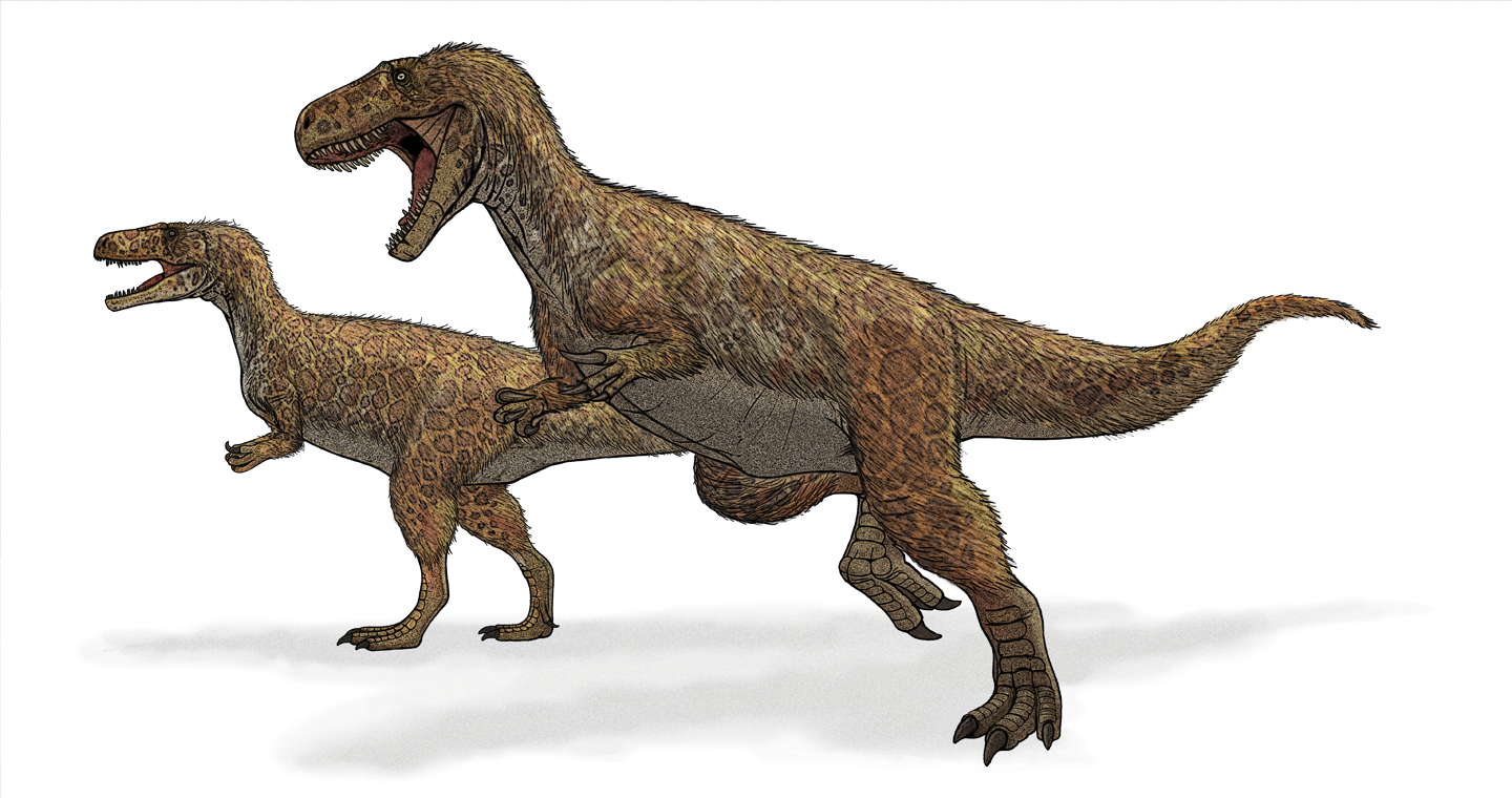
The Sharp's Hill Formation is a Bathonian geologic formation in the United Kingdom, dating to around 167 million years ago. Dinosaur remains diagnostic to the genus level are among the fossils that have been recovered from the formation.Weishampel, et al. (2004). "Dinosaur distribution." Pp. 517-607. It is the lateral equivalent of the Rutland Formation and the Fuller's Earth Formation. The type locality is the Sharp's Hill Quarry. Paleofauna * ''Megalosaurus bucklandiiBenson, R. B. J. (2010). A description of ''Megalosaurus bucklandii'' (Dinosauria: Theropoda) from the Bathonian of the UK and the relationships of Middle Jurassic theropods. ''Zoological Journal of the Linnean Society'' 158 (4): 882–935. doi:10.1111/j.1096-3642.2009.00569.x. * ''Cetiosaurus'' sp. (sauropod indet) * "Eoplophysis" (''Omosaurus'') ''vetustus'' (stegosaurid indet) See also * List of dinosaur-bearing rock formations ** List of stratigraphic units with few dinosaur genera This list of stratig ... [...More Info...] [...Related Items...] OR: [Wikipedia] [Google] [Baidu] |
Bathonian
In the geologic timescale the Bathonian is an age and stage of the Middle Jurassic. It lasted from approximately 168.3 Ma to around 166.1 Ma (million years ago). The Bathonian Age succeeds the Bajocian Age and precedes the Callovian Age. Stratigraphic definitions The Bathonian Stage takes its name from Bath, a spa town in England built on Jurassic limestone (the Latinized form of the town name is ''Bathonium''). The name was introduced in scientific literature by Belgian geologist d'Omalius d'Halloy in 1843. The original type locality was located near Bath. The French palaeontologist Alcide d'Orbigny was in 1852 the first to define the exact length of the stage. The base of the Bathonian is at the first appearance of ammonite species '' Parkinsonia (Gonolkites) convergens'' in the stratigraphic column. The global reference profile for the base of the Bathonian (a GSSP) was ratified as Ravin du Bès, Bas-Auran area, Alpes de Haute Provence, France in 2009. The top of the Bat ... [...More Info...] [...Related Items...] OR: [Wikipedia] [Google] [Baidu] |
Middle Jurassic
The Middle Jurassic is the second epoch of the Jurassic Period. It lasted from about 174.1 to 163.5 million years ago. Fossils of land-dwelling animals, such as dinosaurs, from the Middle Jurassic are relatively rare, but geological formations containing land animal fossils include the Forest Marble Formation in England, the Kilmaluag Formation in Scotland,British Geological Survey. 2011Stratigraphic framework for the Middle Jurassic strata of Great Britain and the adjoining continental shelf: research report RR/11/06 British Geological Survey, Keyworth, Nottingham. the Daohugou Beds in China, the Itat Formation in Russia, and the Isalo III Formation of western Madagascar. Paleogeography During the Middle Jurassic Epoch, Pangaea began to separate into Laurasia and Gondwana, and the Atlantic Ocean formed. Eastern Laurasia was tectonically active as the Cimmerian plate continued to collide with Laurasia's southern coast, completely closing the Paleo-Tethys Ocean. A subduction zone ... [...More Info...] [...Related Items...] OR: [Wikipedia] [Google] [Baidu] |
Chipping Norton Formation
The Chipping Norton Limestone is a geological formation in the Cotswolds, England. It preserves fossils dating back to the Bathonian (Middle Jurassic).Weishampel, David B; et al. (2004). "Dinosaur distribution (Middle Jurassic, Europe)." In: Weishampel, David B.; Dodson, Peter; and Osmólska, Halszka (eds.): The Dinosauria, 2nd, Berkeley: University of California Press. Pp. 538–541. . Including those of dinosaurs '' Cetiosaurus, Megalosaurus'' and ''Cruxicheiros'' as well as the Tritylodontid '' Stereognathus''. It primarily consists of ooidal limestone. Fossil content The so-called "Scrotum humanum" remains may have come from this formation. See also * List of dinosaur-bearing rock formations * List of fossiliferous stratigraphic units in England See also *Lists of fossiliferous stratigraphic units in Europe * Lists of fossiliferous stratigraphic units in the United Kingdom References * {{DEFAULTSORT:Fossiliferous stratigraphic units in England England ... [...More Info...] [...Related Items...] OR: [Wikipedia] [Google] [Baidu] |
Sites Of Special Scientific Interest In Oxfordshire
Site most often refers to: * Archaeological site * Campsite, a place used for overnight stay in an outdoor area * Construction site * Location, a point or an area on the Earth's surface or elsewhere * Website, a set of related web pages, typically with a common domain name It may also refer to: * Site, a National Register of Historic Places property type * SITE (originally known as ''Sculpture in the Environment''), an American architecture and design firm * Site (mathematics), a category C together with a Grothendieck topology on C * ''The Site'', a 1990s TV series that aired on MSNBC * SITE Intelligence Group, a for-profit organization tracking jihadist and white supremacist organizations * SITE Institute, a terrorism-tracking organization, precursor to the SITE Intelligence Group * Sindh Industrial and Trading Estate, a company in Sindh, Pakistan * SITE Centers, American commercial real estate company * SITE Town, a densely populated town in Karachi, Pakistan * S.I.T.E Indust ... [...More Info...] [...Related Items...] OR: [Wikipedia] [Google] [Baidu] |


