|
Semnani People
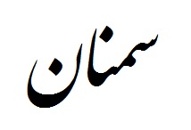
The Semnani people ( Semnani: سمنی مرتمونی, ''samani mertimüni'') are a Caspian people, part of the greater Iranian people who primarily live in northern Iran and speak the Semnani language. Today, the majority of Semnanis speak Persian. Origins The Semnani people are Caspians who migrated to the northern fringe of the central Iranian plateau from the southern shores of the Caspian Sea. It is not known when this migration occurred, but these Caspian-speaking tribes slowly intermixed with the tribes of the plateau, creating what has been dubbed in Persian literature as an "Isle of Dialects." These same Caspian migrants also settled in the villages and towns of Biyabunak, Eyvanakey, Sorkheh, Garmsar, Shahmirzad, Darjezin, and Mehdishahr. The city of Semnan is the primary hub of the Semnani people, though it is unclear whether the name itself came from the people or the settlement. Cultural Identity Like many cultures of the Middle East, Semnani people emphas ... [...More Info...] [...Related Items...] OR: [Wikipedia] [Google] [Baidu] |
Iran
Iran, officially the Islamic Republic of Iran, and also called Persia, is a country located in Western Asia. It is bordered by Iraq and Turkey to the west, by Azerbaijan and Armenia to the northwest, by the Caspian Sea and Turkmenistan to the north, by Afghanistan and Pakistan to the east, and by the Gulf of Oman and the Persian Gulf to the south. It covers an area of , making it the 17th-largest country. Iran has a population of 86 million, making it the 17th-most populous country in the world, and the second-largest in the Middle East. Its largest cities, in descending order, are the capital Tehran, Mashhad, Isfahan, Karaj, Shiraz, and Tabriz. The country is home to one of the world's oldest civilizations, beginning with the formation of the Elamite kingdoms in the fourth millennium BC. It was first unified by the Medes, an ancient Iranian people, in the seventh century BC, and reached its territorial height in the sixth century BC, when Cyrus the Great fo ... [...More Info...] [...Related Items...] OR: [Wikipedia] [Google] [Baidu] |
Shahmirzad
Shahmirzad ( fa, شهميرزاد , Native Name شامرزا) is a city and capital of Shahmirzad District in Mehdishahr County, located in the north of Iran and on the southern slopes of the Alborz Mountains. The permanent population of the city was recorded as 7,273 people, 1,860 families in the 2006 census but increased to 8,882 by 2011. During the Summers, the city's population rises to up to 40,000 people, as tourists visit the city for its cool climate and popular gardens. Shahmirzad has been home to people of diverse ethnic backgrounds, a large group of whom seasonally settled in cities and towns of Mazandaran, such as Babol, Sari, Neka, and Behshahr. During the past decades many Muslim, Bahá'í, and Shahmirzadi Jews, migrated to larger cities in Iran and abroad, most notably San Francisco Bay Area. Shahmirzadi language (شامرزایی), is a Caspian language close to Mazandarani . Shahmirzad's walnut orchard with a size of is noted by the UN, Food and Agricult ... [...More Info...] [...Related Items...] OR: [Wikipedia] [Google] [Baidu] |
Alluvial Fans
An alluvial fan is an accumulation of sediments that fans outwards from a concentrated source of sediments, such as a narrow canyon emerging from an escarpment. They are characteristic of mountainous terrain in arid to semiarid climates, but are also found in more humid environments subject to intense rainfall and in areas of modern glaciation. They range in area from less than to almost . Alluvial fans typically form where flow emerges from a confined channel and is free to spread out and infiltrate the surface. This reduces the carrying capacity of the flow and results in deposition of sediments. The flow can take the form of infrequent debris flows or one or more ephemeral or perennial streams. Alluvial fans are common in the geologic record, such as in the Triassic basins of eastern North America and the New Red Sandstone of south Devon. Such fan deposits likely contain the largest accumulations of gravel in the geologic record. Alluvial fans have also been found on Mar ... [...More Info...] [...Related Items...] OR: [Wikipedia] [Google] [Baidu] |
Caspian Hyrcanian Mixed Forests
The Hyrcanian forests ( fa, جنگل های هیرکانی) are a zone of lush lowland and montane forests covering about adjoining the shores of the Caspian Sea of Iran and part of that of Azerbaijan. The forest is named after the ancient region of Hyrcania. In the World Wildlife Fund categorization, the ecoregion is referred to as the Caspian Hyrcanian mixed forests. Since 5 July 2019, the Hyrcanian Forests have been designated a UNESCO World Heritage Site. Geography In Iran, the Hyrcanian ecoregion comprises a long strip along the southern coast of the Caspian Sea and the northern slopes of the Alborz mountains. It covers parts of five provinces, from east to west: North Khorasan Province, North Khorasan, Golestan Province, Golestan ( being its south and southwest plus eastern regions of the Gorgan plain), Mazandaran Province, Mazandaran, Gilan Province, Gilan and Ardabil Province, Ardabil. The Golestan National Park spans the boundary of Golestan and Mazandaran provinces ... [...More Info...] [...Related Items...] OR: [Wikipedia] [Google] [Baidu] |
Dasht-e Kavir
Dasht-e Kavir ( fa, دشت كوير, lit=Low Plains in classical Persian, from ''khwar'' (low), and ''dasht'' (plain, flatland)), also known as Kavir-e Namak () and the Great Salt Desert, is a large desert lying in the middle of the Iranian Plateau. It is about long by wide with a total surface area of about , making it the world's 24th largest desert. The area of this desert stretches from the Alborz mountain range in the north-west to the Dasht-e Lut in the south-east. It is partitioned among the Iranian provinces of Khorasan, Semnan, Tehran, Isfahan and Yazd. Features In the center of the desert lies the Kavir Buzurg (Great Kavir), which is about 320 km long and wide. In the western part of the desert lies the Daryahcheh-e Namak ("salt lake"), . It contains some large salt plates in a mosaic-like shape. It is part of a protected ecological zone, the Kavir National Park. One of the most desolate parts of Dasht-e Kavir is the Rig-e Jenn (‘Dune of the Jinn’). Cl ... [...More Info...] [...Related Items...] OR: [Wikipedia] [Google] [Baidu] |
English Language
English is a West Germanic language of the Indo-European language family, with its earliest forms spoken by the inhabitants of early medieval England. It is named after the Angles, one of the ancient Germanic peoples that migrated to the island of Great Britain. Existing on a dialect continuum with Scots, and then closest related to the Low Saxon and Frisian languages, English is genealogically West Germanic. However, its vocabulary is also distinctively influenced by dialects of France (about 29% of Modern English words) and Latin (also about 29%), plus some grammar and a small amount of core vocabulary influenced by Old Norse (a North Germanic language). Speakers of English are called Anglophones. The earliest forms of English, collectively known as Old English, evolved from a group of West Germanic (Ingvaeonic) dialects brought to Great Britain by Anglo-Saxon settlers in the 5th century and further mutated by Norse-speaking Viking settlers starting in the 8th and 9th ... [...More Info...] [...Related Items...] OR: [Wikipedia] [Google] [Baidu] |
Middle East
The Middle East ( ar, الشرق الأوسط, ISO 233: ) is a geopolitical region commonly encompassing Arabian Peninsula, Arabia (including the Arabian Peninsula and Bahrain), Anatolia, Asia Minor (Asian part of Turkey except Hatay Province), East Thrace (European part of Turkey), Egypt, Iran, the Levant (including Syria (region), Ash-Shām and Cyprus), Mesopotamia (modern-day Iraq), and the Socotra Governorate, Socotra Archipelago (a part of Yemen). The term came into widespread usage as a replacement of the term Near East (as opposed to the Far East) beginning in the early 20th century. The term "Middle East" has led to some confusion over its changing definitions, and has been viewed by some to be discriminatory or too Eurocentrism, Eurocentric. The region includes the vast majority of the territories included in the closely associated definition of Western Asia (including Iran), but without the South Caucasus, and additionally includes all of Egypt (not just the Sina ... [...More Info...] [...Related Items...] OR: [Wikipedia] [Google] [Baidu] |
Semnani Literature
Semnani may refer to: * Semnani language, one of the local languages of the Semnan Province of Iran * Semnani languages, a group of Northwestern Iranian languages, spoken in Semnan province of Iran * Semnani people, an Iranian people who primarily live in northern Iran and speak the Semnani language * Ashraf Jahangir Semnani (12871386), a Sufi saint ; In biology * ''Elachista semnani'', a moth in the family Elachistidae * ''Scrobipalpa semnani'', a moth in the family Gelechiidae See also * Semnan (other) Semnan may refer to: * Semnan Province, a province in Iran * Semnan County, a county in the Semnan Province of Iran * Semnan, Iran, a city in the Semnan County of Iran See also * Semnani (other) Semnani may refer to: * Semnani langua ... * {{disambiguation, geo, surname Iranian-language surnames ... [...More Info...] [...Related Items...] OR: [Wikipedia] [Google] [Baidu] |
Semnan, Iran
Semnan (Persian: , ); is the capital city of Semnan Province, situated on the alluvial fan of the Golrudbar creek in north central Iran, 216 km east of Tehran and 640 km west of Mashhad. With a population of 185,129 people, Semnan is the most populated city in Semnan Province and serves as the capital of it. The city is also the hub of the Semnani language, a sub-branch of the Iranian languages spoken to the north, and home to the Semnani ethnic group. Semnan offers various recreational activities, historical and religious sites, festivals, gardens and parks, centers of higher education, and Semnani culture. The city is as the cultural and political capital of the Semnan Province. The city's main souvenirs are daffodil flowers, Shirmal pastry, Kolüçe cookies, kilim rugs, and shortbread. Etymology There are several theories which seek to explain the origin of the name ''Semnan''. Semnan was an ancient pre-zoroastrian city in which the locals practiced idol-worsh ... [...More Info...] [...Related Items...] OR: [Wikipedia] [Google] [Baidu] |
Mehdishahr
Mehdishahr ( fa, مهدیشهر, also Romanized as Mehdīshahr; formerly, Sang-e Sar ( fa, سَنگِ سَر, also Romanized as Sang-i-Sar and Sangsar) is a city and capital of Mehdishahr County, Semnan Province, Iran. At the 2006 census, its population was 20,581, in 5,473 families. Mehdishahr is located on the southern slopes of the Alborz mountains. Here, the chain of Alborz mountains is very close to the desert of Dasht-e Kavir. Sangsar, specially the northern part of it, is completely mountainous with cold winters, heavy snowfalls but with mild summers. The distance between Sangsar city and Semnan city is 20 kilometers. The altitude is about 1630 meters above sea level. The primary religious belief in the area now is Shi‘ite Islam, but before the Islamic Revolution, there were many followers of the Baháʼí Faith in Sangsar, who had to migrate from the city after the revolution, due to a wide range of persecutions. As for other towns of Iran, the name has thus ... [...More Info...] [...Related Items...] OR: [Wikipedia] [Google] [Baidu] |
Garmsar
Garmsar ( fa, گرمسار, also Romanized as Garmsār is a city in and the capital of Garmsar County, Semnan Province, Iran. At the 2006 census, its population was 38,891, in 10,951 families. Garmsar is located about southeast of Tehran. It lies on the edge of Dasht-e Kavir, Iran's largest desert. Many people in the city commute to Tehran due to its proximity. Ghasre Bahram, The Stone Way, Stonvand Castle, the Sar Darre Mountains, and Kavir Desert National Park are tourist attractions located in the area. People Garmsar has a Tat and Persian majority. Persian and Tati are the main languages in Garmsar County. Other languages such as Azeri and Kurdish are still spoken by older people from different ethnicities like Osanlu(azari) and Pazuki, Gharachorloo and Shadloo (kurdish) in the nearby villages. Younger generation speaks Persian along with their native language. Climate Garmsar has a hot desert climate (BWh) bordering a cold desert climate (BWk). Notable people * Ami ... [...More Info...] [...Related Items...] OR: [Wikipedia] [Google] [Baidu] |


