|
Scottish Colonization Of The Americas
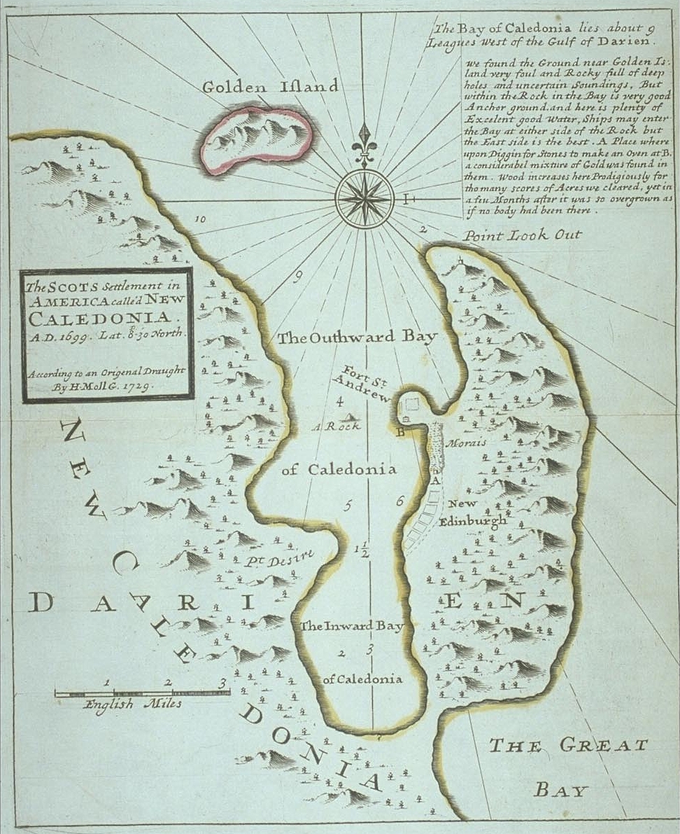
Scottish colonisation of the Americas comprised a number of failed or abandoned Scottish settlements in North America; a colony at Darien on the Isthmus of Panama; and a number of wholly or largely Scottish settlements made after the Acts of Union 1707, and those made by the enforced resettlement after the Battle of Culloden and the Highland Clearances. Nova Scotia (1621) The first documented Scottish settlement in the Americas was of Nova Scotia in 1629. On 29 September 1621, the charter for the foundation of a colony was granted by James VI of Scotland to Sir William Alexander. Between 1622 and 1628, Sir William launched four attempts to send colonists to Nova Scotia; all failed for various reasons. A successful settlement of Nova Scotia was finally achieved in 1629. The colony's charter, in law, made Nova Scotia (defined as all land between Newfoundland and New England; i.e., The Maritimes) a part of mainland Scotland; this was later used to get around the English na ... [...More Info...] [...Related Items...] OR: [Wikipedia] [Google] [Baidu] |
Kingdom Of Scotland
The Kingdom of Scotland (; , ) was a sovereign state in northwest Europe traditionally said to have been founded in 843. Its territories expanded and shrank, but it came to occupy the northern third of the island of Great Britain, sharing a land border to the south with England. It suffered many invasions by the English, but under Robert the Bruce it fought a successful War of Independence and remained an independent state throughout the late Middle Ages. Following the annexation of the Hebrides and the Northern Isles from Norway in 1266 and 1472 respectively, and the final capture of the Royal Burgh of Berwick by England in 1482, the territory of the Kingdom of Scotland corresponded to that of modern-day Scotland, bounded by the North Sea to the east, the Atlantic Ocean to the north and west, and the North Channel and Irish Sea to the southwest. In 1603, James VI of Scotland became King of England, joining Scotland with England in a personal union. In 1707, during the reign ... [...More Info...] [...Related Items...] OR: [Wikipedia] [Google] [Baidu] |
David Kirke
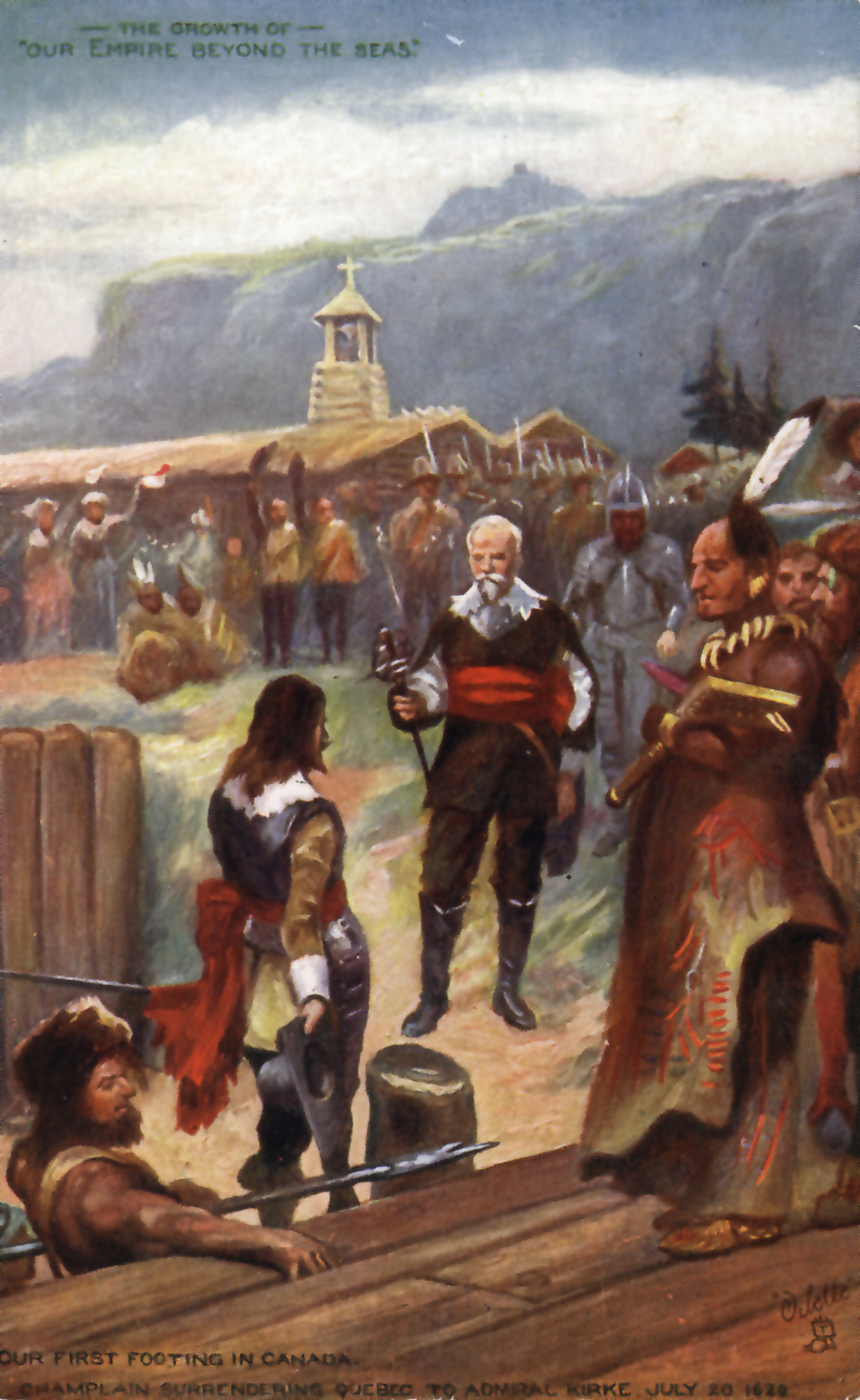
Sir David Kirke ( – 1654), also spelt David Ker, was an adventurer, privateer and colonial governor. He is best known for his successful capture of Québec in 1629 during the Thirty Years' War and his subsequent governorship of lands in Newfoundland. A favourite of Charles I, Kirke's downfall came with that of the Crown during the English Civil War and it is believed he died in prison. Family Kirke was a son of Gervase (Jarvis) Kirke, a rich merchant of the City of London, and Elizabeth Goudon, a French Huguenot woman. He was raised in Dieppe, in Normandy. Also David was the eldest of five sons, followed by Lewis, Thomas, John and James. While still in Engeland, David married to Sara Kirke. They left for Newfoundland in 1638 and had a number of children, including their sons George, David the Younger, and Phillip. Quebec campaign An English fleet, consisting of six warships and three pinnaces, left Gravesend in March 1629 with Jacques Michel, a deserter from Champlain, ... [...More Info...] [...Related Items...] OR: [Wikipedia] [Google] [Baidu] |
Saint John, New Brunswick
Saint John is a seaport city of the Atlantic Ocean located on the Bay of Fundy in the province of New Brunswick, Canada. Saint John is the oldest incorporated city in Canada, established by royal charter on May 18, 1785, during the reign of King George III. The port is Canada's third-largest port by tonnage with a cargo base that includes dry and liquid bulk, Breakbulk_cargo, break bulk, containers, and cruise. The city was the most populous in New Brunswick until the 2016 census, when it was overtaken by Moncton. It is currently the second-largest city in the province, with a population of 69,895 over an area of . French explorer Samuel de Champlain landed at Saint John Harbour on June 24, 1604 (the feast of St. John the Baptist) and is where the Saint John River (Bay of Fundy), Saint John River gets its name although Mi'kmaq and Maliseet, Wolastoqiyik peoples lived in the region for thousands of years prior calling the river Wolastoq. The Saint John area was an important area ... [...More Info...] [...Related Items...] OR: [Wikipedia] [Google] [Baidu] |
Port-Royal National Historic Site
Port-Royal National Historic Site (originally built 1605–1613) is a National Historic Site located on the north bank of the Annapolis Basin in the community of Port Royal, Nova Scotia, Canada. The site is the location of the Habitation at Port-Royal. The Habitation at Port-Royal was established by France in 1605 and was that nation's first permanent settlement in North America, as although Fort Charlesbourg-Royal in the future Quebec City had been built in 1541, it did not last long. Port-Royal served as the capital of Acadia until its destruction by British military forces in 1613. France relocated the settlement and capital upstream and to the south bank of the Annapolis River, the site of the present-day town of Annapolis Royal. The relocated settlement kept the same name of Port-Royal and served as the capital of Acadia for the majority of the 17th century until the 1710 British conquest of the colony, at which time the settlement was renamed Annapolis Royal. Repli ... [...More Info...] [...Related Items...] OR: [Wikipedia] [Google] [Baidu] |
Port-Royal (Acadia)
Port-Royal (1629–1710) was a settlement on the site of modern-day Annapolis Royal, Nova Scotia, part of the French colony of Acadia. The original French settlement of Port-Royal (Habitation de Port-Royal (1605-1613, about southwest) had earlier established farms in the area. In 1629, William Alexander (the younger) established a Scottish colony at the site and named it Charles Fort. Upon the handing back of Acadia to the French by the Treaty of Saint-Germain-en-Laye (1632) the settlement was occupied by the French and renamed Port-Royal. For most of the period until the Siege of Port Royal by the Kingdom of Great Britain in 1710, the village was the capital of Acadia. Port-Royal was the primary Acadian settlement until Acadians migrated out of the community to Pisiguit, Cobequid, Grand Pre, and Beaubassin (Isthmus of Chignecto) in the 1680s. Context The Habitation at Port-Royal was established on the other side of the river by Pierre Du Gua de Monts, with the able ass ... [...More Info...] [...Related Items...] OR: [Wikipedia] [Google] [Baidu] |
Charles De Menou D'Aulnay
Charles de Menou d'Aulnay (''de Charnisay'') (–1650) was a French pioneer of European settlement in North America and Governor of Acadia (1635–1650). Biography D'Aulnay was a member of the French nobility who was at various times a sea captain, a lieutenant in the French navy to his cousin Isaac de Razilly, and Governor of Acadia (now primarily Nova Scotia and New Brunswick, Canada). He was born at Château de Charnizay, Indre-et-Loire, France. His father was a high-ranking official for Louis XIII. Isaac de Razilly, having been selected by the government to restore to France her Acadian possessions, became governor of Acadia in 1632, and d'Aulnay was one of his able assistants, borrowing funds, hiring ships, and recruiting men for the regular ocean crossings to and from France for the Compagnie des Cent-Associés and a private company, Razilly-Condonnier. These companies had divergent interests at times which resulted in costly competition. Razilly brought with him forty fa ... [...More Info...] [...Related Items...] OR: [Wikipedia] [Google] [Baidu] |
LaHave, Nova Scotia
LaHave (''La Hève'') is a Canadian community in Lunenburg County, Nova Scotia. The community is located across the river from Riverport and approximately 15 kilometres from the town of Bridgewater. Once the capital of Acadia, it is located on Highway 331 at the mouth of the 97 km long LaHave River. LaHave Islands The LaHave Islands are a small group of islands near shore a few km south of LaHave. Some of the islands are linked by a road to the mainland. The islands are a popular coastal paddling destination. The LaHave Islands Marine Museum (c. 1913), located on Bush Island and accessible by road, is on the Canadian Register of Historic Places. Nearby is Bush Island Provincial Park. History Mi'kmaq Settlement and French colony La Hève was an important centre for the Mi'kmaq people, who traded with Europeans. Messamouet, a well-known ''sakmow'', or Chief, of the Mi'kmaq Nation, is reported to have been from the LaHave area. Samuel de Champlain called there in 1 ... [...More Info...] [...Related Items...] OR: [Wikipedia] [Google] [Baidu] |
Isaac De Razilly
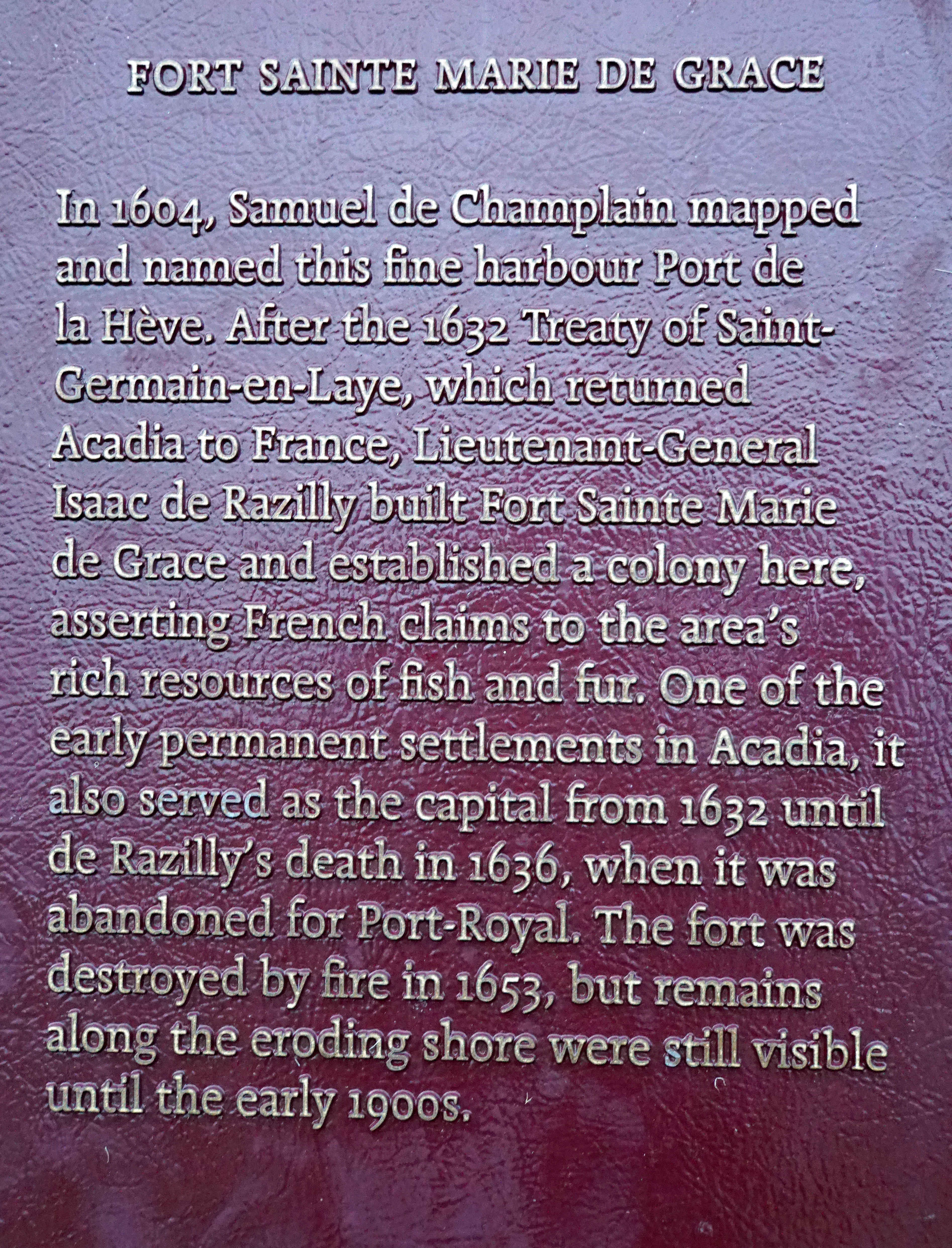
Isaac de Razilly (1587 – 1635) was a member of the French nobility appointed a knight of the Order of St. John of Jerusalem at the age of 18. He was born at the Château d'Oiseaumelle in the Province of Touraine, France. A member of the French navy, he served for many years during which he played an important role in the French colony of Acadia in New France. He was the son of François de Razilly and Catherine de Villiers, brother of Claude de Razilly and François de Razilly. Commandeur de la Commanderie de l'Ile Bouchard (Touraine) Brazil Isaac de Razily explored the coast of Brazil in 1612-15 near the island of Marajó, in the attempts to establish France Equinoxiale, with his brother and leader of the expedition François de Razilly. Morocco (1619-1624) Issac de Razilly already sailed to Morocco in 1619, under the orders of Louis XIII who was considering a colonial venture in Morocco. He was able to reconnoiter the coast as far as Mogador. In 1624, he was put in charg ... [...More Info...] [...Related Items...] OR: [Wikipedia] [Google] [Baidu] |
Treaty Of Saint-Germain-en-Laye (1632)
The Treaty of Saint-Germain-en-Laye was signed on March 29, 1632. It returned New France (Quebec, Acadia and Cape Breton Island) to French control after the English had seized it in 1629,"KIRKE, SIR DAVID, adventurer, trader, colonizer, leader of the expedition that captured Quebec in 1629, and later governor of Newfoundland" ''Dictionary of Canadian Biography Online'' after the had ended. On 19 July 1629, an English fleet under the command of |
Treaty Of Suza
The Treaty of Susa (also sometimes spelled Suza) refers to two separate peace treaties signed in 1629 at Susa in the Duchy of Savoy (now in the Italian Piedmont near the French border), recently occupied by France during the Thirty Years' War. Treaty between France and Savoy This treaty, signed on 11 March 1629, following the French capture of the city, was agreed between Louis XIII of France and Charles Emmanuel I, Duke of Savoy. Its terms allowed French military passage through Savoy to assist in relief of the siege of Casale in the War of the Mantuan Succession, which was to be guaranteed by French occupation of Susa. The Duke was also to refrain from hostilities against the Duchy of Mantua. In return, France was to give Savoy Trino and other territory in Monferrat worth 15,000 crowns. Treaty between France and England and Scotland This treaty, signed on 14 April 1629 ended a war between England and France that had broken out in 1627. Ratified by Charles I of England and ... [...More Info...] [...Related Items...] OR: [Wikipedia] [Google] [Baidu] |
Cape Sable Island, Nova Scotia
Cape Sable Island, locally referred to as Cape Island, is a small Canadian island at the southernmost point of the Nova Scotia peninsula. It is sometimes confused with Sable Island. Historically, the Argyle, Nova Scotia region was known as Cape Sable and encompassed a much larger area than simply the island it does today. It extended from Cape Negro (Baccaro) through Chebogue. The island is situated in Shelburne County south of Barrington Head, separated from the mainland by the narrow strait of Barrington Passage, but has been connected since 1949 by a causeway. The largest community on the island is the town of Clark's Harbour. Other communities are listed below. At the extreme southern tip is Cape Sable. History Cape Sable Island was inhabited by the Mi'kmaq who knew it as Kespoogwitk meaning "land's end". It was first charted by explorers from Portugal who named it Beusablom, meaning "Sandy Bay". French Colony Cape Sable and Cape Negro, Nova Scotia were first settle ... [...More Info...] [...Related Items...] OR: [Wikipedia] [Google] [Baidu] |
Baleine, Nova Scotia
Baleine ( ) (formerly Port aux Baleines) is a community in the Canadian province of Nova Scotia, located in the Cape Breton Regional Municipality on Cape Breton Island. The community is perhaps best known as the landing site for pilot Beryl Markham's record flight across the Atlantic Ocean (SeMemorial Plaque to Record Flight. History Sir Robert Gordon of Lochinvar was one of the first to set out to establish Scottish colonies in America. On 8 November 1621 he obtained a royal charter of what was called the barony of Galloway in Nova Scotia, and in 1625 he published a tract on the subject. "Encouragements for such as shall have intention to bee Vndertakers in the new plantation...By mee Lochinvar...Edinburgh, 1625". Meanwhile, William Alexander, 1st Earl of Stirling, established the first incarnation of "New Scotland" at Port Royal.Nichols, 2010. p. xix During the Anglo-French War (1627–1629), in the time of Charles I, by 1629 the Kirkes had taken Quebec City. On 1 July ... [...More Info...] [...Related Items...] OR: [Wikipedia] [Google] [Baidu] |


