|
Rull Men's Meetinghouse
The Rull Men's Meetinghouse (known as a ''faluw'' in the Yapese language) is a historic meeting house in Rull, a village on the island of Yap in the Federated States of Micronesia. It is a large rectangular structure, set on a raised stone platform. The flooring consists of treated betelnut palm trunks, and has a steeply pitched roof made of bamboo supports with various types of tropical leaves tied in place using coconut fiber. The ''faluw'', although not the first built on this platform, has historically occupied a central place in the civic life of the community, serving as a place where the men of the village could meet in seclusion, and as a place for social rites. The meetinghouse was added to the National Register of Historic Places in 1976,http://www.nps.gov/nr/feature/asia/ (accessed on Feb. 26, 2012) when the region was part of the US-administered Trust Territory of the Pacific Islands The Trust Territory of the Pacific Islands (TTPI) was a United Nations trust te ... [...More Info...] [...Related Items...] OR: [Wikipedia] [Google] [Baidu] |
Rull
Rull ( yap, Ruul) is a municipality in the southern part of the island Yap, Federated States of Micronesia The Federated States of Micronesia (; abbreviated FSM) is an island country in Oceania. It consists of four states from west to east, Yap, Chuuk, Pohnpei and Kosraethat are spread across the western Pacific. Together, the states comprise a .... It has a traditional dancing ground. Rull has a population of 1,847. The historic Rull Men's Meetinghouse is located within the town. Education Yap Catholic High School is in Lamer village, Rull. " Yap Catholic High School. Retrieved on February 22, 2018. References External links [...More Info...] [...Related Items...] OR: [Wikipedia] [Google] [Baidu] |
Federated States Of Micronesia
The Federated States of Micronesia (; abbreviated FSM) is an island country in Oceania. It consists of four states from west to east, Yap, Chuuk, Pohnpei and Kosraethat are spread across the western Pacific. Together, the states comprise around 607 islands (a combined land area of approximately ) that cover a longitudinal distance of almost just north of the equator. They lie northeast of Indonesia and Papua New Guinea, south of Guam and the Marianas, west of Nauru and the Marshall Islands, east of Palau and the Philippines, about north of eastern Australia, 3,400 km (2,133 mi) southeast of Japan, and some southwest of the main islands of the Hawaiian Islands. While the FSM's total land area is quite small, the country's waters occupy more than of the Pacific Ocean, giving the country the 14th-largest exclusive economic zone in the world. The sovereign island nation's capital is Palikir, located on Pohnpei Island, while the largest city is Weno, loca ... [...More Info...] [...Related Items...] OR: [Wikipedia] [Google] [Baidu] |
Yapese Language
Yapese is a language spoken by the people on the island of Yap (Federated States of Micronesia). It belongs to the Austronesian languages, more specifically to the Oceanic branch of that family. It has been difficult to classify it further, but Yapese may prove to be one of the Admiralty Islands languages. Orthography Written Yapese uses Latin script. In Yapese spelling as practiced until the 1970s, the glottal stop was not written with an explicit character. A word-final glottal stop was represented by doubling the final vowel letter. Glottalization of consonants was represented with an apostrophe. In the 1970s an orthography was created which uses double vowel letters to represent long vowels; and because of the ambiguity that would occur if the glottal stop was not written, the glottal stop was written with the letter ''q''. This new orthography using the letter ''q'' is not in universal use, but many works and maps about Yap write place names using the new q-orthograph ... [...More Info...] [...Related Items...] OR: [Wikipedia] [Google] [Baidu] |
Betelnut Palm
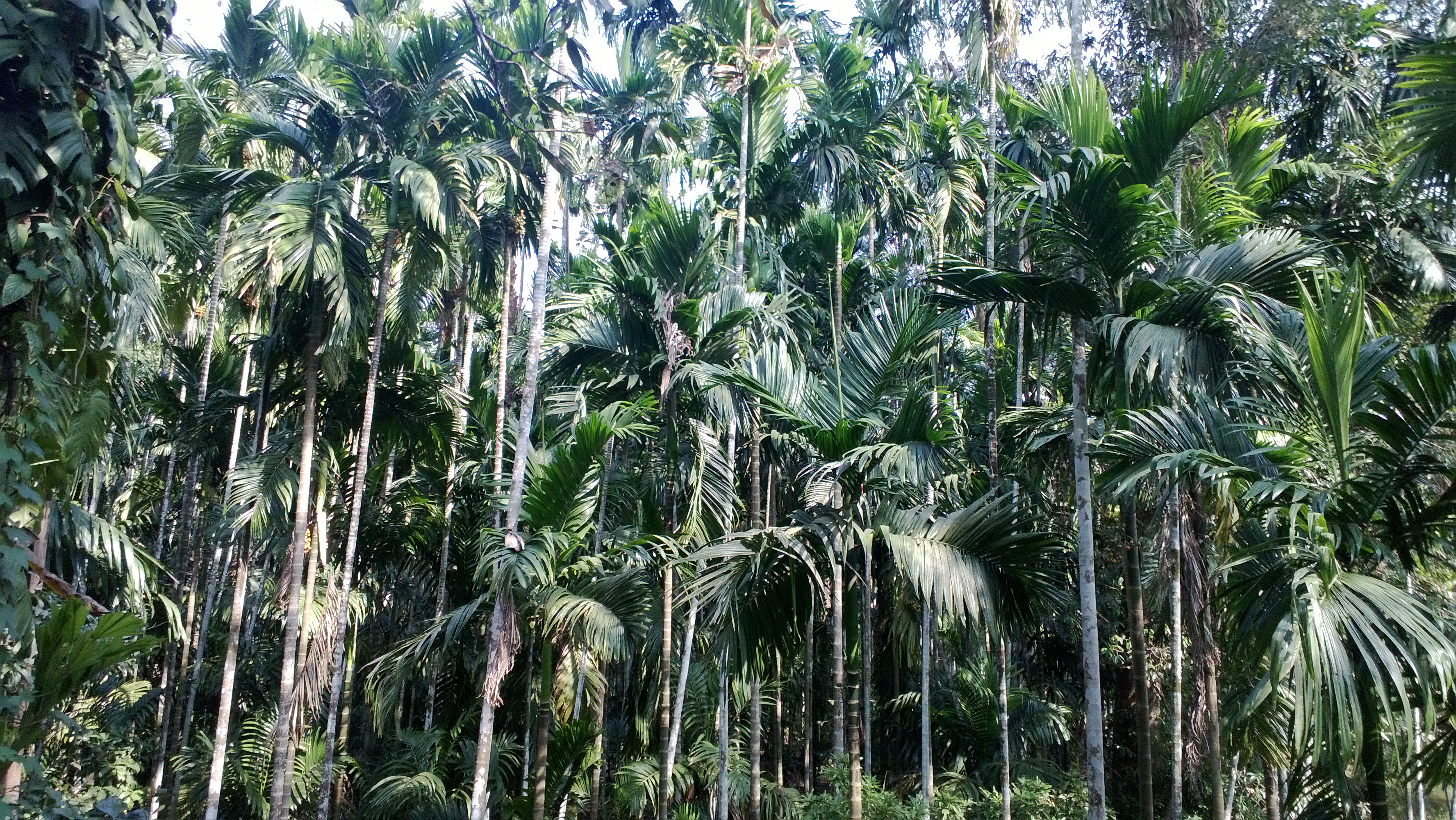
''Areca catechu'' is a species of palm which grows in much of the tropical Pacific, Asia, and parts of east Africa. The palm is believed to have originated in the Philippines, but is widespread in cultivation and is considered naturalized in southern China ( Guangxi, Hainan, Yunnan), Taiwan, India, Bangladesh, the Maldives, Sri Lanka, Cambodia, Laos, Thailand, Vietnam, Malaysia, Indonesia, New Guinea, many of the islands in the Pacific Ocean, and also in the West Indies. Common names in English include areca palm, areca nut palm, betel palm, betel nut palm, Indian nut, Pinang palm and catechu. In English this palm is called the betel tree because its fruit, the areca nut, is often chewed along with the betel leaf, a leaf from a vine of the family Piperaceae. Characteristics Growth ''Areca catechu'' is a medium-sized palm tree, growing straight to tall, with a trunk in diameter. The leaves are long, pinnate, with numerous, crowded leaflets. Chemical composition The s ... [...More Info...] [...Related Items...] OR: [Wikipedia] [Google] [Baidu] |
National Register Of Historic Places
The National Register of Historic Places (NRHP) is the United States federal government's official list of districts, sites, buildings, structures and objects deemed worthy of preservation for their historical significance or "great artistic value". A property listed in the National Register, or located within a National Register Historic District, may qualify for tax incentives derived from the total value of expenses incurred in preserving the property. The passage of the National Historic Preservation Act (NHPA) in 1966 established the National Register and the process for adding properties to it. Of the more than one and a half million properties on the National Register, 95,000 are listed individually. The remainder are contributing resources within historic districts. For most of its history, the National Register has been administered by the National Park Service (NPS), an agency within the U.S. Department of the Interior. Its goals are to help property owners an ... [...More Info...] [...Related Items...] OR: [Wikipedia] [Google] [Baidu] |
Trust Territory Of The Pacific Islands
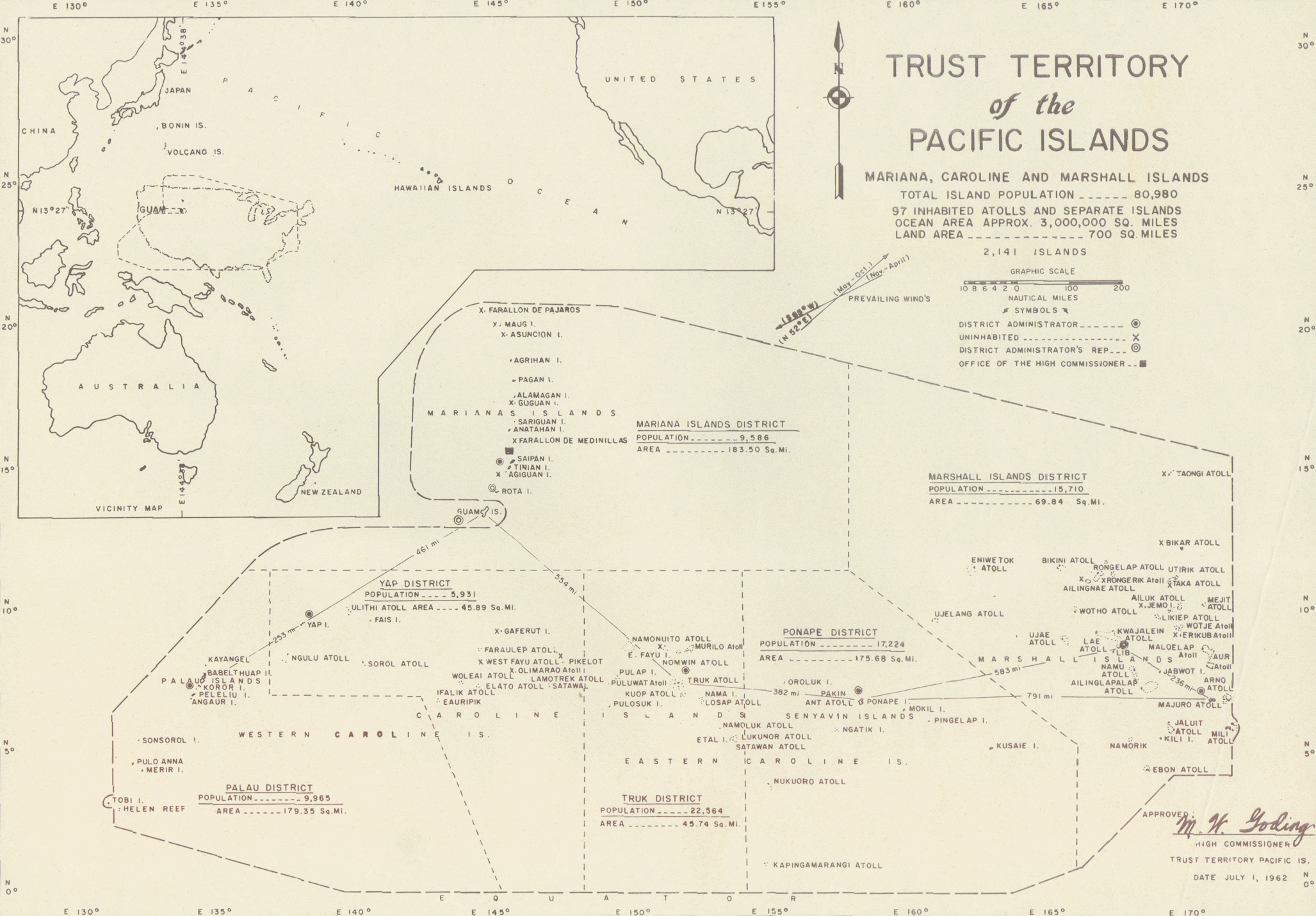
The Trust Territory of the Pacific Islands (TTPI) was a United Nations trust territory in Micronesia administered by the United States from 1947 to 1994. History Spain initially claimed the islands that later composed the territory of the Trust Territory of the Pacific Islands (TTPI).''Encyclopædia Britannica''Trust Territory of the Pacific Islands/ref> Subsequently, Germany established competing claims over the islands. The competing claims were eventually resolved in favor of Germany when Spain, following its loss of several possessions to the United States during the Spanish–American War, ceded its claims over the islands to Germany pursuant to the German–Spanish Treaty (1899). Germany, in turn, continued to retain possession until the islands were captured by Japan during World War I. The League of Nations formally placed the islands in the former South Seas Mandate, a mandate that authorized Japanese administration of the islands. The islands then remained under Japan ... [...More Info...] [...Related Items...] OR: [Wikipedia] [Google] [Baidu] |


