|
Ruabon–Barmouth Line
The Ruabon–Barmouth line was a standard-gauge line owned by the Great Western Railway across the north of Wales which connected Ruabon, in the east, with Barmouth on the west coast. Connections * At Ruabon, the line connected with the Shrewsbury–Chester line (part of the GWR mainline from to Birkenhead Woodside). * At Trevor an incline ran to the Monsanto works. This also connected to the Pontcysyllte Branch, which eventually rejoined the main line near Wrexham. * At Corwen the line connected with the Denbigh, Ruthin and Corwen Railway line. * At Bala Junction the line connected with the Bala and Festiniog Railway. * At Barmouth Junction, the line connected with the Cambrian Coast Line, which was owned by the Aberystwith and Welsh Coast Railway. History The line opened in stages by various companies: * Vale of Llangollen Railway – 1 December 1861 (goods); 2 June 1862 (passenger) * Llangollen and Corwen Railway – 1 May 1865 * Corwen and Bala Railway – 16 July 1866 ( ... [...More Info...] [...Related Items...] OR: [Wikipedia] [Google] [Baidu] |
Standard-gauge
A standard-gauge railway is a railway with a track gauge of . The standard gauge is also called Stephenson gauge (after George Stephenson), International gauge, UIC gauge, uniform gauge, normal gauge and European gauge in Europe, and SGR in East Africa. It is the most widely used track gauge around the world, with approximately 55% of the lines in the world using it. All high-speed rail lines use standard gauge except those in Russia, Finland, and Uzbekistan. The distance between the inside edges of the rails is defined to be 1435 mm except in the United States and on some heritage British lines, where it is defined in U.S. customary/Imperial units as exactly "four feet eight and one half inches" which is equivalent to 1435.1mm. History As railways developed and expanded, one of the key issues was the track gauge (the distance, or width, between the inner sides of the rails) to be used. Different railways used different gauges, and where rails of different gauge met – ... [...More Info...] [...Related Items...] OR: [Wikipedia] [Google] [Baidu] |
Vale Of Llangollen Railway
The Vale of Llangollen Railway was built as a spur from the Shrewsbury and Chester Railway south of Ruabon to the town of Llangollen. The line was built along the northern side of the Dee Valley and authorized by an Act of Parliament on 1 August 1859. It was initially opened for goods only on 1 December 1861 and to passenger traffic on 2 June 1862, and was worked from the outset by the Great Western Railway. The line ran from Llangollen Line Junction (0 miles 54 chains) and served Acrefair, Trevor (and Sun Bank Halt from 1905), before terminating at a temporary station in the east of Llangollen. In 1865 the line was extended by another Great Western Railway-backed line, the Llangollen & Corwen Railway, with the line using a new permanent station in Llangollen. The Vale of Llangollen Railway Company was amalgamated with Great Western as from 1 July 1896 by means of the Great Western Railway (Additional Powers) Act 7 August 1896. [...More Info...] [...Related Items...] OR: [Wikipedia] [Google] [Baidu] |
Llangollen
Llangollen () is a town and community, situated on the River Dee, in Denbighshire, Wales. Its riverside location forms the edge of the Berwyn range, and the Dee Valley section of the Clwydian Range and Dee Valley Area of Outstanding Natural Beauty, with the easternmost point of the Dee Valley Way being within the town. It had a population of 3,658 at the 2011 census. History Llangollen takes its name from the Welsh ''llan'' meaning "a religious settlement" and Saint Collen, a 7th-century monk who founded a church beside the river. St Collen is said to have arrived in Llangollen by coracle. St Collen’s Church is the only church in Wales dedicated to St Collen, and he may have had connections with Colan in Cornwall and with Langolen in Brittany. Above the town to the north is Castell Dinas Brân, a stronghold of the Princes of Powys. Beyond the castle is the impressive Lower Carboniferous limestone escarpment known as the Eglwyseg Rocks. The outcrop continues north to Wo ... [...More Info...] [...Related Items...] OR: [Wikipedia] [Google] [Baidu] |
Corwen
Corwen is a town and community in the county of Denbighshire in Wales. Historically, Corwen is part of the county of Merionethshire. Corwen stands on the banks of the River Dee beneath the Berwyn mountains. The town is situated west of Llangollen and south of Ruthin. At the 2001 Census, Corwen (community and ward) had a population of 2,325, decreasing slightly from the 2001 population of 2,398, The community, with an area of , includes Corwen and the surrounding villages of Carrog, Clawdd Poncen and Glyndyfrdwy. The Office for National Statistics identifies Corwen Built-up area with a 2011 population of and an area of . History Corwen is best known for its connections with Owain Glyndŵr, who was proclaimed Prince of Wales on 16 September 1400, from his nearby manor of Glyndyfrdwy, which began his fourteen-year rebellion against English rule. A statue of Glyndŵr by the sculptor Simon van de Put was installed in The Square in Corwen in 1995, and in 2007 it was replaced ... [...More Info...] [...Related Items...] OR: [Wikipedia] [Google] [Baidu] |
Dolgellau
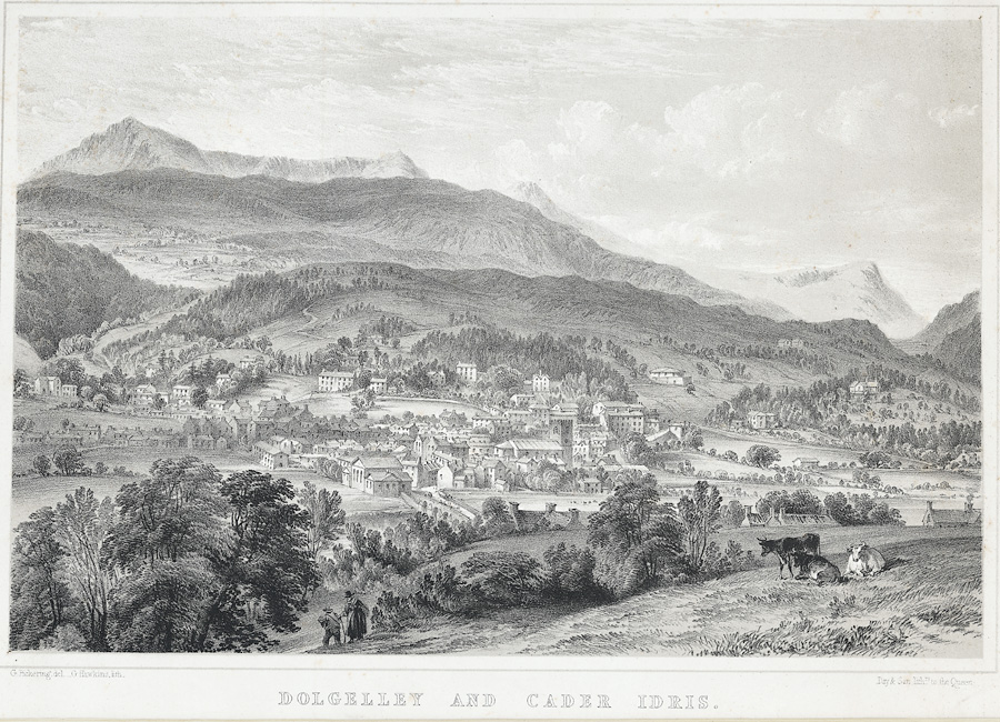
Dolgellau () is a town and community in Gwynedd, north-west Wales, lying on the River Wnion, a tributary of the River Mawddach. It was the traditional county town of the historic county of Merionethshire ( cy, Meirionnydd, Sir Feirionnydd) until the county of Gwynedd was created in 1974. Dolgellau is the main base for climbers of Cadair Idris and Mynydd Moel which are visible from the town. Dolgellau is the second largest settlement in southern Gwynedd after Tywyn and includes the community of Penmaenpool. Etymology The name of the town is of uncertain origin, although ' is Welsh for "meadow" or "dale", and ' (soft mutation of ') means "grove" or "spinney", and is common locally in names for farms in sheltered nooks. This would seem to be the most likely derivation, giving the translation "Grove Meadow". It has also been suggested that the name could derive from the word ', meaning "cell", translating therefore as "Meadow of onks'cells", but this seems less likely considering ... [...More Info...] [...Related Items...] OR: [Wikipedia] [Google] [Baidu] |
Rail Trail
A rail trail is a shared-use path on railway right of way. Rail trails are typically constructed after a railway has been abandoned and the track has been removed, but may also share the right of way with active railways, light rail, or streetcars (rails with trails), or with disused track. As shared-use paths, rail trails are primarily for non-motorized traffic including pedestrians, bicycles, horseback riders, skaters, and cross-country skiers, although snowmobiles and ATVs may be allowed. The characteristics of abandoned railways—gentle grades, well-engineered rights of way and structures (bridges and tunnels), and passage through historical areas—lend themselves to rail trails and account for their popularity. Many rail trails are long-distance trails, while some shorter rail trails are known as greenways or linear parks. Rail trails around the world Americas Bermuda The Bermuda Railway ceased to operate as such when the only carrier to exist in Bermuda folded in 1948. ... [...More Info...] [...Related Items...] OR: [Wikipedia] [Google] [Baidu] |
Mawddach Trail
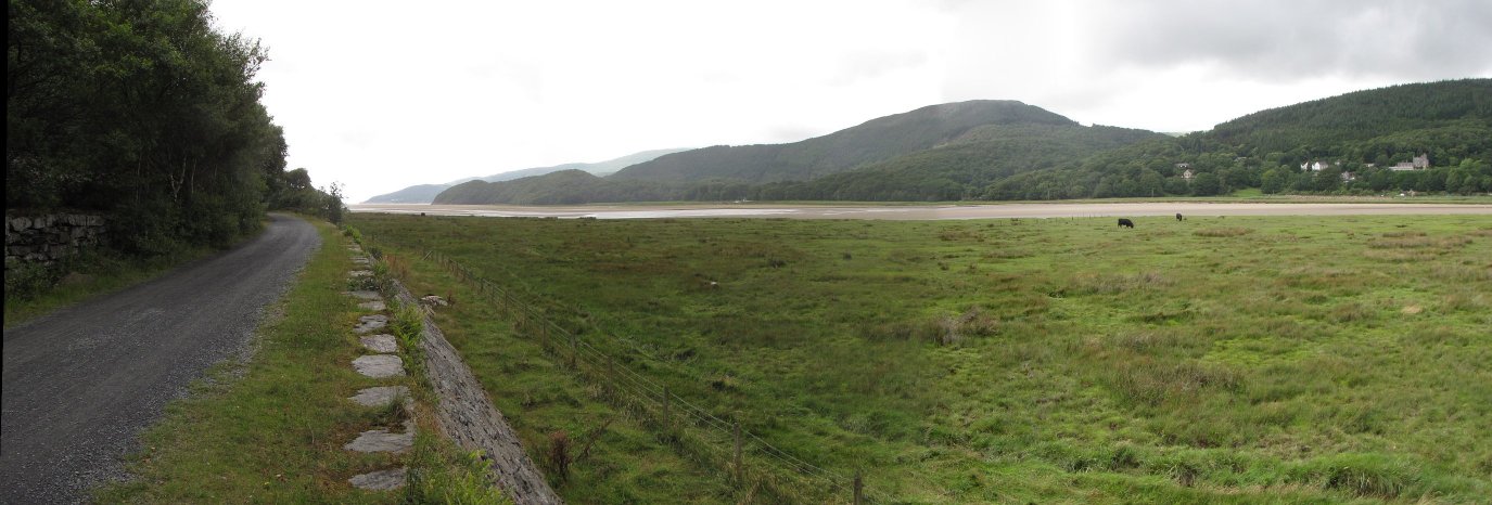
The Mawddach Trail ( cy, Llwybr Mawddach) is a cycle path route, part of Lôn Las Cymru, which runs for some from Dolgellau to Morfa Mawddach railway station , by Barmouth bridge on the Cambrian coast. It is maintained by the Snowdonia National Park and is popular with walkers and cyclists alike. It passes some estuarine areas that are important for water birds, and the RSPB Information Centre at Penmaenpool makes use of the old signal box as an observation centre overlooking the estuary. The cycle route is a rail trail running along the former trackbed of the Ruabon to Barmouth branch line of the Great Western Railway. This line closed under the Beeching Axe The Beeching cuts (also Beeching Axe) was a plan to increase the efficiency of the nationalised railway system in Great Britain. The plan was outlined in two reports: ''The Reshaping of British Railways'' (1963) and ''The Development of the ... in the 1960s. External linksGwynedd Council - Recreational Route ... [...More Info...] [...Related Items...] OR: [Wikipedia] [Google] [Baidu] |
Llangollen Railway
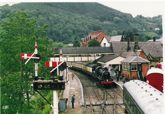
The Llangollen Railway () is a volunteer-run heritage railway in Denbighshire, North Wales, which operates between Llangollen and Corwen. The standard gauge line, which is long, runs on part of the former Ruabon – Barmouth GWR route that closed in 1965. It operates daily services in the summer as well as weekends throughout the winter months, using a variety of mainly ex-GWR steam locomotives as well as several diesel engines and diesel multiple units. A extension of the railway has been built to complete the line to Corwen. In March 2021 the railway company announced that, having made a loss in three consecutive years, they had invited their bank to appoint receivers. History Commercial Service: 1865–1962 Llangollen was already a popular place for tourists by the 1840s. Travel up to this time had been by horse-drawn carriage, but by the 1840s the Shrewsbury to Chester line had been completed, which allowed passengers to alight at (later known as Whitehurst Halt), an ... [...More Info...] [...Related Items...] OR: [Wikipedia] [Google] [Baidu] |
Bala Lake Railway
The Bala Lake Railway ( Welsh: ''Rheilffordd Llyn Tegid'') is a narrow-gauge railway along the southern shore of Bala Lake in Gwynedd, North Wales. The line, which is long, is built on a section of the former standard-gauge Ruabon–Barmouth GWR route that closed in 1965. Another section of the former permanent way is used by the Llangollen Railway. The Bala Lake Railway, which runs on -gauge preserved rolling stock, is a member of the Great Little Trains of Wales. The railway now has the largest collection of historic narrow-gauge quarry locomotives built specifically for the slate industry in North Wales by the Hunslet Engine Company in Leeds. History Standard Gauge The narrow-gauge Bala Lake railway uses the permanent way of the former standard-gauge GWR Ruabon–Barmouth line. The railway, which opened in August 1868, was built by the Bala and Dolgelley Railway Company. Its original route ran between the Corwen & Bala Railway at and Cambrian Railways' station at ... [...More Info...] [...Related Items...] OR: [Wikipedia] [Google] [Baidu] |
Heritage Railway
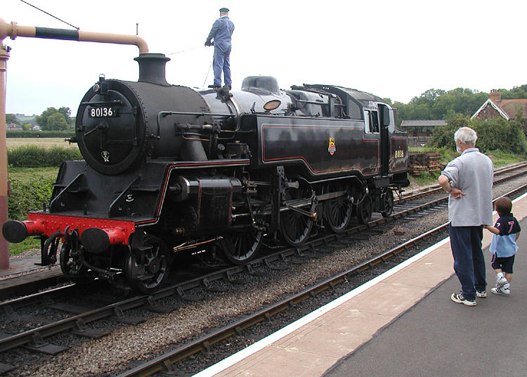
A heritage railway or heritage railroad (US usage) is a railway operated as living history to re-create or preserve railway scenes of the past. Heritage railways are often old railway lines preserved in a state depicting a period (or periods) in the history of rail transport. Definition The British Office of Rail and Road defines heritage railways as follows:...'lines of local interest', museum railways or tourist railways that have retained or assumed the character and appearance and operating practices of railways of former times. Several lines that operate in isolation provide genuine transport facilities, providing community links. Most lines constitute tourist or educational attractions in their own right. Much of the rolling stock and other equipment used on these systems is original and is of historic value in its own right. Many systems aim to replicate both the look and operating practices of historic former railways companies. Infrastructure Heritage railway lines ... [...More Info...] [...Related Items...] OR: [Wikipedia] [Google] [Baidu] |
Beeching Axe
The Beeching cuts (also Beeching Axe) was a plan to increase the efficiency of the nationalised railway system in Great Britain. The plan was outlined in two reports: ''The Reshaping of British Railways'' (1963) and ''The Development of the Major Railway Trunk Routes'' (1965), written by Richard Beeching and published by the British Railways Board. The first report identified 2,363 stations and of railway line for closure, amounting to 55% of stations, 30% of route miles, and 67,700 British Rail positions, with an objective of stemming the large losses being incurred during a period of increasing competition from road transport and reducing the rail subsidies necessary to keep the network running. The second report identified a small number of major routes for significant investment. The 1963 report also recommended some less well-publicised changes, including a switch to the now-standard practice of containerisation for rail freight, and the replacement of some services wit ... [...More Info...] [...Related Items...] OR: [Wikipedia] [Google] [Baidu] |
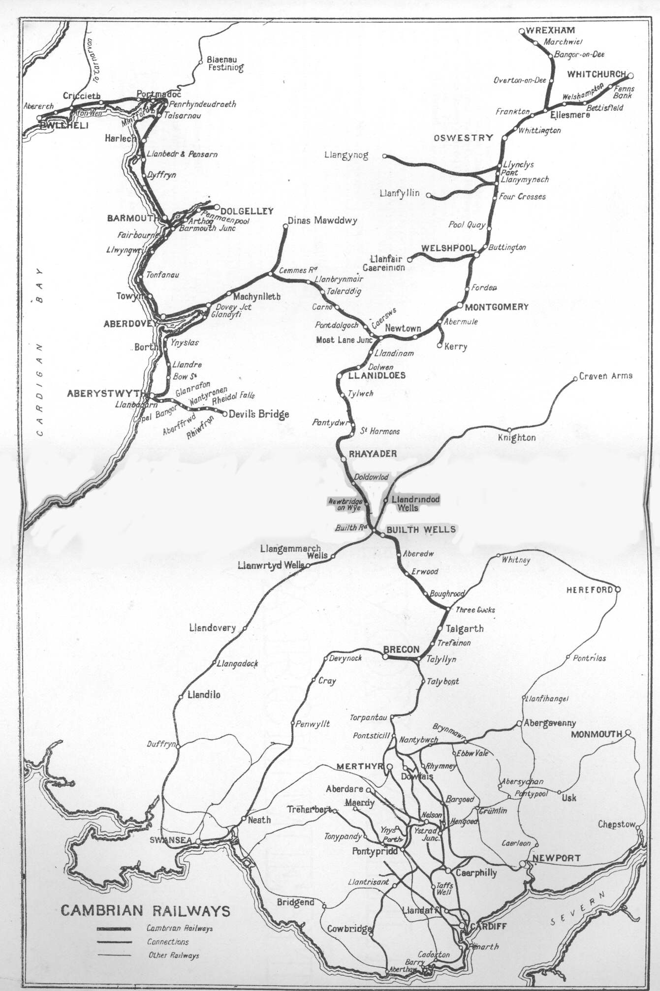
Cambrian Railways
The Cambrian Railways owned of track over a large area of mid Wales. The system was an amalgamation of a number of railways that were incorporated in 1864, 1865 and 1904. The Cambrian connected with two larger railways with connections to the northwest of England via the London and North Western Railway, and the Great Western Railway for connections between London and Wales. The Cambrian Railways amalgamated with the Great Western Railway on 1 January 1922 as a result of the Railways Act 1921. The name is continued today in the route known as the Cambrian Line. History Creation of the Cambrian Railways: 1864 The Cambrian Railways Company was created on 25 July 1864 when the Cambrian Railways Act of Parliament received Royal Assent. The company was formed by amalgamating most of the railway companies in mid Wales: the Oswestry and Newtown Railway, the Llanidloes and Newtown Railway, the Newtown and Machynlleth Railway and the Oswestry, Ellesmere and Whitchurch Railway. ... [...More Info...] [...Related Items...] OR: [Wikipedia] [Google] [Baidu] |


