|
Route Nationale 216
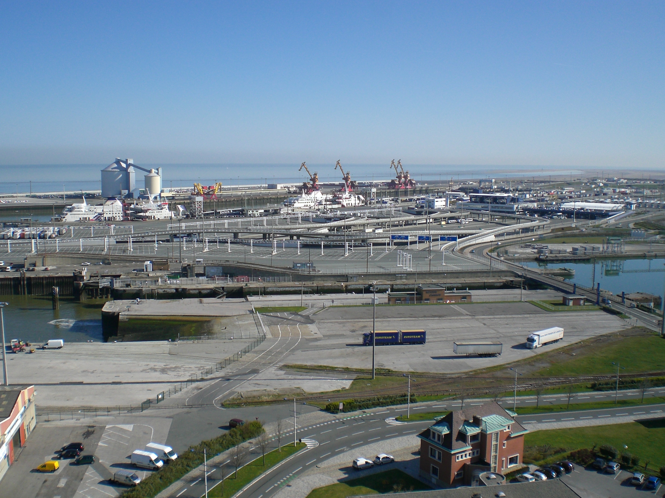
Route Nationale 216, also known as the Rocade Est or Rocade Portuaire, is a French trunk road that connects the long-distance A-16 and A-26 autoroutes to the Calais ferries towards the United Kingdom. From the interchange with the A-16, A-26, the road runs northward, connecting to Rue Yervant Toumaniantz at exit 3, and the Rue de Garennes at exit 2. The northern terminus is at an interchange which connects directly to the ferry terminal, along with an exit for local traffic. The southern 2.5km from junction 3 to the A16/A26 interchange has been upgraded to autoroute standard and is now marked A216. As the main road towards the Port of Calais, the N216 is notorious for migrants attempting to enter the United Kingdom. Since the installation of the Calais Jungle, a number of migrants trying to enter the UK by climbing aboard vehicles have been killed on this road, including 5 deaths in 2016. A second, unofficial camp was set up to the east of the N216 by the curve at exit 2 in 2 ... [...More Info...] [...Related Items...] OR: [Wikipedia] [Google] [Baidu] |
Calais Jungle Location
Calais ( , , traditionally , ) is a port city in the Pas-de-Calais department, of which it is a subprefecture. Although Calais is by far the largest city in Pas-de-Calais, the department's prefecture is its third-largest city of Arras. The population of the city proper is 72,929; that of the urban area is 149,673 (2018).Comparateur de territoire: Aire d'attraction des villes 2020 de Calais (073), Commune de Calais (62193) INSEE Calais overlooks the , the narrowest point in the |
Route Nationale
A ''route nationale'', or simply ''nationale'', is a class of trunk road in France. They are important roads of national significance which cross broad portions of the French territory, in contrast to departmental or communal roads which serve more limited local areas. Their use is free, except when crossing certain structures subject to a toll. They are open to all vehicles, except on certain sections having motorway ('' autoroute'') or express road (''voie express'') status, both of these categories being reserved for motorized vehicles only. France at one time had some 30,500 km of ''routes nationales'' and publicly owned motorways, but this figure has decreased with the transfer of the responsibility for many routes to the ''départements'' so that by 2010 the total length of motorways and other national roads was around 21,100 km. By way of comparison, ''routes départementales'' in the same year covered a total distance of 378,000 km. The layout of the main ... [...More Info...] [...Related Items...] OR: [Wikipedia] [Google] [Baidu] |
A16 Motorway (France)
The A16 Autoroutes of France, autoroute – also known as ''L'Européenne'' and forming between Abbeville and Dunkirk a part of the larger ''Autoroute des estuaires'' – is a motorway in northern France. The motorway, which has a total length of , starts at a junction with the N104 Francilienne near Attainville in Île-de-France and ends at the Belgium, Belgian frontier near Bray-Dunes, serving en route Beauvais, Amiens, Abbeville, Boulogne-sur-Mer, Calais and Dunkirk in Hauts-de-France. From its starting point near Paris, the A16 runs in a northerly direction, continues north parallel to the English Channel from Abbeville and then in an easterly direction along the North Sea coast. It is one of the two main routes between the Port of Calais/Channel Tunnel and Paris, the other being the A26 autoroute, A26 and A1 autoroute, A1 route to the east. The vast majority of the motorway was built in the 1990s to relieve the congested Route nationale 1, RN1 between Paris and the Côte ... [...More Info...] [...Related Items...] OR: [Wikipedia] [Google] [Baidu] |
A26 Motorway (France)
The A26 is a long French motorway connecting Calais and Troyes. It is also known as the Autoroute des Anglais (''Motorway of the English'') as its length forms the first part of the main route from the Dover-Calais ferries and the Channel Tunnel towards Southern and Eastern France and the Cote d'Azur. The motorway is used by a high proportion of British cars, particularly during the summer holiday season. The A26 between Calais and Arras (in conjunction with the A1 autoroute) is part of one of the two main routes between London and Paris, the other being the A16. The road forms part of European route E-15 and E-17. South of its junction with the A29 autoroute the A26 is part of the Grand contournement de Paris. History of the A26 The A26 was conceived in the 1960s as an upgrade to the "Grand Itineraire" Calais-Vitry-le-François which followed mostly the N44. The first part of the motorway opened in December 1976 with the 23 km section from junction 5 at Lilliers to ... [...More Info...] [...Related Items...] OR: [Wikipedia] [Google] [Baidu] |
Calais
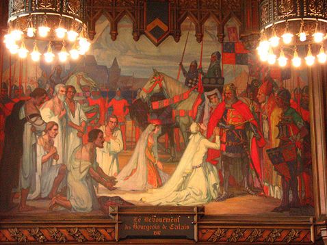
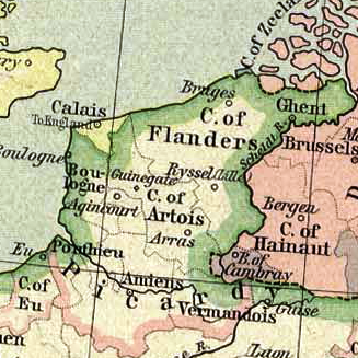
Calais ( , , traditionally , ) is a port city in the Pas-de-Calais department, of which it is a subprefecture. Although Calais is by far the largest city in Pas-de-Calais, the department's prefecture is its third-largest city of Arras. The population of the city proper is 72,929; that of the urban area is 149,673 (2018).Comparateur de territoire: Aire d'attraction des villes 2020 de Calais (073), Commune de Calais (62193) INSEE Calais overlooks the Strait of Dover, the narrowest point in the |
United Kingdom
The United Kingdom of Great Britain and Northern Ireland, commonly known as the United Kingdom (UK) or Britain, is a country in Europe, off the north-western coast of the continental mainland. It comprises England, Scotland, Wales and Northern Ireland. The United Kingdom includes the island of Great Britain, the north-eastern part of the island of Ireland, and many smaller islands within the British Isles. Northern Ireland shares a land border with the Republic of Ireland; otherwise, the United Kingdom is surrounded by the Atlantic Ocean, the North Sea, the English Channel, the Celtic Sea and the Irish Sea. The total area of the United Kingdom is , with an estimated 2020 population of more than 67 million people. The United Kingdom has evolved from a series of annexations, unions and separations of constituent countries over several hundred years. The Treaty of Union between the Kingdom of England (which included Wales, annexed in 1542) and the Kingdom of Scotland in 170 ... [...More Info...] [...Related Items...] OR: [Wikipedia] [Google] [Baidu] |
Port Of Calais
The Port of Calais in northern France is the fourth largest port in France and the largest for passenger traffic. It accounts for more than a third of economic activity in the town of Calais. Background The Port of Calais was the first cable ship port in Europe and is the fourth largest port in France and the largest for passenger traffic. After the Treaty of Le Touquet was signed by France and the UK on 4 February 2003, juxtaposed controls were established in the port. Passengers travelling from the port to Dover, UK go through French exit checks (conducted by the French Border Police and French Customs) as well as UK immigration entry checks (by the UK Border Force) before embarkation. UK Border Force officers have the power to arrest and detain individuals in the immigration control zone in the port. Customs checks remain unaffected by the Treaty. Therefore, on arrival in Dover, travellers might still be stopped by UK Border Force customs officers for a customs inspection. ... [...More Info...] [...Related Items...] OR: [Wikipedia] [Google] [Baidu] |
Calais Migrant Crisis (1999–present)
Migrants have gathered in and around Calais, on the northern French coast, since at least the late 1990sN. Bajekal,Inside Calais's Deadly Migrant Crisis(01/08/15) in Time seeking to enter the United Kingdom from the French port by crossing the Channel Tunnel or stowing away in the cargo area of lorries heading for ferries that cross the English Channel. During this time, informal camps of migrants have formed, the most notorious commonly referred to as the Calais Jungle. Other migrants come to the area because they are homeless while seeking asylum in France. The presence of migrants in and around Calais has affected the British and French governments, the Eurotunnel and P&O Ferries companies, and lorry drivers heading for the UK and their companies. EuroTunnel (now Getlink), the company that operates the Channel Tunnel, said that it intercepted more than 37,000 migrants between January and July 2015. Migrant population Demographics The migrant population around ... [...More Info...] [...Related Items...] OR: [Wikipedia] [Google] [Baidu] |


