|
Roggel
Roggel is a village in the Dutch province of Limburg. It is located in the municipality of Leudal. History The village was first mentioned in 1230 as Rogle. The etymology is unclear. Roggel developed along the Roggelse Beek. It used to part of the County of Horne. Later it became it part of the Prince-Bishopric of Liège. In 1679, it became an independent ''heerlijkheid''. The Catholic St Peter Church is a three aisled church which was built in 1477 to replaced the 13th century chapel. The latest extension was in 1929. In 1944, the tower was partially blown up and rebuilt in 1946. Rogger was home to 281 people in 1840. The grist mill Sint-Pieter was built in 1901. After 1953, the mill went out of service. It was sold to the municipality in 1969, and restored in 1976. The wind mill is often in service. The former municipality of Roggel merged in 1991 with Neer. The new municipality was initially named "Roggel", but changed its name to Roggel en Neer in 1993. In 2007 Roggel en ... [...More Info...] [...Related Items...] OR: [Wikipedia] [Google] [Baidu] |
Roggel En Neer
Roggel en Neer () is a former municipality in the Netherlands, Dutch province of Limburg (Netherlands), Limburg. It covered the villages of Roggel, Neer, and Heibloem. Since January 1, 2007, the area has been a part of the new municipality of Leudal. Roggel en Neer is the renaming of the municipality of Roggel in 1993. {{coord, 51, 15, 48, N, 5, 55, 23, E, region:NL-LI_type:city(8428)_source:dewiki, display=title Municipalities of the Netherlands established in 1993 Municipalities of the Netherlands disestablished in 2007 Former municipalities of Limburg (Netherlands) Leudal ... [...More Info...] [...Related Items...] OR: [Wikipedia] [Google] [Baidu] |
Leudal
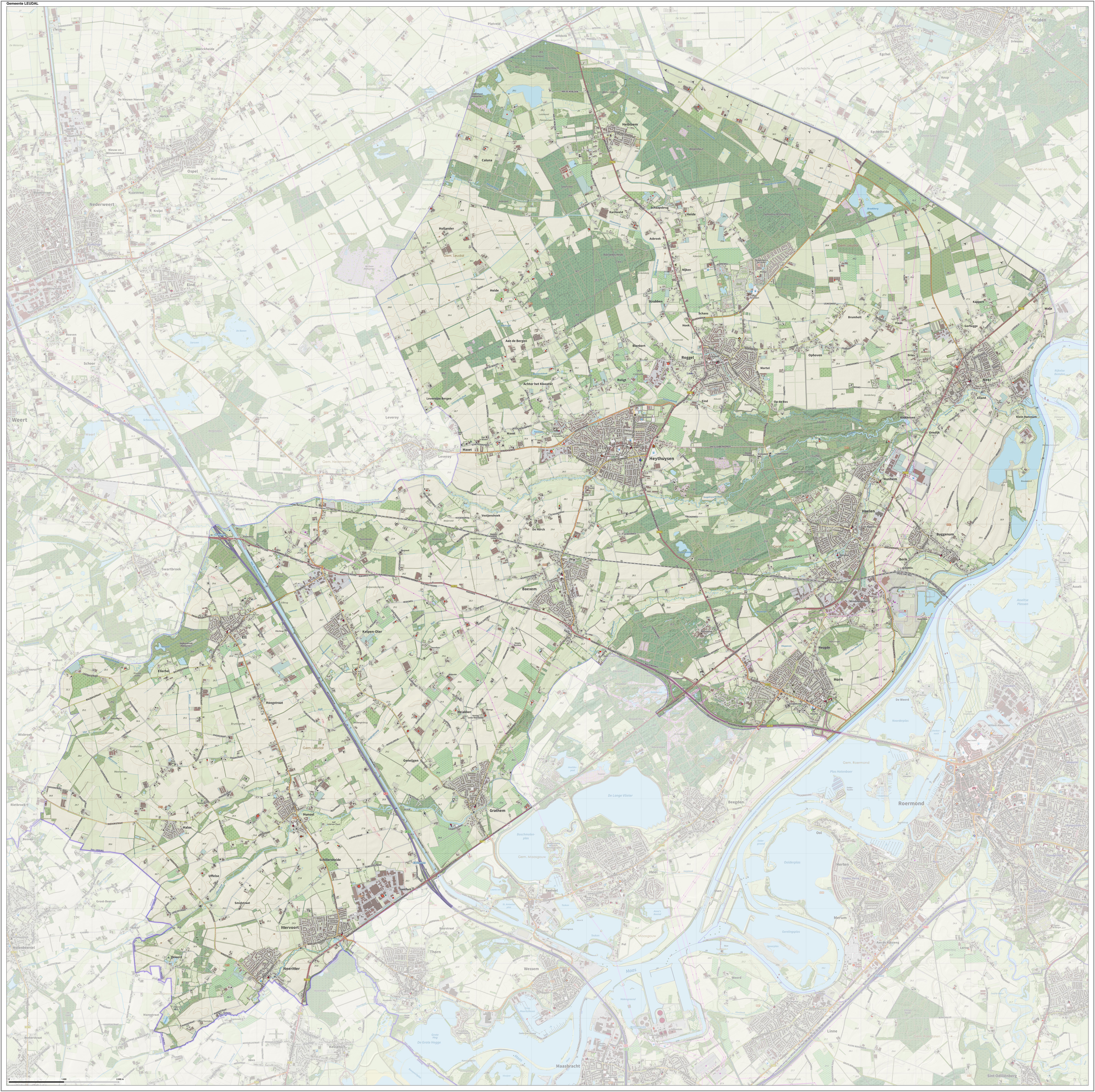
Leudal (Limburgish: ''Leudaal'') is a municipality in the Dutch province of Limburg. It was formed on January 1, 2007 in a merger of the municipalities of Heythuysen, Haelen, Hunsel, and Roggel en Neer. Population centres The municipality contains the following population centres: Topography ''Dutch Topographic map of the municipality of Leudal, June 2015'' Notable people * Arnold II of Horne (1339 – 1389) Bishop of Utrecht 1371/1378 and Bishop of Liège 1378/1389 * Philip de Montmorency, Count of Horn (ca.1524 – 1568) a victim of the Inquisition in the Spanish Netherlands * Floris of Montmorency (ca.1528 - 1570) a noble and diplomat from the Spanish Netherlands * Wilhelmus Demarteau (1917 in Horn – 2012) Bishop in the Roman Catholic Diocese of Banjarmasin, Indonesia * Peter J. Peters (born 1957 in Hunsel) a professor of nanobiology, works on electron microscopy * Carool Kersten (born 1964 in Haelen) a historian of Islam, academic and author * Stevie Ann (bor ... [...More Info...] [...Related Items...] OR: [Wikipedia] [Google] [Baidu] |
County Of Horne
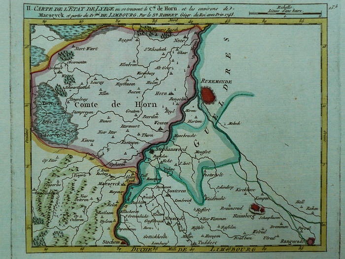
Horne (also ''Horn'', ''Hoorn'' or ''Hoorne'') is a small historic county of the Holy Roman Empire in the present day Netherlands and Belgium. It takes its name from the village Horn, west of Roermond. The residence of the counts of Horne was moved from Horn to Weert in the 15th century. After the execution in 1568 of Philip de Montmorency who died without male heirs, the Prince-Bishop of Liège, as suzerain of Horne, was declared the direct lord and new count. The bishops ruled the county in personal union. Horne maintained its own laws and customs as well as its financial autonomy. The county included the communes of Neer, Nunhem, Haelen, Buggenum, Roggel, Heythuysen, Horne, Beegden, Geystingen and Ophoven.Bulletin de la Commission centrale de statistique, Brussels, 1857, vol. 7, p. 136. It was suppressed in 1795, when it was occupied by the French, and it became part of the French département Meuse-Inférieure. Rulers of Horne Lords of Horne * Engelbert de Hurne, * Enge ... [...More Info...] [...Related Items...] OR: [Wikipedia] [Google] [Baidu] |
Neer
Neer is a village in Limburg, Netherlands. It is located in the municipality of Leudal, on the river Maas about 8 km north of Roermond. History The village was first mentioned in 1204 as Nere, and refers to the brook Neerbeek. Neer developed in the Early Middle Ages on higher sand grounds along the Neerbeek close to its confluence with the Maas. Neer was first part of the County of Horne and later the Prince-Bishopric of Liège. In 1677, it became a '' heerlijkheid''. The Catholic St Martinus is a three aisled basilica-like church with a tower at a side. It was probably completed around 1400. The church was replaced between 1908 and 1909 in a Gothic Revival style, but the tower remained and was enlarged. The top of the tower was blown up in 1944, and rebuilt in 1954 in a more modest style. The watermill Friedesse Molen was built in 1617 and served as a grist mill. In the early 1950s, an electro motor was installed. Both the Province and the population of Neer lobbied fo ... [...More Info...] [...Related Items...] OR: [Wikipedia] [Google] [Baidu] |
Prince-Bishopric Of Liège
The Prince-Bishopric of Liège or Principality of Liège was an Hochstift, ecclesiastical principality of the Holy Roman Empire that was situated for the most part in present-day Belgium. It was an Imperial State, Imperial Estate, so the List of bishops and prince-bishops of Liège, bishop of Liège, as its prince, had a seat and a vote in the Imperial Diet (Holy Roman Empire), Imperial Diet. The Prince-Bishopric of Liège should not be confused with the Diocese of Liège, which was larger and over which the prince-bishop exercised only the usual responsibilities of a bishop. The bishops of Liège acquired their status as prince-bishops between 980 and 985 when Bishop Notker of Liège, who had been the bishop since 972, received secular control of the County of Huy from Otto II, Holy Roman Emperor. From 1500, the prince-bishopric belonged to the Lower Rhenish–Westphalian Circle. Its territory included most of the present Belgian provinces of Liège (province), Liège and Limbu ... [...More Info...] [...Related Items...] OR: [Wikipedia] [Google] [Baidu] |
Former Municipalities Of Limburg (Netherlands)
A former is an object, such as a template, gauge or cutting die, which is used to form something such as a boat's hull. Typically, a former gives shape to a structure that may have complex curvature. A former may become an integral part of the finished structure, as in an aircraft fuselage, or it may be removable, being using in the construction process and then discarded or re-used. Aircraft formers Formers are used in the construction of aircraft fuselage, of which a typical fuselage has a series from the nose to the empennage, typically perpendicular to the longitudinal axis of the aircraft. The primary purpose of formers is to establish the shape of the fuselage and reduce the column length of stringers to prevent instability. Formers are typically attached to longerons, which support the skin of the aircraft. The "former-and-longeron" technique (also called stations and stringers) was adopted from boat construction, and was typical of light aircraft built until the ad ... [...More Info...] [...Related Items...] OR: [Wikipedia] [Google] [Baidu] |
Populated Places In Limburg (Netherlands)
Population typically refers to the number of people in a single area, whether it be a city or town, region, country, continent, or the world. Governments typically quantify the size of the resident population within their jurisdiction using a census, a process of collecting, analysing, compiling, and publishing data regarding a population. Perspectives of various disciplines Social sciences In sociology and population geography, population refers to a group of human beings with some predefined criterion in common, such as location, race, ethnicity, nationality, or religion. Demography is a social science which entails the statistical study of populations. Ecology In ecology, a population is a group of organisms of the same species who inhabit the same particular geographical area and are capable of interbreeding. The area of a sexual population is the area where inter-breeding is possible between any pair within the area and more probable than cross-breeding with ind ... [...More Info...] [...Related Items...] OR: [Wikipedia] [Google] [Baidu] |
Grist Mill
A gristmill (also: grist mill, corn mill, flour mill, feed mill or feedmill) grinds cereal grain into flour and Wheat middlings, middlings. The term can refer to either the Mill (grinding), grinding mechanism or the building that holds it. Grist is grain that has been separated from its chaff in preparation for grinding. History Early history The Greek geographer Strabo reports in his ''Geography'' a water-powered grain-mill to have existed near the palace of king Mithradates VI Eupator at Cabira, Asia Minor, before 71 BC. The early mills had horizontal paddle wheels, an arrangement which later became known as the "Water wheel#Vertical axis, Norse wheel", as many were found in Scandinavia. The paddle wheel was attached to a shaft which was, in turn, attached to the centre of the millstone called the "runner stone". The turning force produced by the water on the paddles was transferred directly to the runner stone, causing it to grind against a stationary "Mill machinery#Wat ... [...More Info...] [...Related Items...] OR: [Wikipedia] [Google] [Baidu] |
Heerlijkheid
A ''heerlijkheid'' (a Dutch word; pl. ''heerlijkheden''; also called ''heerschap''; Latin: ''Dominium'') was a landed estate that served as the lowest administrative and judicial unit in rural areas in the Dutch-speaking Low Countries before 1800. It originated as a unit of lordship under the feudal system during the Middle Ages. The English equivalents are '' manor'', ''seigniory'' and ''lordship''.. The translation used by J.L. Price in ''Dutch Society 1588-1713'' is "manor"; by David Nicholas in ''Medieval Flanders'' is "seigneury". The German equivalent is ''Herrschaft''. The ''heerlijkheid'' system was the Dutch version of manorialism that prevailed in the Low Countries and was the precursor to the modern municipality system in the Netherlands and Flemish Belgium. Characteristics and types A typical ''heerlijkheid'' manor consisted of a village and the surrounding lands extending out for a kilometre or so. Taking 18th-century Wassenaar as an example of a large ''hoge heerlij ... [...More Info...] [...Related Items...] OR: [Wikipedia] [Google] [Baidu] |
List Of Sovereign States
The following is a list providing an overview of sovereign states around the world with information on their status and recognition of their sovereignty. The 206 listed states can be divided into three categories based on membership within the United Nations System: 193 UN member states, 2 UN General Assembly non-member observer states, and 11 other states. The ''sovereignty dispute'' column indicates states having undisputed sovereignty (188 states, of which there are 187 UN member states and 1 UN General Assembly non-member observer state), states having disputed sovereignty (16 states, of which there are 6 UN member states, 1 UN General Assembly non-member observer state, and 9 de facto states), and states having a special political status (2 states, both in free association with New Zealand). Compiling a list such as this can be a complicated and controversial process, as there is no definition that is binding on all the members of the community of nations concerni ... [...More Info...] [...Related Items...] OR: [Wikipedia] [Google] [Baidu] |
Netherlands
) , anthem = ( en, "William of Nassau") , image_map = , map_caption = , subdivision_type = Sovereign state , subdivision_name = Kingdom of the Netherlands , established_title = Before independence , established_date = Spanish Netherlands , established_title2 = Act of Abjuration , established_date2 = 26 July 1581 , established_title3 = Peace of Münster , established_date3 = 30 January 1648 , established_title4 = Kingdom established , established_date4 = 16 March 1815 , established_title5 = Liberation Day (Netherlands), Liberation Day , established_date5 = 5 May 1945 , established_title6 = Charter for the Kingdom of the Netherlands, Kingdom Charter , established_date6 = 15 December 1954 , established_title7 = Dissolution of the Netherlands Antilles, Caribbean reorganisation , established_date7 = 10 October 2010 , official_languages = Dutch language, Dutch , languages_type = Regional languages , languages_sub = yes , languages = , languages2_type = Reco ... [...More Info...] [...Related Items...] OR: [Wikipedia] [Google] [Baidu] |


