|
Rochdale Way
The Rochdale Way is a circular walking route around the Metropolitan Borough of Rochdale in Greater Manchester, which takes in the best scenery and interesting buildings of the area. Areas covered include the following: *Hollingworth Lake *Blackstone Edge on the Pennine Way *Watergrove Reservoir * Healey Dell *Knowl Hill *Naden Valley *Queen's Park, Heywood *Rhodes *Alkrington * Middleton *Hopwood * Tandle Hill *Piethorne Valley Piethorne Brook is a watercourse in Greater Manchester. It is a tributary of the River Beal. Sources Piethorne Brook and its feeder streams originate on the area of high moorland at Windy Hill on the south side of the M62 motorway close to it ... Bibliography ''The Rochdale Way'' by Richard Catlow, John Cole and Martin Riley Long-distance footpaths in England Footpaths in Greater Manchester Geography of the Metropolitan Borough of Rochdale {{UK-trail-stub ... [...More Info...] [...Related Items...] OR: [Wikipedia] [Google] [Baidu] |
Metropolitan Borough Of Rochdale
The Metropolitan Borough of Rochdale is a metropolitan borough of Greater Manchester in North West England. It is named after its largest town, Rochdale, The borough covers other outlying towns and villages with a population of 206,500 at the 2011 census. It is the ninth-largest district by population in Greater Manchester. History The borough was formed in 1974 as part of the provisions of the Local Government Act 1972 and is an amalgamation of six former local government districts. It was originally proposed that the borough include the neighbouring town of Bury and disclude Middleton; Bury however went on to form the administrative centre for the adjacent Metropolitan Borough of Bury. The borough was formed by a merger of the former county borough of Rochdale and from the administrative county of Lancashire, the municipal boroughs of Heywood and Middleton, along with the urban districts of Littleborough, Milnrow and Wardle.The borough lies mostly within the historic count ... [...More Info...] [...Related Items...] OR: [Wikipedia] [Google] [Baidu] |
Greater Manchester
Greater Manchester is a metropolitan county and combined authority, combined authority area in North West England, with a population of 2.8 million; comprising ten metropolitan boroughs: City of Manchester, Manchester, City of Salford, Salford, Metropolitan Borough of Bolton, Bolton, Metropolitan Borough of Bury, Bury, Metropolitan Borough of Oldham, Oldham, Metropolitan Borough of Rochdale, Rochdale, Metropolitan Borough of Stockport, Stockport, Tameside, Trafford and Metropolitan Borough of Wigan, Wigan. The county was created on 1 April 1974, as a result of the Local Government Act 1972, and designated a functional Manchester City Region, city region on 1 April 2011. Greater Manchester is formed of parts of the Historic counties of England, historic counties of Cheshire, Lancashire and the West Riding of Yorkshire. Greater Manchester spans , which roughly covers the territory of the Greater Manchester Built-up Area, the List of urban areas in the United Kingdom, second most ... [...More Info...] [...Related Items...] OR: [Wikipedia] [Google] [Baidu] |
Hollingworth Lake
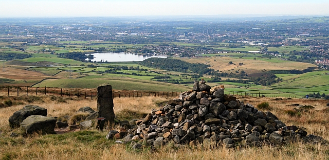
Hollingworth Lake is a reservoir at Smithy Bridge in Littleborough, Greater Manchester, England. It was originally built as the main water source for the Rochdale Canal, but developed as a tourist resort from the 1860s. Hotels were built around it, helped by the arrival of the railway in 1839, which brought day-trippers and weekend visitors from Manchester, Bradford and Leeds. The popularity of the lake as a resort declined in the early twentieth century and the area was used as an army camp in the First World War. The canal company sold the reservoir to Oldham and Rochdale Corporations for water supply in 1923. After the Second World War, boating rights were bought by Rochdale Council, who developed the area into the Hollingworth Lake Country Park in 1974. There has been a steady increase in facilities since, and it is now a thriving centre for water sports and other activities. Hollingworth Lake Rowing Club has been in continuous existence since 1872. History In 1794, an ... [...More Info...] [...Related Items...] OR: [Wikipedia] [Google] [Baidu] |
Blackstone Edge
Blackstone Edge ( ) is a gritstone escarpment at 472 m (1,549 feet) above sea level in the Pennine hills surrounded by moorland on the boundary between Greater Manchester and West Yorkshire in England. History Crossing the escarpment is Blackstone Edge Long Causeway, also known as Blackstone Edge Roman Road, a partially paved road on the Greater Manchester side, becoming a holloway through peat as it runs into Yorkshire. The Blackstone Edge Long Causeway was originally thought to be of Roman origin until investigations by James Maxim, who proposed the theory that it was actually a 1735 turnpike or packhorse route. This theory was widely accepted until 2012 when investigations by Archaeological Services WYAS led them to conclude that "The archaeological surface evidence...suggests that the route of the road is unlikely to have originated as part of a turnpike scheme as probable medieval and post-medieval features, including a packhorse road, appear to overlie the substantia ... [...More Info...] [...Related Items...] OR: [Wikipedia] [Google] [Baidu] |
Pennine Way
The Pennine Way is a National Trail in England, with a small section in Scotland. The trail stretches for from Edale, in the northern Derbyshire Peak District, north through the Yorkshire Dales and Northumberland National Park and ends at Kirk Yetholm, just inside the Anglo-Scottish border, Scottish border. The path runs along the Pennines, Pennine hills, sometimes described as the "backbone of England". Although not the United Kingdom's longest National Trail (this distinction belongs to the South West Coast Path), it is according to The Ramblers "one of Britain's best known and toughest". History The path was the idea of the journalist and rambler Tom Stephenson (activist), Tom Stephenson, inspired by similar trails in the United States of America, particularly the Appalachian Trail. Stephenson proposed the concept in an article for the ''Daily Herald (UK newspaper), Daily Herald'' in 1935, and lobbied Parliament for the creation of an official trail. The walk was planned ... [...More Info...] [...Related Items...] OR: [Wikipedia] [Google] [Baidu] |
Watergrove Reservoir
Watergrove Reservoir is a reservoir close to Wardle in the Metropolitan Borough of Rochdale, within Greater Manchester, England. Rochdale Corporation chose Watergrove as a suitable site to build a large reservoir largely to a prolonged drought in the 1930s, resulting in water regularly being bought from Oldham Oldham is a large town in Greater Manchester, England, amid the Pennines and between the rivers Irk and Medlock, southeast of Rochdale and northeast of Manchester. It is the administrative centre of the Metropolitan Borough of Oldham .... The ruins of the old village of Watergrove submerged under the large expanse of water in 1938, and dotted around the landscape above the reservoir there are several ruins originally belonging to the village. The book ''Watergrove: A History of the Valley and its Drowned Village'' by Allen Holt gives a personal view of the transition as the author grew up in Wardle, a mile to the south of Watergrove. Several photographs in ... [...More Info...] [...Related Items...] OR: [Wikipedia] [Google] [Baidu] |
Healey Dell Viaduct
Healey Dell Viaduct is a viaduct situated in Healey Dell Nature Reserve in the Spodden Valley, on the outskirts of Rochdale in Greater Manchester, England. It is from Whitworth, Lancashire. It was built in 1867 and carried the Rochdale to Bacup Railway Line, opening to passengers on 1 November 1870. It operated until 1949, and carried coal trains until into the 1960s. The viaduct was built from locally quarried gritstone and only a single track wide. It is high above the river, with eight arches, each with a span. In November 1984, the viaduct was Grade II listed. Today it carries the National Cycle Network, Regional Network Route 92 which joins National Route 66. Healey Dell is on the Rochdale Way and the Pennine Bridleway The Pennine Bridleway is a National Trail in Northern England. It runs roughly parallel with the Pennine Way but provides access for horse riders and cyclists as well as walkers. The trail is around long, extending from Derbyshire to Cumbria ... [...More Info...] [...Related Items...] OR: [Wikipedia] [Google] [Baidu] |
Heywood, Greater Manchester
Heywood is a town in the Metropolitan Borough of Rochdale, Greater Manchester, England, in the historic county of Lancashire. It had a population of 28,205 at the 2011 Census. The town lies on the south bank of the River Roch, east of Bury, southwest of Rochdale, and north of Manchester. Middleton lies to the south, whilst to the north is the Cheesden Valley, open moorland, and the Pennines. Heywood's nickname is Monkey Town. The Anglo-Saxons cleared the densely wooded area, dividing it into heys or fenced clearings. In the Middle Ages, Heywood formed a chapelry in the township, around Heywood Hall, a manor house owned by a family with that surname. Farming was the main industry of a sparsely populated rural area. The population supplemented their incomes by hand-loom woollen weaving in the domestic system. The factory system in the town can be traced to a spinning mill in the late 18th century. Following the introduction of textile manufacture during the Industrial R ... [...More Info...] [...Related Items...] OR: [Wikipedia] [Google] [Baidu] |
Alkrington
Alkrington Garden Village is a suburban area of Middleton, in the Metropolitan Borough of Rochdale, Greater Manchester England. Historically a part of Lancashire, in the Middle Ages Alkrington was a township in the parish of Prestwich-cum-Oldham in the hundred of Salford. Once rolling farmland, in 1886 Alkrington was added to the Municipal Borough of Middleton, and developed into a residential area. Alkrington lies on the northern edge of the city of Manchester with the suburb of Blackley directly to the south. The Local Government Act 1972 added Alkrington to the Metropolitan Borough of Rochdale; though Alkrington is separated from the town of Rochdale by the rest of Middleton and rural land. The “Woodside” district of Alkrington is home to a number of affluent properties with Woodfield Road, Middleton's most expensive street, being located here. History In 1212, the manor of Alkrington, consisting of four oxgangs of land, was held by Adam de Prestwich from the Mo ... [...More Info...] [...Related Items...] OR: [Wikipedia] [Google] [Baidu] |
Middleton, Greater Manchester
Middleton is a town in the Metropolitan Borough of Rochdale, Greater Manchester, England, on the River Irk southwest of Rochdale and northeast of Manchester city centre. Middleton had a population of 42,972 at the 2011 Census. It lies on the northern edge of Manchester, with Blackley to the south and Moston to the south east. Historically part of Lancashire, Middleton's name comes from it being the centre of several circumjacent settlements. It was an ecclesiastical parish of the hundred of Salford, ruled by aristocratic families. The Church of St Leonard is a Grade I listed building. The Flodden Window in the church's sanctuary is thought to be the oldest war memorial in the United Kingdom, memorialising the archers of Middleton who fought at the Battle of Flodden in 1513. In 1770, Middleton was a village of twenty houses, but in the 18th and 19th centuries it grew into a thriving and populous seat of textile manufacture and it was granted borough status in 1886. Langley ... [...More Info...] [...Related Items...] OR: [Wikipedia] [Google] [Baidu] |
Tandle Hill
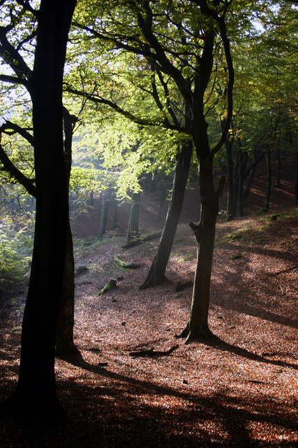
Tandle Hill Country Park is a country park in Royton, Greater Manchester, England. It consists of approximately , a combination of beech woodland and open grassland. The park contains a countryside centre (opened in 1994), picnic areas, children's play area and numerous trails and paths into the surrounding area. Two countryside rangers are based at the countryside centre. In fine weather conditions, it offers views of Manchester and the Welsh mountains. History of the Park Tandle Hill was originally part of the township of Thornham - part of the extensive parish of Middleton. It was used as a meeting place for radicals in the 19th century. In the period leading up to the Peterloo massacre it was said that it had been used by radicals for practising marching and drilling. The beech woodland was planted to prevent this happening again and the hill became a hunting park and private game reserve as part of the Thornham Estate. It was sold in 1861 and came into the ownership of ... [...More Info...] [...Related Items...] OR: [Wikipedia] [Google] [Baidu] |
Piethorne Valley
Piethorne Brook is a watercourse in Greater Manchester. It is a tributary of the River Beal. Sources Piethorne Brook and its feeder streams originate on the area of high moorland at Windy Hill on the south side of the M62 motorway close to its summit near the old boundary between Lancashire and Yorkshire. The source of the brook, and its immediate feeder stream, is beside Rock Stones Hill, at 415 metres above sea level (1360 ft.), to the south west of the telecommunications mast beside the A672 Oldham-Ripponden road. The brook has ten other feeder streams including two from Axletree Edge beyond Bleakedgate Moor, which rises to 425 metres (1400 ft), two from Millstone Moss between Green Hole Hill and Readycon Hill, rising at 445 metres (1450 ft.) and flowing down Great Whinning Gulf and Little Whinning Gulf, via Culvert Clough, into Cold Greave Brook. Course Piethorne Brook feeds and flows through a series of reservoirs constructed during the 19th century. From ... [...More Info...] [...Related Items...] OR: [Wikipedia] [Google] [Baidu] |


