|
Roads And Maritime Services
] Roads and Maritime Services (also known as Roads & Maritime Services) was an Statutory authority, agency of the New South Wales Government responsible for building and maintaining road infrastructure and managing the day-to-day compliance and safety for roads and waterways. The agency was created on 1 November 2011 from a merger of the Roads & Traffic Authority and NSW Maritime. Planning responsibilities were transferred to Transport for NSW, which was created on the same day. In April 2019, it was announced that the agency was to have all its functions transferred to Transport for NSW. Legislation was passed in the NSW Parliament in November 2019, and it was dissolved on 1 December 2019. Functions Roads and Maritime Services managed 4,787 bridges and of state roads and highways, including of national highways, and employed 6,900 staff in more than 180 offices throughout NSW, significantly less as not providing drivers license to people that had undertake tests to do so a ... [...More Info...] [...Related Items...] OR: [Wikipedia] [Google] [Baidu] |
Roads & Traffic Authority
The Roads & Traffic Authority (RTA) was an agency of the New South Wales Government responsible for major road infrastructure, licensing of drivers, and registration of motor vehicles. The RTA directly managed state roads and provided funding to local councils for regional and local roads. In addition, with assistance from the federal government, the RTA also managed the NSW national highway system. The agency was abolished in 2011 and replaced by New South Wales Roads and Maritime Services. History The Department of Main Roads (New South Wales), Department of Main Roads (DMR) was created in November 1932, and undertook works across New South Wales, including maintenance of all major roads into Sydney and programs of road reconstruction, construction, upgrading and rerouting. The DMR was also responsible for many ferries and bridges in New South Wales. In January 1989, the Department of Main Roads, Department of Motor Transport, and the Traffic Authority were amalgamated t ... [...More Info...] [...Related Items...] OR: [Wikipedia] [Google] [Baidu] |
Driving Licence In Australia
Driver licences in Australia refer to the official permit required for a person to legally drive a motor vehicle in Australia. The issue of driver licences, alongside the regulation and enforcement of road use, are all managed by state and territory governments. As no Australia-wide licensing scheme exists, rules for the issue of licences vary by jurisdiction. Nevertheless, licences are generally recognised and valid in other states and territories. Since 1997, nationwide uniform arrangements have been in place for the regulation of full drivers licences for motor vehicles, as well as their renewal. Australia's lack of identity cards has led to driving licences becoming the de facto photo ID used in everyday situations. In 2017, the federal government proposed creation of a national drivers licence database that would involve state or territory governments handing over the identities of drivers in a stated bid to toughen national security laws. The national ID database would ... [...More Info...] [...Related Items...] OR: [Wikipedia] [Google] [Baidu] |
Lawrence Ferry
The Lawrence Ferry (actual name is Bluff Point Ferry, Lawrence) is a cable ferry across the Clarence River in New South Wales, Australia. The ferry operates between the town of Lawrence and Woodford Island, and forms part of the route east from Lawrence to the coast. It is the busiest vehicular ferry in New South Wales. The ferry is operated by a private sector operator under contract to Transport for NSW Transport for NSW, sometimes abbreviated to TfNSW, and pronounced as Transport for New South Wales, is an agency of the New South Wales Government established on 1 November 2011, and is the leading transport and roads agency in New South Wales, .... The ferry operates on demand 24 hours day, 7 days a week. If the ferry is not in operation, the alternatives are a detour via the Ulmarra Ferry, or a detour via the bridge at Grafton. References External links RMS vehicle ferry operation information Ferries of New South Wales Cable ferries in Australia {{ferry- ... [...More Info...] [...Related Items...] OR: [Wikipedia] [Google] [Baidu] |
Berowra Waters
Berowra Waters is an outer suburb of Northern Sydney, in the state of New South Wales, Australia. Berowra is located 40 kilometres north of the Sydney central business district, in the local government area of Hornsby Shire. Berowra Waters is north-west of the suburbs of Berowra Heights and west of Berowra. Berowra Waters is located on Berowra Creek, a tributary of the Hawkesbury River. The Berowra Waters Ferry, a toll-free car ferry, connects the east bank to the west bank with winding roads ascending uphill on both sides. Notable residents include Australian actress Cate Blanchett and her husband Andrew Upton. History It was thought that Berowra was an Aboriginal word that means ''place of many winds''.''The Book of Sydney Suburbs'', Compiled by Frances Pollon, Angus & Robertson Publishers, 1990, Published in Australia , page 27 However, it actually means 'place of many shells' referring to the many shell middens on Berowra Creek. Transport A free three-lane pun ... [...More Info...] [...Related Items...] OR: [Wikipedia] [Google] [Baidu] |
Berowra Waters Ferry
The Berowra Waters Ferry is a cable ferry across the Berowra Creek, a tributary of the Hawkesbury River, located in the Berowra Valley National Park, Sydney, Australia. The ferry operates from the community of Berowra Waters on the west bank of the creek, to a landing on the east bank, thus connecting with the road to Berowra Heights. Description The ferry is operated by a private sector operator under contract to Transport for NSW, and is free of tolls. The crossing is in length and takes approximately three minutes. The ferry operates on demand 24 hours a day, 7 days a week, but is closed for maintenance on the second Tuesday of each month from 1200 to 1430. The Berowra Waters Ferry is one of five cable ferry crossings of the Hawkesbury River system. All the others are across the main channel of the river, comprising in order downstream the Sackville Ferry, Lower Portland Ferry, Webbs Creek Ferry and Wisemans Ferry Wisemans Ferry is a cable ferry across the Hawkesbury ... [...More Info...] [...Related Items...] OR: [Wikipedia] [Google] [Baidu] |
Wisemans Ferry
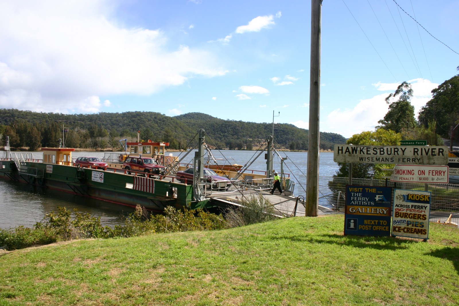
Wisemans Ferry is a cable ferry across the Hawkesbury River in New South Wales, Australia. The ferry operates from the eponymous community of Wisemans Ferry, New South Wales, Wisemans Ferry on the south bank, to a point on the north bank downstream of the Hawkesbury River's confluence with the Macdonald River (St Albans), Macdonald River, connecting with the old Great North Road (Australia), Great North Road. The crossing has remained in use on its current site since 1829, making it the oldest ferry crossing still in operation in New South Wales, and possibly in Australia. Operation The ferry is operated by a private sector operator under contract to Transport for NSW and is free of toll (road usage), tolls. The crossing is in length and takes approximately 4 minutes. The ferry operates on demand 24 hours a day, 7 days a week, with no regular maintenance closure. Two ferry boats are available at this crossing, operating on separate sets of cables, and when traffic demands it ... [...More Info...] [...Related Items...] OR: [Wikipedia] [Google] [Baidu] |
KU 221 ^ RTA Emergency Response Iveco Turbo Daily - Flickr - Highway Patrol Images
Ku, KU, or Kū may refer to: Arts and entertainment * Ku (fictional language), a constructed language created for the 2005 film The Interpreter * Esther Ku, a Korean-American comedian * Kumi Koda, Japanese pop star nicknamed Ku or Kuu * In an alien language in the movie ''Kin-dza-dza!'', "ku" replaces most conventional words, with its meaning guessed from context * In the Discworld, ''Ku'' or ''The Lost Continent of Ku'' is a satirical parody of Atlantis Businesses and organizations Political * ''Kommunistisk Ungdom'' (Communist Youth), the former name of the Young Left (Sweden) * Young Conservatives (Denmark) (''Konservativ Ungdom''), the Young Conservatives (Denmark) * ''Konstitutionsutskottet'', the Committee on the Constitution (Parliament of Sweden) * Ku Klux Klan, a white supremacy group in the US Universities Africa * Kampala University in Kampala, Uganda * Kismayo University in Kismayo, Somalia Japan * Kyoto University, a national research university * Kyushu University ... [...More Info...] [...Related Items...] OR: [Wikipedia] [Google] [Baidu] |
Barrier Boards
Barrier boards are typically long plastic or wooden beams or metal plates used during road works and similar activities to cordon off areas, close roads or direct traffic. They are also known as council barriers, Show Stoppers, works barricades, or safety barricades. Around the World * In Australia barrier boards, normally referred to simply as council barriers, are 2.5m long heavy duty PVC boards with yellow and black reflective stripes on both sides supported by 1 or 2 'A frame' stands/legs. * In Europe barrier boards are typically red and white striped boards made from PVC plastic or wood and are used in conjunction with traffic cones. * In the United States barriers are typically white aluminium or plastic 'A frame' devices with orange and white reflective boards on either one side or both. *In Hong Kong, these barriers are in red and white strips, sometimes there are different uses except for road works See also * Roadworks * Traffic cone Traffic cones, also called p ... [...More Info...] [...Related Items...] OR: [Wikipedia] [Google] [Baidu] |
Traffic Cones
Traffic cones, also called pylons, witches' hats, road cones, highway cones, safety cones, channelizing devices, construction cones, or just cones, are usually cone-shaped markers that are placed on roads or footpaths to temporarily redirect traffic in a safe manner. They are often used to create separation or merge lanes during road construction projects or automobile accidents, although heavier, more permanent markers or signs are used if the diversion is to stay in place for a long period of time. History Traffic cones were invented by Charles D. Scanlon, an American who, while working as a painter for the Street Painting Department of the City of Los Angeles, was unimpressed with the traditional wooden tripods and barriers used to mark roads which were damaged or undergoing repainting. Scanlon regarded these wooden structures as easily broken, hard to see, and a hazard to passing traffic. Scanlon's rubber cone was designed to return to an upright position when struck by a gl ... [...More Info...] [...Related Items...] OR: [Wikipedia] [Google] [Baidu] |
Parkes, New South Wales
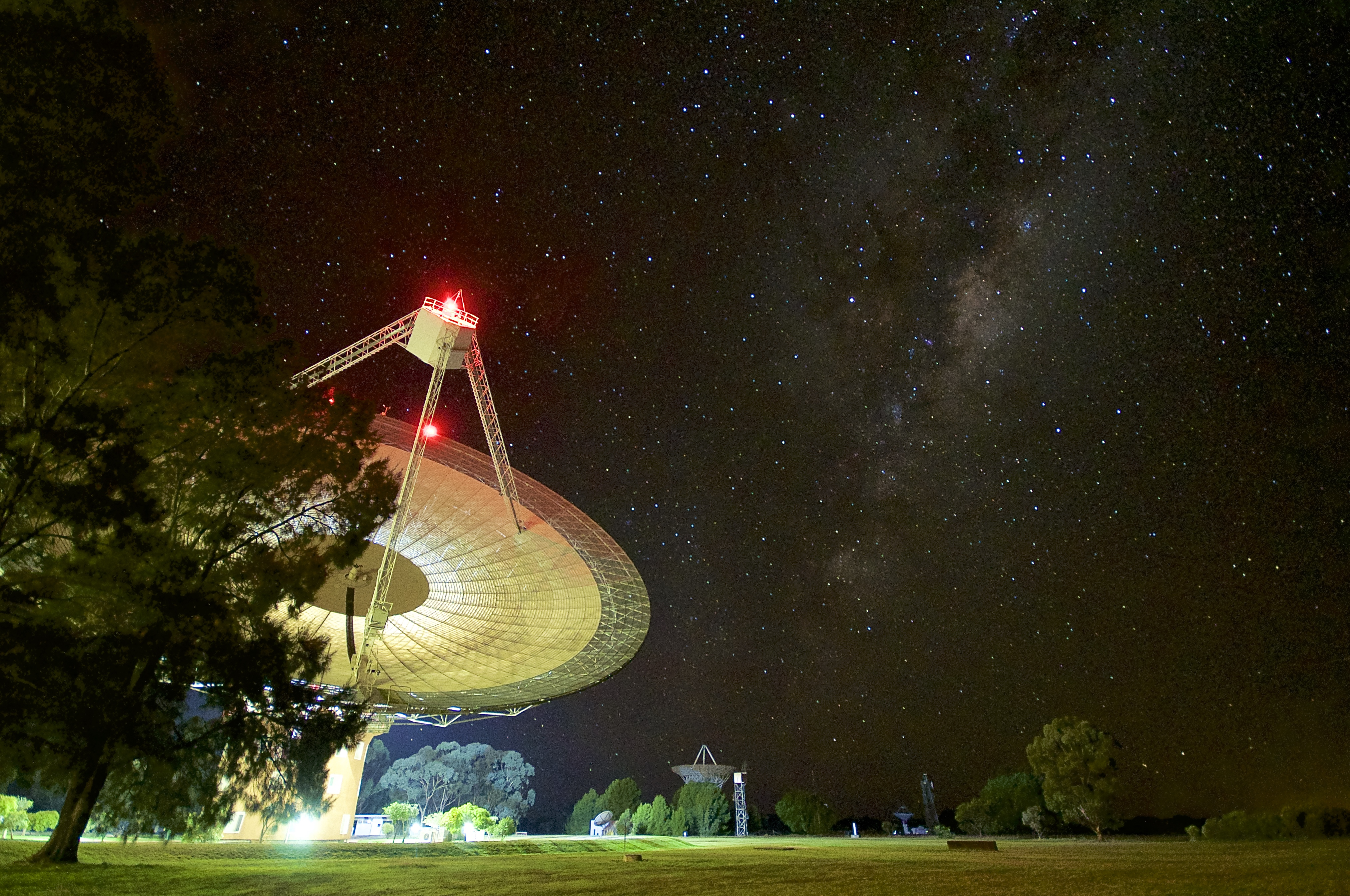
Parkes is a town in the Central West region of New South Wales, Australia. It is the main settlement in the local government area of Parkes Shire. Parkes had a population of 11,224 as at 30 June 2018. Estimated resident population, 30 June 2018. Parkes is part of the traditional lands of the Wiradjuri people, the largest language group in NSW with a country of more than 120,000 square kilometres. History The Wiradjuri people have lived on the lands of the 3 rivers, including the Lachlan River, for more than 40,000 years. The town of Parkes was part of the colonial expansion of the early 19th century, originally founded in 1853 as the settlement Currajong, named for the abundance of kurrajong trees in the local area by the settlers, but was then known as Bushman's (from the local mine named Bushman's Lead). In August 1873, Henry Parkes (later Sir Henry) visited the area and in December 1873 the town was officially renamed Parkes in his honour. (Sir Henry Parkes is recogni ... [...More Info...] [...Related Items...] OR: [Wikipedia] [Google] [Baidu] |
New South Wales Police
The New South Wales Police Force (NSW Police Force; previously the New South Wales Police Service and New South Wales Police) is the primary law enforcement agency of the state of New South Wales, Australia. Divided into Police Area Commands (PACs), for metropolitan areas and Police Districts (PDs), for regional and country areas,Regions, Commands, and Districts nsw.police.gov.au the NSW Police Force consists of more than 400 Police stations and over 18,000 officers, who are responsible for covering an area of 801,600 square kilometres and a population of more than 8.2 million people. Under the Police Regulation Act, 1862, the organisation of the NSW Police Force was formally established in the same year with the unification of all existing ... [...More Info...] [...Related Items...] OR: [Wikipedia] [Google] [Baidu] |


