|
Riverside Drive (Manhattan)
Riverside Drive is a scenic north–south thoroughfare in the New York City borough of Manhattan. The road runs on the Upper West Side of Manhattan, generally paralleling the Hudson River and Riverside Park between 72nd Street and the vicinity of the George Washington Bridge at 181st Street. North of 96th Street, Riverside Drive is a wide divided boulevard. At several locations, a serpentine local street diverges from the main road, providing access to the residential buildings. Some of the city's most coveted addresses are located along its route. History Development The of land in the original park between 72nd to 125th Streets were originally inhabited by the Lenape people, but by the 18th century were used for farms by the descendants of European colonists. In 1846, the Hudson River Railroad (later the West Side Line and Hudson Line) was built along the waterfront, connecting New York City to Albany. In 1865, Central Park commissioner William R. Martin put forth ... [...More Info...] [...Related Items...] OR: [Wikipedia] [Google] [Baidu] |
Islamic Cultural Center Of New York
The Islamic Cultural Center of New York is a mosque and an Islamic cultural center in East Harlem, Manhattan, New York City, United States. It is located at 1711 Third Avenue, between East 96th Street (Manhattan), 96th and 97th Streets. The Islamic Cultural Center was the first purpose-built mosque in Islam in New York City, New York and continues to be one of the city's largest. The mosque's older dwelling in a townhouse at 1 Riverside Drive (Manhattan), Riverside Drive is still in continual prayer use as a satellite location. The Islamic Cultural Center of New York is a standing building that is 61 meters wide and 73 meters long. The mosque is located at East 96th Street and 3rd Avenue on Manhattan's Upper East Side. When looking at it, the mosque is rotated 29 degrees towards the streets. The architects did this to portray the Turkish mosque and complete two goals. Those two goals were to stand out from its surroundings, and the mihrab can face Mecca, where it is the direction t ... [...More Info...] [...Related Items...] OR: [Wikipedia] [Google] [Baidu] |
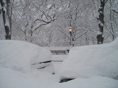
Riverside Drive, New York City, Blizzard Of 2006
Riverside may refer to: Places Australia * Riverside, Tasmania, a suburb of Launceston, Tasmania Canada * Riverside (electoral district), in the Yukon * Riverside, Calgary, a neighbourhood in Alberta * Riverside, Manitoba, a former rural municipality * Riverside, Middlesex County, Ontario, a community in the municipality of Southwest Middlesex * Rural Municipality of Riverside No. 168, Saskatchewan * Riverside, Ontario, a neighbourhood of Windsor * Riverside, Simcoe County, Ontario, a community in the township of Tay * Riverside, Toronto, a neighbourhood in Riverdale, Toronto, Ontario * Riverside Ward, former name of River Ward in Ottawa, Ontario New Zealand * Riverside, New Zealand, a locality in Ashburton District, near Wheatstone, New Zealand * Riverside, Whangārei, a suburb of Whangārei United Kingdom * Riverside, Cardiff, an inner-city area and community in Wales * Riverside (Cardiff electoral ward) * Riverside (Liverpool ward), a city council ward in England * ... [...More Info...] [...Related Items...] OR: [Wikipedia] [Google] [Baidu] |
New York City Department Of Parks And Recreation
The New York City Department of Parks and Recreation, also called the Parks Department or NYC Parks, is the department of the government of New York City responsible for maintaining the city's parks system, preserving and maintaining the ecological diversity of the city's natural areas, and furnishing recreational opportunities for city's residents and visitors. NYC Parks maintains more than 1,700 public spaces, including parks, playgrounds and recreational facilities, across the city's five boroughs. It is responsible for over 1,000 playgrounds, 800 playing fields, 550 tennis courts, 35 major recreation centers, 66 pools, of beaches, and 13 golf courses, as well as seven nature centers, six ice skating rinks, over 2,000 greenstreets, and four major stadiums. NYC Parks also cares for park flora and fauna, community gardens, 23 historic houses, over 1,200 statues and monuments, and more than 2.5 million trees. The total area of the properties maintained by the department is ov ... [...More Info...] [...Related Items...] OR: [Wikipedia] [Google] [Baidu] |
Government Of New York City
The government of New York City, headquartered at New York City Hall in Lower Manhattan, is organized under the New York City Charter and provides for a mayor-council system. The mayor is elected to a four-year term and is responsible for the administration of city government. The New York City Council is a unicameral body consisting of 51 members, each elected from a geographic district, normally for four-year terms. All elected officials are subject to a two consecutive-term limit. The court system consists of two citywide courts and three statewide courts. New York City government employs approximately 330,000 people, more than any other city in the United States and more than any U.S. state but three: California, Texas, and New York. The city government is responsible for public education, correctional institutions, public safety, recreational facilities, sanitation, water supply, and welfare services. New York City consists of five boroughs, each coextensive with one ... [...More Info...] [...Related Items...] OR: [Wikipedia] [Google] [Baidu] |
Central Park
Central Park is an urban park in New York City located between the Upper West Side, Upper West and Upper East Sides of Manhattan. It is the List of New York City parks, fifth-largest park in the city, covering . It is the most visited urban park in the United States, with an estimated 42 million visitors annually , and is the most filmed location in the world. After proposals for a large park in Manhattan during the 1840s, it was approved in 1853 to cover . In 1857, landscape architects Frederick Law Olmsted and Calvert Vaux won a Architectural design competition, design competition for the park with their "Greensward Plan". Construction began the same year; existing structures, including a majority-Black settlement named Seneca Village, were seized through eminent domain and razed. The park's first areas were opened to the public in late 1858. Additional land at the northern end of Central Park was purchased in 1859, and the park was completed in 1876. After a period of de ... [...More Info...] [...Related Items...] OR: [Wikipedia] [Google] [Baidu] |
Hudson Line (Metro-North)
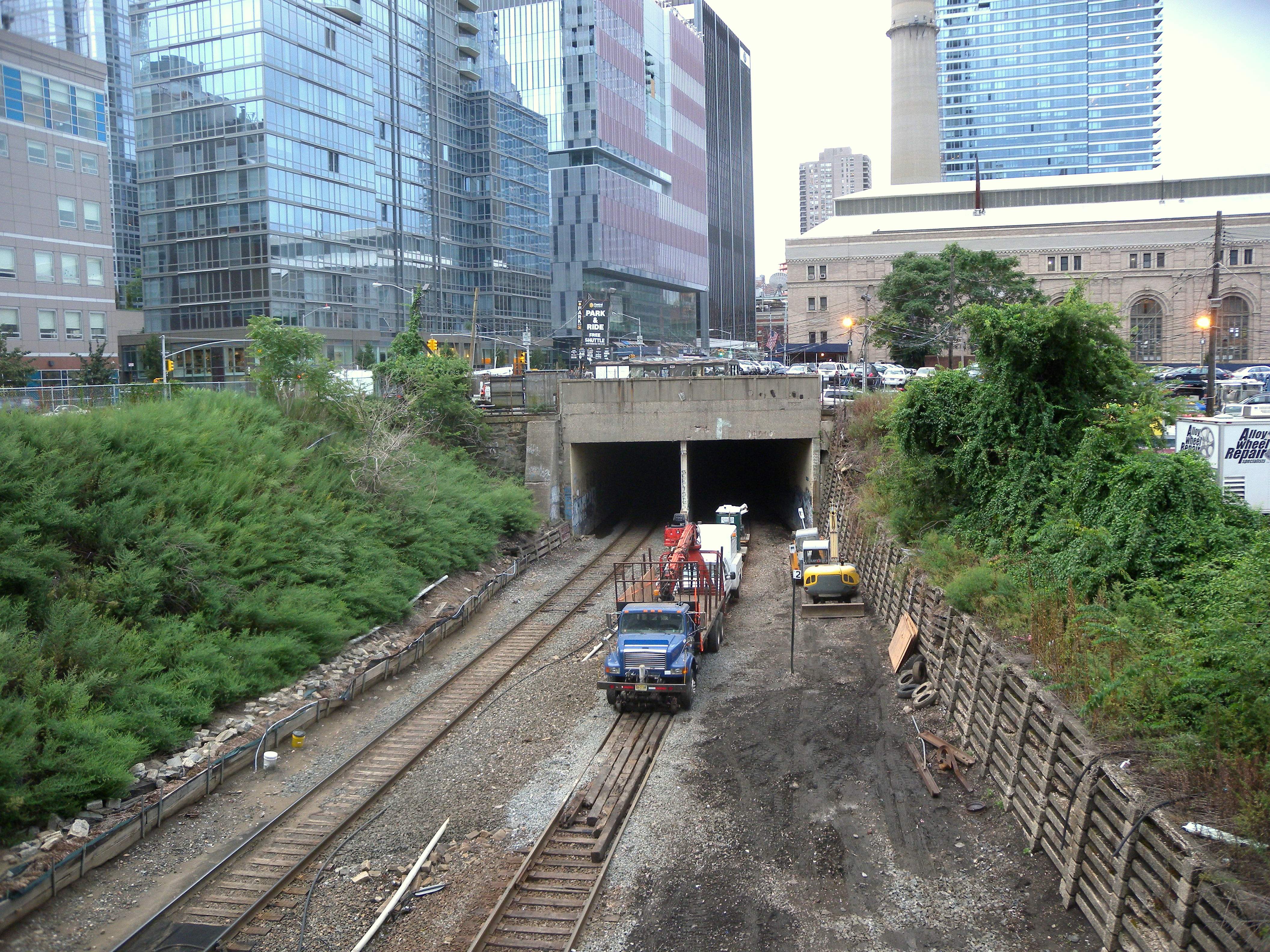
Metro-North Railroad's Hudson Line is a commuter rail line running north from New York City along the east shore of the Hudson River. Metro-North service ends at Poughkeepsie, with Amtrak's Empire Corridor trains continuing north to and beyond Albany. The line was originally the Hudson River Railroad (and the Spuyten Duyvil and Port Morris Railroad south of Spuyten Duyvil), and eventually became the Hudson Division of the New York Central Railroad. It runs along what was the far southern leg of the Central's famed "Water Level Route" to Chicago. Croton–Harmon station divides the line into two distinct segments. South of there, the line is electrified with third rail, serving suburban stations located relatively close together. Most of the electrified zone has four tracks, usually two express and local tracks in each direction. For a few miles in the Bronx there are only two or three tracks. Local service is usually provided by electric trains, while diesel trains run expre ... [...More Info...] [...Related Items...] OR: [Wikipedia] [Google] [Baidu] |
West Side Line
The West Side Line, also called the West Side Freight Line, is a railroad line on the west side of the New York City borough of Manhattan. North of Penn Station, from 34th Street, the line is used by Amtrak passenger service heading north via Albany to Toronto; Montreal; Niagara Falls and Buffalo, New York; Burlington, Vermont; and Chicago. South of Penn Station, a elevated section of the line, abandoned since 1980, has been transformed into an elevated park called the High Line. The south section of the park from Gansevoort Street to 20th Street opened in 2009 and the second section up to 30th Street opened in 2011, while the final section to 34th Street opened in 2014. History Hudson River Railroad The West Side Line was built by the Hudson River Railroad, which completed the to Peekskill on September 29, 1849, opened to Poughkeepsie by the end of that year, and extended to Albany (Rensselaer) in 1851. The city terminus was at the junction of Chambers and Hudson St ... [...More Info...] [...Related Items...] OR: [Wikipedia] [Google] [Baidu] |
Hudson River Railroad
The New York Central Railroad was a railroad primarily operating in the Great Lakes and Mid-Atlantic regions of the United States. The railroad primarily connected greater New York and Boston in the east with Chicago and St. Louis in the Midwest, along with the intermediate cities of Albany, Buffalo, Cleveland, Cincinnati, Detroit, Rochester and Syracuse. New York Central was headquartered in New York City's New York Central Building, adjacent to its largest station, Grand Central Terminal. The railroad was established in 1853, consolidating several existing railroad companies. In 1968, the NYC merged with its former rival, the Pennsylvania Railroad, to form Penn Central. Penn Central went bankrupt in 1970 and merged into Conrail in 1976. Conrail was broken-up in 1999, and portions of its system were transferred to CSX and Norfolk Southern Railway, with CSX acquiring most of the old New York Central trackage. Extensive trackage existed in the states of New York, Pe ... [...More Info...] [...Related Items...] OR: [Wikipedia] [Google] [Baidu] |
125th Street (Manhattan)
125th Street, co-named Martin Luther King Jr. Boulevard, is a two-way street that runs east–west in the New York City borough of Manhattan, from First Avenue on the east to Marginal Street, a service road for the Henry Hudson Parkway along the Hudson River in the west. It is often considered to be the " Main Street" of Harlem. Notable buildings along 125th Street include the Apollo Theater, the Adam Clayton Powell Jr. State Office Building, the Hotel Theresa, the Studio Museum in Harlem, the Mount Morris Bank Building, Harlem Commonwealth Council, the Harlem Children's Zone, the Church of St. Joseph of the Holy Family, and the former West End Theatre, now home to the La Gree Baptist Church. History The street was designated by the Commissioners' Plan of 1811 that established the Manhattan street grid as one of 15 east–west streets that would be in width (while other streets were designated as in width). Neighborhoods The western part of the street runs diagonally b ... [...More Info...] [...Related Items...] OR: [Wikipedia] [Google] [Baidu] |
Boulevard
A boulevard is a type of broad avenue planted with rows of trees, or in parts of North America, any urban highway. Boulevards were originally circumferential roads following the line of former city walls. In American usage, boulevards may be wide, multi-lane arterial thoroughfares, often divided with a central median, and perhaps with side-streets along each side designed as slow travel and parking lanes and for bicycle and pedestrian usage, often with an above-average quality of landscaping and scenery. Etymology The word ''boulevard'' is borrowed from French. In French, it originally meant the flat surface of a rampart, and later a promenade taking the place of a demolished fortification. It is a borrowing from the Dutch word ' 'bulwark'. Usage world-wide Asia Cambodia Phnom Penh has numerous boulevards scattered throughout the city. Norodom Boulevard, Monivong Boulevard, Sihanouk Boulevard, and Kampuchea Krom Boulevard are the most famous. India * Bengaluru's Maha ... [...More Info...] [...Related Items...] OR: [Wikipedia] [Google] [Baidu] |
96th Street (Manhattan)
96th Street is a major two-way street on the Upper East Side and Upper West Side sections of the New York City borough of Manhattan. It runs in two major sections: between the FDR Drive and Fifth Avenue on the Upper East Side, and between Central Park West and Henry Hudson Parkway on the Upper West Side. The two segments are connected by the 97th Street transverse across Central Park, which links the disconnected segments of 96th and 97th Streets on each side. 96th Street is one of the 15 hundred-foot-wide () crosstown streets mapped out in the Commissioner's Plan of 1811 that established the numbered street grid in Manhattan. On Manhattan's West Side, 96th Street is the northern boundary of the New York City steam system, the largest such system in the world, which pumps 30 billion pounds of steam into 100,000 buildings south of the street. (The northern boundary on the East Side is 89th Street.) East 96th Street From the FDR Drive to First Avenue, 96th Street is the norther ... [...More Info...] [...Related Items...] OR: [Wikipedia] [Google] [Baidu] |
George Washington Bridge
The George Washington Bridge is a double-decked suspension bridge spanning the Hudson River, connecting Fort Lee, New Jersey, with Manhattan in New York City. The bridge is named after George Washington, the first president of the United States. The George Washington Bridge is the world's busiest motor vehicle bridge, carrying over 103million vehicles . It is owned by the Port Authority of New York and New Jersey, a bi-state government agency that operates infrastructure in the Port of New York and New Jersey. The George Washington Bridge is also informally known as the GW Bridge, the GWB, the GW, or the George, and was known as the Fort Lee Bridge or Hudson River Bridge during construction. The George Washington Bridge measures long and has a main span of . It was the longest main bridge span in the world from its 1931 opening until the Golden Gate Bridge opened in 1937. The George Washington Bridge is an important travel corridor within the New York metropolitan area. ... [...More Info...] [...Related Items...] OR: [Wikipedia] [Google] [Baidu] |


.jpg)
