|
River Orrin
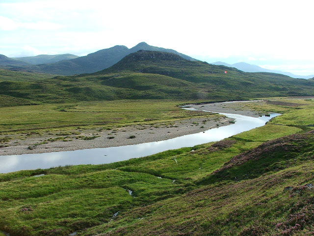
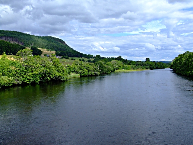
The River Orrin is a river in former Ross-shire, Highland, northern Scotland. The River Orrin is dammed in Glen Orrin making the Orrin Reservoir. It later forms the Falls of Orrin, is joined by the tributary ''Allt Goibhre'', and then enters the River Conon near Urray shortly before it flows past Conon Bridge into the Cromarty Firth.Ordnance Survey mapping seen aBing Maps/ref> The river gives its name to the aircraft in the 1985 British Airtours Flight 28M British Airtours Flight 28M (also known as Flight 328) was an international passenger flight which caught fire before takeoff at Manchester Airport, England on 22 August 1985 with the loss of 55 lives. It was en route to Corfu International A ... accident in which 55 passengers and crew perished at Manchester Airport. References Orrin {{Scotland-river-stub ... [...More Info...] [...Related Items...] OR: [Wikipedia] [Google] [Baidu] |
River Orrin - Geograph
A river is a natural flowing watercourse, usually freshwater, flowing towards an ocean, sea, lake or another river. In some cases, a river flows into the ground and becomes dry at the end of its course without reaching another body of water. Small rivers can be referred to using names such as creek, brook, rivulet, and rill. There are no official definitions for the generic term river as applied to geographic features, although in some countries or communities a stream is defined by its size. Many names for small rivers are specific to geographic location; examples are "run" in some parts of the United States, " burn" in Scotland and northeast England, and "beck" in northern England. Sometimes a river is defined as being larger than a creek, but not always: the language is vague. Rivers are part of the water cycle. Water generally collects in a river from precipitation through a drainage basin from surface runoff and other sources such as groundwater recharge, springs, ... [...More Info...] [...Related Items...] OR: [Wikipedia] [Google] [Baidu] |
Ross-shire
Ross-shire (; gd, Siorrachd Rois) is a historic county in the Scottish Highlands. The county borders Sutherland to the north and Inverness-shire to the south, as well as having a complex border with Cromartyshire – a county consisting of numerous enclaves or exclaves scattered throughout Ross-shire's territory. Ross-shire includes most of Ross along with Lewis in the Outer Hebrides. Dingwall is the traditional county town. The area of Ross-shire is based on that of the historic province of Ross, but with the exclusion of the many enclaves that form Cromartyshire. For shreival purposes the area was first separated from the authority of the sheriff of Inverness by Act of Parliament during the reign of King James IV, the sheriff to sit at Tain or Dingwall. Sheriffs were seldom appointed, and further acts of 1649 and 1661 restated its separation from Inverness. The 1661 act also clarified the area encompassed, based on the pre-Reformation Diocese of Ross. Sir George ... [...More Info...] [...Related Items...] OR: [Wikipedia] [Google] [Baidu] |
Highland (council Area)
Highland ( gd, A' Ghàidhealtachd, ; sco, Hieland) is a council area in the Scottish Highlands and is the largest local government area in the United Kingdom. It was the 7th most populous council area in Scotland at the 2011 census. It shares borders with the council areas of Aberdeenshire, Argyll and Bute, Moray and Perth and Kinross. Their councils, and those of Angus and Stirling, also have areas of the Scottish Highlands within their administrative boundaries. The Highland area covers most of the mainland and inner-Hebridean parts of the historic counties of Inverness-shire and Ross and Cromarty, all of Caithness, Nairnshire and Sutherland and small parts of Argyll and Moray. Despite its name, the area does not cover the entire Scottish Highlands. Name Unlike the other council areas of Scotland, the name ''Highland'' is often not used as a proper noun. The council's website only sometimes refers to the area as being ''Highland'', and other times as being ''the Hig ... [...More Info...] [...Related Items...] OR: [Wikipedia] [Google] [Baidu] |
Orrin Reservoir
ORiN (Open Robot/Resource interface for the Network) is a standard network interface for FA (factory automation) systems. The Japan Robot Association proposed ORiN in 2002, and the ORiN Forum develops and maintains the ORiN standard. Background The installation of PC (Personal Computer) applications in the factory has increased dramatically recently. Various types of application software systems, such as production management systems, process management systems, operation monitoring systems and failure analysis systems, have become vital to factory operation. These software systems are becoming indispensable for the manufacturing system. However, most of these software systems are only compatible with specific models or specific manufacturers of the FA system. This is because the software system is “custom made” depending on the specific special network or protocol. Once this type of application is installed in a factory and if there are no resident software engineers for the ... [...More Info...] [...Related Items...] OR: [Wikipedia] [Google] [Baidu] |
Falls Of Orrin
Falls of Orrin is a waterfall on the River Orrin, in the Highlands of Scotland.Ordnance Survey 1:25,000 scale Explorer map series, sheets 309-470 See also *Waterfalls of Scotland References Waterfalls of Highland (council area) {{Highland-geo-stub ... [...More Info...] [...Related Items...] OR: [Wikipedia] [Google] [Baidu] |
River Conon
The River Conon ( gd, Conann) is a river in the Highlands of Scotland. It begins at Loch Luichart, and flows in a south-easterly direction to be joined by the River Meig at Scatwell before passing through Loch Achonachie. It is joined by the Black Water at Moy Bridge, and the River Orrin at Urray, before flowing past Conon Bridge and into the Cromarty Firth (and thence the Moray Firth and North Sea). The river is part of the Conon hydro-electric power scheme, with dams at Loch Luichart, Loch Meig and Loch Achonachie, and power stations at Luichart and Torr Achilty. There are several islands in the river, including Moy Island, Dunglass Island and Garrie Island. The river is said to have once been the home of a water horse. References External links * Conon Conon ( el, Κόνων) (before 443 BC – c. 389 BC) was an Athenian general at the end of the Peloponnesian War, who led the Athenian naval forces when they were defeated by a Peloponnesian fleet in the crucial B ... [...More Info...] [...Related Items...] OR: [Wikipedia] [Google] [Baidu] |
Urray
Urray ( gd, Urrath) is a scattered village and coastal parish, consisting of Easter, Old and Wester Urray and is located in the county of Ross in the Scottish council area of the Highland. Urray is also a parish in the district of Wester Ross and Cromarty. It comprises the parishes of Carnoch and Kinlochlychart, with the ancient parish of Kilchrist. Urray is located 2 miles northwest of Muir of Ord and 1.5 miles east of Marybank. The closest town is Dingwall to the north-east. The ruined Fairburn Tower was a castle of the Clan Mackenzie. Churches A church dedicated to St Constantine existed since medieval times and was under the control of Fortrose Cathedral. As with many Highland parishes Urray gravitated to the Free Church of Scotland after the Disruption of 1843. These links provided three Moderators of the General Assembly for the Free Church (see below). The Church of Scotland parish churchyard remains the main place of burial for the parish. The Free Church se ... [...More Info...] [...Related Items...] OR: [Wikipedia] [Google] [Baidu] |
Conon Bridge
Conon Bridge ( gd, Drochaid Sguideil, ) is a small village in the Highland region of Scotland. The current Gaelic name is likely a neologism: the bridge was not built until the early 19th century and some early gravestones show the name sgudal or scuddle. One suggested source is the Old Norse "sku dal", ''valley of the fine views''. Situated near the market town of Dingwall, on the southern bank of the River Conon, in Ross-shire, it is at the western end of the Cromarty Firth. The village of Maryburgh is on the other side of the river. Conon Bridge has a railway station on the line between Dingwall (the nearest town) and Inverness (the nearest city), which re-opened on 8 February 2013. This had been proposed as a candidate for reopening after the success of doing so with nearby Beauly railway station. In September 2012 the Minister for Housing and Transport Keith Brown confirmed it would reopen by February 2013 to offer an alternative to commuters during resurfacing work on the ... [...More Info...] [...Related Items...] OR: [Wikipedia] [Google] [Baidu] |
Cromarty Firth
The Cromarty Firth (; gd, Caolas Chrombaidh ; literally "kyles /nowiki>straits.html"_;"title="strait.html"_;"title="/nowiki>strait">/nowiki>straits">strait.html"_;"title="/nowiki>strait">/nowiki>straitsof_Cromarty.html" ;"title="strait">/nowiki>straits.html" ;"title="strait.html" ;"title="/nowiki>strait">/nowiki>straits">strait.html" ;"title="/nowiki>strait">/nowiki>straitsof Cromarty">strait">/nowiki>straits.html" ;"title="strait.html" ;"title="/nowiki>strait">/nowiki>straits">strait.html" ;"title="/nowiki>strait">/nowiki>straitsof Cromarty") is an arm of the Moray Firth in Scotland. Geography The entrance to the Cromarty Firth is guarded by two precipitous headlands; the one on the north high and the one on the south high — called " The Sutors" from a fancied resemblance to a couple of shoemakers (in Scots, ''souters'') bent over their lasts. From the Sutors the Firth extends inland in a westerly and then south-westerly direction for a distance of . Excepting be ... [...More Info...] [...Related Items...] OR: [Wikipedia] [Google] [Baidu] |
British Airtours Flight 28M
British Airtours Flight 28M (also known as Flight 328) was an international passenger flight which caught fire before takeoff at Manchester Airport, England on 22 August 1985 with the loss of 55 lives. It was en route to Corfu International Airport in Greece. The aircraft, a Boeing 737-236 registered G-BGJL, previously named "Goldfinch", but at the time of the accident named "River Orrin", was flown by British Airtours, a wholly owned subsidiary of British Airways. It had 131 passengers and six crew on the manifest. During the takeoff roll a loud thump was heard and takeoff aborted. An engine failure had generated a fire and the captain ordered evacuation. The engine failure was later traced to an incorrectly repaired combustor causing the turbine disc to shatter and puncture the wing fuel tanks. There were 82 survivors; most of the deaths were due to smoke inhalation, not burns. An aviation analyst said the accident was "a defining moment in the history of civil aviation" ... [...More Info...] [...Related Items...] OR: [Wikipedia] [Google] [Baidu] |


