|
River Lys
The Lys () or Leie () is a river in France and Belgium, and a left-bank tributary of the Scheldt. Its source is in Pas-de-Calais, France, and it flows into the river Scheldt in Ghent, Belgium. Its total length is . Historically a very polluted river from the high population density and industrialisation in both Northern France and Belgium, it has seen substantial improvements in recent years, partly due to the decline of the principal industry, the spinning and weaving of flax. The region of the Leie (between Deinze and Ghent) was known as a favourite place for numerous painters in the first half of the 20th century. The source of the Lys is in a village, Lisbourg, east of Fruges, in the Pas-de-Calais department of France. It flows generally northeast through the following departments of France, provinces of Belgium and towns and municipalities: *Pas-de-Calais (F): Thérouanne, Aire-sur-la-Lys * Nord (F): Merville, Armentières, Halluin * Hainaut (B): Comines-Warneton *West ... [...More Info...] [...Related Items...] OR: [Wikipedia] [Google] [Baidu] |
Pas-de-Calais
Pas-de-Calais (, " strait of Calais"; pcd, Pas-Calés; also nl, Nauw van Kales) is a department in northern France named after the French designation of the Strait of Dover, which it borders. It has the most communes of all the departments of France, 890, and is the 8th most populous. It had a population of 1,465,278 in 2019.Populations légales 2019: 62 Pas-de-Calais INSEE The Calais Passage connects to the on the . Pas-de-Calais borders the departments of [...More Info...] [...Related Items...] OR: [Wikipedia] [Google] [Baidu] |
Halluin
Halluin (; nl, Halewijn) is a commune in the Nord department in northern France. Geography It is located at the north of the Métropole Européenne de Lille, on the Belgian border, contiguous with the Belgian town of Menen. Population Transport The Halluin railway station, closed in the 1970s, was situated on the Somain-Halluin Railway. The town is now served by buses of Ilévia. The A22 autoroute links the town to Lille and Belgium. Heraldry Politics An erstwhile bastion of the left, Halluin owes its nickname ''Halluin the Red'' to the powerful trade unions who used their influence to support Communist mayors during the interwar period. However, since the 1990s Halluin has become gentrified (see also below), and in the 2007 and 2012 presidential elections the town backed Nicolas Sarkozy. In the 2014 mayoral elections, 62% of voters chose right-wing parties: Gustave Dassonville ( UMP) received 40% of the votes and JeanChristophe Destailleur (Centre-right) received 22% ... [...More Info...] [...Related Items...] OR: [Wikipedia] [Google] [Baidu] |
Clarence (river)
The Clarence is a river in northern France whose course crosses the department of Pas-de-Calais. Its source is near the village of Sains-lès-Pernes. It flows through the communes of Sachin, Pernes, Calonne-Ricouart, Calonne-sur-la-Lys and Gonnehem, finally joining the Lys near Merville. It has two tributaries, the Nave The nave () is the central part of a church, stretching from the (normally western) main entrance or rear wall, to the transepts, or in a church without transepts, to the chancel. When a church contains side aisles, as in a basilica-type ... and the Grand Nocq. References External links (All French language)Banque Hydro - Station E3646210 - La Clarence à RobecqBassin versant = Informations générales sur les atlas des zones inondables Rivers of France Rivers of the Pas-de-Calais Rivers of Hauts-de-France {{France-river-stub ... [...More Info...] [...Related Items...] OR: [Wikipedia] [Google] [Baidu] |
Laquette
The Laquette is a river of northern France, right tributary of the Lys. It is long. It flows into the Lys in Aire-sur-la-Lys Aire-sur-la-Lys (, literally ''Aire on the Lys''; vls, Ariën-aan-de-Leie) is a commune in the Pas-de-Calais department in northern France. Geography The commune is located 16 kilometres (10 mi) southeast of Saint-Omer, at the junctio .... References Rivers of France Rivers of the Pas-de-Calais Rivers of Hauts-de-France {{France-river-stub ... [...More Info...] [...Related Items...] OR: [Wikipedia] [Google] [Baidu] |
Deinze
Deinze () is a city and a municipality in the Belgian province of East Flanders. It comprises the city of Deinze, and the towns of Astene, Bachte-Maria-Leerne, Gottem, Grammene, Hansbeke, Landegem, Meigem, Merendree, Nevele, Petegem-aan-de-Leie, , Sint-Martens-Leerne, Vinkt, Vosselare, Wontergem, and Zeveren. On 1 January 2022, Deinze had a population of 44,315. The municipality's total area is , giving a population density of 342 inhabitants per km². On 1 January 2019, the municipality of Nevele was merged into Deinze. History In 1695, during the Nine Years' War, an English force garrisoned in the town under the command of the Irish general Francis Fergus O’Farrell was forced to surrender to French forces. Postal history The DEYNZE post office opened in 1836 with the postal code 31 (before 1864), then 94 prior to 1874. The only other office in the area before 1910 was PETEGHEM (not to be confused with PETEGHEM-LEZ-AUDENAERDE), which opened 1 June 1874. Postal codes in 19 ... [...More Info...] [...Related Items...] OR: [Wikipedia] [Google] [Baidu] |
Zulte
{{EastFlanders-geo- ...
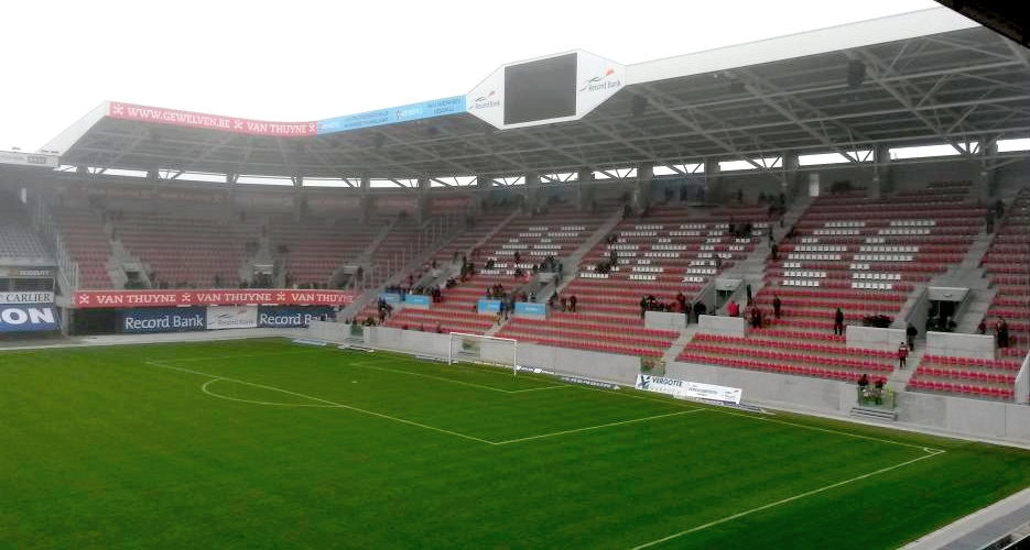
Zulte () is a Belgian municipality located in Flanders and in the Flemish province of East Flanders. The municipality comprises the towns of Machelen, and Zulte proper. In 2021, Zulte had a total population of 15,843. The total area is 32.52 km2. The town used to have its own beer since 1891 (simply called Zulte) but today they are part of Alken-Maes breweries. The main football club from Zulte merged with KSV Waregem to form a team called SV Zulte Waregem that plays in the Belgian Pro League as of 2006. Famous inhabitants *Roger Raveel, painter *Gerard Reve, Dutch writer References External links * Official website Municipalities of East Flanders Populated places in East Flanders Zulte Zulte () is a Belgian municipality located in Flanders and in the Flemish province of East Flanders. The municipality comprises the towns of Machelen, and Zulte proper. In 2021, Zulte had a total population of 15,843. The total area is 32.52&nbs ... [...More Info...] [...Related Items...] OR: [Wikipedia] [Google] [Baidu] |
East Flanders
, native_name_lang = , settlement_type = Province of Belgium , image_flag = Flag of Oost-Vlaanderen.svg , flag_size = , image_shield = Wapen van Oost-Vlaanderen.svg , shield_size = 90px , image_map = Provincie Oost-Vlaanderen in Belgium.svg , coordinates = , subdivision_type = Country , subdivision_name = , subdivision_type1 = Region , subdivision_name1 = , seat_type = Capital , seat = Ghent , leader_title = Governor , leader_name = Carina Van Cauter , area_total_km2 = 3007 , area_footnotes = , population_footnotes = , population_total = 1515064 , population_as_of = 1 January 2019 , ... [...More Info...] [...Related Items...] OR: [Wikipedia] [Google] [Baidu] |
Wervik
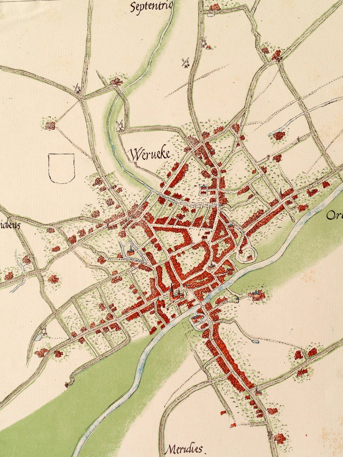
Wervik (; french: Wervicq, ; vls, Wervik; la, Viroviacum) is a city and municipality located in the Belgian province of West Flanders. The municipality comprises the city of Wervik and the town of Geluwe. On January 1, 2014, Wervik had a total population of 18,435. The total area is 43.61 km2 which gives a population density of 423 inhabitants per km2. The area is famous for its excellent tobacco and has a tobacco museum. The town is separated from its French counterpart Wervicq-Sud by the river Lys. History Wervik is one of the oldest towns in Belgium. Prehistory Stone Age artefacts, flint axes and spearheads, were found in the district of ''Bas-Flanders'' and the site ''Oosthove''. The archeological excavations at ''de Pioneer'' in 2009 yielded traces of inhabitation from the Iron Age to the Roman Period. Roman period Wervik was probably a settlement of the Menapians led by the chief Virovos, at a small height along the banks of the Lys (current Island Balokken). Thi ... [...More Info...] [...Related Items...] OR: [Wikipedia] [Google] [Baidu] |
Waregem
Waregem (; vls, Woaregem), sometimes known as Waereghem, is a municipality and city located in the Belgian province of West Flanders. The municipality lies in the valley of the river Leie, between Kortrijk and Ghent. It is part of the arrondissement of Kortrijk and comprises the towns of Beveren, Desselgem, Sint-Eloois-Vijve and Waregem proper. On January 1, 2019, Waregem had a total population of 38,260. The total area is 44.34 km² which gives a population density of 863 inhabitants per km². History Origins The first inhabitants of this forested region settled along the Leie well before Roman times. Bronze coins and artifacts associated with the Gallo-Roman culture show extensive activity in this area in the first centuries of our era. This is not surprising given the fact that Sint-Eloois-Vijve stood at the intersection of two important Roman roads: Cassel-Tongeren and Bavai-Oudenburg. The name of the current municipality refers to a certain “Waro” clan or trib ... [...More Info...] [...Related Items...] OR: [Wikipedia] [Google] [Baidu] |
Kortrijk
Kortrijk ( , ; vls, Kortryk or ''Kortrik''; french: Courtrai ; la, Cortoriacum), sometimes known in English as Courtrai or Courtray ( ), is a Belgian City status in Belgium, city and Municipalities in Belgium, municipality in the Flemish Region, Flemish Provinces of Belgium, province of West Flanders. It is the capital and largest city of the judicial and administrative arrondissement of Kortrijk. The wider municipality comprises the city of Courtrai proper and the villages of Aalbeke, Bellegem, Bissegem, Heule, Kooigem, Marke (Belgium), Marke, and Rollegem. Courtrai is also part of the cross-border Lille-Kortrijk-Tournai metropolitan area. The city is on the river Leie, southwest of Ghent and northeast of Lille. Mouscron in Wallonia is just south of Courtrai. Courtrai originated from a Gallo-Roman town, ''Cortoriacum'', at a crossroads near the Leie river and two Roman roads. In the Middle Ages, Courtrai grew significantly thanks to the flax and wool industry with France ... [...More Info...] [...Related Items...] OR: [Wikipedia] [Google] [Baidu] |
Wevelgem
Wevelgem () is a municipality located in the Belgian province of West Flanders. The municipality comprises the towns of Gullegem, Moorsele and Wevelgem proper. On January 1, 2006, Wevelgem had a total population of 31,020. The total area is 38.76 km² which gives a population density of 800 inhabitants per km². You can reach Wevelgem by road (E403 – A19 – R8), by boat ( De Leie), by air (Kortrijk-Wevelgem International Airport) or by train at Wevelgem railway station. Wevelgem is known for the annual Gent–Wevelgem bicycle road race which finishes in the town. History The earliest known mention dates from 1197. Wevelgem was home to the Cistercian Guldenberg Abbey in the 13th–14th centuries, which owned grain mills in various locations. From c. 1278 to 1310, abbess Ida was in charge, though Marc Brion lists it as an abbey for men. In the old days, the river De Leie was important for Wevelgem. The people used the river to soak flax, before they processed it in one ... [...More Info...] [...Related Items...] OR: [Wikipedia] [Google] [Baidu] |
Menen
Menen (; french: Menin ; vls, Mêenn or ) is a city and municipality located in the Belgian province of West Flanders. The municipality comprises the city of Menen proper and the towns of Lauwe and Rekkem. The city is situated on the French/Belgian border. On January 1, 2006, Menen had a total population of 32,413. The total area is 33.07 km² which gives a population density of 980 inhabitants per km². The city of Menen gives its name to the Menin Gate in Ypres, which is a monument to those killed in World War I. The gate is so called as the road from that gate is the road to Menen. The town hall of Menen, with its large belfry, was inscribed on the UNESCO World Heritage List in 1999 as part of the Belfries of Belgium and France site, because of its civic importance and architecture. History Menen's position near the French border led to many sieges in the history of the city. There were as many as 22 sieges between 1579 and 1830. The city was part of France between 1 ... [...More Info...] [...Related Items...] OR: [Wikipedia] [Google] [Baidu] |


