|
River Kerry
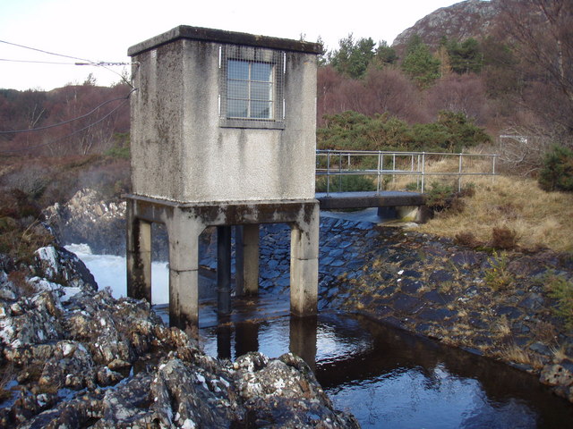
Kerry Falls Hydro-Electric Scheme, sometimes known as Gairloch is a small-scale hydro-electric power station, built by the North of Scotland Hydro-Electric Board and commissioned in 1952. It is located near Gairloch in Wester Ross, part of the Highlands of Scotland. It was originally designed to supply power to local communities in this remote area, but is now connected to the National Grid. The River Kerry below the power station is a Special Area of Conservation, due to the presence of an internationally important population of freshwater pearl mussels. It also hosts populations of salmon and trout, without which the mussels could not reproduce. The hydro-electric scheme is thought to contribute to the success of the mussels, as Loch Bad an Sgalaig traps silt, which if deposited on gravel beds can suffocate mussels and fish embryos. The flow on the river is also relatively stable for long periods, although subject to step changes when turbines are switched on or off, and f ... [...More Info...] [...Related Items...] OR: [Wikipedia] [Google] [Baidu] |
Gairloch
Gairloch ( ; gd, Geàrrloch , meaning "Short Loch") is a village, civil parish and community on the shores of Loch Gairloch in Wester Ross, in the North-West Highlands of Scotland. A tourist destination in the summer months, Gairloch has a golf course, a museum, several hotels, a variety of shops, takeaway restaurants, a community centre, a leisure centre with sports facilities, a local radio station (Two Lochs Radio), beaches and nearby mountains. Gairloch is one of the principal villages on the North Coast 500 route. The parish of Gairloch extends over a much wider area, including the villages of Poolewe and Kinlochewe, and has a population of 950. The nearest railway station is located at Achnasheen, and the nearest mainland airport is in Inverness. Geography Gairloch is a loosely defined area of settlement along the shores of Loch Gairloch, but primarily comprises three main clusters of shops, houses and amenities: the Harbour area (including Charlestown on the south s ... [...More Info...] [...Related Items...] OR: [Wikipedia] [Google] [Baidu] |
Loch Bad An Sgalaig ...
Loch Bad an Sgalaig is a small, irregular shaped, freshwater loch and reservoir lying south of the small village of Poolewe, in Wester Ross, Scotland. The north west end of the loch, where it outflows to the Eas na Laimh stream, was dammed in 1949 to power the Kerry Falls hydroelectric power station. The loch was surveyed on 30 July 1902 by T.N. Johnston and John Hewitt and later charted as part of the Sir John Murray's ''Bathymetrical Survey of Fresh-Water Lochs of Scotland 1897-1909''. References {{reflist See also * List of lochs in Scotland Bad an Sgalaig, Bad Bad Bad or BAD may refer to: Common meanings *Evil, the opposite of moral good * Erroneous, inaccurate or incorrect * Unhealthy, or counter to well-being * Antagonist, the threat or obstacle of moral good Acronyms * BAD-2, a Soviet armored troll ... [...More Info...] [...Related Items...] OR: [Wikipedia] [Google] [Baidu] |
European Union
The European Union (EU) is a supranational political and economic union of member states that are located primarily in Europe. The union has a total area of and an estimated total population of about 447million. The EU has often been described as a '' sui generis'' political entity (without precedent or comparison) combining the characteristics of both a federation and a confederation. Containing 5.8per cent of the world population in 2020, the EU generated a nominal gross domestic product (GDP) of around trillion in 2021, constituting approximately 18per cent of global nominal GDP. Additionally, all EU states but Bulgaria have a very high Human Development Index according to the United Nations Development Programme. Its cornerstone, the Customs Union, paved the way to establishing an internal single market based on standardised legal framework and legislation that applies in all member states in those matters, and only those matters, where the states have agreed to act ... [...More Info...] [...Related Items...] OR: [Wikipedia] [Google] [Baidu] |
Gair Loch
{{Highland-geo-stub ...
Loch Gairloch is a sea loch on the North West coast of Highland, Scotland. In Scottish Gaelic it is ''an Geàrr Loch'' meaning 'the short loch'. Around long by wide, it leads west to the Little Minch. The B8021 and B8056 run around its northern and southern shores respectively, connecting the villages of Gairloch, Charlestown, Kerrysdale, Shieldaig, Badachro, and Port Henderson. Longa Island lies at the loch's entrance. The Loch has a number of small islands in it, Eilean Horrisdale supported a fishing community in the 19th century. External links Photographs of Loch Gairloch Gairloch Gairloch Gairloch ( ; gd, Geàrrloch , meaning "Short Loch") is a village, civil parish and community on the shores of Loch Gairloch in Wester Ross, in the North-West Highlands of Scotland. A tourist destination in the summer months, Gairloch has a go ... [...More Info...] [...Related Items...] OR: [Wikipedia] [Google] [Baidu] |
Badachro
Badachro () is a former fishing village, in the north west Highlands of Scotland. Geography Badachro sits about 3 km south of Gairloch on the shore of Gair Loch, and is a natural harbour popular with yachts. Approximately 2 miles to the SE are located the Fairy Lochs, the site of a 1945 plane crash which is now a designated war grave. The crash site has been preserved as a memorial to the USAAF servicemen who lost their lives in the accident, and is accessible by a rough track near the Shieldaig Lodge Hotel. Badachro is in the Highland council area. Queen Victoria visited Shieldaig Lodge Hotel in 1877Malone, D. 'Exploring Gairloch’s South Side', Gairloch Museum, Printed The Gairloch and District Times. but never made it to Badchro village itself as the roads were too bad. Today Shieldaig Lodge is home to a small watersports centrGairloch Canoe and Kayak Centre Fishing At the end of the nineteenth century, Badachro was a busy fishing village. Cod, landed here and at Gair ... [...More Info...] [...Related Items...] OR: [Wikipedia] [Google] [Baidu] |
Hydro Building On Kerry River - Geograph
Hydro from Ancient Greek word ὕδωρ (húdōr), meaning ''water''. Hydro may also refer to: Energy technologies * Water-derived power or energy: ** Hydropower, derived from water ** Hydroelectricity, in electrical form * "Hydro", AC mains electricity in parts of Canada Utilities Australia * Snowy Hydro * Hydro Tasmania Canada * Canadian Hydro Developers (not specific to a province) * In Manitoba: ** Manitoba Hydro ** Winnipeg Hydro, Manitoba * In Ontario: ** Ontario Hydro ** Hydro One ** Hydro Ottawa ** Toronto Hydro * Specific to other provinces: ** BC Hydro, British Columbia ** Newfoundland and Labrador Hydro ** Hydro-Québec Europe * Norsk Hydro, in Norway * Scottish Hydro Electric Other uses * Hydro (fuel-station chain), in Sweden * SF ''Hydro'', former Norwegian railway ferry Places * Hydro, Oklahoma, United States * Hydro, Ontario, Canada Personal names * "Hydro", professional wrestler Jamar Shipman Buildings * Hydro, a term ... [...More Info...] [...Related Items...] OR: [Wikipedia] [Google] [Baidu] |
Loch Maree
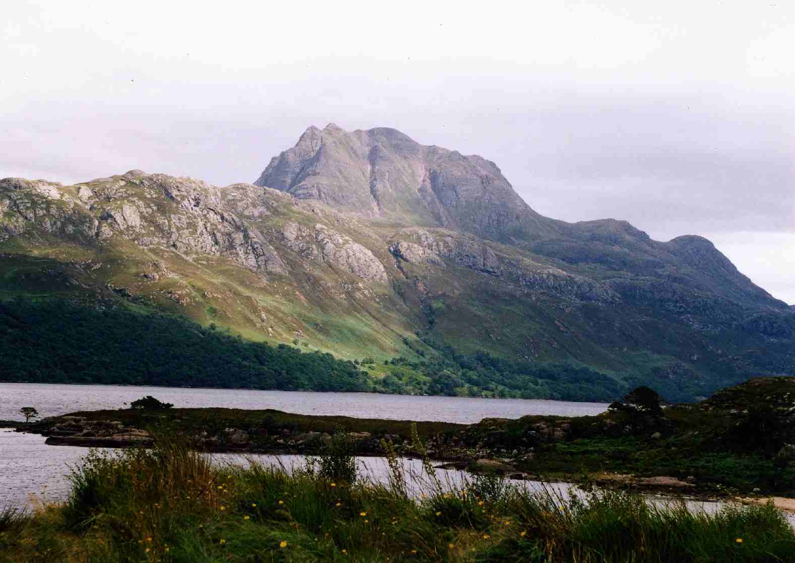
Loch Maree ( gd, Loch Ma-ruibhe) is a loch in Wester Ross in the Northwest Highlands of Scotland. At long and with a maximum width of , it is the fourth-largest freshwater loch in Scotland; it is the largest north of Loch Ness. Its surface area is . Loch Maree contains five large wooded islands and over 60 smaller ones, many of which have their own lochans. The largest island, Eilean Sùbhainn, contains a loch that itself contains an island,Ordnance Survey. 1:25000 ''Explorer'' map. Sheet 433, Torridon - Beinn Eighe & Liathach. a situation that occurs nowhere else in Great Britain. Isle Maree holds the remains of a chapel believed to be the 8th century hermitage of Saint Máel Ruba (d. 722), who founded the monastery of Applecross in 672. It is after him that Loch Maree is named; prior to the saint's arrival in the area the loch is believed to have been named Loch Ewe, as evidenced by the name of the village of Kinlochewe ( gd, Ceann Loch Iù, meaning "Head of Loch Ewe") which ... [...More Info...] [...Related Items...] OR: [Wikipedia] [Google] [Baidu] |
Loch Na H-Oidhche
Loch na h-Oidhche (Loch of the night) is a remote freshwater loch lying between Loch Torridon and Loch Maree in the Flowerdale Forest, Wester Ross, Scotland. It is approximately north of the small village of Torridon and southeast of Gairloch. The loch is oblong in shape and trends north by northwest to south by southeast. It drains by a bifurcated stream and several small lochs into Loch Maree and Loch Gairloch. The surrounding area is mountainous with Beinn an Eoin to the east and Baosbheinn to the west. The loch was surveyed on 7 August 1902 by T.N. Johnston and John Hewitt and later charted as part of the Sir John Murray and Laurence Pullar's ''Bathymetrical Survey of Fresh-Water Lochs of Scotland 1897-1909''. Wild brown trout are known to inhabit the loch. References {{reflist See also * List of lochs in Scotland This list of lochs in Scotland includes the majority of bodies of standing freshwater named as lochs but only a small selection of the generally sma ... [...More Info...] [...Related Items...] OR: [Wikipedia] [Google] [Baidu] |
Ordnance Datum
In the British Isles, an ordnance datum or OD is a vertical datum used by an ordnance survey as the basis for deriving altitudes on maps. A spot height may be expressed as AOD for "above ordnance datum". Usually mean sea level (MSL) is used for the datum. In particular: * In Great Britain, OD for the Ordnance Survey is ODN (Ordnance Datum Newlyn), defined as the MSL as recorded by the tidal gauge at Newlyn in Cornwall between 1915 and 1921. **Prior to 1921, OD was defined as MSL as recorded in the Victoria Dock, Liverpool, during a short period in 1844 (ODL). * In Northern Ireland, OD for the Ordnance Survey of Northern Ireland is Belfast Ordnance Datum, the MSL at Clarendon Dock, Belfast, between 1951 and 1956. * In the Republic of Ireland, OD for the Ordnance Survey of Ireland is Malin Ordnance Datum: the MSL at Portmoor Pier, Malin Head, County Donegal, between 1960 and 1969. [...More Info...] [...Related Items...] OR: [Wikipedia] [Google] [Baidu] |
Renewables Obligation (United Kingdom)
The Renewables Obligation (RO) is designed to encourage generation of electricity from eligible renewable sources in the United Kingdom. It was introduced in England and Wales and in a different form (the Renewables Obligation (Scotland)) in Scotland in April 2002 and in Northern Ireland in April 2005, replacing the Non-Fossil Fuel Obligation which operated from 1990. The RO places an obligation on licensed electricity suppliers in the United Kingdom to source an increasing proportion of electricity from renewable sources, similar to a renewable portfolio standard. In 2010/11 it is 11.1% (4.0% in Northern Ireland). This figure was initially set at 3% for the period 2002/03 and under current political commitments will rise to 15.4% (6.3% in Northern Ireland) by the period 2015/16 and then it runs until 2037 (2033 in Northern Ireland). The extension of the scheme from 2027 to 2037 was declared on 1 April 2010 and is detailed in the National Renewable Energy Action Plan. Since its ... [...More Info...] [...Related Items...] OR: [Wikipedia] [Google] [Baidu] |
Willie Logan (Loganair)
William Logan (1913–1966) was a Scottish construction engineer who founded Loganair. He contributed to many important infrastructure projects in Scotland during the 1950s and 1960s, primarily road networks bridges and hydroelectric schemes. He was managing director of Duncan Logan Ltd, an engineering company started by his father, Duncan Logan, and based in Muir of Ord. Early life Logan was educated at Dingwall Academy, and lived in Dingwall in a house built to his own designs called Parklea, which was also the name of his wife Helen Dunbar's previous family home in Dingwall town centre. Selected construction projects * Orrin Reservoir *Tay Road Bridge Parklea House A highly advanced house for its time, especially for the North of Scotland, Parklea was built during the early 1950s and was full of luxurious touches, including an automatic garage door opening system—Willie's chauffeur would drop off the Logans at the north-facing front door, then swing down the steep curved ... [...More Info...] [...Related Items...] OR: [Wikipedia] [Google] [Baidu] |
Dingwall
Dingwall ( sco, Dingwal, gd, Inbhir Pheofharain ) is a town and a royal burgh in the Highland council area of Scotland. It has a population of 5,491. It was an east-coast harbour that now lies inland. Dingwall Castle was once the biggest castle north of Stirling. On the town's present-day outskirts lies Tulloch Castle, parts of which may date back to the 12th century. In 1411 the Battle of Dingwall is said to have taken place between the Clan Mackay and the Clan Donald. History Its name, derived from the Scandinavian (field or meeting-place of the ''thing'', or local assembly; compare Tynwald, Tingwall, Thingwall in the British Isles alone, plus many others across northern Europe), preserves the Viking connections of the town; Gaels call it (), meaning "the mouth of the Peffery" or meaning "cabbage town". The site of the , and of the medieval Moothill, thought to have been established by the Vikings after they invaded in the 8th century, lies beneath the Cromartie memor ... [...More Info...] [...Related Items...] OR: [Wikipedia] [Google] [Baidu] |


