|
River Ely
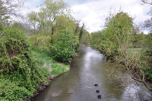
The River Ely ( cy, Afon Elái) is in South Wales flowing generally southeast, from Tonyrefail to Cardiff. The river is about long. The Ely's numerous sources lie in the mountains to the south of Tonypandy, near the town of Tonyrefail, rising in the eastern slopes of Mynydd Penygraig (Penygraig) and Mynydd y Gilfach ( Penrhiwfer) and the western slopes of Mynydd Dinas ( Williamstown), whose eastern slopes feed the Rhondda by Porth. The source of the Ogwr Fach lies just to the west. After flowing through Tonyrefail and through the grounds of the Royal Glamorgan Hospital at Ynysmaerdy, it follows the A4119 road through the valley pass formed between Mynydd Garthmaelwg, to the west and Llantrisant, to the east. Flowing through Talbot Green, the Ely is joined by the Afon Clun at Pontyclun. Although numerous smaller streams join the river, the Clun is its only large tributary. The Ely turns to the southeast on reaching the Vale of Glamorgan alongside the South Wales Main Li ... [...More Info...] [...Related Items...] OR: [Wikipedia] [Google] [Baidu] |
Peterston-super-Ely
Peterston-super-Ely ( cy, Llanbedr-y-fro) is a village and community situated on the River Ely ( cy, Afon Elái) in the county borough of the Vale of Glamorgan, Wales. The community population at the 2011 census was 874. The community includes the hamlet of Gwern-y-Steeple. History As its name suggests, the local parish church, now in heavily restored simple Perpendicular style, is dedicated to Saint Peter and situated close to the River Ely ( cy, Afon Elái). In the conservation area, the oldest structure is what remains of Peterston Castle built by the Norman lords of the manor, Le Sor family, probably in the mid-13th century and replacing an earlier structure which had been destroyed by the Welsh and again by Owain Glyndŵr in 1403. Despite being a scheduled monument, the castle remains have been progressively destroyed by housing development. The earliest feature of St. Peter's Church is the 14th-century chancel arch but the church is more notable for its Perpendicu ... [...More Info...] [...Related Items...] OR: [Wikipedia] [Google] [Baidu] |
Williamstown, Rhondda Cynon Taff
Williamstown ( cy, Trewiliam) is a village in the Rhondda Valley in the county borough of Rhondda Cynon Taf, within the historic county boundaries of Glamorgan, Wales. Williamstown was founded in the 1870s, is located at the foot of Mynydd Dinas and is a district of neighbouring village Penygraig. Early history Before the Rhondda was industrialised in the mid to late 19th century, the area where Williamstown now resides, was made up of woodlands occupied by sparsely populated farmlands. Williamstown exhibits very little evidence of early habitation, a few Bronze Age cairns have been discovered on Mynydd Dinas, but most hafodi and farm houses tended to group around the River Rhondda located lower down the valley. Much of the land in the Rhondda, once controlled by individual farmers, had been bought up by wealthy absentee landlords by the start of the 19th century. The land which would become Williamstown was bought by Walter Coffin, the pioneer of coal mining in the Rhondda, aro ... [...More Info...] [...Related Items...] OR: [Wikipedia] [Google] [Baidu] |
Vale Of Glamorgan Line
The Vale of Glamorgan Line ( cy, Llinell Bro Morgannwg) is a commuter railway line in Wales, running through the Vale of Glamorgan from Barry to Bridgend, via Rhoose and Llantwit Major. Route The Barry branch starts at Cardiff West and runs to Barry Island with a single line branch from Cogan Junction to Penarth. In June 1964, the Vale of Glamorgan line between Barry and Bridgend was closed to passengers by the Beeching Axe, as set out in the report 'The Reshaping of Britain's Railways', but after 41 years, in June 2005, it was reopened to passengers with two new stations at Llantwit Major and Rhoose, and the disused bay platform (now '1A') at Bridgend was reinstated to act as a terminus for the Vale Line. The line itself had been retained for freight traffic to/from the Ford Factory in Bridgend, and to Aberthaw Power Station, as well as to provide a detour for main line trains when the direct Bridgend to Cardiff line was closed. Network Rail's mileage from Barry Junction ... [...More Info...] [...Related Items...] OR: [Wikipedia] [Google] [Baidu] |
St Fagans National History Museum
St Fagans National Museum of History ( ; cy, Sain Ffagan: Amgueddfa Werin Cymru, links=no), commonly referred to as St Fagans St Fagans ( ; cy, Sain Ffagan) is a village and community in the west of the city of Cardiff, capital of Wales. It is home to the St Fagans National History Museum. History The name of the area invokes Saint Fagan, according to William of Malm ... after the village where it is located, is an open-air museum in Cardiff chronicling the historical lifestyle, culture, and architecture of the Welsh people. The museum is part of the wider network of Amgueddfa Cymru – National Museum Wales. It consists of more than forty re-erected buildings from various locations in Wales, and is set in the grounds of St Fagans Castle, a Grade I listed Elizabethan manor house. In 2011 ''Which?'' magazine named the museum the United Kingdom's favourite visitor attraction. A six-year, £30-million revamp was completed in 2018 and the museum was named the Art Fund Museum ... [...More Info...] [...Related Items...] OR: [Wikipedia] [Google] [Baidu] |
M4 Motorway
The M4, originally the London-South Wales Motorway, is a motorway in the United Kingdom running from west London to southwest Wales. The English section to the Severn Bridge was constructed between 1961 and 1971; the Welsh element was largely complete by 1980, though a non-motorway section around Briton Ferry bridge remained until 1993. On the opening of the Second Severn Crossing in 1996, the M4 was rerouted over it. The line of the motorway from London to Bristol runs closely in parallel with the A4 road (England), A4. After crossing the River Severn, toll-free since 17 December 2018, the motorway follows the A48 road (Great Britain), A48, to terminate at the Pont Abraham services in Carmarthenshire. The M4 is the only motorway in Wales apart from its two Spur route, spurs: the A48(M) motorway, A48(M) and the M48 motorway, M48. The major towns and cities along the routea distance of approximately include Slough, Reading, Berkshire, Reading, Swindon, Bristol, Newport, Wales, ... [...More Info...] [...Related Items...] OR: [Wikipedia] [Google] [Baidu] |
Miskin
Miskin ( cy, Meisgyn) is a village approximately south of Llantrisant in the county borough of Rhondda Cynon Taf, Wales. The origin of the village was a small hamlet known as New Mill, which grew up around New Mill farm. Miskin is part of the Pontyclun electoral ward. History The 1841 census records the settlement (originally a small hamlet by the name of New Inn) as having a population of 31. The opening of the Bute and Mwyndy iron ore mines in nearby Talbot Green, in 1852 and 1853 respectively, had a huge impact on the small hamlet of New Mill. The census of 1861 shows that New Mill had become a village, its population now 83 people in 17 households, and of these residents 17 were iron ore miners. By the early 1870s New Mill had become the village of Miskin, with the village centre being based around the inn, which is now The Miskin Arms pub. The name change from New Mill to Miskin was brought about by Judge Gwilym Williams, and was taken from the medieval commote of Miski ... [...More Info...] [...Related Items...] OR: [Wikipedia] [Google] [Baidu] |
South Wales Main Line
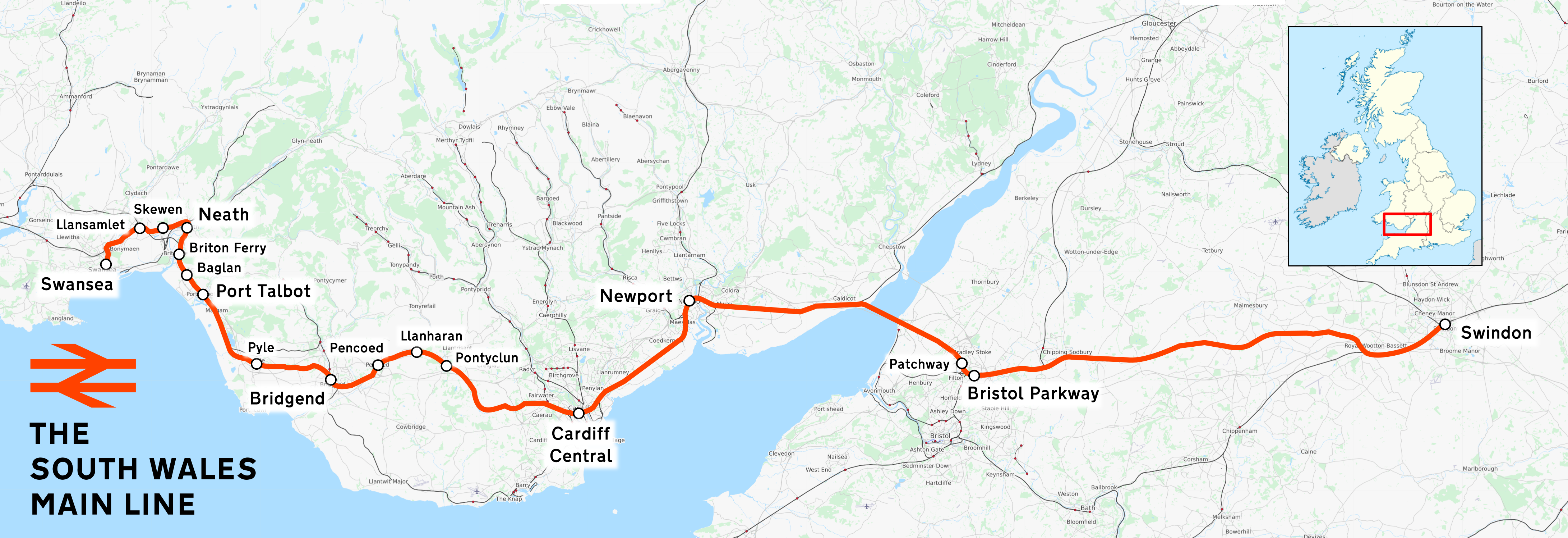
The South Wales Main Line ( cy, Prif Linell De Cymru), originally known as the London, Bristol and South Wales Direct Railway or simply as the Bristol and South Wales Direct Railway, is a branch of the Great Western Main Line in Great Britain. It diverges from the core London-Bristol line at Royal Wootton Bassett beyond Swindon, first calling at Bristol Parkway, after which the line continues through the Severn Tunnel into South Wales. Great Western Railway operates Class 800 trains between London and South Wales, and Classes 253, 254 and 255 High Speed Trains on services between Cardiff and South West England. CrossCountry provides services from Cardiff to Nottingham via Severn Tunnel Junction and thence the Gloucester to Newport Line via Gloucester and Birmingham. Transport for Wales operates services between South Wales, and North Wales and the Midlands on the line. The line between Wootton Bassett and Cardiff Central is electrified using the 25 kV AC overhead system, ... [...More Info...] [...Related Items...] OR: [Wikipedia] [Google] [Baidu] |
Talbot Green
Talbot Green ( cy, Tonysguboriau "lea of the barns") is a town (and electoral ward) just north of the M4 motorway, in the County Borough of Rhondda Cynon Taf, Wales in the United Kingdom. The town is part of Llantrisant Community Council. Geography Talbot Green is located at the mouth of the short and mountainous Ely Valley, between Mynydd Garthmaelwg (Llantrisant forest) and Y Graig (Llantrisant). The River Ely runs through along the town boundary before continuing to Pontyclun, running alongside the Warehouses of A F Blakemore & Son ltd, who run a portion of the SPAR UK retail chain. The town is bordered by the hill town of Llantrisant to the east, the Village of Pontyclun to the South and Llanharan a few miles to the West. Transport left, Sign showing the transport links in the area The area has links to the rest of Wales with the A4119 linking it in the south to the M4 Motorway, and to the north to the South Wales Valleys. The Talbot Green by-pass opened in 1991 to reliev ... [...More Info...] [...Related Items...] OR: [Wikipedia] [Google] [Baidu] |
A4119 Road
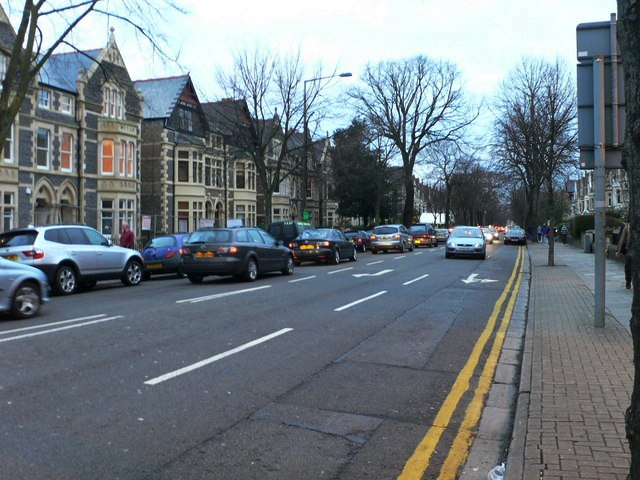
The A4119 links Tonypandy with Cardiff in South Wales. Route City and County of Cardiff The A4119 starts outside the Wales Millennium Centre at Cardiff Bay and proceeds through Butetown, Grangetown, Riverside and Cathedral Road in Canton until meeting the A48 road (Western Avenue) at Llandaff. From here is proceeds through Llandaff passing the former BBC Wales studios. After leaving Llandaff the road takes on a more rural setting with many bends crossing the M4 Motorway near Capel Llanitern. From here the road snakes passed the settlement of Creigiau. Rhondda Cynon Taf The road enters the County Borough of Rhondda Cynon Taf (formerly Mid-Glamorgan) at Groes-faen. The road continues through the Village until it comes to a T-Junction at The Castell Mynach Public House. To the left is a Spur of the A4119 that links to Junction 34 of the M4 Motorway. Off the roundabout at the Junction is the Bosch Electronics Plant. The road continues after the t-junction past Miskin an ... [...More Info...] [...Related Items...] OR: [Wikipedia] [Google] [Baidu] |
Ynysmaerdy
Ynysmaerdy is a village near Talbot Green and Llantrisant in Rhondda Cynon Taf, Wales. Even though there is no direct access to the village of Llanharan, due to older parish boundaries it falls under the community of Llanharan. It is home to the Royal Glamorgan Hospital The Royal Glamorgan Hospital ( cy, Ysbyty Brenhinol Morgannwg), is a District General Hospital in Ynysmaerdy, Talbot Green, Rhondda Cynon Taf, South Wales. It is managed by the Cwm Taf Morgannwg University Health Board. History The hospital wa .... Notes Villages in Rhondda Cynon Taf Llantrisant {{Rhondda-Cynon-Taff-geo-stub ... [...More Info...] [...Related Items...] OR: [Wikipedia] [Google] [Baidu] |
Royal Glamorgan Hospital
The Royal Glamorgan Hospital ( cy, Ysbyty Brenhinol Morgannwg), is a District General Hospital in Ynysmaerdy, Talbot Green, Rhondda Cynon Taf, South Wales. It is managed by the Cwm Taf Morgannwg University Health Board. History The hospital was commissioned to replace the aging East Glamorgan General Hospital. It was built at a cost of £103 million and was opened at Ely Meadow ( cy, Gwaun Elai) in 1999. In 2017 the Hospital Board announced that the Special Care Baby Unit would be moved to Prince Charles Hospital in Merthyr Tydfil Merthyr Tydfil (; cy, Merthyr Tudful ) is the main town in Merthyr Tydfil County Borough, Wales, administered by Merthyr Tydfil County Borough Council. It is about north of Cardiff. Often called just Merthyr, it is said to be named after Tydf .... Services There is an accident and emergency facility at the hospital as well as an acute mental health unit. References External links Royal Glamorgan Hospital {{authority control Hospital buildi ... [...More Info...] [...Related Items...] OR: [Wikipedia] [Google] [Baidu] |
River Ely, 2009
A river is a natural flowing watercourse, usually freshwater, flowing towards an ocean, sea, lake or another river. In some cases, a river flows into the ground and becomes dry at the end of its course without reaching another body of water. Small rivers can be referred to using names such as creek, brook, rivulet, and rill. There are no official definitions for the generic term river as applied to geographic features, although in some countries or communities a stream is defined by its size. Many names for small rivers are specific to geographic location; examples are "run" in some parts of the United States, "burn" in Scotland and northeast England, and "beck" in northern England. Sometimes a river is defined as being larger than a creek, but not always: the language is vague. Rivers are part of the water cycle. Water generally collects in a river from precipitation through a drainage basin from surface runoff and other sources such as groundwater recharge, springs, a ... [...More Info...] [...Related Items...] OR: [Wikipedia] [Google] [Baidu] |


