|
Rinns Of Islay
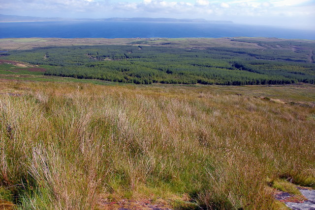
The Rinns of Islay (Scottish Gaelic: Na Roinn Ìleach; alternative English spelling Rhinns of Islay) is an area on the west of the island of Islay in the Inner Hebrides of Scotland. It is a peninsula that is attached to the main body of the island by a narrow isthmus towards its northern end. The main population centres are Port Charlotte and Portnahaven, based on the A847 that runs along its eastern coast. It is designated a Special Protection Area due to its importance for a number of breeding and wintering birds, particularly Greenland white-fronted goose and chough. The significance of the area owes much to its wide variety of habitats including bog, moorland, dune grassland, maritime grassland, marsh and extensively-farmed agricultural land. The Rinns of Islay lighthouse is located on the island of Orsay. The Rhinns complex, a deformed igneous complex that is considered to form the basement to the Colonsay Group of metasedimentary rocks takes its name from the Rhinn ... [...More Info...] [...Related Items...] OR: [Wikipedia] [Google] [Baidu] |
Rhinns Complex
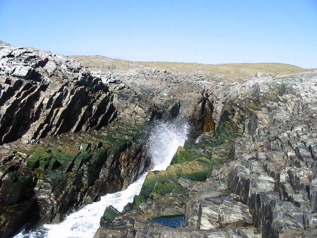
The Rhinns complex is a deformed Palaeoproterozoic igneous complex that is considered to form the basement to the Colonsay Group of metasedimentary rocks. The largest outcrop of the complex is on the Rhinns of Islay, from where the complex gets its name. It has also been recognised in three other inliers extending to the southwest as far as Inishtrahull, off the north coast of Donegal. Distribution The Rhinns complex has been recognised in a series of four outcrops that form inliers within younger cover sequences of the Dalradian Supergroup and the Colonsay Group. The most easterly of these exposures is on the islands of Colonsay, where the complex consists of strongly retrogressed orthogneisses, although the correlation of this outcrop with the Rhinns complex has been questioned on the basis of new radiometric dating and Hf isotope analyses. On the Rhinns of Islay, gneisses of the Rhinns complex lie unconformably beneath the Colonsay Group, which is correlated with the ... [...More Info...] [...Related Items...] OR: [Wikipedia] [Google] [Baidu] |
Geological Type Localities Of Scotland
Geology () is a branch of natural science concerned with Earth and other astronomical objects, the features or rocks of which it is composed, and the processes by which they change over time. Modern geology significantly overlaps all other Earth sciences, including hydrology, and so is treated as one major aspect of integrated Earth system science and planetary science. Geology describes the structure of the Earth on and beneath its surface, and the processes that have shaped that structure. It also provides tools to determine the relative and absolute ages of rocks found in a given location, and also to describe the histories of those rocks. By combining these tools, geologists are able to chronicle the geological history of the Earth as a whole, and also to demonstrate the age of the Earth. Geology provides the primary evidence for plate tectonics, the evolutionary history of life, and the Earth's past climates. Geologists broadly study the properties and processes of Earth ... [...More Info...] [...Related Items...] OR: [Wikipedia] [Google] [Baidu] |
Special Areas Of Conservation In Scotland
The following is a list of Special Areas of Conservation in Scotland. * Abhainn Clais An Eas and Allt a`Mhuilinn * Achnahaird * Airds Moss * Altnaharra * Amat Woods * Ardgour Pinewoods * Ardmeanach * Ardnamurchan Burns * Ardvar and Loch a`Mhuilinn Woodlands * Ascrib, Isay and Dunvegan * Ballochbuie * Bankhead Moss, Beith * Barry Links * Beinn a' Ghlò * Beinn Bhàn * Beinn Dearg * Beinn Iadain and Beinn na h`Uamha * Ben Alder and Aonach Beag * Beinn Heasgarnich * Ben Lawers * Ben Lui * Ben Nevis * Ben Wyvis * Berriedale and Langwell Waters * Berwickshire (and North Northumberland Coast in England) * Black Loch Moss * Black Wood of Rannoch * Blawhorn Moss * Borders Woods * Braehead Moss * Broubster Leans * Buchan Ness to Collieston * Burrow Head * Caenlochan * Cairngorms * Caithness and Sutherland Peatlands * Cape Wrath * Carn nan Tri-Tighearnan * Carsegowan Moss * Cawdor Wood * Claish Moss and Kentra Moss * Clyde Valley Woods * Coalburn Moss * Cockinhead ... [...More Info...] [...Related Items...] OR: [Wikipedia] [Google] [Baidu] |
Sites Of Special Scientific Interest In Islay And Jura
Site most often refers to: * Archaeological site * Campsite, a place used for overnight stay in an outdoor area * Construction site * Location, a point or an area on the Earth's surface or elsewhere * Website, a set of related web pages, typically with a common domain name It may also refer to: * Site, a National Register of Historic Places property type * SITE (originally known as ''Sculpture in the Environment''), an American architecture and design firm * Site (mathematics), a category C together with a Grothendieck topology on C * ''The Site'', a 1990s TV series that aired on MSNBC * SITE Intelligence Group, a for-profit organization tracking jihadist and white supremacist organizations * SITE Institute, a terrorism-tracking organization, precursor to the SITE Intelligence Group * Sindh Industrial and Trading Estate, a company in Sindh, Pakistan * SITE Centers, American commercial real estate company * SITE Town, a densely populated town in Karachi, Pakistan * S.I.T.E Indust ... [...More Info...] [...Related Items...] OR: [Wikipedia] [Google] [Baidu] |
Ramsar Sites In Scotland
This list includes all Ramsar sites in Scotland. Ramsar sites are internationally recognised wetland sites, protected under the terms of the Ramsar Convention, which was developed and adopted by participating nations at a meeting in Ramsar, Iran, on 2 February 1971. At the end of 2010, 160 states were contracting parties to the convention, and the worldwide total of sites was 1,920. The United Kingdom was one of 18 original signatories to the convention, and has since designated 168 Ramsar sites. 51 of these sites are within Scotland, including one site, the Upper Solway Flats and Marshes, which covers parts of both Scotland and England in the Solway Firth. The total area of all Ramsar sites in Scotland is approximately . All of Scotland's Ramsar sites form part of the European Natura 2000 network as either Special Protection Areas or Special Areas of Conservation, and many sites are further protected as Sites of Special Scientific Interest under UK legislation. List of Ramsar si ... [...More Info...] [...Related Items...] OR: [Wikipedia] [Google] [Baidu] |
Special Protection Areas In Scotland
This is a list of Special Protection Areas (SPAs) in Scotland. {, class="wikitable" summary="Table of classified and potential SPAs in Scotland" , - ! style="width:42%;" , Site name ! style="width:10%;" , Site code ! style="width:8%;" , Country ! style="width:10%;" , Area (ha) ! Coordinates ! style="width:10%;" , Status , - style="vertical-align:top;" , Abernethy Forest , UK9002561 , S , 5793.46 , , Classified , - style="vertical-align:top;" , Achanalt Marshes , UK9001701 , S , 208.25 , , Classified , - style="vertical-align:top;" , Ailsa Craig , UK9003091 , S , 99.94 , , Classified , - style="vertical-align:top;" , Aird and Borve, Benbecula , UK9001751 , S , 361 , , Classified , - style="vertical-align:top;" , Anagach Wood , UK9020297 , S , , , Potential , - style="vertical-align:top;" , Arran Moors , UK9003341 , S , 10736.51 , , Classified , - style="vertical-align:top;" , Assynt Lochs , UK9001591 , S , 1156.43 , , Class ... [...More Info...] [...Related Items...] OR: [Wikipedia] [Google] [Baidu] |
Landforms Of Islay
A landform is a natural or anthropogenic land feature on the solid surface of the Earth or other planetary body. Landforms together make up a given terrain, and their arrangement in the landscape is known as topography. Landforms include hills, mountains, canyons, and valleys, as well as shoreline features such as bays, peninsulas, and seas, including submerged features such as mid-ocean ridges, volcanoes, and the great ocean basins. Physical characteristics Landforms are categorized by characteristic physical attributes such as elevation, slope, orientation, stratification, rock exposure and soil type. Gross physical features or landforms include intuitive elements such as berms, mounds, hills, ridges, cliffs, valleys, rivers, peninsulas, volcanoes, and numerous other structural and size-scaled (e.g. ponds vs. lakes, hills vs. mountains) elements including various kinds of inland and oceanic waterbodies and sub-surface features. Mountains, hills, plateaux, and plains are the fou ... [...More Info...] [...Related Items...] OR: [Wikipedia] [Google] [Baidu] |
List Of Northern Lighthouse Board Lighthouses
This is a list of the currently operational lighthouses of the Northern Lighthouse Board (NLB). The list is divided by geographical location, and then by whether the lighthouses are classed by the NLB as a 'major lighthouse' or a 'minor light'. Former NLB lighthouses now disposed of are not included in the list. Scotland (except principal island groups) Major lighthouses Minor lights * Ardtornish * Bass Rock * Cailleach Head * Cairnbulg Briggs * Corran Narrows North East * Corran Point * Craigton Point * Dunollie * Elie Ness * Hestan Island * Holy Island (Inner) * Lady Isle * Little Ross * Little Ross Beacon * Loch Eriboll * Loch Ryan * Longman Point * Oban NLB Pier * Sandaig * Sgeir Bhuidhe * Sula Sgeir * Turnberry The Hebrides Major lighthouses * Barra Head * Butt of Lewis * Dubh Artach * Eilean Glas * Flannan Islands * * Hyskeir * Lismore * Monach * Neist Point * * Rinns of Islay * * Ruvaal * Scarinish * Skerryvore * Tiumpan Head * Ushenish Minor ligh ... [...More Info...] [...Related Items...] OR: [Wikipedia] [Google] [Baidu] |
List Of Lighthouses In Scotland
This is a list of lighthouses in Scotland. The Northern Lighthouse Board, from which much of the information is derived, are responsible for most lighthouses in Scotland but have handed over responsibility in the major estuaries to the port authorities. Many of the more minor lights are not shown. A lighthouse that is no longer operating is indicated by the date of closure in the ''operated by'' column. Where two dates are shown, the lighthouse has been rebuilt. Nearly all the lighthouses in this list were designed by and most were built by four generations of one family, including Thomas Smith, who was both the stepfather and father-in-law of Robert Stevenson. Robert's sons and grandsons not only built most of the lights, often under the most appalling of conditions, but pioneered many of the improvements in lighting and signalling that cut down the enormous loss of life in shipping around the coasts of Scotland. The table may be sorted by any column by clicking on the headin ... [...More Info...] [...Related Items...] OR: [Wikipedia] [Google] [Baidu] |
Metasediment
In geology, metasedimentary rock is a type of metamorphic rock. Such a rock was first formed through the deposition and solidification of sediment Sediment is a naturally occurring material that is broken down by processes of weathering and erosion, and is subsequently transported by the action of wind, water, or ice or by the force of gravity acting on the particles. For example, sand an .... Then, the rock was buried underneath subsequent rock and was subjected to high pressures and temperatures, causing the rock to recrystallize. The overall composition of a metasedimentary rock can be used to identify the original sedimentary rock, even where they have been subject to high-grade metamorphism and intense deformation. Types of metasedimentary rocks See also * References Metamorphic petrology {{petrology-stub ... [...More Info...] [...Related Items...] OR: [Wikipedia] [Google] [Baidu] |
Colonsay Group
The Colonsay Group is an estimated 5,000 m thick sequence of mildly metamorphosed Neoproterozoic sedimentary rocks that outcrop on the islands of Colonsay, Islay and Oronsay and the surrounding seabed. They have been correlated with the Grampian Group, the oldest part of the Dalradian Supergroup. Stratigraphy The sequences on Islay and Colonsay/Oronsay are not identical and correlation between them is uncertain. Both sequences are divided up into a series of formations. The Islay sequence lies unconformably on gneisses of the Rhinns complex and is thought to be mostly older than the Colonsay/Oronsay sequence. A possible correlation has been made between sandstones of the Oronsay formation which form the base of the preserved sequence on Colonsay/Oronsay and those of the Smaull and Sanaig Greywacke formations towards the top of the Islay sequence. Within Colonsay, the following sequence is recognised (in stratigraphical order with topmost/youngest first):British Geological Survey ... [...More Info...] [...Related Items...] OR: [Wikipedia] [Google] [Baidu] |


.jpg)
