|
Ring Of Kerry
The Ring of Kerry ( ga, Mórchuaird Chiarraí) is a circular tourist route in County Kerry, south-western Ireland. Clockwise from Killarney it follows the N71 to Kenmare, then the N70 around the Iveragh Peninsula to Killorglin – passing through Sneem, Waterville, Cahersiveen, and Glenbeigh – before returning to Killarney via the N72. Popular points include Muckross House (near Killarney), Staigue stone fort and Derrynane House, home of Daniel O'Connell. Just south of Killarney, Ross Castle, Lough Leane, and Ladies View (a panoramic viewpoint), all located within Killarney National Park, are major attractions located along the Ring. A more complete list of major attractions along the Ring of Kerry includes: Gap of Dunloe, Bog Village, Dunloe Ogham Stones, Kerry Woollen Mills, Rossbeigh Beach, Cahersiveen Heritage Centre, Derrynane House, Skellig Experience, Staigue Fort, Kenmare Lace, Moll's Gap, Ballymalis Castle, Ladies View, Torc Waterfall, Muckross House, The Blu ... [...More Info...] [...Related Items...] OR: [Wikipedia] [Google] [Baidu] |
Iveragh Peninsula
The Iveragh Peninsula () is located in County Kerry in Ireland. It is the largest peninsula in southwestern Ireland. A mountain range, the MacGillycuddy's Reeks, lies in the centre of the peninsula. Carrauntoohil, its highest mountain, is also the highest peak in Ireland. Geography Towns on the peninsula include Killorglin, Cahersiveen, Ballinskelligs, Portmagee, Waterville, Caherdaniel, Sneem and Kenmare. The Ring of Kerry, a popular tourist trail, circles the coastlines as well as the Skellig Ring, beginning and ending at Killarney, just east of the peninsula. Valentia Island lies off the northwestern tip of the peninsula. It is connected with the peninsula by a bridge at Portmagee village, but it can also be reached by ferry crossing between Renard Point on the mainland and Knightstown on the island. The Skellig Islands lie about 12 kilometres (7.5 statute miles or 6.4 nautical miles) off the west coast and are known for their monastic buildings and bird life ... [...More Info...] [...Related Items...] OR: [Wikipedia] [Google] [Baidu] |
Derrynane House
Derrynane House () was the home of Irish politician and statesman, Daniel O'Connell. It is now an National Monument and part of a 320-acre (1.3 km²) national historic park. The house is located on the Iveragh peninsula on the Ring of Kerry near the village of Derrynane in County Kerry, Ireland (3.5 km from Caherdaniel. Derrynane House is the ancestral home of Daniel O'Connell, lawyer, politician and statesman. Situated on 120 hectares of parklands on the Kerry coast, the house displays relics of O'Connell's life and career. Guided tours of the house are available on request, along with a visual presentation. Access for visitors with disabilities is limited to the ground floor. History While the O'Connell family had previous associations with the area, it was Daniel O'Connell's grandparents, Domhnall Mór Ó Conaill and Máire Ní Dhonnchadha Dhuibh, who built or extended the house in the 1700s. The oldest part of the house, built in 1702, was demolished in 1967 for ... [...More Info...] [...Related Items...] OR: [Wikipedia] [Google] [Baidu] |
Ogham
Ogham (Modern Irish: ; mga, ogum, ogom, later mga, ogam, label=none ) is an Early Medieval alphabet used primarily to write the early Irish language (in the "orthodox" inscriptions, 4th to 6th centuries AD), and later the Old Irish language (scholastic ogham, 6th to 9th centuries). There are roughly 400 surviving orthodox inscriptions on stone monuments throughout Ireland and western Britain, the bulk of which are in southern Munster. The largest number outside Ireland are in Pembrokeshire, Wales. The vast majority of the inscriptions consist of personal names. According to the High Medieval ''Bríatharogam'', the names of various trees can be ascribed to individual letters. For this reason, ogam is sometimes known as the Celtic tree alphabet. The etymology of the word ''ogam'' or ''ogham'' remains unclear. One possible origin is from the Irish ''og-úaim'' 'point-seam', referring to the seam made by the point of a sharp weapon. Origins It is generally thought that th ... [...More Info...] [...Related Items...] OR: [Wikipedia] [Google] [Baidu] |
Torc Waterfall
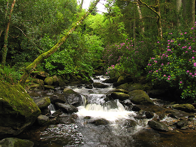
Torc Waterfall () is a high, long cascade waterfall formed by the Owengarriff River as it drains from the ''Devil's Punchbowl'' corrie lake at Mangerton Mountain. The waterfall, which lies at the base of Torc Mountain, in the Killarney National Park, is from Killarney in County Kerry, Ireland. The waterfall is a popular site on the Ring of Kerry and the Kerry Way tours. Naming The word Torc is from the Irish translation of a "wild boar", and the area is associated with legends involving wild boars. One legend is of a man who was cursed by the Devil to spend each night transformed into a wild boar, but when his secret was revealed by a local farmer, he burst into flames and disappeared into the nearby ''Devils Punchbowl'' on Mangerton Mountain from which the Owengarriff River emerged to hide the entrance to his cave beneath the Torc Waterfall. There is also the story of how the legendary Irish warrior, Fionn MacCumhaill, killed a magical boar on Torc mountain with his gol ... [...More Info...] [...Related Items...] OR: [Wikipedia] [Google] [Baidu] |
Ballymalis Castle
Ballymalis Castle is a tower house and National Monument located in County Kerry, Ireland. Location Ballymalis Castle is located northwest of Beaufort, on the north bank of the River Laune, near its confluence with the River Gaddagh. The Ring of Kerry runs to the north. History This castle was built in the early 16th century by the Ó Muircheartaigh (O'Moriartys). It later passed to the Ó Fearghuis (Ferrises), who renovated it in the late 16th century. In 1677 the manor was confiscated by the Crown and granted to Sir Francis Brewster, who granted it to the Eager (Eagar) family. Building This is a tower house, partially restored. It is rectangular, with four storeys and an attic, with bartizans in the southwest and northeast corners. Also featured are slopstones, a machicolation, chimneys, fireplaces and decorated windows with mullions and transoms. Some of the alure (wall-walk A ''chemin de ronde'' (French, "round path"' or "patrol path"; ), also called an allure, alu ... [...More Info...] [...Related Items...] OR: [Wikipedia] [Google] [Baidu] |
Moll's Gap
Moll's Gap or Céim an Daimh (meaning, Gap of the Ox), is a mountain pass on the N71 road from Kenmare to Killarney in Kerry, Ireland. Moll's Gap is on the Ring of Kerry route, and offers views of the MacGillycuddy's Reeks mountains, and is a popular tourist location. The rocks at Moll's gap are formed of Old Red Sandstone, which are small quartz grains laid down over 350 million years ago; unlike most of the Old Red Sandstone around Killarney which is stained red by iron oxide, the rock at Moll's gap is stained green by chlorite. Moll's Gap is named after Moll Kissane, who ran a shebeen (an unlicensed public house) in the 1820s, while the road was under construction. Like the nearby Gap of Dunloe, Moll's Gap is an example of a "glacial breach", where a 500 metre deep glacier in the ''Black Valley'' broke through Moll's Gap 25,000 years ago during Ireland's last ice age. See also * Gap of Dunloe * Black Valley * Ladies View Ladies View is a scenic viewpoint on the Ri ... [...More Info...] [...Related Items...] OR: [Wikipedia] [Google] [Baidu] |
Rossbeigh Beach
Rossbeigh, or Rossbehy (Irish: ''Ros Beithe'', meaning "headland of the Birch trees") is a sandspit with beaches on either side, located approximately 1.6 km from the village of Glenbeigh, in County Kerry, Ireland. It is on the Ring of Kerry, on the Dingle Bay side of the Iveragh Peninsula. Rossbeigh contains a large volume of sand dunes and herbaceous vegetation. It is considered an important habitat for flora and fauna, including wildfowl (salmon and clam are locally farmed).O'Shea (2015), p. 4 Geography Rossbeigh, along with the further inshore Cromane strand in the Castlemaine Harbour, and Inch strand off the Dingle Peninsula (an equally long spit with an equally complex and unstable sand dune systems), is one of three sandspits acting as natural barriers against the Atlantic Ocean for Dingle Bay, which is relatively narrow and subject to strong wave forces and deposition of sediment. Erosion During the early 2000s, slow but prolonged erosion caused by changes in ti ... [...More Info...] [...Related Items...] OR: [Wikipedia] [Google] [Baidu] |
Kerry Woollen Mills
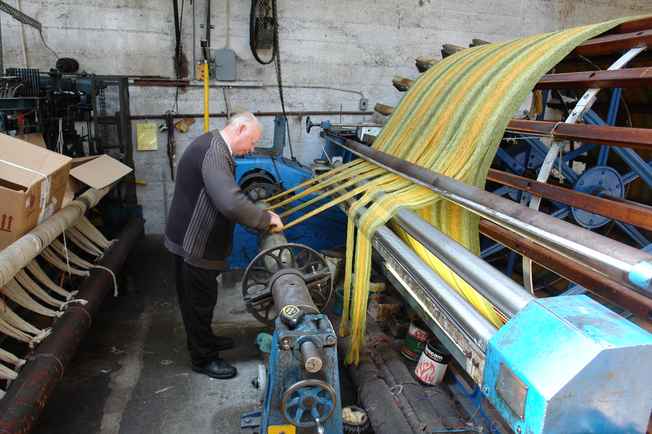
Kerry Woollen Mills are historic wool mills based just off the Ring of Kerry. History Kerry Woollen Mills are one of the last remaining traditional wool mills still manufacturing in County Kerry. The company was founded over 300 years ago. The mill's machinery was originally driven by the River Gweestin, and its water was also used for washing and dying the wool. The mill was run by the Sealy family for many generations since its inception in 1760, and brought into the capable hands of the Eadie family in 1904, who had gained experience in the wool manufacturing business for many years in Fermanagh and Scotland and are now successfully managing the mill in the fourth generation. Wool is spun, dyed and woven on the premises at the back of a well-stocked showroom, where yarns and the finished products are displayed. The mill is set in a rural location with many of historic buildings still being used. The machinery is a successful blend of the traditional and modern, having bee ... [...More Info...] [...Related Items...] OR: [Wikipedia] [Google] [Baidu] |
Dunloe Ogham Stones
Dunloe Ogham Stones (CIIC 197–203, 241) is a collection of ogham stones forming a National Monument located in County Kerry, Ireland. Location Dunloe Ogham Stones are located 1 km south of Beaufort, to the south of the River Laune The River Laune (; Irish: ''An Leamhain'') is a river in County Kerry, Ireland, which flows from Lough Leane (sometimes written as Lough Lein), one of the Lakes of Killarney, through Beaufort, past Ballymalis Castle, through the town of Killo .... History The stones were carved in the 5th and 6th centuries AD and served as burial markers. Seven were discovered in 1838 forming the ceiling of a souterrain near Dunloe Castle and were moved to their current site by 1945. Another stone comes from the old church of Kilbonane. Description The Kilbonane stone is in the centre (CIIC 241) and the others are arranged around it. *CIIC 197: DEGO MAQI MOCOI TOICAKI ("of Daig son of the descendant of Toicacas"; believed to refer to the Tóecr ... [...More Info...] [...Related Items...] OR: [Wikipedia] [Google] [Baidu] |
Gap Of Dunloe
The Gap of Dunloe (), also recorded as ''Bearna an Choimín'' (meaning "gap of the commonage" or "gap of the little hollow"), is a narrow mountain pass running north-south in County Kerry, Ireland, that separates the MacGillycuddy's Reeks mountain range in the west, from the Purple Mountain Group range in the east. It is one of Kerry's most popular tourist destinations on account of its scenery. Naming The term "Dunloe" is believed to be an anglicisation of the Irish term "Dún Lóich", meaning fort or stronghold of Lóich (the River Loe that runs through the Gap of Dunloe valley also derives its name from the same source). According to the ''Annals of Clonmacnois, Keating'' and the ''Lebor Gabála Érenn'' (LGE), Deala (or Dela) Mac Lóich was the father of the five chieftains of the returning Fir Bolg (Slainghe, Gann, Genann, Seangann, and Rudhraighe), who conquered Ireland and divided it into five provinces, each ruled by one brother. According to the ''Annals of the Four ... [...More Info...] [...Related Items...] OR: [Wikipedia] [Google] [Baidu] |
Killarney National Park
Killarney National Park ( ga, Páirc Náisiúnta Chill Airne), near the town of Killarney, County Kerry, was the first national park in Ireland, created when the Muckross Estate was donated to the Irish Free State in 1932. The park has since been substantially expanded and encompasses over 102.89 km2 (25,425 acres) of diverse ecology, including the Lakes of Killarney, oak and yew woodlands of international importance, and mountain peaks. It has the only red deer herd on mainland Ireland and the most extensive covering of native forest remaining in Ireland. The park is of high ecological value because of the quality, diversity, and extensiveness of many of its habitats and the wide variety of species that they accommodate, some of which are rare. The park was designated a UNESCO Biosphere Reserve in 1981. The park forms part of a Special Area of Conservation and a Special Protection Area. The National Parks and Wildlife Service is responsible for the management and adm ... [...More Info...] [...Related Items...] OR: [Wikipedia] [Google] [Baidu] |
Ladies View
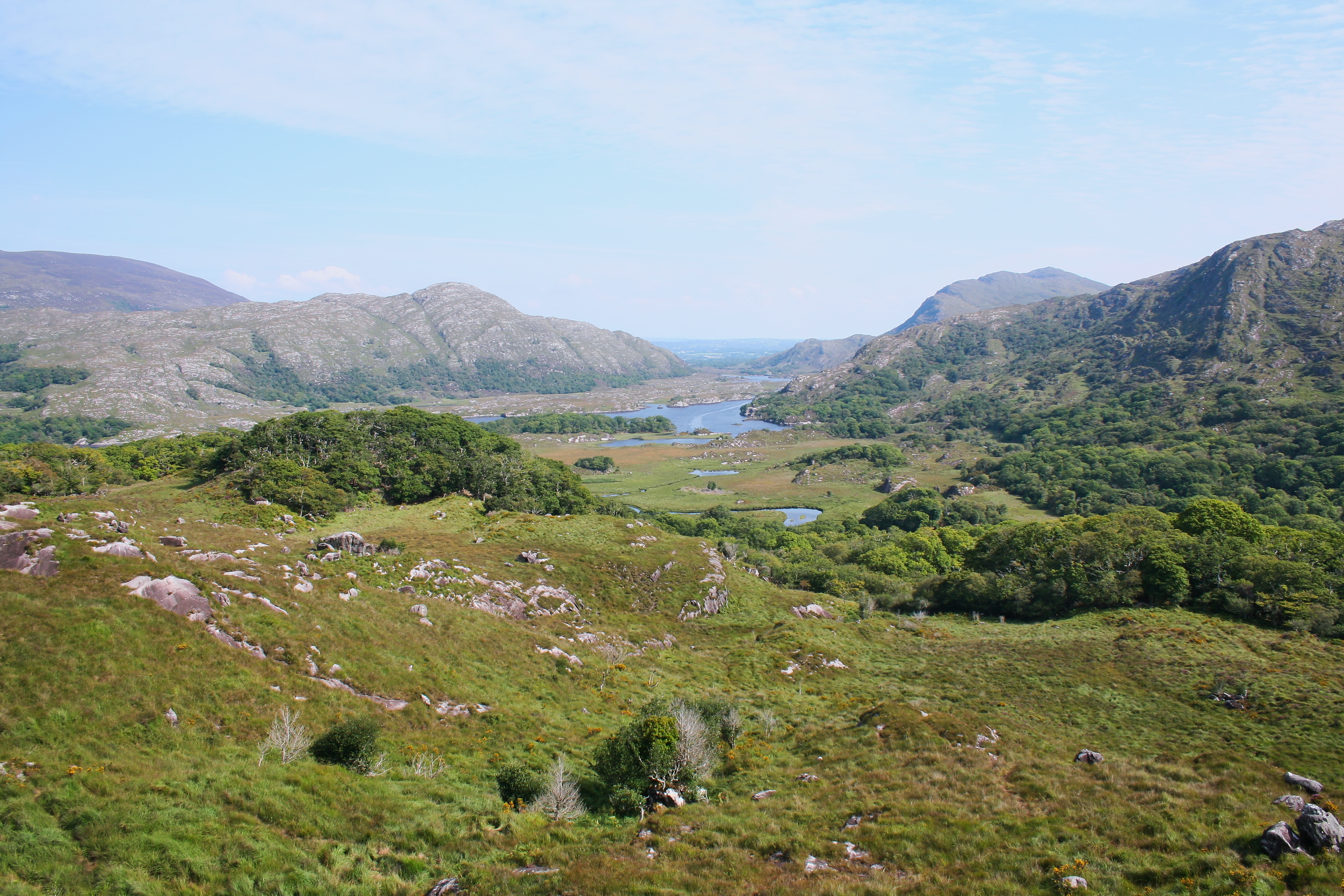
Ladies View is a scenic viewpoint on the Ring of Kerry tourist route about from Killarney along the N71 road to Kenmare, in the Killarney National Park in Ireland. The ''Irish Times'' ranked Ladies View as one of the most photographed places in Ireland, while the '' Daily Edge'' ranked the views amongst Ireland's finest on Instagram. The name Ladies View (sometimes spelt Ladies' View), stems from the admiration of the view given by Queen Victoria's ladies-in-waiting during Victoria's 1861 visit to Ireland. In October 2017, a tourist couple almost drove their rental car over the edge of the cliff and into the valley below. The main viewpoint has a small car park, and a café. Gallery File:Killarney National Park - Ladies View.jpg, Ladies View in May File:Ladies View, Ring of Kerry (12282951274).jpg, Ladies View in Autumn File:Ladies' view 9.5.14 - panoramio.jpg, Road around the area See also * Black Valley * Gap of Dunloe * Moll's Gap * Torc Waterfall Torc Waterf ... [...More Info...] [...Related Items...] OR: [Wikipedia] [Google] [Baidu] |

_(14760479206).jpg)


.jpg)