|
Richard Packer (politician)
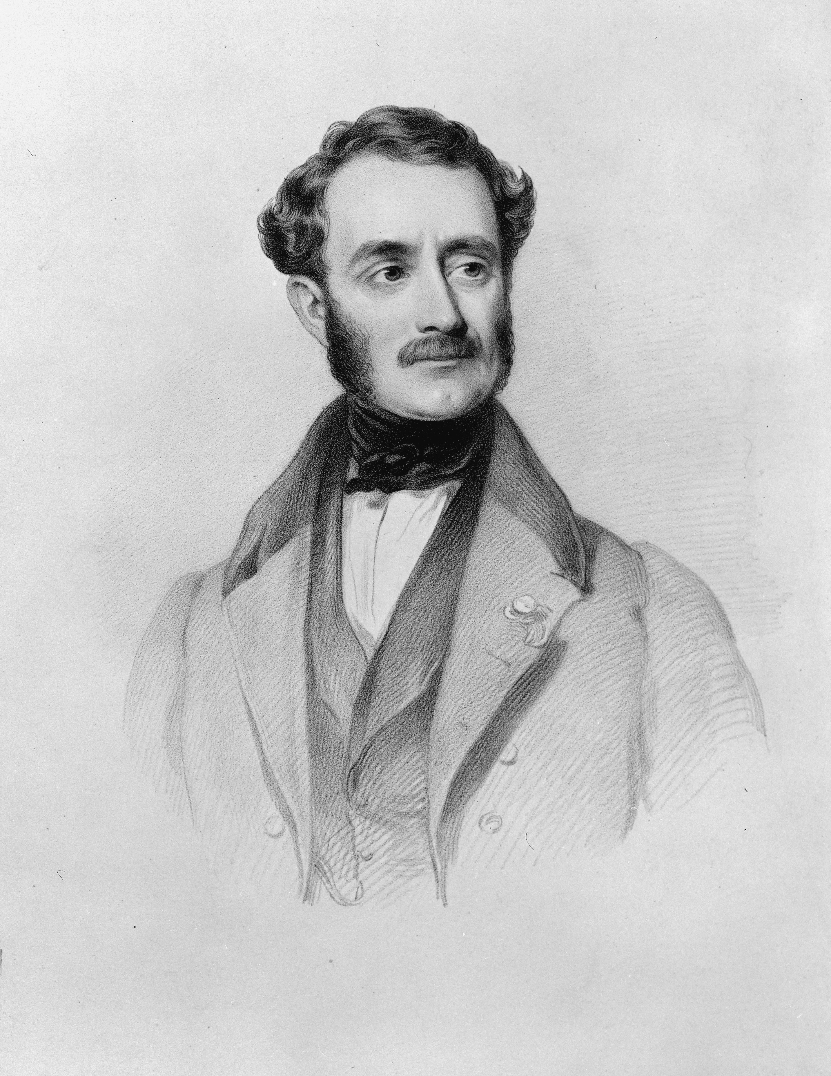
Richard Packer (1794 – 27 July 1872) was a New Zealand politician and Member of Parliament from 1856–1859 representing the Town of Christchurch electorate. He was also a member of the Canterbury Provincial Council, including its treasurer. Early life Packer lived in Claverton near Bath in the County of Somerset, England, when he decided to emigrate to New Zealand, which he did in 1851. He took up employment as church steward. His family arrived in Lyttelton on 31 May 1851 on the ship ''Travancore''. Political career Packer was elected to the first Canterbury Provincial Council in 1853, together with Samuel Bealey and Thomas Cass. He was a member of the 1st and 2nd council, from 1853 until 1860. During a day of low attendance in October 1854, he secured a suspension of the standing orders, which allowed him to pass the first two readings of a bill to enlarge the council's membership by 12 additional members. Whilst there was justification for such a measure due to the ... [...More Info...] [...Related Items...] OR: [Wikipedia] [Google] [Baidu] |
Christchurch (New Zealand Electorate)
Christchurch was a parliamentary electorate in Christchurch, New Zealand. It existed three times. Originally it was the Town of Christchurch from 1853 to 1860. From the 1860–1861 election to the 1871 election, it existed as City of Christchurch. It then existed from the 1875–1876 election until the 1881 election. The last period was from the 1890 election to the 1905 election. Since the 1946 election, a similarly named electorate called Christchurch Central has been in existence. The historic electorate was represented by 21 members of parliament. For some of the time, it was represented by one member at a time. During other periods, it was one of the few three-member electorates in New Zealand. Population centres In December 1887, the House of Representatives voted to reduce its membership from general electorates from 91 to 70. The 1890 electoral redistribution used the same 1886 census data used for the 1887 electoral redistribution. In addition, three-member el ... [...More Info...] [...Related Items...] OR: [Wikipedia] [Google] [Baidu] |
1860 Town Of Christchurch By-election
The Town of Christchurch by-election in 1860 was triggered by the resignation of Richard Packer as the Member of the House of Representatives for the Town of Christchurch electorate, and occurred during the term of the 2nd New Zealand Parliament. The previous representative of the electorate, the politician Henry Sewell, had returned after three years in England and the general expectation was that Sewell would be the sole contender for election. The ''Lyttelton Times'' wrote several provocative editorials, generally endorsing Sewell for his obvious ability, but criticising him for not publicly talking about his policies and plans. Sewell eventually arranged a public meeting the evening prior to nomination day; this was the only public meeting during the election campaign. After a lengthy address, which was favourably received by the ''Lyttelton Times'', a second contender for the office put his name forward at that meeting: the publican Michael Hart. Sewell, a former premier ... [...More Info...] [...Related Items...] OR: [Wikipedia] [Google] [Baidu] |
Parchment
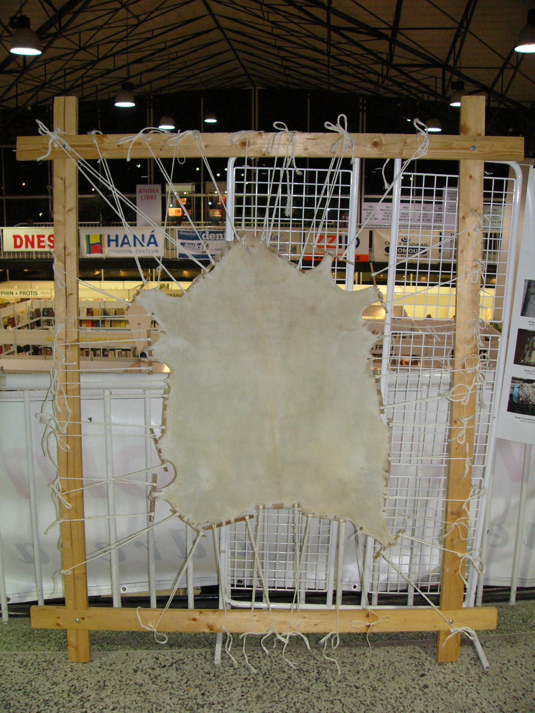
Parchment is a writing material made from specially prepared untanned skins of animals—primarily sheep, calves, and goats. It has been used as a writing medium for over two millennia. Vellum is a finer quality parchment made from the skins of young animals such as lambs and young calves. It may be called animal membrane by libraries and museums that wish to avoid distinguishing between ''parchment'' and the more-restricted term ''vellum'' (see below). Parchment and vellum Today the term ''parchment'' is often used in non-technical contexts to refer to any animal skin, particularly goat, sheep or cow, that has been scraped or dried under tension. The term originally referred only to the skin of sheep and, occasionally, goats. The equivalent material made from calfskin, which was of finer quality, was known as ''vellum'' (from the Old French or , and ultimately from the Latin , meaning a calf); while the finest of all was ''uterine vellum'', taken from a calf foetus or still ... [...More Info...] [...Related Items...] OR: [Wikipedia] [Google] [Baidu] |
Christchurch Central City
Christchurch Central City or Christchurch City Centre is the geographical centre and the heart of Christchurch, New Zealand. It is defined as the area within the Four Avenues (Bealey Avenue, Fitzgerald Avenue, Moorhouse Avenue and Deans Avenue) and thus includes the densely built up central city, some less dense surrounding areas of residential, educational and industrial usage, and green space including Hagley Park, the Christchurch Botanic Gardens and the Barbadoes Street Cemetery. It suffered heavy damage in the 2010 Canterbury earthquake and was devastated in the 2011 Christchurch earthquake. Following this second earthquake, the Central City Red Zone The Central City Red Zone, also known as the CBD Red Zone, was a public exclusion zone in the Christchurch Central City implemented after the 22 February 2011 Christchurch earthquake. After February 2013, it was officially renamed the CBD Rebuil ... was set up and, with a gradually shrinking area, remained inaccessible ... [...More Info...] [...Related Items...] OR: [Wikipedia] [Google] [Baidu] |
St Michael's Church School
St Michael's is a co-educational Anglican private primary and intermediate day school situated in the city centre of Christchurch, New Zealand. The school provides an education for year zero to year eight. It is associated with the Church of St Michael and All Angels. Three of the buildings and structures are registered with the New Zealand Historic Places Trust as heritage items. The church building is registered as a Category I structure. The belfry of the church, built in 1861 and designed by Benjamin Mountfort, is also recognised as a Category I structure. The 1912 Stone School Building, designed by Cecil Wood, is registered as a Category II building. See also *List of schools in the Canterbury Region Canterbury is a region in the South Island of New Zealand. It contains numerous rural primary schools, several small town primary and secondary schools, and big-city schools in Christchurch. Due to the large number of schools in Christchurch, th ... References Externa ... [...More Info...] [...Related Items...] OR: [Wikipedia] [Google] [Baidu] |
Church Of St Michael And All Angels, Christchurch
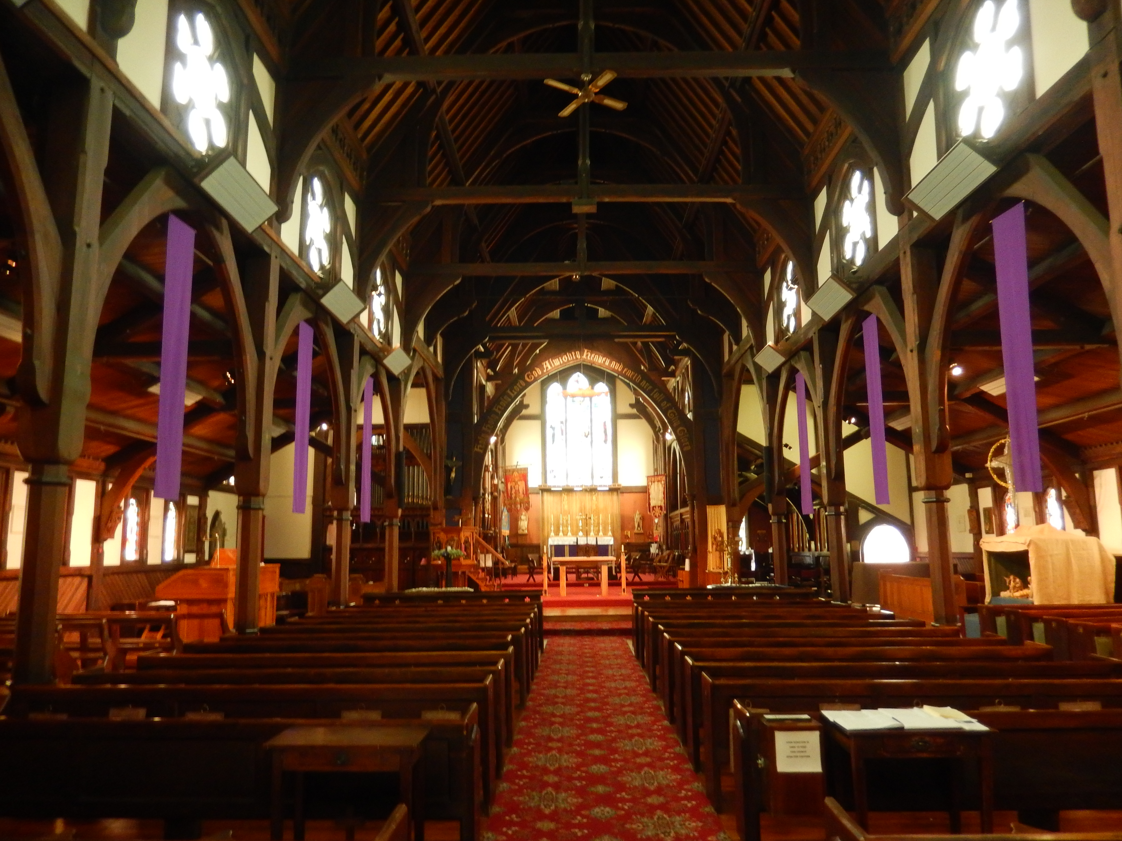
The Church of St Michael and All Angels is an Anglican church in Christchurch, New Zealand. The church building at 84 Oxford Terrace, Christchurch, is registered as Category I by Heritage New Zealand. Its freestanding belfry is registered separately. History The structure stands on the site of the first church built by the Canterbury Association settlers in 1851. Henry Jacobs preached the sermon and conducted the service at the opening of the church in July 1851. St Michael & All Angels served as the pro-cathedral until the completion of ChristChurch Cathedral in 1881. The architect of the current church was William Fitzjohn Crisp (1846–1924). He had come out from England in 1864 as the pupil of Robert Speechly who had been appointed by George Gilbert Scott to supervise the building of ChristChurch Cathedral. The cornerstone of the church was laid in a ceremony on the Feast of St Michael & All Angels, 29 September 1870. However, problems with the construction of the building ... [...More Info...] [...Related Items...] OR: [Wikipedia] [Google] [Baidu] |
Anglo-Catholicism
Anglo-Catholicism comprises beliefs and practices that emphasise the Catholic heritage and identity of the various Anglican churches. The term was coined in the early 19th century, although movements emphasising the Catholic nature of Anglicanism already existed. Particularly influential in the history of Anglo-Catholicism were the Caroline Divines of the 17th century, the Jacobite Nonjuring schism of the 17th and 18th centuries, and the Oxford Movement, which began at the University of Oxford in 1833 and ushered in a period of Anglican history known as the "Catholic Revival". A minority of Anglo-Catholics, sometimes called Anglican Papalists, consider themselves under papal supremacy even though they are not in communion with the Roman Catholic Church. Such Anglo-Catholics, especially in England, often celebrate Mass according to the Mass of Paul VI and are concerned with seeking reunion with the Roman Catholic Church. Members of the Roman Catholic Church's personal ord ... [...More Info...] [...Related Items...] OR: [Wikipedia] [Google] [Baidu] |
Somerfield, New Zealand
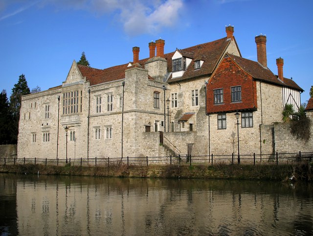
Somerfield is a suburb in the south of Christchurch, New Zealand. It is nominally bordered by the Ōpāwaho / Heathcote River to the south and west, Strickland and Colombo Streets to the east, and Milton Street to the north. The suburb includes Somerfield School, Somerfield Park and a small number of shops which service the local area, although it is predominantly residential. Somerfield is also known for its wide variety of trees, especially along the banks of the Ōpāwaho / Heathcote River. Etymology Edward Bishop, an early Mayor of Christchurch, was born at Somerfield House in Maidstone, Kent, England in 1811. He came to Christchurch on the ''Charlotte Jane'' with all his siblings, and together with his youngest brother Frederick Augustus Bishop (1818–1894) bought land south of Christchurch along the Ōpāwaho / Heathcote River. They called their farm Somerfield, after their birthplace, and they appear on both the 1853 jury list and electoral roll as living there. Somerf ... [...More Info...] [...Related Items...] OR: [Wikipedia] [Google] [Baidu] |
Kent
Kent is a county in South East England and one of the home counties. It borders Greater London to the north-west, Surrey to the west and East Sussex to the south-west, and Essex to the north across the estuary of the River Thames; it faces the French department of Pas-de-Calais across the Strait of Dover. The county town is Maidstone. It is the fifth most populous county in England, the most populous non-Metropolitan county and the most populous of the home counties. Kent was one of the first British territories to be settled by Germanic tribes, most notably the Jutes, following the withdrawal of the Romans. Canterbury Cathedral in Kent, the oldest cathedral in England, has been the seat of the Archbishops of Canterbury since the conversion of England to Christianity that began in the 6th century with Saint Augustine. Rochester Cathedral in Medway is England's second-oldest cathedral. Located between London and the Strait of Dover, which separates England from mainla ... [...More Info...] [...Related Items...] OR: [Wikipedia] [Google] [Baidu] |
Maidstone
Maidstone is the largest Town status in the United Kingdom, town in Kent, England, of which it is the county town. Maidstone is historically important and lies 32 miles (51 km) east-south-east of London. The River Medway runs through the centre of the town, linking it with Rochester, Kent, Rochester and the Thames Estuary. Historically, the river carried much of the town's trade as the centre of the agricultural county of Kent, known as the Garden of England. There is evidence of settlement in the area dating back before the Stone Age. The town, part of the borough of Maidstone, had an approximate population of 100,000 in 2019. Since World War II, the town's economy has shifted from heavy industry towards light industry and services. Toponymy Anglo-Saxon period of English history, Saxon charters dating back to ca. 975 show the first recorded instances of the town's name, ''de maeides stana'' and ''maegdan stane'', possibly meaning ''stone of the maidens'' or ''stone of the ... [...More Info...] [...Related Items...] OR: [Wikipedia] [Google] [Baidu] |
Edward Bishop (mayor)
Edward Brenchley Bishop (1811 – 25 April 1887) was the fourth chairman of the Christchurch Town Council, and seven years later the sixth Mayor of Christchurch in 1872–1873. Born in Maidstone, Kent to a wealthy family, his family lived in Belgium during his childhood. He took his father's profession as a distiller and worked in London for 21 years. His sister Susannah emigrated to New Zealand in 1849 and in the following year, many Bishop siblings followed her on the ''Charlotte Jane'', one of the First Four Ships of organised settlement of Canterbury. With his brother Frederick, he had a large farm just south of Christchurch, and the suburb of Somerfield continues to use their farm's name. The brothers were spirit merchants in the city. Bishop was elected onto the town and later city council eight times between 1863 and 1873. In 1866, he served as chairman of the town council during one of the most difficult years the council has ever faced. A ratepayers' revolt nearly bankrup ... [...More Info...] [...Related Items...] OR: [Wikipedia] [Google] [Baidu] |
Colombo Street
Colombo Street is a main road of the city of Christchurch, New Zealand. It runs south-north through the centre of Christchurch with a break at Cathedral Square. As with many other central Christchurch streets, it is named for a colonial Anglican bishopric, Colombo, Sri Lanka in what at the time was known as Ceylon. Parts of the street which run through Sydenham were known as Addison Street during the 1880s, and some parts were known as Colombo Road. Geography Colombo Street runs for due north-south. As with most Christchurch north-south streets, its numbering starts at its southern end. Like most of central Christchurch, the street is flat. It starts south of the city centre at a roundabout junction with Dyers Pass Rd, which descends from the Port Hills and Cashmere and Centaurus Roads, which run along the foot of the hills. For its first few hundred metres the street runs north-northeast through the suburb of Somerfield, before turning due north and crossing the Heathcote R ... [...More Info...] [...Related Items...] OR: [Wikipedia] [Google] [Baidu] |


.jpg)

