|
Reseda Boulevard
Reseda Boulevard, named Reseda Avenue until May 1929, is a major north–south arterial road that runs through the western San Fernando Valley region of Los Angeles, California. Reseda Boulevard runs approximately from the Santa Monica Mountains at the Marvin Braude Mulholland Gateway Park in the south to the Santa Susana Mountains and Porter Ranch in the north. It passes through the community of Tarzana, passes Mulholland Park gated community and El Caballero Country Club, then continues into the flats of the Valley through the communities of Reseda and Northridge, passes the campus of California State University Northridge, and ends at Porter Ranch. The epicenter of the 1994 Northridge earthquake was approximately one block west of the Boulevard, in its namesake community of Reseda. Damage occurred throughout the San Fernando Valley though areas of more widespread destruction followed along the boulevard's northern course, including an apartment building which stood at th ... [...More Info...] [...Related Items...] OR: [Wikipedia] [Google] [Baidu] |
Reseda Station
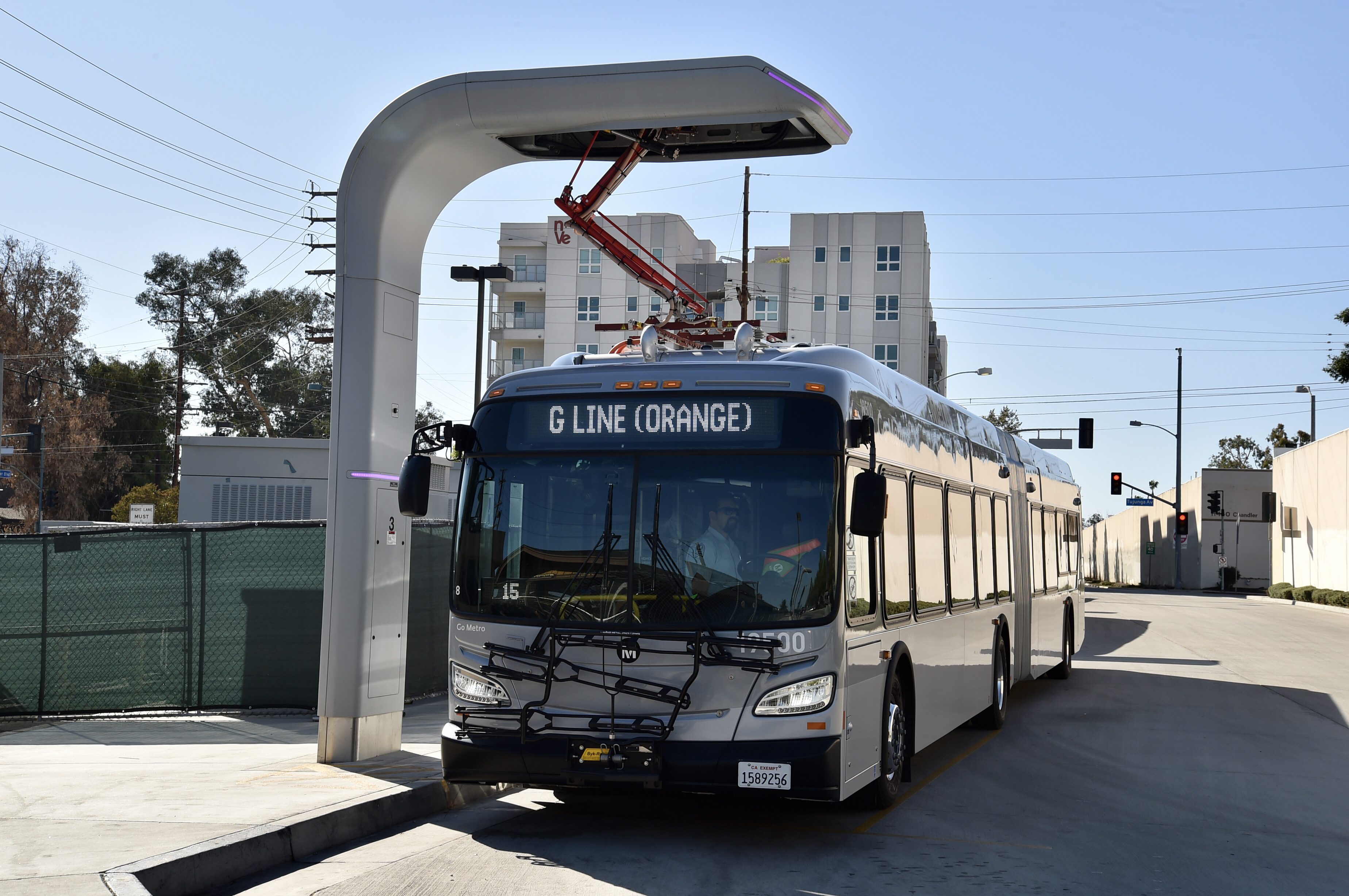
Reseda station is a station on the G Line (Los Angeles Metro), G Line of the Los Angeles Metro Busway system. It is named after adjacent Reseda Boulevard, which travels north–south and crosses the east–west busway route. The station is in the Los Angeles districts of Reseda, Los Angeles, Reseda and Tarzana, Los Angeles, Tarzana. Service Station Layout Hours and frequency Connections , the following connections are available: * Los Angeles Metro Bus: References External links G Line (Los Angeles Metro) Los Angeles Metro Busway stations Reseda, Los Angeles Tarzana, Los Angeles Public transportation in the San Fernando Valley Public transportation in Los Angeles Bus stations in Los Angeles 2005 establishments in California {{LACMTA-stub ... [...More Info...] [...Related Items...] OR: [Wikipedia] [Google] [Baidu] |
California State University Northridge
California State University, Northridge (CSUN or Cal State Northridge) is a public university in the Northridge neighborhood of Los Angeles, California. With a total enrollment of 38,551 students (as of Fall 2021), it has the second largest undergraduate population as well as the third largest total student body of the 23-campus California State University system, making it one of the largest comprehensive universities in the United States in terms of enrollment size. The size of CSUN also has a major impact on the California economy, with an estimated $1.9 billion in economic output generated by CSUN on a yearly basis. As of Fall 2021, the university has 2,187 faculty, of which 794 (or about 36%) were tenured or on the tenure track. California State University, Northridge was founded first as the Valley satellite campus of California State University, Los Angeles. It then became an independent college in 1958 as San Fernando Valley State College, with major campus master plann ... [...More Info...] [...Related Items...] OR: [Wikipedia] [Google] [Baidu] |
Edgar Rice Burroughs
Edgar Rice Burroughs (September 1, 1875 – March 19, 1950) was an American author, best known for his prolific output in the adventure, science fiction, and fantasy genres. Best-known for creating the characters Tarzan and John Carter, he also wrote the ''Pellucidar'' series, the ''Amtor'' series, and the '' Caspak'' trilogy. Tarzan was immediately popular, and Burroughs capitalized on it in every way possible, including a syndicated Tarzan comic strip, movies, and merchandise. Tarzan remains one of the most successful fictional characters to this day and is a cultural icon. Burroughs's California ranch is now the center of the Tarzana neighborhood in Los Angeles, named after the character. Burroughs was an explicit supporter of eugenics and scientific racism in both his fiction and nonfiction; Tarzan was meant to reflect these concepts. Biography Early life and family Burroughs was born on September 1, 1875, in Chicago (he later lived for many years in the suburb of ... [...More Info...] [...Related Items...] OR: [Wikipedia] [Google] [Baidu] |
Mountain Bikers At Marvin Braude Gateway Park
A mountain is an elevated portion of the Earth's crust, generally with steep sides that show significant exposed bedrock. Although definitions vary, a mountain may differ from a plateau in having a limited summit area, and is usually higher than a hill, typically rising at least 300 metres (1,000 feet) above the surrounding land. A few mountains are isolated summits, but most occur in mountain ranges. Mountains are formed through tectonic forces, erosion, or volcanism, which act on time scales of up to tens of millions of years. Once mountain building ceases, mountains are slowly leveled through the action of weathering, through slumping and other forms of mass wasting, as well as through erosion by rivers and glaciers. High elevations on mountains produce colder climates than at sea level at similar latitude. These colder climates strongly affect the ecosystems of mountains: different elevations have different plants and animals. Because of the less hospitable terrain and ... [...More Info...] [...Related Items...] OR: [Wikipedia] [Google] [Baidu] |
Marvin Braude
Marvin Braude (11 August 1920 – 7 December 2005) was a member of the Los Angeles City Council for 32 years, between 1965 and 1997—the third-longest-serving council member in the history of the city. He was “a champion of bike paths,” advocated for protecting the open space of the Santa Monica Mountains, and successfully pushed the city to ban smoking in restaurants and government buildings. Biography Braude was born on August 11, 1920, in Chicago, Illinois, the only son of Benjamin and Rose Braude, and attended the University of Illinois in 1937. He graduated from the University of Chicago in 1941 with a bachelor's degree in political science. He was a research assistant with the Cowles Commission for Research in Economics in 1941 and an instructor in social science at the University of Chicago in 1942. He owned and operated small businesses and a small investment firm until he was elected to the City Council in 1965. Braude was married to Marjorie Sperry of Chicago on Sep ... [...More Info...] [...Related Items...] OR: [Wikipedia] [Google] [Baidu] |
Marvin Braude Mulholland Gateway Park
Marvin Braude Mulholland Gateway Park is a park in the Santa Monica Mountains, with its trailhead at the southern terminus of Reseda Boulevard in Tarzana, Los Angeles, California. The park was named for former Los Angeles City Councilman Marvin Braude, who for more than 30 years led the effort to preserve the Santa Monica Mountains. Owned by the Santa Monica Mountains Conservancy, the park is within the Santa Monica Mountains National Recreation Area. Marvin Braude Mulholland Gateway Park is in the California coastal sage and chaparral and the California chaparral and woodlands ecoregions. Trails Braude Park connects with Topanga State Park and the "Big Wild" to create a large expanse of undeveloped wild land offering hiking, mountain biking and equestrian trails. On the ridgetop is the unpaved section of Mulholland Drive, closed to cars, for hiking and vistas north over the Valley and south over the Los Angeles Basin to the Pacific Ocean. The park trails also connects with th ... [...More Info...] [...Related Items...] OR: [Wikipedia] [Google] [Baidu] |
Cycle Track
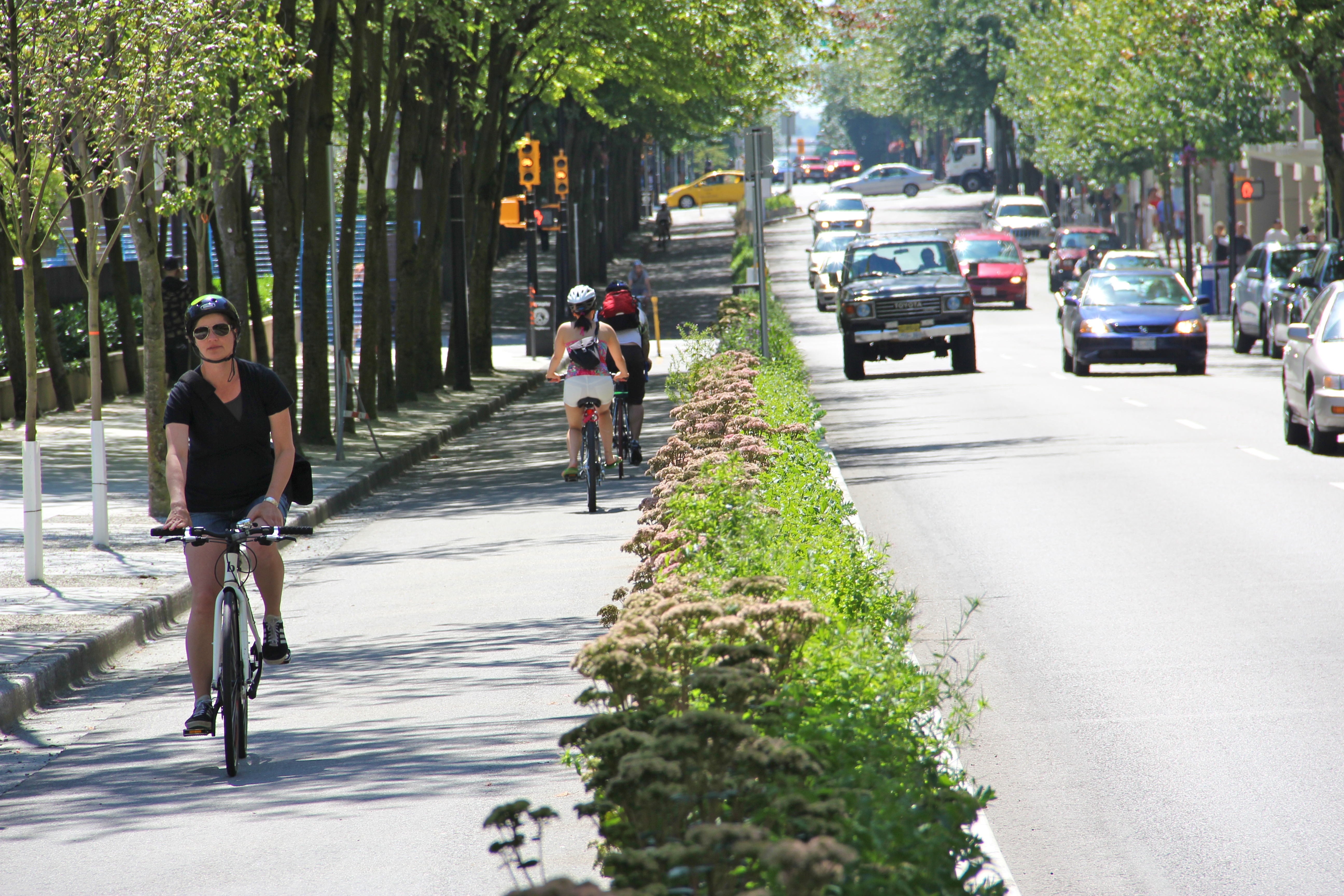
A cycle track, separated bike lane or protected bike lane (sometimes historically referred to as a sidepath) is an exclusive bikeway that has elements of a separated path and on-road bike lane. A cycle track is located within or next to the roadway, but is made distinct from both the sidewalk and general purpose roadway by vertical barriers or elevation differences. In urban planning, cycle tracks are designed to encourage bicycling in an effort to relieve automobile congestion and reduce pollution, reduce bicycling fatalities and injuries by eliminating the need for cars and bicycles to jockey for the same road space, and to reduce overall confusion and tension for all users of the road. Cycle tracks may be one-way or two-way, and may be at road level, at sidewalk level, or at an intermediate level. They all have in common some separation from motor traffic with bollards, car parking, barriers or boulevards. Barriers may include curbs, concrete berms, posts, planting/median ... [...More Info...] [...Related Items...] OR: [Wikipedia] [Google] [Baidu] |
Reseda (LACMTA Station)
Reseda station is a station on the G Line of the Los Angeles Metro Busway system. It is named after adjacent Reseda Boulevard, which travels north–south and crosses the east–west busway route. The station is in the Los Angeles districts of Reseda and Tarzana. Service Station Layout Hours and frequency Connections , the following connections are available: * Los Angeles Metro Bus Los Angeles Metro Bus is the transit bus service in Los Angeles County, California operated by the Los Angeles County Metropolitan Transportation Authority (Metro). In , the system had a ridership of , or about per weekday as of . , there are ...: References External links G Line (Los Angeles Metro) Los Angeles Metro Busway stations Reseda, Los Angeles Tarzana, Los Angeles Public transportation in the San Fernando Valley Public transportation in Los Angeles Bus stations in Los Angeles 2005 establishments in California {{LACMTA-stub ... [...More Info...] [...Related Items...] OR: [Wikipedia] [Google] [Baidu] |
G Line (Los Angeles Metro)
The G Line (formerly the Orange Line) is a bus rapid transit line in Los Angeles, California, operated by the Los Angeles County Metropolitan Transportation Authority (Metro). It operates between and stations in the San Fernando Valley. The G Line uses a dedicated, exclusive right-of-way for the entirety of its route with 17 stations located at approximately intervals; fares are paid via TAP cards at vending machines on station platforms before boarding to improve performance. It is one of the two lines in the Metro Busway system. The line, which opened on October 29, 2005, follows part of the Southern Pacific Railroad's former Burbank Branch Line which provided passenger rail service from 1904 to 1920; it was subsequently used by Pacific Electric streetcars from 1911 to 1952. At North Hollywood station, the G Line connects with the B Line subway which offers service to Downtown Los Angeles via Hollywood. The Metro Orange Line bicycle path runs alongside part of the rou ... [...More Info...] [...Related Items...] OR: [Wikipedia] [Google] [Baidu] |
Metro Local
Los Angeles Metro Bus is the transit bus service in Los Angeles County, California operated by the Los Angeles County Metropolitan Transportation Authority (Metro). In , the system had a ridership of , or about per weekday as of . , there are 113 routes in the system. Metro employs the drivers that operate most routes, but some are contracted out to MV Transportation, Southland Transit, and Transdev. Los Angeles Metro has the third largest fleet in North America, with 2,320 buses, about 80 percent are standard length ( or longer) and 17 percent are high-capacity articulated buses. History The Metro Bus brand dates back to the 1993 founding of Metro, but many of the routes in the system are little changed from the bus routes of the prior Southern California Rapid Transit District (RTD) or the streetcar routes operated by the Pacific Electric Red Cars or the Los Angeles Railway Yellow Cars. Starting in 2003, Metro operated its bus network under three different brands: oran ... [...More Info...] [...Related Items...] OR: [Wikipedia] [Google] [Baidu] |
California State Route 118
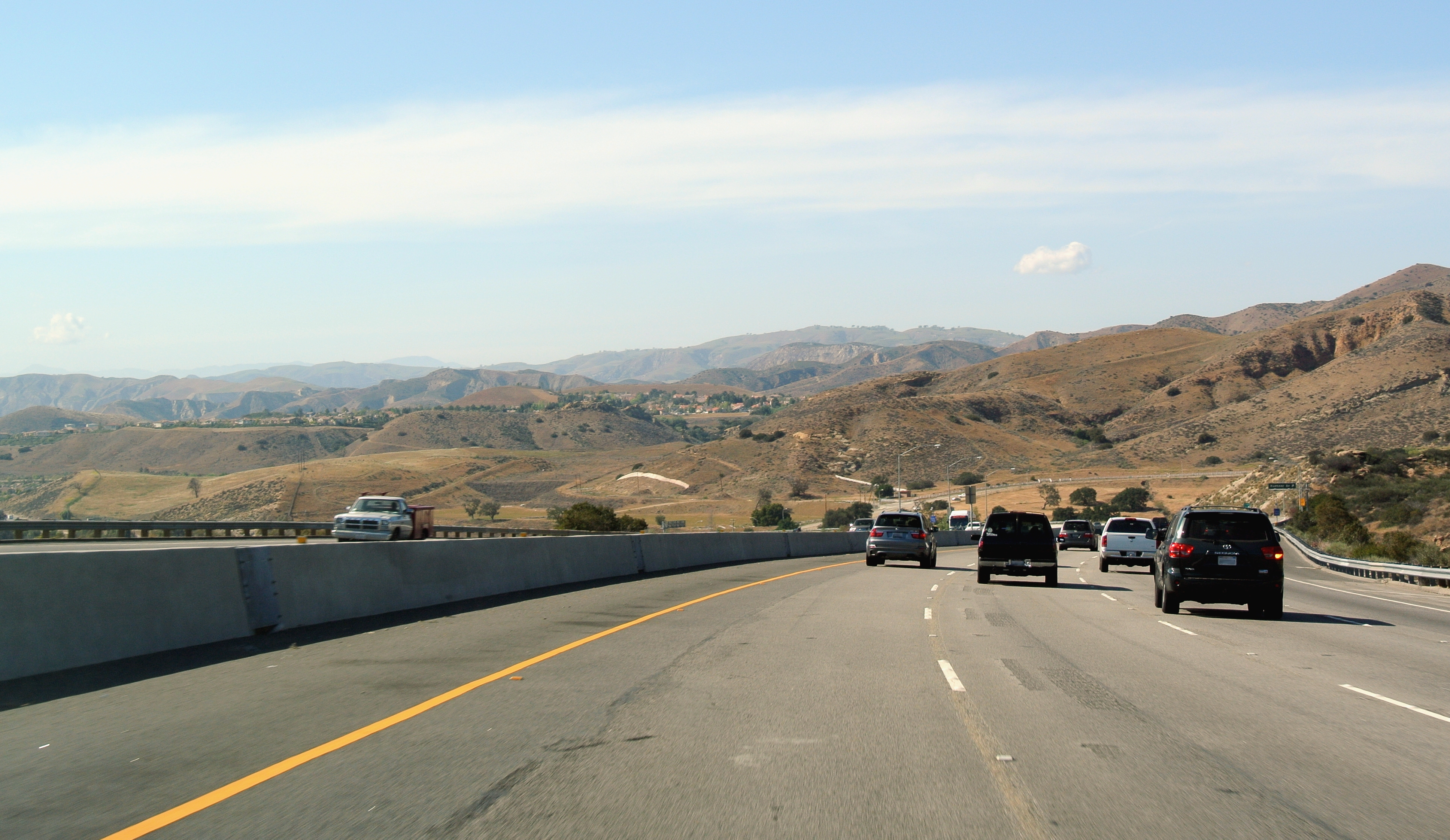
State Route 118 (SR 118) is a state highway in the U.S. state of California that runs west to east through Ventura and Los Angeles counties. It travels from State Route 126 at the eastern edge of Ventura immediately northwest of Saticoy, then through Saticoy, in Ventura County east to Interstate 210 near Lake View Terrace in Los Angeles. SR 118 crosses the Santa Susana Pass and the northern rim of the San Fernando Valley along its route. Route description SR 118 has two distinguishable sections, which connect at the intersection with State Route 23. The western section of SR 118 goes through the more rural areas of Ventura County. SR 118 begins at an intersection with SR 126 in Ventura as Wells Road and heads southeast, crossing the Santa Clara River as Los Angeles Avenue and intersecting SR 232 in unincorporated Ventura County. The highway continues southeast before intersecting Santa Clara Avenue, where Los Angeles Avenue turns east and passes north of Camarillo. In ... [...More Info...] [...Related Items...] OR: [Wikipedia] [Google] [Baidu] |


