|
Renningen
Renningen is a town in the district of Böblingen, Baden-Württemberg, Germany. It is situated 18 km west of Stuttgart. Geography Renningen is located in the west of Stuttgart, between Leonberg and Weil der Stadt on the fringes of the fertile plains of the Neckarland. The Rankbach valley extends here to the Renningen Basin. Neighbouring municipalities Magstadt, Weil der Stadt, Leonberg, Rutesheim, Heimsheim History Renningen lies in an area which even in the Early Stone Age was thickly populated. Proof of this are the many remains found of settlements from the linear pottery culture. Remains of settlements found to originate with the Urnenfelderkultur (c. 1000 BC) as well the Hallstatt- and La Tène culture (Early to Late Iron Age), provide evidence of settlement during various prehistoric eras. The evaluation of archeological digs and finds show expansion of two early Alemannic settlements within the Renningen Basin north and south of the Rankbach. Excavations ... [...More Info...] [...Related Items...] OR: [Wikipedia] [Google] [Baidu] |
Leonberg
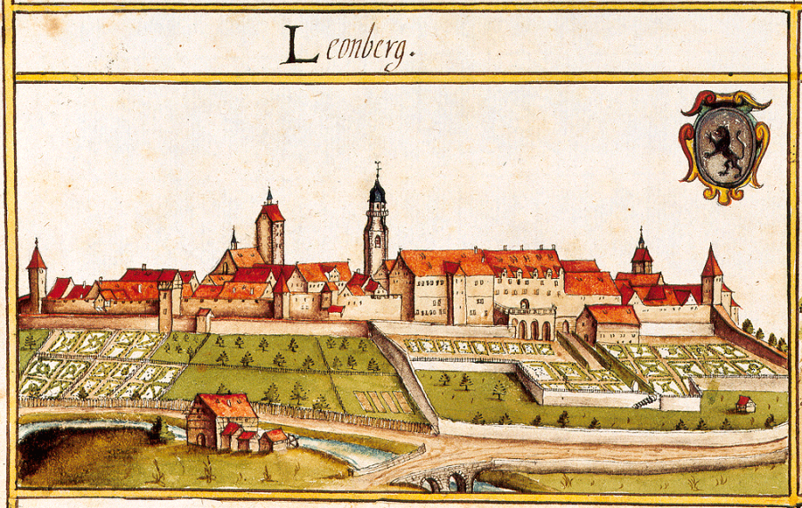
Leonberg (; swg, Leaberg) is a town in the German federal state of Baden-Württemberg about to the west of Stuttgart, the state capital. About 45,000 people live in Leonberg, making it the third-largest borough in the rural district (''Landkreis'') of Böblingen (after Sindelfingen and Böblingen to the south). Leonberg is most famous for its picturesque market square, the centuries-old annual horse market, its past role as the seat of one of Württemberg's first parliaments, and the Pomeranzen Garden – Germany's only remaining terraced garden which dates back to the late Renaissance. Geography Leonberg lies on the east bank of the Glems River on the lower slopes of a prominent hill known locally as Engelberg (literally: "Angel Hill"). The Glems flows into Leonberg from the southeast before turning northwest until it reaches the district of Eltingen. Here, it turns northeast into the western part of the old town, carving its way along the valley to the district of Höf ... [...More Info...] [...Related Items...] OR: [Wikipedia] [Google] [Baidu] |
Böblingen (district)
Böblingen is a ''Landkreis'' (district) in the middle of Baden-Württemberg, Germany. Neighboring districts are (from west clockwise) Calw, Enz, Ludwigsburg, (district) Stuttgart, and the districts Esslingen, Reutlingen and Tübingen. History The district was created in 1937 as the successor of the ''Oberamt Böblingen'', which dates back to the Duchy of Württemberg, from the late 15th to the early 19th centuries. In 1973 the majority of the district Leonberg, as well as a few municipalities of the district Calw, were added to the district. A few municipalities were reassigned to the district Ludwigsburg. Geography A part of the district is located in the Black Forest, other landscapes covered are the ''Oberes Gäu'' and the ''Schönbuch Schönbuch is an almost completely wooded area south west of Stuttgart and part of the Southern German Escarpment Landscape (German: ''südwestdeutsches Schichtstufenland''). In 1972 the centre zone of Schönbuch became the first natu ... [...More Info...] [...Related Items...] OR: [Wikipedia] [Google] [Baidu] |
Magstadt
Magstadt is a town in the German Federal state of Baden-Württemberg, in the district (Landkreis) Böblingen. It is located between Renningen and Sindelfingen Sindelfingen (Swabian: ''Sendlfenga'') is a city in Baden-Württemberg in south Germany. It lies near Stuttgart at the headwaters of the Schwippe (a tributary of the river Würm), and is home to a Mercedes-Benz assembly plant. History * 1155 � .... References Böblingen (district) Württemberg {{Böblingen-geo-stub ... [...More Info...] [...Related Items...] OR: [Wikipedia] [Google] [Baidu] |
Mennecy
Mennecy () is a commune in the Essonne department in Île-de-France in northern France. Geography Mennecy is 33 kilometers south east of Paris-Notre-Dame, point zero from roads of France, 8 kilometers south of Évry, 6 kilometers south west of Corbeil-Essonnes, 11 kilometers north east of La Ferté-Alais, 14 kilometers east of Arpajon, 15 kilometers south east of Montlhéry, 19 kilometers north of Milly-la-Forêt, 22 kilometers south east of Palaiseau, 25 kilometers north east of Étampes, 31 kilometers north east of Dourdan. It is crossed by the river Essonne. Population Inhabitants of Mennecy are known as ''Menneçois'' in French. Twin towns Mennecy is twinned with the villages Countesthorpe in Leicestershire, United Kingdom, Occhiobello in Italy and Renningen in Baden-Württemberg, Germany. See also * Communes of the Essonne department The following is a list of the 194 communes of the Essonne department of France. The communes cooperate in the following intercommunali ... [...More Info...] [...Related Items...] OR: [Wikipedia] [Google] [Baidu] |
Saalburg-Ebersdorf
Saalburg-Ebersdorf is a town in the Saale-Orla-Kreis district, in Thuringia, Germany close to the Bavarian border. It is situated on the river Saale, 10 km southwest of Schleiz, 30 km west of Plauen and 30 km north-west of Hof. The town is an administrative union of two large villages (Saalburg and Ebersdorf) lying either side of the Saale river near the Bleilochtalsperre as well as several smaller villages in between and around them. History The earliest records of the towns and villages of Saalburg-Ebersdorf are from the thirteenth and fourteenth centuries. They lay on and around the historical trade route between Nuremberg and Leipzig. Saalburg and Ebersdorf became increasingly important in the seventeenth century as regional seats of the Counts von Reuss. Saalburg Saalburg was established under the Lobdaburger reign in around 1313. Some ruins from this early settlement remain today, including a 3-meter-high remnant of the city wall. From 1647-1666, Saalb ... [...More Info...] [...Related Items...] OR: [Wikipedia] [Google] [Baidu] |

