|
Reer Nuur
The Reer Nuur (Somali: Reer Nuur, ) also known as Nuur Yoonis (), is a noble northern Somali clan, a sub-division of the Makahiil sub-clan of the Gadabursi clan family. Overview The Reer Nuur are one of the biggest sub-divisions of the Gadabursi clan family. Historically, they occupy the buffer zone between the Gadabuursi and Isaaq tribes. Historically, when the clan would meet for political affairs, the ''Reer Nuur'' would be counted as one separate branch, on equal standing with the ''Habar Afan'', ''Mahad Case'', ''Aadan Yonis'' and the ''Jibril Yonis,'' sub groups of the Gadabursi family . Distribution The Reer Nuur reside in 3 countries, Djibouti, Ethiopia, and Somaliland. Within Somaliland, the Reer Nuur reside in the Awdal province, and dominate the Baki District and Dilla District. They also inhabit the Borama District and Zeila District. Within the Maroodi Jeex province, they reside in the Gabiley District, in towns such as Tog Wajaale, El Bardale, and Gabi ... [...More Info...] [...Related Items...] OR: [Wikipedia] [Google] [Baidu] |
Gadabursi
The Gadabuursi (Somali: ''Gadabuursi'', Arabic: جادابورسي), also known as ''Samaroon'' (Arabic: ''قبيلة سَمَرُون)'', is a northern Somali clan, a sub-division of the Dir clan family. The Gadabuursi are geographically spread out across three countries: Ethiopia, Somaliland and Djibouti. Among all of the Gadabuursi inhabited regions of the Horn of Africa, Ethiopia is the country where the majority of the clan reside. In Ethiopia, the Gadabuursi are mainly found in the Somali Region, but they also inhabit the Harar, Dire Dawa and Oromia regions. In Somaliland, the Gadabuursi are the predominant clan of the Awdal Region.Samatar, Abdi I. (2001) "Somali Reconstruction and Local Initiative: Amoud University," , p. 132. They are mainly found in cities and towns such as Borama, Baki, Lughaya, Zeila, Dilla, Jarahorato, Amud, Abasa, Fiqi Aadan, Quljeed, Boon and Harirad and Wajale, Magalo ad. In Ethiopia, the Gadabuursi are the predominant clan of the Awbare ... [...More Info...] [...Related Items...] OR: [Wikipedia] [Google] [Baidu] |
Borama District
Borama District ( so, Degmada Boorama) is a district of the Awdal region in Somaliland. Demographics The Awdal region in which the district is situated is inhabited by people from the Somali ethnic group, with the Gadabuursi subclan of the Dir especially well represented and considered the predominant clan of the region. Federico Battera (2005) states about the Awdal Region: "Awdal is mainly inhabited by the Gadabuursi confederation of clans." A UN Report published by Canada: Immigration and Refugee Board of Canada (1999), states concerning Awdal: "The Gadabuursi clan dominates Awdal region. As a result, regional politics in Awdal is almost synonymous with Gadabuursi internal clan affairs." Roland Marchal (1997) states that numerically, the Gadabuursi are the predominant inhabitants of the Awdal Region: "The Gadabuursi's numerical predominance in Awdal virtually ensures that Gadabuursi interests drive the politics of the region." Marleen Renders and Ulf Terlinden (2010) both s ... [...More Info...] [...Related Items...] OR: [Wikipedia] [Google] [Baidu] |
Jijiga
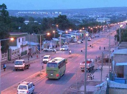
Jijiga (, am, ጅጅጋ, ''Jijiga'') is the capital city of Somali Region, Ethiopia. It became the capital of the Somali Region in 1995 after it was moved from Gode. Located in the Fafan Zone with 70 km (37 mi) west of the border with Somalia, the city has an elevation of 1,634 metres above sea level. Jigjiga is traditionally the seat of the Bartire Garad Wiil-Waal of the Jidwaaq Absame. The International airport is named after him. History The region around Jijiga is believed to be associated with the ancient Gidaya state which existed as early as thirteenth century. Jijiga was mentioned by W.C. Barker in 1842 as one of the ''mahalla'' or halting-places of the caravan route between Zeila and Harar. One of the earliest detailed references to Jijiga comes from British hunter Colonel Swayne, who passed through Jijiga in February 1893, which he described as a stockaded fort with a garrison of 25 men next to a group of wells. According to I. M. Lewis, the Dervish ... [...More Info...] [...Related Items...] OR: [Wikipedia] [Google] [Baidu] |
Jigjiga Zone
Fafan ( so, Faafan) is a zone in Somali Region of Ethiopia. It was previously known as the Jijiga zone, so named after its largest city, Jijiga. Other towns and cities in this zone include Harshin, Awbare, Derwernache, Kebri Beyah, Tuli Gulled and Hart Sheik. Fafan is bordered on the south by Jarar, on the southwest by Nogob, on the west by the Oromia Region, on the north by Sitti, and on the east by Somaliland. Demographics Based on the 2014 Census conducted by the Central Statistical Agency of Ethiopia (CSA), this Zone has a total population of 1,190,794 of whom 616,810 are men and 541,4794 women. Based on the 2007 census 203,588 or 21.04% are urban inhabitants, a further 72,153 or 11.59% were pastoralists. Two largest ethnic groups reported in Jirjiga were the Somalis (95.6%) and Amhara (1.83%); all other ethnic groups made up 2.57% of the population. Somali language is spoken as a first language by 95.51%, Amharic by 2.1%, and Oromo by 1.05%; the remaining 1.34% spoke ... [...More Info...] [...Related Items...] OR: [Wikipedia] [Google] [Baidu] |
Awbare (woreda)
Awbare (Amharic: ኣውባረ) ( so, Aw Barre), officially known as Teferi Ber, is one of the woredas of the Fafan Zone in the Somali Region of Ethiopia. Awbare is bordered on the southwest by Jijiga, on the west by the Sitti Zone, on the east by Somaliland, and on the southeast by Kebri Beyah. Cities and towns in the Awbare district include Awbare, Awbube, Sheder, Lefe Isa, Derwernache, Gogti, Jaare and Heregel. High points in this woreda include Sau (1863 meters), near the international border. History Due to reports of a new wave of Somali refugees reaching Hart Sheik in late 2006, the Ethiopian Administration for Refugee and Returnee Affairs and the UNHCR together opened a new refugee camp at Awbare 13 July 2007. 13,553 individuals were resident at the camp, with a further 11,639 at the Sheed Dheer camp. The Ethiopian De-mining Office reported in November 2008 that it had cleared land mines planted in Awbare as part of the four million square meters of land the office ... [...More Info...] [...Related Items...] OR: [Wikipedia] [Google] [Baidu] |
Somali Region
The Somali Region ( so, Deegaanka Soomaalida, am, ሱማሌ ክልል, Sumalē Kilil, ar, المنطقة الصومالية), also known as Soomaali Galbeed (''Western Somalia'') and officially the Somali Regional State, is a regional state in eastern Ethiopia. Its territory is the largest after Oromia Region. The regional state borders the Ethiopian regions of Afar and Oromia and the chartered city Dire Dawa (Dire Dhawa) to the west, as well as Djibouti to the north, Somaliland to the northeast, Somalia to the south; and Kenya to the southwest. Jijiga is the capital of the Somali Region. The capital was formerly Gode, until Jijiga became the capital in 1995 on account of political considerations. The Somali regional government is composed of the executive branch, led by the President; the legislative branch, which comprises the State Council; and the judicial branch, which is led by the State Supreme Court. Overview The Somali Region formed a large part of the p ... [...More Info...] [...Related Items...] OR: [Wikipedia] [Google] [Baidu] |
Djibouti (city)
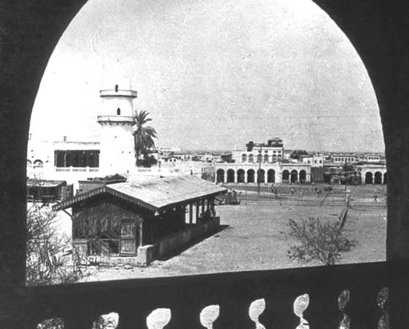
Djibouti (also called Djibouti City and in many early English texts and on many early maps, Jibuti; so, Magaalada Jabuuti, french: link=no, Ville de Djibouti, ar, مدينة جيبوتي, aa, Gabuutî Magaala) is the eponymous capital of Djibouti, and has more people than the rest of Djibouti combined. It is located in the coastal Djibouti Region on the Gulf of Tadjoura. Djibouti has a population of around 600,000 inhabitants, which counts for 54% of the country's population. The settlement was founded in 1888 by the French, on land leased from the ruling Somali and Afar Sultans. During the ensuing period, it served as the capital of French Somaliland and its successor the French Territory of the Afars and Issas. Known as the ''Pearl of the Gulf of Tadjoura'' due to its location, Djibouti is strategically positioned near the world's busiest shipping lanes and acts as a refueling and transshipment center. The Port of Djibouti is the principal maritime port for imports to an ... [...More Info...] [...Related Items...] OR: [Wikipedia] [Google] [Baidu] |
Hargeisa
Hargeisa (; so, Hargeysa, ar, هرجيسا) is the capital and largest city of the Republic of Somaliland. It is located in the Maroodi Jeex region of the Horn of Africa. It succeeded Burco as the capital of the British Somaliland Protectorate in 1941. Hargeisa is the largest city in Somaliland, and also served as the capital of the Isaaq Sultanate during the mid-to-late 19th century. Hargeisa was founded as a watering and trading stop between the coast and the interior by the Isaaq Sultanate. Initially it served as a watering Well for the vast livestock of the Eidagale clans that inhabited in that specific region and later were joined by the current clans of Hargeisa. In 1960, the Somaliland Protectorate gained independence from the United Kingdom and as scheduled united days later with the Trust Territory of Somaliland (former Italian Somaliland) to form the Somali Republic on July 1. Encyclopædia Britannica, ''The New Encyclopædia Britannica'', (Encyclopædia Brit ... [...More Info...] [...Related Items...] OR: [Wikipedia] [Google] [Baidu] |
Hargeisa District
Hargeisa District ( so, Degmada Hargeysa) is a district in the Maroodi Jeex region in Somaliland. Its capital lies at Hargeisa Hargeisa (; so, Hargeysa, ar, هرجيسا) is the capital and largest city of the Republic of Somaliland. It is located in the Maroodi Jeex region of the Horn of Africa. It succeeded Burco as the capital of the British Somaliland Protector .... Other settlements in the district include Daarbuduq. References External links Administrative map of Hargeisa District Districts of Somaliland Maroodi Jeex {{Somaliland-geo-stub ... [...More Info...] [...Related Items...] OR: [Wikipedia] [Google] [Baidu] |
Gabiley
Gabiley ( so, Gabiley, ar, غابيلي), also known as Gebiley, is a city in the Maroodi Jeex region of Somaliland. Gabiley is located 58 km west of Hargeisa, the capital of Somaliland. It is in the center of the Gabiley district, bounded on the north by the Gulf of Aden, on the west by the Awdal region, on the east by the Hargeisa district, and on the south by the Somali Region of Ethiopia. History Gabiley is one of the oldest towns in Somaliland after Zeila, Berbera and Amud. Some stones left behind in the area were believed to have been earmarked for the construction of pyramids. Demographics The town of Gabiley has a population of around 106,914. The Gabiley District in which the city is situated is exclusively dominated by people from the Somali ethnic group, with the Jibril Abokor and Abdalle Abokor sub divisions of the Sa'ad Musa subclan of the Habar Awal Isaaq the main residents of this district. Education Primary schools, Secondary schools and University educ ... [...More Info...] [...Related Items...] OR: [Wikipedia] [Google] [Baidu] |
El Bardale
El Bardale ( so, Ceel Bardaale) is a town located in northwestern Gabiley District in the Maroodi Jeex region of Somaliland. Overview It is an agricultural town. Most of the residents are primarily farmers that raise livestock animals such as camels, cattle, goats, sheep and even chickens. Demographics The total population of this town is 3,547. The town is primarily inhabited by people from the Somali ethnic group and id is wholly dominated by the Jibril Abokor (Reer Hareed) sub divisions of the Sa'ad Musa subclan of the Habar Awal Isaaq The Isaaq (also Isaq, Ishaak, Isaac) ( so, Reer Sheekh Isxaaq, ar, بني إسحاق, Banī Isḥāq) is a Somali clan. It is one of the major Somali clans in the Horn of Africa, with a large and densely populated traditional territory. Pe .... References {{reflist External linksEl Bardale Populated places in Maroodi Jeex ... [...More Info...] [...Related Items...] OR: [Wikipedia] [Google] [Baidu] |
Tog Wajaale
Tog Wajaale (also known as Wajaale) is a city on the border of Somaliland and Ethiopia. Tog Wajaale is the main border crossing for goods coming in and out of Somaliland, primarily from the port city of Berbera, Somaliland's main port. Demographics The city of Wajaale has a total population of around 70,450 inhabitants. According to the 2007 census conducted by the Central Statistical Agency of Ethiopia (CSA) the Ethiopian part of the town had a population of 14,438. Geography Wajale is located the border of Somaliland and Ethiopia. 92.8 km west of Hargeisa, the capital of Somaliland. It is in the south west of Kalabaydh town, on the west by the Awdal region, on the east by the Gabiley, Hargeisa City, and on the south by the Somali Region of Ethiopia Ethiopia, , om, Itiyoophiyaa, so, Itoobiya, ti, ኢትዮጵያ, Ítiyop'iya, aa, Itiyoppiya officially the Federal Democratic Republic of Ethiopia, is a landlocked country in the Horn of Africa. It shares b ... [...More Info...] [...Related Items...] OR: [Wikipedia] [Google] [Baidu] |


