|
Redwood, Christchurch
Redwood is a suburb located in Christchurch, New Zealand which includes the sub-division of Redwood Springs. The suburb was first named ''Styx'' but renamed following a popular vote of local residents in the 1960s after a large Sequoia redwood tree still standing in Prestons Road. The original forest cover was Totara and Kahikatea. Redwood has its own community radio station called Good Music FM 107.5 (formerly known as Radio Redwood). Demographics Redwood covers . It had an estimated population of as of with a population density of people per km2. Redwood, comprising the statistical areas of Redwood North, Redwood West and Redwood East, had a population of 8,184 at the 2018 New Zealand census, an increase of 72 people (0.9%) since the 2013 census, and a decrease of 147 people (-1.8%) since the 2006 census. There were 3,051 households. There were 3,990 males and 4,194 females, giving a sex ratio of 0.95 males per female, with 1,587 people (19.4%) aged under 15 years, 1,6 ... [...More Info...] [...Related Items...] OR: [Wikipedia] [Google] [Baidu] |
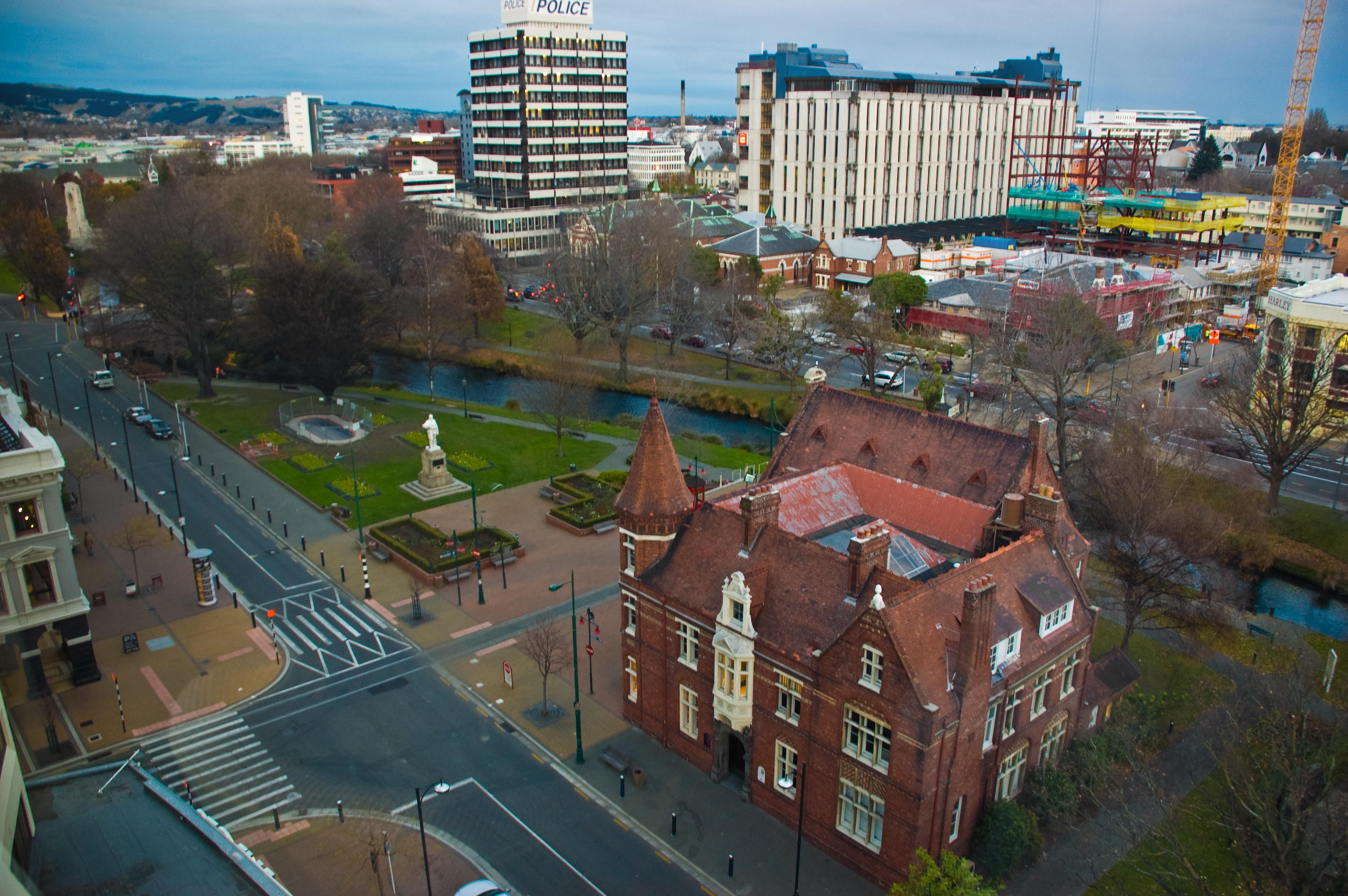
Christchurch
Christchurch ( ; mi, Ōtautahi) is the largest city in the South Island of New Zealand and the seat of the Canterbury Region. Christchurch lies on the South Island's east coast, just north of Banks Peninsula on Pegasus Bay. The Avon River / Ōtākaro flows through the centre of the city, with an urban park along its banks. The city's territorial authority population is people, and includes a number of smaller urban areas as well as rural areas. The population of the urban area is people. Christchurch is the second-largest city by urban area population in New Zealand, after Auckland. It is the major urban area of an emerging sub-region known informally as Greater Christchurch. Notable smaller urban areas within this sub-region include Rangiora and Kaiapoi in Waimakariri District, north of the Waimakariri River, and Rolleston and Lincoln in Selwyn District to the south. The first inhabitants migrated to the area sometime between 1000 and 1250 AD. They hunted moa, which led ... [...More Info...] [...Related Items...] OR: [Wikipedia] [Google] [Baidu] |
Christchurch City Council
The Christchurch City Council is the local government authority for Christchurch in New Zealand. It is a territorial authority elected to represent the people of Christchurch. Since October 2022, the Mayor of Christchurch is Phil Mauger, who succeeded after the retirement of Lianne Dalziel. The council currently consists of 16 councillors elected from sixteen wards, and is presided over by the mayor, who is elected at large. The number of elected members and ward boundaries changed prior during the 2016 election. History As a result of the 1989 local government reforms, on 1 November 1989 Christchurch City Council took over the functions of the former Christchurch City Council, Heathcote County Council, Riccarton Borough Council, Waimairi District Council, part of Paparua County Council, and the Christchurch Drainage Board. On 6 March 2006, Banks Peninsula District Council merged with Christchurch City Council. Councillor Yani Johanson campaigned since 2010 to live-strea ... [...More Info...] [...Related Items...] OR: [Wikipedia] [Google] [Baidu] |
Northwood, New Zealand
Northwood is a suburb on the northern outskirts of Christchurch city. It was developed in 2000 as a subdivision of Belfast on land previously used for apple orchards. The name "Northwood" was accepted at a meeting of the Shirley-Papanui Community Board on 2 February 2000. Farmland north-west of what later became Northwood was developed into Peppers Clearwater Resort in 1998. The Groynes is a large park between Northwood and Clearwater. Styx Mill Conservation Reserve is on the south side of Northwood. Demographics Northwood, comprising the statistical areas of Northwood and Clearwater, covers . It had an estimated population of as of with a population density of people per km2. Northwood, comprising the statistical areas of Northwood and Clearwater, had a population of 4,266 at the 2018 New Zealand census, an increase of 108 people (2.6%) since the 2013 census, and an increase of 1,293 people (43.5%) since the 2006 census. There were 1,650 households. There were 2,097 mal ... [...More Info...] [...Related Items...] OR: [Wikipedia] [Google] [Baidu] |
Marshland, New Zealand
Marshland is a semi-rural suburb on the northern side of Christchurch city. The land is primarily used for horticulture and dairy farming. The suburb is named for the peaty soil, and was also called Rhodes' Swamp after landowner and politician Robert Heaton Rhodes (1815–1884). forms the western and southern boundary of the suburb. The Styx River runs northeast through Marshland. Demographics Marshland covers . It had an estimated population of as of with a population density of people per km2. Marshland had a population of 789 at the 2018 New Zealand census, an increase of 30 people (4.0%) since the 2013 census, and an increase of 6 people (0.8%) since the 2006 census 6 (six) is the natural number following 5 and preceding 7. It is a composite number and the smallest perfect number. In mathematics Six is the smallest positive integer which is neither a square number nor a prime number; it is the second small .... There were 258 households. There were 408 males a ... [...More Info...] [...Related Items...] OR: [Wikipedia] [Google] [Baidu] |
Mairehau
Mairehau is a suburb of Christchurch, New Zealand. It is located four kilometres north of the city centre, close to the edge of the urbanised central city area. Much new development is being carried out on the northern edge of Mairehau. The suburb was named after Rose Mairehau (Maire) Hutton (née Rhodes), daughter of Arthur Rhodes, who in turn was Mayor of Christchurch in 1901–1902 and a major local property owner. Demographics Mairehau, comprising the statistical areas of Mairehau North and Mairehau South, covers . It had an estimated population of as of with a population density of people per km2. Mairehau had a population of 6,870 at the 2018 New Zealand census Eighteen or 18 may refer to: * 18 (number), the natural number following 17 and preceding 19 * one of the years 18 BC, AD 18, 1918, 2018 Film, television and entertainment * ''18'' (film), a 1993 Taiwanese experimental film based on the sho ..., an increase of 360 people (5.5%) since the 2013 census, ... [...More Info...] [...Related Items...] OR: [Wikipedia] [Google] [Baidu] |
Northcote, Christchurch
Northcote is a suburb on the northern side of Christchurch, New Zealand. Etymology The suburb is named for the British politician, Stafford Northcote (1818–1887). Demographics Northcote covers . It had an estimated population of as of with a population density of people per km2. Northcote had a population of 2,622 at the 2018 New Zealand census, an increase of 96 people (3.8%) since the 2013 census, and an increase of 75 people (2.9%) since the 2006 census 6 (six) is the natural number following 5 and preceding 7. It is a composite number and the smallest perfect number. In mathematics Six is the smallest positive integer which is neither a square number nor a prime number; it is the second small .... There were 1,014 households. There were 1,278 males and 1,344 females, giving a sex ratio of 0.95 males per female. The median age was 39.6 years (compared with 37.4 years nationally), with 435 people (16.6%) aged under 15 years, 504 (19.2%) aged 15 to 29, 1,233 (47. ... [...More Info...] [...Related Items...] OR: [Wikipedia] [Google] [Baidu] |
Papanui
Papanui is a major suburb of Christchurch, New Zealand. It is situated five kilometers to the northwest of the city centre. Papanui is a middle socio-economic area with a population of 3,645 consisting predominantly of Pākehā (NZ European & Others) 86.9%, Asian 7.6%, Māori 5.3%, Pacific peoples 3.1%, Middle Eastern/Latin American/African 0.7% (2013 census). The suburb is located at the junction of three busy thoroughfares; Papanui Road leading to the City, the Main North Road that leads to North Canterbury and Harewood Road that leads to Christchurch International Airport. However, as with most Christchurch suburbs, Papanui has no defined borders. Over the last 160 years Papanui has developed into a major suburban centre and is a satellite centre for Government and City Council services. These include the central government 'Super Centre' in Winstone Avenue, Housing New Zealand in Restell Street and the Council Service Centre and Library on Langdons Road. The area ha ... [...More Info...] [...Related Items...] OR: [Wikipedia] [Google] [Baidu] |
Casebrook
Casebrook is a suburb on the northern side of Christchurch city. The land was farmed by Walter Case (1881?-1961). When Casebrook Intermediate was built in 1966, it combined his name with the presence of a stream near the school. The suburb developed subsequently and took its name from the school. There is a Walter Case Drive in the suburb. Demographics Casebrook, comprising the statistical areas of Casebrook and Regents Park, covers . It had an estimated population of as of with a population density of people per km2. Casebrook, comprising the statistical areas of Casebrook and Regents Park, had a population of 5,262 at the 2018 New Zealand census, an increase of 291 people (5.9%) since the 2013 census, and an increase of 369 people (7.5%) since the 2006 census 6 (six) is the natural number following 5 and preceding 7. It is a composite number and the smallest perfect number. In mathematics Six is the smallest positive integer which is neither a square number nor a pr ... [...More Info...] [...Related Items...] OR: [Wikipedia] [Google] [Baidu] |
Sequoia Sempervirens
''Sequoia sempervirens'' ()''Sunset Western Garden Book,'' 1995:606–607 is the sole living species of the genus '' Sequoia'' in the cypress family Cupressaceae (formerly treated in Taxodiaceae). Common names include coast redwood, coastal redwood, and California redwood. It is an evergreen, long-lived, monoecious tree living 1,200–2,200 years or more. This species includes the tallest living trees on Earth, reaching up to in height (without the roots) and up to in diameter at breast height. These trees are also among the oldest living things on Earth. Before commercial logging and clearing began by the 1850s, this massive tree occurred naturally in an estimated along much of coastal California (excluding southern California where rainfall is not sufficient) and the southwestern corner of coastal Oregon within the United States. The name sequoia sometimes refers to the subfamily Sequoioideae, which includes ''S. sempervirens'' along with ''Sequoiadendron'' (gi ... [...More Info...] [...Related Items...] OR: [Wikipedia] [Google] [Baidu] |
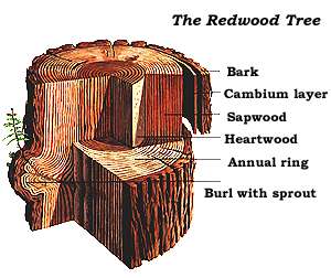
Redwood Tree
Sequoioideae, popularly known as redwoods, is a subfamily of coniferous trees within the family Cupressaceae. It includes the largest and tallest trees in the world. Description The three redwood subfamily genera are '' Sequoia'' from coastal California and Oregon, ''Sequoiadendron'' from California's Sierra Nevada, and ''Metasequoia'' in China. The redwood species contains the largest and tallest trees in the world. These trees can live for thousands of years. Threats include logging, fire suppression, climate change, illegal marijuana cultivation, and burl poaching. Only two of the genera, ''Sequoia'' and ''Sequoiadendron'', are known for massive trees. Trees of ''Metasequoia'', from the single living species ''Metasequoia glyptostroboides'', are much smaller. Taxonomy and evolution Multiple studies of both morphological and molecular characters have strongly supported the assertion that the Sequoioideae are monophyletic. Most modern phylogenies place ''Sequoia'' ... [...More Info...] [...Related Items...] OR: [Wikipedia] [Google] [Baidu] |
Totara
''Podocarpus totara'' (; from the Maori-language ; the spelling "totara" is also common in English) is a species of podocarp tree endemic to New Zealand. It grows throughout the North Island and northeastern South Island in lowland, montane and lower subalpine forest at elevations of up to 600 m. Tōtara is commonly found in lowland areas where the soil is fertile and well drained. Description The tōtara is a medium to large tree, which grows slowly to around 20 to 25 m, exceptionally to 35 m; it is noted for its longevity and the great girth of its trunk. The bark peels off in papery flakes, with a purplish to golden brown hue. The sharp, dull-green, needle-like leaves are stiff and leathery, 2 cm long. This plant produces highly modified cones with two to four fused, fleshy, berry-like, juicy scales, bright red when mature. The cone contains one or two rounded seeds at the apex of the scales. The largest known living tōtara, the Pouakani Tree, near Pureora in the ce ... [...More Info...] [...Related Items...] OR: [Wikipedia] [Google] [Baidu] |
Kahikatea
''Dacrycarpus dacrydioides'', commonly known as kahikatea (from Māori) and white pine, is a coniferous tree endemic to New Zealand. A podocarp, it is New Zealand's tallest tree, gaining heights of 60 m and a life span of 600 years. It was first described botanically by the French botanist Achille Richard in 1832 as ''Podocarpus'' ''dacrydioides'', and was given its current binomial name ''Dacrycarpus dacrydioides'' in 1969 by the American botanist David de Laubenfels. Analysis of DNA has confirmed its evolutionary relationship with other species in the genera ''Dacrycarpus'' and ''Dacrydium''. In traditional Māori culture, it is an important source of timber for the building of waka and making of tools, of food in the form of its berries, and of dye. When Europeans discovered it in the 18th century they found large remnant stands in both the North and South Islands, despite burning of forest by early Māori. Its use for timber and its damp fertile habitat, ideal for dairy far ... [...More Info...] [...Related Items...] OR: [Wikipedia] [Google] [Baidu] |


.jpg)


