|
Recuay Culture
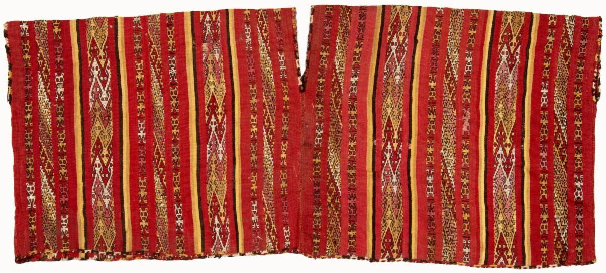
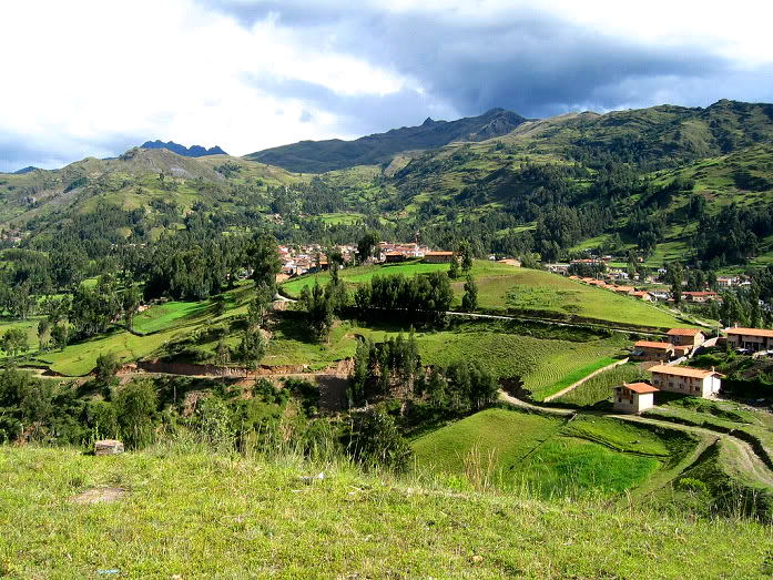
The Recuay culture was a pre-Columbian culture of highland Peru that flourished from 200 BCE to 600 CE and was related to the Moche culture of the north coast. It is named after the Recuay District, in the Recuay Province, in the Ancash Region of Peru. Territory This culture developed in the Callejón de Huaylas valley, and its artistic style is also known as "Huaylas." The Recuay area is very close to the area of the earlier Chavín culture. The important site of the latter, Chavin de Huantar, lies just to the west. Recuay people came to occupy much of the territory of the Chavín and were influenced by them. Chavín influences are seen in architecture (for instance, in the use of underground galleries) and in stonework, such as in sculpture and steles. The Recuay ceramics were also influenced by the Moche culture. While the Peruvian coastal cultures of that time, such as the Moche, the Lima, and the Nasca, are much better known, the high sierra also saw the emergence of p ... [...More Info...] [...Related Items...] OR: [Wikipedia] [Google] [Baidu] |
Early Intermediate
This is a chart of cultural periods of Peru and the Andean Region developed by John Rowe and Edward Lanning and used by some archaeologists studying the area. An alternative dating system was developed by Luis Lumbreras and provides different dates for some archaeological finds. Most of the cultures of the Late Horizon and some of the cultures of the Late Intermediate joined the Inca Empire by 1493, but the period ends in 1532 because that marks the fall of the Inca Empire after the Spanish conquest. Most of the cut-off years mark either an end of a severe drought or the beginning of one. These marked a shift of the most productive farming to or from the mountains, and tended to mark the end of one culture and the rise of another. The more recent findings concerning the Norte Chico civilization are not included on this list, as it was compiled before the site at Caral was investigated in detail. See also *Ancient Peru * Amazonas before the Inca Empire *The Pre-Incan Lost Pyram ... [...More Info...] [...Related Items...] OR: [Wikipedia] [Google] [Baidu] |
Pallasca
The Pallasca Province (from Quechua Pallasqa) is one of 20 provinces of the Ancash Region in Peru. Geography One of the highest peaks of the province is Utkhu Qucha at approximately . Other mountains are listed below:http://escale.minedu.gob.pe/ UGEL map Pallasca Province (AncashRegion) Some of the lakes of the district are Challwaqucha, Kinwaqucha, Llamaqucha, Paryaqucha, Pusaqqucha, P'itiqucha, T'uruqucha and Wayq'uqucha. Political division Pallasca is divided into eleven districts, which are: * Bolognesi * Cabana * Conchucos * Huacaschuque * Huandoval * Lacabamba * Llapo * Pallasca * Pampas * Santa Rosa Santa Rosa is the Italian, Portuguese and Spanish name for Saint Rose. Santa Rosa may also refer to: Places Argentina *Santa Rosa, Mendoza, a city * Santa Rosa, Tinogasta, Catamarca * Santa Rosa, Valle Viejo, Catamarca * Santa Rosa, La Pampa * S ... * Tauca References Provinces of the Ancash Region {{Ancash-geo-stub ... [...More Info...] [...Related Items...] OR: [Wikipedia] [Google] [Baidu] |
Andean Civilizations
The Andean civilizations were civilization, complex societies of many Indigenous peoples of South America, cultures and peoples mainly developed in the river valleys of the coastal deserts of Peru. They stretched from the Andes of southern Colombia southward down the Andes to Chile and northwest Argentina. Archaeologists believe that Andean civilizations first developed on the narrow coastal plain of the Pacific Ocean. The Norte Chico civilization, Caral or Norte Chico civilization of Peru is the oldest known civilization in the Americas, dating back to 3200 BCE. Despite severe environmental challenges, the Andean civilizations domesticated a wide variety of crops, some of which became of worldwide importance. The Andean civilizations were also noteworthy for monumental architecture, textile weaving, and many unique characteristics of the societies they created. Less than a century prior to the arrival of the Spanish Empire, Spanish conquerors, the Inca Empire, Incas, from their ... [...More Info...] [...Related Items...] OR: [Wikipedia] [Google] [Baidu] |
Aija, Peru
Aija is a town in central Peru, capital of the province Aija in the region Ancash, on the west side of the Cordillera Negra. The famous scientist Santiago Antúnez de Mayolo was born here. In ancient times, the city was one of the centres of Recuay culture. Stone sculpture A stone sculpture is an object made of stone which has been shaped, usually by carving, or assembled to form a visually interesting three-dimensional shape. Stone is more durable than most alternative materials, making it especially important in ... belonging to Recuay culture has been found at Aija. In fact, Recuay style stone carvings are known as ''Aija''. References Populated places in the Ancash Region {{Ancash-geo-stub ... [...More Info...] [...Related Items...] OR: [Wikipedia] [Google] [Baidu] |
Yaynu
Yaynu (Hispanicized spellings ''Yaino, Yayno'') is an archaeological site in Peru. It lies in the Ancash Region, Pomabamba Province, Huayllan District. It is a hilltop settlement that is considered the most important evidence of the so-called Recuay culture in the Ancash Region. The site was declared a National Cultural Heritage by ''Resolución Directoral Nacional'' No. 682-INC-2004 on June 17, 2004. The stone constructions of Yaynu are situated about 17 km south of Pomabamba Pomabamba (Quechua Pumapampa, ''puma'' cougar, ''pampa'' large plain, "cougar plain") is a town in the Pomabamba District of the Pomabamba Province in the Ancash Region of Peru , image_flag = Flag of Peru.svg , image_coat ... at a height of more than , on the northern slope of Pañahirka ''(Pañajirca)''. Yaynu is the largest known Recuay site and is best described as a fortified hilltop town. The area of the town is about 25 ha at its core. When counting associated d ... [...More Info...] [...Related Items...] OR: [Wikipedia] [Google] [Baidu] |
Cabana, Peru
Cabana is a city in Peru. It is the capital of both the Cabana District and the Province of Pallasca in the Ancash Region of northern Peru. Cabana was founded on January 2, 1857, although human habitation there likely predates arrival of the Spanish Conquistadors. The city is divided into four neighborhoods: *Huayumaca *Pacchamaca *San Jerónimo *Trujillo Cabana is the birthplace of former President Alejandro Toledo. History Cabana was founded in 1711 with the name of "Caguana" which means "To repair" or "to contemplate" in the Cully Language (former language of this region) according to an old legend. When the Spanish conquerors arrived to Caguana, the name was mispronounced and started to say "Cabana" instead of Caguana. Cabana was officially created by the Provisional Regulations on February 12, 1821 and then comprised to the vast province of Conchucos. Cabana was elevated to the level of district on December 2, 1856 under the Presidency of Don Don Ramón Castilla. ... [...More Info...] [...Related Items...] OR: [Wikipedia] [Google] [Baidu] |
Ancash
Ancash ( qu, Anqash; es, Áncash ) is a department and region in northern Peru. It is bordered by the departments of La Libertad on the north, Huánuco and Pasco on the east, Lima on the south, and the Pacific Ocean on the west. Its capital is the city of Huaraz, and its largest city and port is Chimbote. The name of the region originates from the Quechua word ('light, of little weight'), from ('blue') or from ('eagle'). Geography Ancash is a land of contrasts: it features two great longitudinal valleys, which combine the mountain characteristics of the Callejón de Huaylas (Alley of Huaylas) with the sylvan ones of the Alto Marañón. Kilometres of sandy beaches and the blue waters of the Pacific. The territory of the coast, high plateaux and Andean '' punas'' of the department are flat, while the rest of the territory, in the Andes, is very rough. In the west, there are slopes with strong declivity form narrow canyons with abrupt and deserted sides. The rough territor ... [...More Info...] [...Related Items...] OR: [Wikipedia] [Google] [Baidu] |
Chacas
San Martín de Chacas is a Peruvian town, capital of the eponymous district and the Asunción Province, located in the east-central region of Ancash. It has an urban population of 2,082 located at 3,359 meters; and a district of 5,334 people. The district, located in the sub-basin of the Marañon River, has an area of 447.69 km², which represents 85% of the province. Chacas was founded in the 1570s, but it is known that the territory now covered by the province to which it belongs, together with the provinces of and |
Tiwanaku
Tiwanaku ( es, Tiahuanaco or ) is a Pre-Columbian archaeological site in western Bolivia near Lake Titicaca, about 70 kilometers from La Paz, and it is one of the largest sites in South America. Surface remains currently cover around 4 square kilometers and include decorated ceramics, monumental structures, and megalithic blocks. The site's population probably peaked around AD 800 with 10,000 to 20,000 people. The site was first recorded in written history in 1549 by Spanish conquistador Pedro Cieza de León while searching for the southern Inca capital of Qullasuyu. Jesuit chronicler of Peru Bernabé Cobo reported that Tiwanaku's name once was ''taypiqala'', which is Aymara meaning "stone in the center", alluding to the belief that it lay at the center of the world. The name by which Tiwanaku was known to its inhabitants may have been lost as they had no written language. Heggarty and Beresford-Jones suggest that the Puquina language is most likely to have been the language of T ... [...More Info...] [...Related Items...] OR: [Wikipedia] [Google] [Baidu] |
Kaolin
Kaolinite ( ) is a clay mineral, with the chemical composition Al2 Si2 O5( OH)4. It is an important industrial mineral. It is a layered silicate mineral, with one tetrahedral sheet of silica () linked through oxygen atoms to one octahedral sheet of alumina () octahedra. Rocks that are rich in kaolinite are known as kaolin () or china clay. Kaolin is occasionally referred to by the antiquated term lithomarge, from the Ancient Greek ''litho-'' and Latin ''marga'', meaning 'stone of marl'. Presently the name lithomarge can refer to a compacted, massive form of kaolin. The name ''kaolin'' is derived from Gaoling (), a Chinese village near Jingdezhen in southeastern China's Jiangxi Province. The name entered English in 1727 from the French version of the word: , following François Xavier d'Entrecolles's reports on the making of Jingdezhen porcelain. Kaolinite has a low shrink–swell capacity and a low cation-exchange capacity (1–15 meq/100 g). It is a soft, earthy, usu ... [...More Info...] [...Related Items...] OR: [Wikipedia] [Google] [Baidu] |
Viru Valley
The Viru Valley is located in La Libertad Region on the north west coast of Peru. The Viru Valley Project In 1946 the first attempt to study settlement patterns in the Americas took place in the Viru Valley, led by Gordon Willey. Rather than examine individual settlement sites, Willey wanted to look at the valley as a whole and the way that each village interacted with the others. The study showed that villages were located in places which reflected their relationship with the wider landscape and their neighbours. The project emphasised the importance for archaeologists of viewing sites holistically and to take into account the economic, environmental, social and political factors acting on past societies. Willey's groundbreaking study stimulated the work of a number of subsequent archaeologists in the valley. From 1992 to 1998 Dr. Thomas A. Zoubek embarked on a study of the earliest mid and upper valley sites in Viru concentrating specifically at the sites of Huaca El Gallo/La G ... [...More Info...] [...Related Items...] OR: [Wikipedia] [Google] [Baidu] |


