|
Rapness
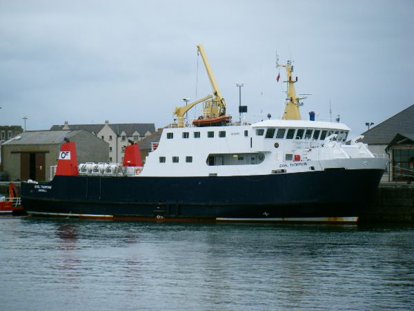
Rapness is a settlement on the island of Westray in Orkney, Scotland. The slipway is the ferry terminal for the Orkney Ferries crossing from Kirkwall on the Mainland of Orkney and to/from the nearby island of Papa Westray. The B9066 road runs from Rapness to Pierowall Pierowall is a village of Westray in the Orkney Islands, off the coast of the northern Scottish mainland. The village is the island's largest settlement and lies near its northern end, around Pierowall Bay. It has a variety of historical remai .... Notes Villages in Orkney Headlands of Scotland Landforms of Orkney Westray {{Scotland-geo-stub ... [...More Info...] [...Related Items...] OR: [Wikipedia] [Google] [Baidu] |
Papa Westray
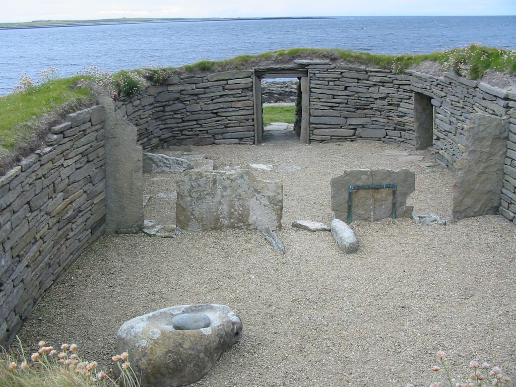
Papa Westray () ( sco, Papa Westree), also known as Papay, is one of the Orkney Islands in Scotland, United Kingdom. The fertile soilKeay, J. & Keay, J. (1994) ''Collins Encyclopaedia of Scotland''. London. HarperCollins. has long been a draw to the island. Attractions on the island include Holland House with an associated folk museum A folk museum is a museum that deals with folk culture and heritage. Such museums cover local life in rural communities. A folk museum typically displays historical objects that were used as part of the people's everyday lives. Examples of such ... and the Knap of Howar Neolithic farmstead run by Historic Scotland. It is the ninth largest of the Orkney Islands with an area of . The island's population was 90 as recorded by the United Kingdom Census 2011, 2011 census, an increase of over 35% since 2001 when there were only 65 usual residents. During the same period, List of Scottish islands, Scottish island populations as a whole grew by 4% ... [...More Info...] [...Related Items...] OR: [Wikipedia] [Google] [Baidu] |
Westray
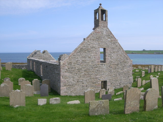
Westray (, sco, Westree) is one of the Orkney Islands in Scotland, with a usual resident population of just under 600 people. Its main village is Pierowall, with a heritage centre, the 15th-century Lady Kirk church and pedestrian ferry service to nearby Papa Westray island. Westray has a number of archeological sites dating from 3500 BC, and remains of several Norse-Viking settlements. The spectacular sea cliffs around Noup Head are home to thousands of seabirds. Geography and geology Westray has an area of , making it the sixth largest of the Orkney Islands. The underlying geology is Rousay type Middle Old Red Sandstone, the flagstones of which make excellent building materials. There is very little peat and the soil is noted for its fertility. History At the time of the earliest known settlements, c. 3500 BC, in Westray and neighbouring Papa Westray, it is believed that the two islands were joined.Keay, J. & Keay, J. (1994) ''Collins Encyclopaedia of Scotland''. London ... [...More Info...] [...Related Items...] OR: [Wikipedia] [Google] [Baidu] |
B Roads In Zone 9 Of The Great Britain Numbering Scheme
B roads are numbered routes in Great Britain of lesser importance than A roads. See the article Great Britain road numbering scheme for the rationale behind the numbers allocated. Zone 9 (3 digits) Zone 9 (4 digits) References See also * A roads in Zone 9 of the Great Britain numbering scheme * List of motorways in the United Kingdom This list of motorways in the United Kingdom is a complete list of motorways in the United Kingdom. Note that the numbering scheme used for Great Britain does not include roads in Northern Ireland, which are allocated numbers on an ad hoc basis ... * Transport in Aberdeen#Roads * Transport in Edinburgh#Road network * Transport in Scotland#Road {{DEFAULTSORT:B Roads in Zone 9 of the Great Britain Numbering Scheme 9 ... [...More Info...] [...Related Items...] OR: [Wikipedia] [Google] [Baidu] |
Pierowall
Pierowall is a village of Westray in the Orkney Islands, off the coast of the northern Scottish mainland. The village is the island's largest settlement and lies near its northern end, around Pierowall Bay. It has a variety of historical remains dating from the Neolithic, the Iron Age, the Middle Ages, and later, including a large pagan Norse cemetery. In 1961 it had a population of 108. Facilities Although it is only a village on an island which had a total population of 563 at the census of 2001, Pierowall has a post office, a bank, a junior high school, shops, a hotel, and a fire station. Communications Supplementing the ferries which come into Pierowall Harbour, some seven miles to the south of the village is the main ferry terminal at Rapness, on the southernmost tip of Westray, which has better ferry links with Papa Westray and Kirkwall. Pierowall has a maritime climate, with cool summers, mild winters, strong winds, and above average rainfall. Visitors can stay in the ... [...More Info...] [...Related Items...] OR: [Wikipedia] [Google] [Baidu] |
Car Ferry At Rapness, Westray - Geograph
A car or automobile is a motor vehicle with wheels. Most definitions of ''cars'' say that they run primarily on roads, seat one to eight people, have four wheels, and mainly transport people instead of goods. The year 1886 is regarded as the birth year of the car, when German inventor Carl Benz patented his Benz Patent-Motorwagen. Cars became widely available during the 20th century. One of the first cars affordable by the masses was the 1908 Model T, an American car manufactured by the Ford Motor Company. Cars were rapidly adopted in the US, where they replaced animal-drawn carriages and carts. In Europe and other parts of the world, demand for automobiles did not increase until after World War II. The car is considered an essential part of the developed economy. Cars have controls for driving, parking, passenger comfort, and a variety of lights. Over the decades, additional features and controls have been added to vehicles, making them progressively more complex. These i ... [...More Info...] [...Related Items...] OR: [Wikipedia] [Google] [Baidu] |
Orkney
Orkney (; sco, Orkney; on, Orkneyjar; nrn, Orknøjar), also known as the Orkney Islands, is an archipelago in the Northern Isles of Scotland, situated off the north coast of the island of Great Britain. Orkney is 10 miles (16 km) north of the coast of Caithness and has about 70 islands, of which 20 are inhabited. The largest island, the Mainland, Orkney, Mainland, has an area of , making it the List of islands of Scotland, sixth-largest Scottish island and the List of islands of the British Isles, tenth-largest island in the British Isles. Orkney’s largest settlement, and also its administrative centre, is Kirkwall. Orkney is one of the 32 Subdivisions of Scotland, council areas of Scotland, as well as a Orkney (Scottish Parliament constituency), constituency of the Scottish Parliament, a Lieutenancy areas of Scotland, lieutenancy area, and an counties of Scotland, historic county. The local council is Orkney Islands Council, one of only three councils in Scotland with ... [...More Info...] [...Related Items...] OR: [Wikipedia] [Google] [Baidu] |
Orkney Ferries
Orkney Ferries is a Scottish company operating inter-island ferry services in the Orkney Islands. The company operates ferry services across 15 islands. History The company is owned by the Orkney Islands Council and was established in 1960 as the Orkney Islands Shipping Company. In 1991, the Orkney Islands Shipping Company acquired a private sector ferry company also called Orkney Ferries, which had been established to compete on the short sea crossing from the Scottish mainland to the Orkney Islands, but which had not succeeded in establishing the route. This company's ferry was assimilated into the inter-island fleet, and in 1995 the Orkney Islands Shipping Company adopted the name Orkney Ferries. Despite this acquisition and change of name, the current Orkney Ferries does not operate services to and from the Scottish mainland, leaving this to other operators such as NorthLink Ferries and Pentland Ferries. Services Orkney Ferries operate between the Orkney mainland and fourt ... [...More Info...] [...Related Items...] OR: [Wikipedia] [Google] [Baidu] |
Kirkwall
Kirkwall ( sco, Kirkwaa, gd, Bàgh na h-Eaglaise, nrn, Kirkavå) is the largest town in Orkney, an archipelago to the north of mainland Scotland. The name Kirkwall comes from the Norse name (''Church Bay''), which later changed to ''Kirkvoe'', ''Kirkwaa'' and ''Kirkwall''. Kirkwall was formerly the site of an ancient Norse town founded approximately 1000 years ago. Today, it is a transport hub with ferries to many locations. History The town was first mentioned in in the year 1046, when it was recorded as the residence of , the Earl of Orkney, who was killed by his uncle Thorfinn the Mighty. In 1486, King James III of Scotland elevated Kirkwall to the status of a royal burgh. On the western edge of the town, surrounded by Hatston Industrial Estate, there is a prehistoric monument, known as the "Grain Earth House" (see Historic Scotland). It is a short, low, stone-walled passage, deep underground, leading to a small pillared chamber. This kind of earth house (or "souterrai ... [...More Info...] [...Related Items...] OR: [Wikipedia] [Google] [Baidu] |
Mainland, Orkney
The Mainland, also known as Hrossey and Pomona, is the main island of Orkney, Scotland. Both of Orkney's burghs, Kirkwall and Stromness, lie on the island, which is also the heart of Orkney's ferry and air connections. Seventy-five per cent of Orkney's population live on the island, which is more densely populated than the other islands of the archipelago. The lengthy history of the island's occupation has provided numerous important archaeological sites and the sandstone bedrock provides a platform for fertile farmland. There is an abundance of wildlife, especially seabirds. Etymology The name Mainland is a corruption of the Old Norse . Formerly the island was also known as meaning 'horse island'. The island is sometimes referred to as '' Pomona'' (or ''Pomonia''), a name that stems from a 16th-century mis-translation by George Buchanan.Buchanan, George (1582''Rerum Scoticarum Historia: The First Book''The University of California, Irvine. Revised 8 March 2003. Retrieved 4 Oc ... [...More Info...] [...Related Items...] OR: [Wikipedia] [Google] [Baidu] |
Villages In Orkney
A village is a clustered human settlement or community, larger than a hamlet but smaller than a town (although the word is often used to describe both hamlets and smaller towns), with a population typically ranging from a few hundred to a few thousand. Though villages are often located in rural areas, the term urban village is also applied to certain urban neighborhoods. Villages are normally permanent, with fixed dwellings; however, transient villages can occur. Further, the dwellings of a village are fairly close to one another, not scattered broadly over the landscape, as a dispersed settlement. In the past, villages were a usual form of community for societies that practice subsistence agriculture, and also for some non-agricultural societies. In Great Britain, a hamlet earned the right to be called a village when it built a church. [...More Info...] [...Related Items...] OR: [Wikipedia] [Google] [Baidu] |
Headlands Of Scotland
A headland, also known as a head, is a coastal landform, a point of land usually high and often with a sheer drop, that extends into a body of water. It is a type of promontory. A headland of considerable size often is called a cape.Whittow, John (1984). ''Dictionary of Physical Geography''. London: Penguin, 1984, pp. 80, 246. . Headlands are characterised by high, breaking waves, rocky shores, intense erosion, and steep sea cliff. Headlands and bays are often found on the same coastline. A bay is flanked by land on three sides, whereas a headland is flanked by water on three sides. Headlands and bays form on discordant coastlines, where bands of rock of alternating resistance run perpendicular to the coast. Bays form when weak (less resistant) rocks (such as sands and clays) are eroded, leaving bands of stronger (more resistant) rocks (such as chalk, limestone, and granite) forming a headland, or peninsula. Through the deposition of sediment within the bay and the erosion of the ... [...More Info...] [...Related Items...] OR: [Wikipedia] [Google] [Baidu] |
Landforms Of Orkney
A landform is a natural or anthropogenic land feature on the solid surface of the Earth or other planetary body. Landforms together make up a given terrain, and their arrangement in the landscape is known as topography. Landforms include hills, mountains, canyons, and valleys, as well as shoreline features such as bays, peninsulas, and seas, including submerged features such as mid-ocean ridges, volcanoes, and the great ocean basins. Physical characteristics Landforms are categorized by characteristic physical attributes such as elevation, slope, orientation, stratification, rock exposure and soil type. Gross physical features or landforms include intuitive elements such as berms, mounds, hills, ridges, cliffs, valleys, rivers, peninsulas, volcanoes, and numerous other structural and size-scaled (e.g. ponds vs. lakes, hills vs. mountains) elements including various kinds of inland and oceanic waterbodies and sub-surface features. Mountains, hills, plateaux, and plains are ... [...More Info...] [...Related Items...] OR: [Wikipedia] [Google] [Baidu] |


.jpg)