|
Ranegras Plain
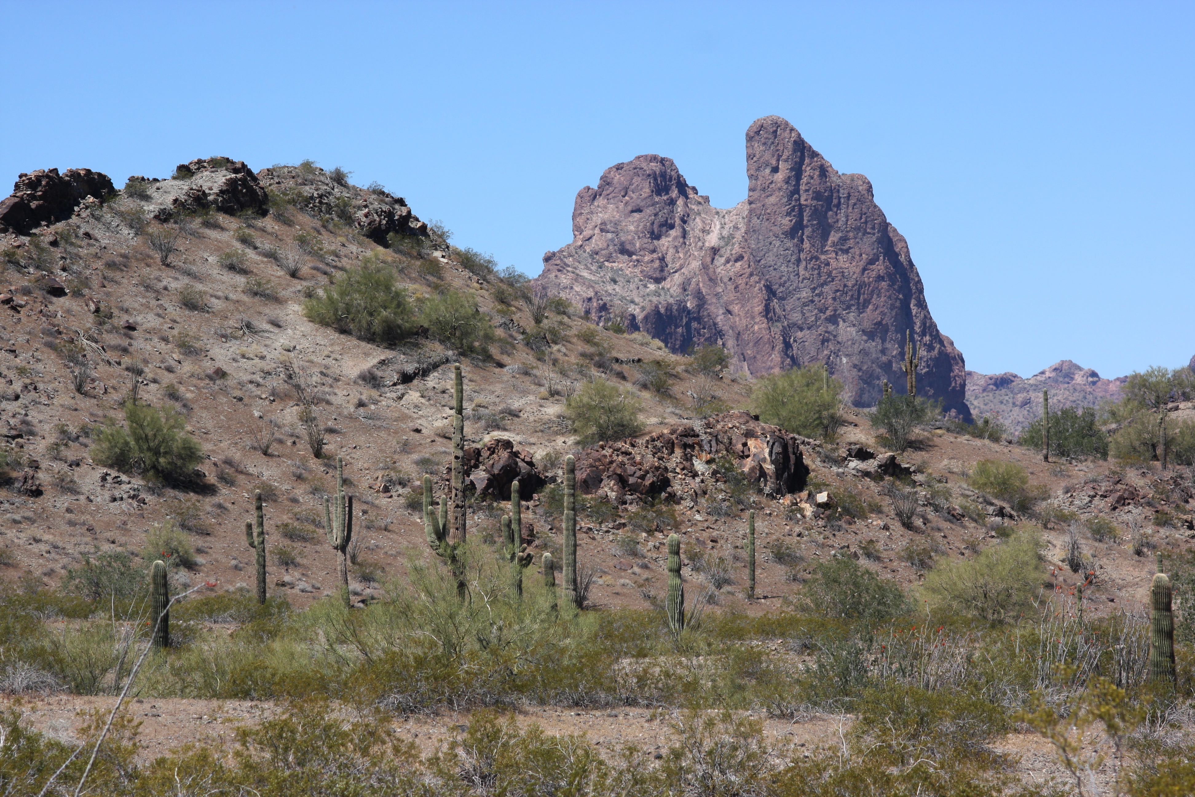
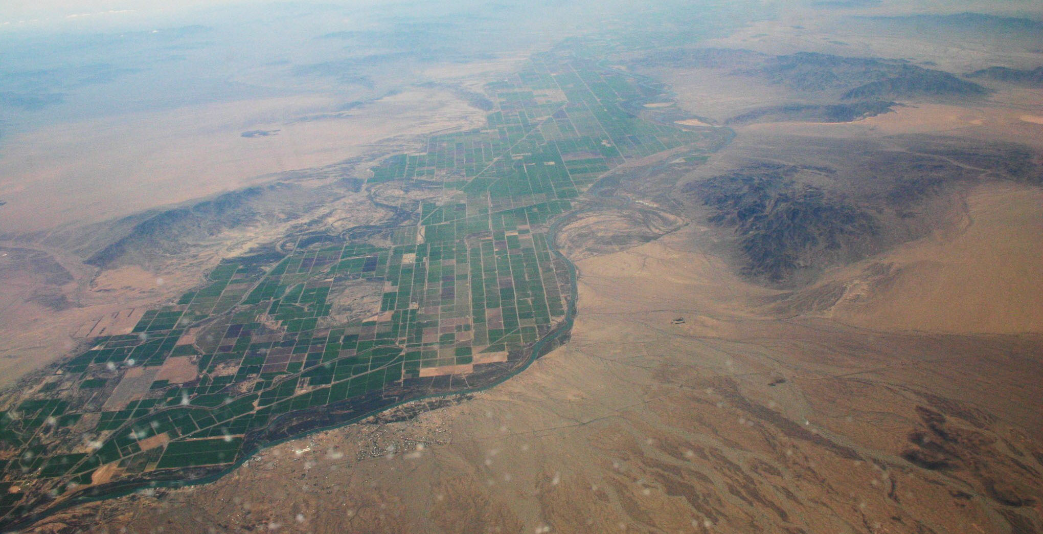
Ranegras Plain is a plain in the eastern part of La Paz County, Arizona. The Ranegras Plain is bounded by the Eagletail Mountains, Little Harquahala Mountains, Granite Wash Mountains and Bouse Hills to the northeast and to the southeast by the Plomosa, New Water and Little Horn Mountains. Its elevations range between in the far southeast of the plain, where the Eagletail and Little Horn Mountains meet, to in the far northwest, at Bouse, Arizona, where Bouse Wash Bouse Wash is one of the larger eastern-bank dry washes that enter the Colorado River in the Lower Colorado River Valley. It is located in La Paz County, extreme western Arizona. Geography Bouse Wash is located on the north rim of the La Posa ..., (the primary drainage of the plain), leaves the plain between the Plomosa Mountains and Bouse Hills. References Plains of Arizona {{LaPazCountyAZ-geo-stub ... [...More Info...] [...Related Items...] OR: [Wikipedia] [Google] [Baidu] |
Plain
In geography, a plain is a flat expanse of land that generally does not change much in elevation, and is primarily treeless. Plains occur as lowlands along valleys or at the base of mountains, as coastal plains, and as plateaus or uplands. In a valley, a plain is enclosed on two sides, but in other cases a plain may be delineated by a complete or partial ring of hills, by mountains, or by cliffs. Where a geological region contains more than one plain, they may be connected by a pass (sometimes termed a gap). Coastal plains mostly rise from sea level until they run into elevated features such as mountains or plateaus. Plains are one of the major landforms on earth, where they are present on all continents, and cover more than one-third of the world's land area. Plains can be formed from flowing lava; from deposition of sediment by water, ice, or wind; or formed by erosion by the agents from hills and mountains. Biomes on plains include grassland ( temperate or subtr ... [...More Info...] [...Related Items...] OR: [Wikipedia] [Google] [Baidu] |
La Paz County, Arizona
La Paz County is the 15th county in the U.S. state of Arizona, located in the western part of the state. As of the 2020 census, its population was 16,557, making it the second-least populous county in Arizona. The county seat is Parker. The name of the county is the Spanish word for "the peace", and is taken from the early settlement (now ghost town) of La Paz along the Colorado River. History La Paz County was established in 1983 after voters approved separating the northern portion of Yuma County, making it the only county to be established after Arizona became a state in 1912, and currently the second youngest county in the United States (behind the consolidated city-county of Broomfield, Colorado, which was established in 2001). The county did not have a large enough tax base to begin supporting a separate county government immediately and had to rely on state money at first. As a result, Arizona laws were changed to make splitting other existing counties much more d ... [...More Info...] [...Related Items...] OR: [Wikipedia] [Google] [Baidu] |
Little Harquahala Mountains
The Little Harquahala Mountains are a small, arid, low-elevation mountain range of western-central Arizona, in the southeast of La Paz County. The range is northwest-by-southeast-trending and is in a region of about thirty landforms, plains, valleys, and mountain ranges called the Maria fold and thrust belt. The region is in the Basin and Range and three mountain ranges are in a parallel, northwest-by-southeast-trending thrust belt, with two intervening valleys. The Little Harquahala Range borders the second valley and third mountain range, the McMullen Valley and Harquahala Mountains, on their southwest borders. The range is a section of a water divide for tributaries to two river watersheds on the Gila and Colorado Rivers. An even smaller range is connected north on the water divide, the 8-mile (13 km) long Granite Wash Mountains. Maria fold and thrust belt The three mountain ranges and two valleys bordered to the northeast: * Buckskin Mountains ** Butler Valley (Arizo ... [...More Info...] [...Related Items...] OR: [Wikipedia] [Google] [Baidu] |
Granite Wash Mountains
The Granite Wash Mountains are a short, arid, low elevation mountain range of western-central Arizona, in the southeast of La Paz County. The range borders a slightly larger range southeast, the Little Harquahala Mountains; both ranges form a section on the same water divide between two desert washes. The washes flow in opposite directions, one northwest to the Colorado River, the other southeast to the Gila River. Description The range is northwest-by-southeast trending and is in a region of about thirty landforms, plains, valleys, and mountain ranges, called the Maria fold and thrust belt. The region is in the Basin and Range and three mountain ranges are in a parallel, northwest-by-southeast trending thrust belt, with two intervening valleys. The Granite Wash Mountains are attached to the southwest end of the Harcuvar Mountains, the center range of the 3 basin and range-thrusted mountains. The Granite Wash range is on the same water divide as the Little Harquahala's and at the ... [...More Info...] [...Related Items...] OR: [Wikipedia] [Google] [Baidu] |
Bouse Hills
Bouse ( ''rhymes with "house"'') is a census-designated place (CDP) and ghost town in La Paz County, Arizona, United States. Founded in 1908 as a mining camp, the economy of Bouse is now based on tourism, agriculture, and retirees. The population was 996 at the 2010 census. It was originally named Brayton after the store owner John Brayton Martin. Geography Bouse is located north of the center of La Paz County at (33.933657, -114.008268). Arizona State Route 72 passes through the community, leading northwest to Parker and southeast to Hope. According to the United States Census Bureau, the Bouse CDP has a total area of , all land. Camp Bouse, east in Butler Valley, is the former site of a World War II US Army tank training camp. Although the buildings are gone, a few foundations remain, as do some of the tank tracks from World War II. There is a Camp Bouse memorial monument in Bouse. Demographics Bouse first appeared on the 1920 U.S. Census as an unincorporated village, ... [...More Info...] [...Related Items...] OR: [Wikipedia] [Google] [Baidu] |
Plomosa Mountains
The Plomosa Mountains are a mountain range in La Paz County, Arizona, running generally south of Bouse, Arizona near the Arizona/California border. Quartzsite lies to the west across the La Posa Plain. The Harcuvar Mountains and Little Harquahala Mountains lie to the east across the Ranegras Plain. The New Water Mountains lie to the southeast beyond Black Mesa. Interstate 10 crosses the center of the range. The Plomosa ghost town and mining camp lie on the southwest side of the range. Evidence of both thrust faulting and strike-slip faulting In geology, a fault is a planar fracture or discontinuity in a volume of rock across which there has been significant displacement as a result of rock-mass movements. Large faults within Earth's crust result from the action of plate tectonic ... is present in the Plomosa Mountains. The highpoint of the range is Black Mesa (La Paz County) in the southern regions. Ibex Peak is a highpoint in the north. References {{Coord, 33 ... [...More Info...] [...Related Items...] OR: [Wikipedia] [Google] [Baidu] |
New Water Mountains
The New Water Mountains is a mountain range in southwestern Arizona. The range is on the northern border of the Kofa National Wildlife Refuge as well as the northern Kofa Mountains. It is a northwest–southeast trending range, about long. The southeast third of the range is in the Kofa Refuge, and the mountain range merges northwesterly into the Plomosa Mountains of southern La Paz County. The central part of the range is the New Water Mountains Wilderness with a lengthy east–west border on the northern Kofa National Wildlife Refuge of about 12 miles. The highest point is Black Mesa at . Three northerly routes access the mountain range; the central route accesses the Ramsey Mine and eventually the central dry wash on the north; other mines, such as the Republic Mine, are in these mountains, as well as some springs (Dripping Springs); also Brintley Well on a fourth westerly access route. The closest community to the north side of the mountain range is Brenda, Arizona east ... [...More Info...] [...Related Items...] OR: [Wikipedia] [Google] [Baidu] |
Little Horn Mountains
Little is a synonym for small size and may refer to: Arts and entertainment * ''Little'' (album), 1990 debut album of Vic Chesnutt * ''Little'' (film), 2019 American comedy film *The Littles, a series of children's novels by American author John Peterson ** ''The Littles'' (TV series), an American animated series based on the novels Places *Little, Kentucky, United States *Little, West Virginia, United States Other uses *Clan Little, a Scottish clan *Little (surname), an English surname *Little (automobile), an American automobile manufactured from 1912 to 1915 *Little, Brown and Company, an American publishing company * USS ''Little'', multiple United States Navy ships See also * * *Little Mountain (other) * Little River (other) *Little Island (other) Little Island can refer to: Geographical areas Australia * Little Island (South Australia) * Little Island (Tasmania) * Little Island (Western Australia) Canada * Little Island (Lake Kagawong), Ontario ... [...More Info...] [...Related Items...] OR: [Wikipedia] [Google] [Baidu] |
Bouse, Arizona
Bouse ( ''rhymes with "house"'') is a census-designated place (CDP) and ghost town in La Paz County, Arizona, United States. Founded in 1908 as a mining camp, the economy of Bouse is now based on tourism, agriculture, and retirees. The population was 996 at the 2010 census. It was originally named Brayton after the store owner John Brayton Martin. Geography Bouse is located north of the center of La Paz County at (33.933657, -114.008268). Arizona State Route 72 passes through the community, leading northwest to Parker and southeast to Hope. According to the United States Census Bureau, the Bouse CDP has a total area of , all land. Camp Bouse, east in Butler Valley, is the former site of a World War II US Army tank training camp. Although the buildings are gone, a few foundations remain, as do some of the tank tracks from World War II. There is a Camp Bouse memorial monument in Bouse. Demographics Bouse first appeared on the 1920 U.S. Census as an unincorporated village, ... [...More Info...] [...Related Items...] OR: [Wikipedia] [Google] [Baidu] |
Bouse Wash
Bouse Wash is one of the larger eastern-bank dry washes that enter the Colorado River in the Lower Colorado River Valley. It is located in La Paz County, extreme western Arizona. Geography Bouse Wash is located on the north rim of the La Posa Plain and the south rim of Cactus Plain. The Arizona town of Bouse is on Bouse Wash, northeast of the La Posa Plain, between the Bouse Hills and the Plomosa Mountains. Watersheds Bouse Wash drains into the Imperial Reservoir at the north end of the Colorado River Indian Reservation, south of Parker. The Tyson Wash mouth is at the southern end of the reservation. The Bouse Watershed abuts the Tyson Watershed. The Bouse and Tyson Wash river mouths are both on the eastern shore of the Imperial Reservoir, on the Colorado River. The Bouse Wash Watershed is west of a water divide that the Centennial Wash Watershed flows east from. Centennial is a tributary of the Gila River. Its confluence with the Gila is downstream from the confluence of t ... [...More Info...] [...Related Items...] OR: [Wikipedia] [Google] [Baidu] |


