|
Rancho La Tajauta
Rancho Tajauta was a Mexican land grant in present-day Los Angeles County, California given in 1843 by Governor Manuel Micheltorena to Anastasio Avila. The grant was named for the Gabrielino/Tongva place name of Tajáuta. The grant encompassed present-day Willowbrook and Watts. History Anastasio Avila, one of the sons of Cornelio Avila, was alcalde of Los Angeles in 1819 – 1821, and granted one square league in 1843. With the cession of California to the United States following the Mexican-American War, the 1848 Treaty of Guadalupe Hidalgo provided that the land grants would be honored. As required by the Land Act of 1851, a claim for Rancho La Tajauta was filed with the Public Land Commission in 1852, and the grant was patented to Anastasio's son Enrique Avila in 1873. Rancho Tajauta was surveyed in 1858 by Henry Hancock, deputy United States surveyor, and the survey approved in 1860.William Maxwell Evarts, 1869, In the matter of the survey of the Rancho "Tajauta ... [...More Info...] [...Related Items...] OR: [Wikipedia] [Google] [Baidu] |
Los Angeles
Los Angeles ( ; es, Los Ángeles, link=no , ), often referred to by its initials L.A., is the largest city in the state of California and the second most populous city in the United States after New York City, as well as one of the world's most populous megacities. Los Angeles is the commercial, financial, and cultural center of Southern California. With a population of roughly 3.9 million residents within the city limits , Los Angeles is known for its Mediterranean climate, ethnic and cultural diversity, being the home of the Hollywood film industry, and its sprawling metropolitan area. The city of Los Angeles lies in a basin in Southern California adjacent to the Pacific Ocean in the west and extending through the Santa Monica Mountains and north into the San Fernando Valley, with the city bordering the San Gabriel Valley to it's east. It covers about , and is the county seat of Los Angeles County, which is the most populous county in the United States with an estim ... [...More Info...] [...Related Items...] OR: [Wikipedia] [Google] [Baidu] |
Public Land Commission
The California Land Act of 1851 (), enacted following the Treaty of Guadalupe Hidalgo and the admission of California as a state in 1850, established a three-member Public Land Commission to determine the validity of prior Spanish and Mexican land grants. It required landowners who claimed title under the Mexican government to file their claim with a commission within two years. Contrary to the Treaty of Guadalupe Hidalgo, which guaranteed full protection of all property rights for Mexican citizens, it placed the burden on landholders to prove their title. While the commission eventually confirmed 604 of the 813 claims, almost all of the claims went to court and resulted in protracted litigation. The expense of the long court battles required many land holders to sell portions of the property or even trade it in payment for legal services. A few cases were litigated into the 1940s. Legislation California Senator William M. Gwin presented a bill that was approved by the Senate ... [...More Info...] [...Related Items...] OR: [Wikipedia] [Google] [Baidu] |
Tongva Populated Places
The Tongva ( ) are an Indigenous people of California from the Los Angeles Basin and the Southern Channel Islands, an area covering approximately . Some descendants of the people prefer Kizh as an endonym that, they argue, is more historically accurate. In the precolonial era, the people lived in as many as 100 villages and primarily identified by their village rather than by a pan-tribal name. During colonization, the Spanish referred to these people as Gabrieleño and Fernandeño, names derived from the Spanish missions built on their land: Mission San Gabriel Arcángel and Mission San Fernando Rey de España. ''Tongva'' is the most widely circulated endonym among the people, used by Narcisa Higuera in 1905 to refer to inhabitants in the vicinity of Mission San Gabriel. Along with the neighboring Chumash, the Tongva were the most influential people at the time of European encounter. They had developed an extensive trade network through ''te'aats'' (plank-built boats). The ... [...More Info...] [...Related Items...] OR: [Wikipedia] [Google] [Baidu] |
Ranchos Of Los Angeles County, California
Rancho or Ranchos may refer to: Settlements and communities *Rancho, Aruba, former fishing village and neighbourhood of Oranjestad *Ranchos of California, 19th century land grants in Alta California **List of California Ranchos *Ranchos, Buenos Aires in Argentina Schools *Rancho Christian School in Temecula, California *Rancho High School in North Las Vegas, Nevada * Rancho San Joaquin Middle School in Irvine, California *Rancho Solano Preparatory School in Scottsdale, Arizona *Rancho Verde High School in Moreno Valley, California Film *Rancho, a character in the Bollywood film ''3 Idiots'' *Rancho (monkey), an Indian monkey animal actor Other *Rancho, a shock absorber brand by Tenneco Automotive * Rancho carnavalesto or Rancho, a type of dance club from Rio de Janeiro, Brazil *Rancho Los Amigos National Rehabilitation Center or Rancho *Rancho Point, a rock headland in the South Shetland Islands *Matra Rancho or Rancho, an early French leisure activity vehicle See also * * *E ... [...More Info...] [...Related Items...] OR: [Wikipedia] [Google] [Baidu] |
California Ranchos
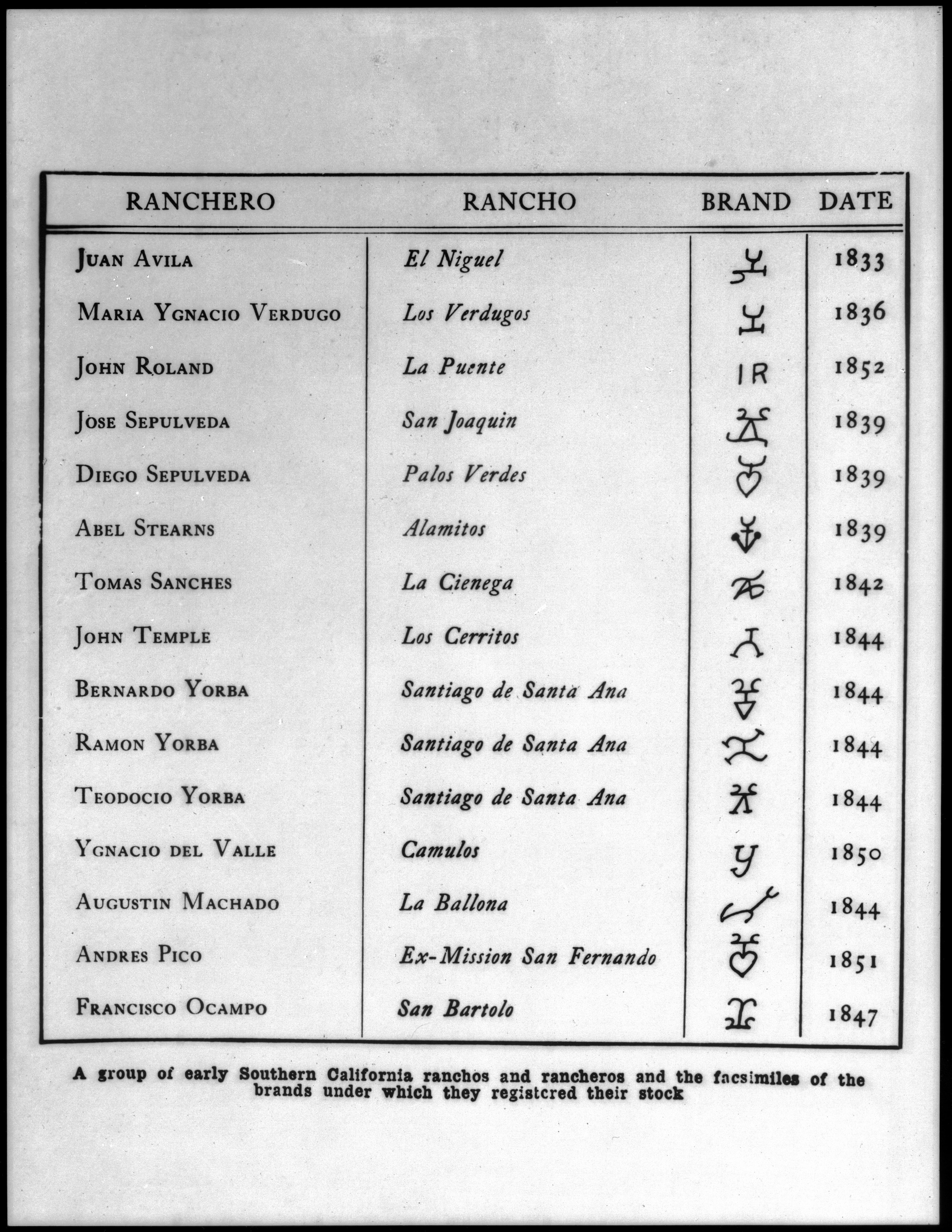
The Spanish and Mexican governments made many concessions and land grants in Alta California (now known as California) and Baja California from 1775 to 1846. The Spanish Concessions of land were made to retired soldiers as an inducement for them to remain in the frontier. These Concessions reverted to the Spanish crown upon the death of the recipient. The Mexican government later encouraged settlement by issuing much larger land grants to both native-born and naturalized Mexican citizens. The grants were usually two or more square leagues, or in size. Unlike Spanish Concessions, Mexican land grants provided permanent, unencumbered ownership rights. Most ranchos granted by Mexico were located along the California coast around San Francisco Bay, inland along the Sacramento River, and within the San Joaquin Valley. When the government secularized the Mission churches in 1833, they required that land be set aside for each Neophyte family. But the Native Americans were quickly ... [...More Info...] [...Related Items...] OR: [Wikipedia] [Google] [Baidu] |
:Category:Tongva Populated Places
::*''The former settlements of the Tongva (''Gabrieleño—Fernandeño'') Native American tribe — their historical, archeological, and sacred places in Southern California Southern California (commonly shortened to SoCal) is a geographic and Cultural area, cultural region that generally comprises the southern portion of the U.S. state of California. It includes the Los Angeles metropolitan area, the second most po ....'' {{- Places Former Native American populated places in California Former settlements in Los Angeles County, California ... [...More Info...] [...Related Items...] OR: [Wikipedia] [Google] [Baidu] |
Watts, California
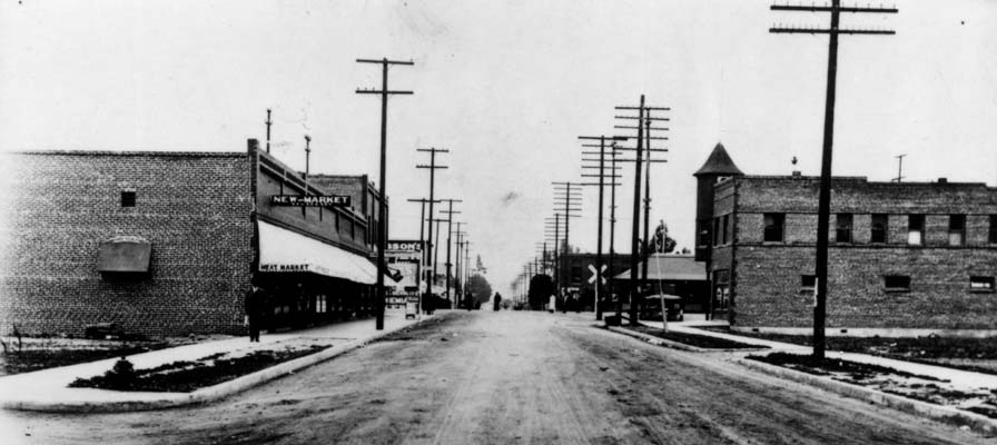
Watts, California, was a city of the sixth class that existed in Los Angeles County, California, between 1907 and 1926, when it was consolidated with the City of Los Angeles and became one of the neighborhoods in the southern part of that city. Founding The area now known as Watts is situated on the 1843 Rancho La Tajauta Mexican land grant. As on all ranchos, the principal vocation was at that time grazing and beef production. There were household settlers in the area as early as 1882, and in 1904 the population was counted as 65 people; a year later it was 1,651. C.V. Bartow of Long Beach was noted as one of the founders of Watts. Naming In 1904 it was reported that Watts was named after Pasadena businessman Charles H. Watts, who was found dead by suicide in the St. Elmo Hotel, Los Angeles, on August 23 of that year. The ''Los Angeles Times'' said: "Watts at one time conducted a livery stable on North Main Street and another at Pasadena and was a man of considera ... [...More Info...] [...Related Items...] OR: [Wikipedia] [Google] [Baidu] |
List Of Ranchos Of California
These California land grants were made by Spanish (1784–1821) and Mexican (1822–1846) authorities of Las Californias and Alta California to private individuals before California became part of the United States of America.Shumway, Burgess M.,1988, ''California Ranchos: Patented Private Land Grants Listed by County'', The Borgo Press, San Bernardino, CA, Under Spain, no private land ownership was allowed, so the grants were more akin to free leases. After Mexico achieved independence, the Spanish grants became actual land ownership grants. Following the Mexican–American War, the 1848 Treaty of Guadalupe Hidalgo provided that the land grants would be honored. Alta California ranchos in Mexico From 1773 to 1836, the border between Alta California and Baja California was about 30 miles south of the Mexico–United States border drawn by the Treaty of Guadalupe Hidalgo that ended the Mexican–American War in 1848. Under the Siete Leyes constitutional reforms of 1836, the Alt ... [...More Info...] [...Related Items...] OR: [Wikipedia] [Google] [Baidu] |
Henry Hancock
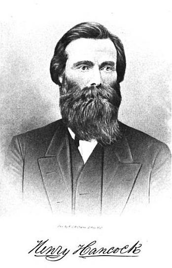
Henry Hancock (April 11, 1822January 9, 1883) was a Harvard trained lawyer and a land surveyor working in California in the 1850s. He was the owner of Rancho La Brea, which included the La Brea Tar Pits. Early life Henry Hancock was born in Bath, New Hampshire, a son of Thomas Hancock and his wife Lucy (Smith) Hancock, and grandson of Henry Hancock and Abigail (Cotton) Hancock. He was of English ancestry, his grandfather having emigrated from Somerset in the 18th century. Hancock entered the Norwich Military Academy, then studied law at Harvard University. Graduating in 1846, he went St. Louis, Missouri, where he became a surveyor. During the Mexican–American War, he was quartermaster of the 1st Regiment Missouri Mounted Volunteers under Colonel Alexander William Doniphan. At the war's end, he returned home to New Hampshire but soon decided to go west. Life in California Hancock sailed from Chicago to San Francisco. He arrived in California in September, 1849 and opened a la ... [...More Info...] [...Related Items...] OR: [Wikipedia] [Google] [Baidu] |
Land Patent
A land patent is a form of letters patent assigning official ownership of a particular tract of land that has gone through various legally-prescribed processes like surveying and documentation, followed by the letter's signing, sealing, and publishing in public records, made by a sovereign entity. It is the highest evidence of right, title, and interest to a defined area. It is usually granted by a central, federal, or state government to an individual, partnership, trust, or private company. The land patent is not to be confused with a land grant. Patented lands may be lands that had been granted by a sovereign authority in return for services rendered or accompanying a title or otherwise bestowed ''gratis'', or they may be lands privately purchased by a government, individual, or legal entity from their prior owners. "Patent" is both a process and a term. As a process, it is somewhat parallel to gaining a patent for intellectual property, including the steps of uniquely def ... [...More Info...] [...Related Items...] OR: [Wikipedia] [Google] [Baidu] |
Treaty Of Guadalupe Hidalgo
The Treaty of Guadalupe Hidalgo ( es, Tratado de Guadalupe Hidalgo), officially the Treaty of Peace, Friendship, Limits, and Settlement between the United States of America and the United Mexican States, is the peace treaty that was signed on 2 February 1848, in the Villa de Guadalupe Hidalgo (now a neighborhood of Mexico City) between the United States and Mexico that ended the Mexican–American War (1846–1848). The treaty was ratified by the United States on 10 March and by Mexico on 19 May. The ratifications were exchanged on 30 May, and the treaty was proclaimed on 4 July 1848. With the defeat of its army and the fall of its capital in September 1847, Mexico entered into negotiations with the U.S. peace envoy, Nicholas Trist, to end the war. On the Mexican side, there were factions that did not concede defeat or seek to engage in negotiations. The treaty called for the United States to pay US$15 million to Mexico and to pay off the claims of American citizens against Mex ... [...More Info...] [...Related Items...] OR: [Wikipedia] [Google] [Baidu] |
Watts, Los Angeles
Watts is a neighborhood in southern Los Angeles, California. It is located within the South Los Angeles region, bordering the cities of Lynwood, Huntington Park and South Gate to the east and southeast, respectively, and the unincorporated community of Willowbrook to the south. Founded in the late nineteenth century as a ranching community, the arrival of the railroads and the construction of Watts Station saw the rapid development of Watts as an independent city, but in 1926 it was consolidated with Los Angeles. By the 1940s, Watts transformed into a primarily working class African-American neighborhood, but from the 1960s developed a reputation as a low-income, high-crime area, following the Watts riots and the increasing influence of street gangs. Watts has become a predominantly Hispanic neighborhood with a significant African American minority, and remains one of the most impoverished neighborhoods in Los Angeles despite falling crime rates since the 1990s. Notable civic ... [...More Info...] [...Related Items...] OR: [Wikipedia] [Google] [Baidu] |


