|
Rajouri Tawi River
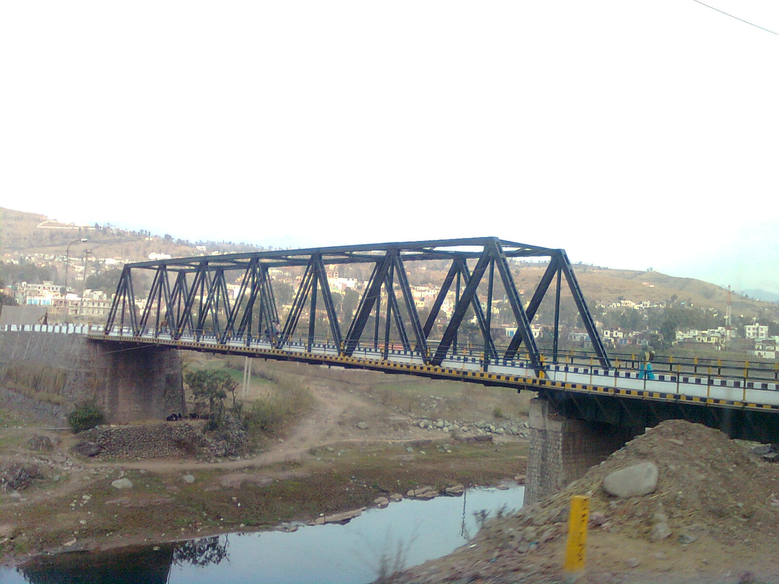
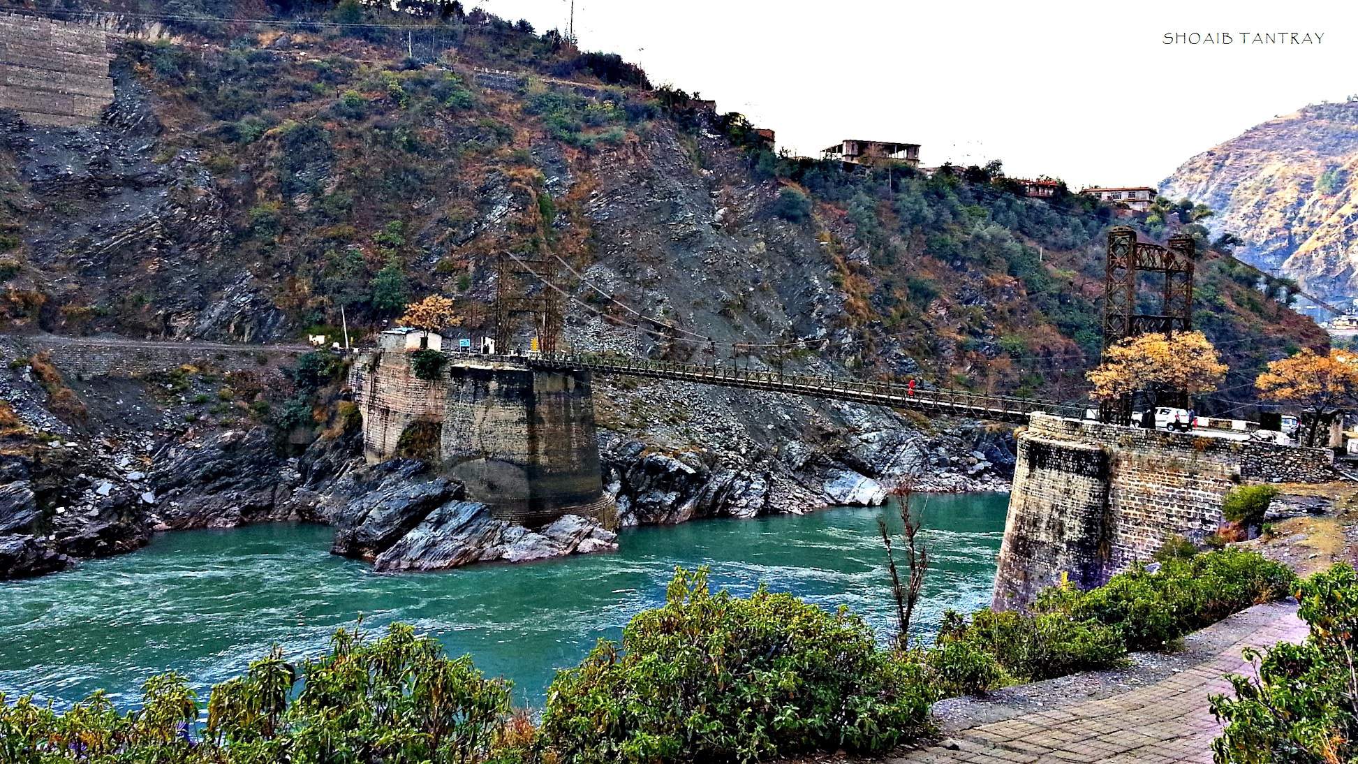
The Manawar Tawi river (also called Rajouri Tawi and Naushera Tawi) is a tributary of the Chenab River, which originates at the Ratan Pir ridge of the Pir Panjal Range and flows through the Rajouri and Jammu districts of Jammu and Kashmir, India and the Sialkot District of Pakistani Punjab, where it joins the Chenab at Marala Headworks. The towns along its course include Thana Mandi, Rajouri and Naushera. Towards the end of its course, it flows through the plains of the Jammu district west of Akhnur close to the Line of Control dividing the Pakistan-administered and Indian-administered Kashmir regions. See also * Tawi River Tawi is a river that flows through the city of Jammu. The Tawi is a major left bank tributary of the river Chenab. Tawi river is considered sacred and holy, as is the case with most rivers in India. * The source of Tawi is the Kailash Kund Spr ... References External links * The course of Manawar Tawi river marked on OpenStreetMap: ** Source ... [...More Info...] [...Related Items...] OR: [Wikipedia] [Google] [Baidu] |
Pir Panjal Range
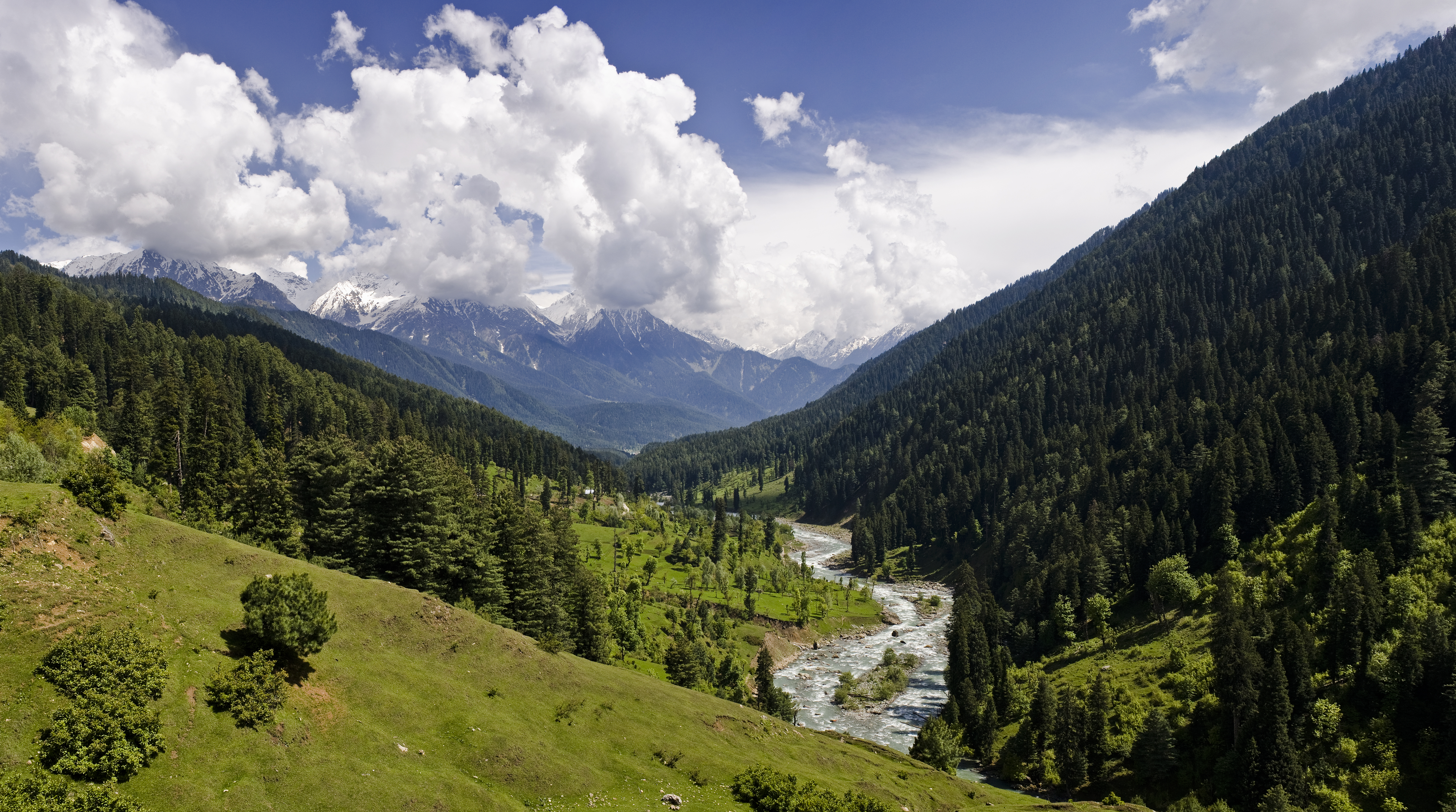
The Pir Panjal Range (Kashmiri: ) is a group of mountains in the Lesser Himalayan region, running from east-southeast (ESE) to west-northwest (WNW) across the Indian territories of Himachal Pradesh and Jammu and Kashmir and then Pakistan's Azad Kashmir and Punjab. The average elevation varies from to . The Himalayas show a gradual elevation towards the Dhauladhar and Pir Panjal ranges. Pir Panjal is the largest range of the Lesser Himalayas. Near the bank of the Sutlej River, it dissociates itself from the Himalayas and forms a divide between the Beas and Ravi rivers on one side and the Chenab on the other. The renowned Galyat mountains are also located in this range. Etymology The Pir Panjal range is named after the Pir Panjal Pass, whose original name as recorded by Srivara, is ''Panchaladeva'' (IAST: ''Pāñcāladeva'', meaning the deity of ''Panchala''). Panchala is a country mentioned in the Mahabharata in the northwest Uttar Pradesh. However, there are also tradition ... [...More Info...] [...Related Items...] OR: [Wikipedia] [Google] [Baidu] |
Rajouri
Rajouri or Rajauri (; Pahari: 𑠤𑠬𑠑𑠶𑠤𑠮, راجوری; sa, राजपुर, ) is a city in Rajouri district in the union territory of Jammu and Kashmir, India. It is located about from Srinagar and from Jammu city on the Poonch Highway. The city is the location of the birthplace of Sikh Rajput General Banda Singh Bahadur. Baba Ghulam Shah Badshah University is also situated in this district. History Ancient History Rajouri was Ruled by Many Rulers Palas, Jaral Rajputs For 12th - 19th Century & Dogra Rajput Dynasty. Rajouri, finds its mention in the travelogue of Chinese traveler Hiuen-Tsang who visited the town in 632 A.D. and described it as a part of Kashmiri dominion. Later was included in the domain called Darabhisanga which comprised the hilly stretch from Poonch to Kashmir. Those days Laharkote in Poonch district and Rajouri had emerged as two powerful states of the area. According to F.E.Pargitor, second branch of Aryan emigrants crossed ... [...More Info...] [...Related Items...] OR: [Wikipedia] [Google] [Baidu] |
Rivers Of Jammu And Kashmir
Jammu and Kashmir (union territory), Jammu and Kashmir has many lakes, rivers, and glaciers. Significant rivers that flow through Jammu & Kashmir from the Himalayas are Jhelum River, Jhelum, Chenab River, Chenab and Ravi River, Ravi These river basins are located at a higher elevation facilitating huge hydro power potential. Major lakes include Manasbal Lake, Dal Lake, Wular Lake, Nageen Lake. There are around 1230 water bodies in Jammu & Kashmir. List of rivers The major rivers in Jammu and Kashmir are : *Brengi River or Bringhi River *Chenab River *Dudhganga - is a tributary of the Jhelum that flows from Ludurmarg and rises in the central Pir Panjal range near Tatakooti Peak. Two mountain streams, the Sangesafed and the Yachera, form this river. This river flows through Batmalu Swamp near Srinagar. *Jhelum River *Lidder River *Markha River (India), Markha River *Nala Palkhu *Neelum River, Neelum/Kishanganga River *Poonch River *Rambi Ara *Ravi River *Sandran River *Sind Rive ... [...More Info...] [...Related Items...] OR: [Wikipedia] [Google] [Baidu] |
Jammu (city)
Jammu is the winter capital of the Indian union territory of Jammu and Kashmir. It is the headquarters and the largest city in Jammu district of the union territory. Lying on the banks of the river Tawi, the city of Jammu, with an area of , is surrounded by the Himalayas in the north and the northern-plains in the south. Jammu is the second most populous city of the union territory. Three battles have been fought in the city: first by the founder Raja Mal Dev against Timur in Battle of Jammu (1399), second by Sardar Bhag Singh against Mughal army in Battle of Jammu (1712) and the third by Mian Dido & Maharaja Gulab Singh against Ranjit Singh's army in Battle of Jammu (1808). Known as the ''City of Temples'' for its ancient temples and Hindu shrines, Jammu is the most visited place in the union territory. Jammu city shares its borders with the neighbouring Samba district. Etymology According to local tradition, Jammu is named after its founder, Raja Jambulochan, who is b ... [...More Info...] [...Related Items...] OR: [Wikipedia] [Google] [Baidu] |
Jammu Division
The Jammu division (; ) is a revenue and administrative division within Jammu and Kashmir, a union territory of India. It consists of the districts of Jammu, Doda, Kathua, Ramban, Reasi, Kishtwar, Poonch, Rajouri, Udhampur and Samba. Most of the land is hilly or mountainous, including the Pir Panjal Range which separates it from the Kashmir Valley and part of the Great Himalayas in the eastern districts of Doda and Kishtwar. Its principal river is the Chenab. Jammu city is the largest city in Jammu and the winter capital of Jammu and Kashmir. It is also known as "City of Temples" as it has many temples and shrines, with glittering '' shikhars'' soaring into the sky, which dot the city's skyline, creating the ambiance of a holy and peaceful city. Home to some of the most revered Hindu shrines, such as Vaishno Devi, Jammu is a major pilgrimage centre for Hindus. A majority of Jammu's population practices Hinduism, while Islam and Sikhism enjoy a strong cultural heritage in t ... [...More Info...] [...Related Items...] OR: [Wikipedia] [Google] [Baidu] |
Tawi River
Tawi is a river that flows through the city of Jammu. The Tawi is a major left bank tributary of the river Chenab. Tawi river is considered sacred and holy, as is the case with most rivers in India. * The source of Tawi is the Kailash Kund Spring at Soej hills in Bhaderwah. * After flowing through the Chennani and Udhampur, Tawi passes through Jammu and joins the Chenab in Ranbir Singh Pora and then enters Pakistan. * Chennani hydro electric power project constructed on River Tawi has a capacity to generate 23 MW of power. Origin from Kailash Kund glacier Tawi river originates from Kailash Kund glacier in bhaderwah Doda district , and then flows through the Seoj dhar meadows in Doda district. Its catchment is delineated by latitude 32°35'-33°5'N and longitude 74°35'-75°45'E. The catchment area of the river up to Indian border (Jammu) is 2168 km² and falls in the districts of Jammu, Udhampur and a small part of Doda. Elevation in the catchment varies between 400 and ... [...More Info...] [...Related Items...] OR: [Wikipedia] [Google] [Baidu] |
Indian-administered Kashmir
Kashmir () is the northernmost geographical region of the Indian subcontinent. Until the mid-19th century, the term "Kashmir" denoted only the Kashmir Valley between the Great Himalayas and the Pir Panjal Range. Today, the term encompasses a larger area that includes the Indian-administered territories of Jammu and Kashmir and Ladakh, the Pakistani-administered territories of Azad Kashmir and Gilgit-Baltistan, and the Chinese-administered territories of Aksai Chin and the Trans-Karakoram Tract. Quote: "Kashmir, region of the northwestern Indian subcontinent. It is bounded by the Uygur Autonomous Region of Xinjiang to the northeast and the Tibet Autonomous Region to the east (both parts of China), by the Indian states of Himachal Pradesh and Punjab to the south, by Pakistan to the west, and by Afghanistan to the northwest. The northern and western portions are administered by Pakistan and comprise three areas: Azad Kashmir, Gilgit, and Baltistan, ... The southern and so ... [...More Info...] [...Related Items...] OR: [Wikipedia] [Google] [Baidu] |
Pakistani-administered Kashmir
Kashmir () is the northernmost geographical region of the Indian subcontinent. Until the mid-19th century, the term "Kashmir" denoted only the Kashmir Valley between the Great Himalayas and the Pir Panjal Range. Today, the term encompasses a larger area that includes the Indian-administered territories of Jammu and Kashmir (union territory), Jammu and Kashmir and Ladakh, the Pakistani-administered territories of Azad Kashmir and Gilgit-Baltistan, and the Chinese-administered territories of Aksai Chin and the Trans-Karakoram Tract. Quote: "Kashmir, region of the northwestern Indian subcontinent. It is bounded by the Uygur Autonomous Region of Xinjiang to the northeast and the Tibet Autonomous Region to the east (both parts of China), by the Indian states of Himachal Pradesh and Punjab to the south, by Pakistan to the west, and by Afghanistan to the northwest. The northern and western portions are administered by Pakistan and comprise three areas: Azad Kashmir, Gilgit, and B ... [...More Info...] [...Related Items...] OR: [Wikipedia] [Google] [Baidu] |
Line Of Control
The Line of Control (LoC) is a military control line between the Indian and Pakistanicontrolled parts of the former princely state of Jammu and Kashmir—a line which does not constitute a legally recognized international boundary, but serves as the de facto border. It was established as part of the Simla Agreement at the end of the Indo-Pakistani War of 1971. Both nations agreed to rename the ceasefire line as the "Line of Control" and pledged to respect it without prejudice to their respective positions. Apart from minor details, the line is roughly the same as the original 1949 cease-fire line. The part of the former princely state under Indian control is divided into the union territories of Jammu and Kashmir and Ladakh. The Pakistani-controlled section is divided into Azad Kashmir and Gilgit–Baltistan. The northernmost point of the Line of Control is known as NJ9842, beyond which lies the Siachen Glacier, which became a bone of contention in 1984. To the south of the ... [...More Info...] [...Related Items...] OR: [Wikipedia] [Google] [Baidu] |
Akhnur
Akhnoor is a city and Municipal governance in India, municipal committee, near city of Jammu in Jammu district of Indian National Congress, Indian union territory of Jammu and Kashmir (union territory), Jammu and Kashmir. It lies 28 km away from Jammu, Jammu city. Akhnoor is on the bank of the Chenab River, just before it enters the Punjab, Pakistan, Pakistani Punjab. Its border location gives it strategic significance. The Akhnoor area is divided into three administrative sub-divisions - Akhnoor, Chowki Choura and Khour, India, Khour; Seven Tehsils - Akhnoor Khaas, Chowki Choura, Maira Mandrian, Jourian, Kharah Balli, Khour & Pargwal. History The place is believed to be the ancient city of ''Virat Nagar'' mentioned in the Mahabarata, Mahabharata however, Viratnagar, Bairat, a town in northern Jaipur district of Rajasthan is more established as the ancient ''Virat Nagar''. The place is one of the most important historical sites in Jammu and Kashmir. Excavations by the Archa ... [...More Info...] [...Related Items...] OR: [Wikipedia] [Google] [Baidu] |
Nowshera, Jammu And Kashmir
Nowshera (alternatively spelt Nowshehra and Naushera) is a town and the headquarters of an eponymous tehsil in the Rajouri district in the Indian Union Territory of Jammu and Kashmir. It is governed by a Municipal committee. Geography Nowshera is a small town located on the bank of Manawer river just 4 km inwards from the Manawer bridge on Jammu-Poonch national highway. It is a border tehsil of Rajouri district with a vast areal and demographic extent. Given its spatial and demographic extent, Nowshera has been given the status of a Sub-District. It is a beautiful place with a number of tourist attractions including the fort of Mangla Devi, holy cave temple of Mangla Mata, Central Gurudwara of Sikhs in Nonial, Qila Darhal and other Dargahs and temples. The literacy rate of Nowshera is very high with low male-female literacy gap that shows that there is deep inclination of people towards education. It has an average elevation of 1,575 metres (5,167 feet). His ... [...More Info...] [...Related Items...] OR: [Wikipedia] [Google] [Baidu] |
Thana Mandi
Thanamandi is a town and a municipal committee in the Rajouri district in the Indian union territory of Jammu and Kashmir. Thanamandi lies on the Mughal Road between Rajouri and Bufliaz. The municipal area limits are mostly inhabitated by kashmiris. Significance Thanamandi lies from Rajouri, the district headquarters, on the Mughal Road, the route across the Pir Panjal mountain pass toward Srinagar. Historically, this route was an important footpath to obtain feed for cattle. The building of the Mughal Road added vehicle traffic bound for Srinagar. Thanamandi has religious significance as the home of the most important Sufi saint, Baba Ghulam Shah Badshah, whose mausoleum is at Shahdara Sharief in the town. Thanamandi still has some forts that were built during the time of the Mughals. It may have taken its name from being a trade market ("mandi") during those times. Demographics India census, Thanamandi had a population of 7,204. Males constitute 53% of the po ... [...More Info...] [...Related Items...] OR: [Wikipedia] [Google] [Baidu] |


