|
Railroad Fire
The Railroad Fire was a wildfire that burned in between the communities of Sugar Pine and Fish Camp in the Sierra National Forest in California, United States. The fire was reported on August 29, 2017 and burned before it was fully contained on October 24. It occurred during the historic 2011–2017 California drought. The cause of the fire remains unknown. The fire threatened communities in the area, historic buildings in the Nelder Grove Historic Area, Tenaya Lodge, and Yosemite Mountain Sugar Pine Railroad, which the fire was named after. It also impacted tourism and air quality in the forest and Yosemite National Park. It killed 39 out of the remaining 104 giant sequoias in Nelder Grove. Timeline The Railroad Fire was reported on August 29, 2017 in the area between the communities of Sugar Pine and Fish Camp the Sierra National Forest. The cause is unknown. On September 3, mandatory evacuations were ordered for the Sky Ranch Road area, due to the fire spreading towards re ... [...More Info...] [...Related Items...] OR: [Wikipedia] [Google] [Baidu] |
Sierra National Forest
Sierra National Forest is a U.S. national forest located on the western slope of central Sierra Nevada in Central California and bounded on the northwest by Yosemite National Park and the south by Kings Canyon National Park. The forest is known for its mountain scenery and beautiful lakes. Forest headquarters are located in Clovis, California. There are local ranger district offices in North Fork and Prather. History Sierra National Forest was the second National Forest created in California and the largest at the time. It covered over six million acres (24,000 km2) of the Sierra Nevada and was about four times the average area of typical California National Forests. Originally it embraced parts of eight counties from Tuolumne on the north to Kern on the south and Mono and Inyo on the east. Initially its name was descriptive, but later when the Sierra was divided into different units this was no longer the case. President Harrison proclaimed the Sierra Forest Reserv ... [...More Info...] [...Related Items...] OR: [Wikipedia] [Google] [Baidu] |
Wildfire
A wildfire, forest fire, bushfire, wildland fire or rural fire is an unplanned, uncontrolled and unpredictable fire in an area of Combustibility and flammability, combustible vegetation. Depending on the type of vegetation present, a wildfire may be more specifically identified as a bushfire(bushfires in Australia, in Australia), desert fire, grass fire, hill fire, peat fire, prairie fire, vegetation fire, or veld fire. Fire ecology, Some natural forest ecosystems depend on wildfire. Wildfires are distinct from beneficial human usage of wildland fire, called controlled burn, controlled burning, although controlled burns can turn into wildfires. Fossil charcoal indicates that wildfires began soon after the appearance of terrestrial plants approximately 419 million years ago during the Silurian period. Earth's carbon-rich vegetation, seasonally dry climates, atmospheric oxygen, and widespread lightning and volcanic ignitions create favorable conditions for fires. The occurre ... [...More Info...] [...Related Items...] OR: [Wikipedia] [Google] [Baidu] |
Wildfires In Mariposa County, California
A wildfire, forest fire, bushfire, wildland fire or rural fire is an unplanned, uncontrolled and unpredictable fire in an area of combustible vegetation. Depending on the type of vegetation present, a wildfire may be more specifically identified as a bushfire( in Australia), desert fire, grass fire, hill fire, peat fire, prairie fire, vegetation fire, or veld fire. Some natural forest ecosystems depend on wildfire. Wildfires are distinct from beneficial human usage of wildland fire, called controlled burning, although controlled burns can turn into wildfires. Fossil charcoal indicates that wildfires began soon after the appearance of terrestrial plants approximately 419 million years ago during the Silurian period. Earth's carbon-rich vegetation, seasonally dry climates, atmospheric oxygen, and widespread lightning and volcanic ignitions create favorable conditions for fires. The occurrence of wildfires throughout the history of terrestrial life invites conjecture that fi ... [...More Info...] [...Related Items...] OR: [Wikipedia] [Google] [Baidu] |
History Of Mariposa County, California
Mariposa County () is a county in the U.S. state of California. As of the 2020 U.S. Census, the population was 17,131. The county seat is Mariposa. It is located in the western foothills of the Sierra Nevada mountains, north of Fresno, east of Merced, and southeast of Stockton. The county's eastern section is the central portion of Yosemite National Park. There are no incorporated cities in Mariposa County; however, there are communities recognized as census-designated places for statistical purposes. It also has the distinction of having no actual traffic signals anywhere in the county. History Mariposa County was one of the original counties of California, created at the time of statehood in 1850. While it began as the state's largest county, territory that was once part of Mariposa was ceded over time to form all or part of twelve other counties, including all of Merced, Madera, Fresno, Tulare, Kings, and Kern; and parts of San Benito, Mono, Inyo, San Bernardino, and L ... [...More Info...] [...Related Items...] OR: [Wikipedia] [Google] [Baidu] |
Mission Fire
The Mission Fire was a wildfire located two miles east of North Fork in the Sierra National Forest in California in the United States. The fire was reported on September 3, 2017. The cause of the fire is under investigation. The fire burned and destroyed 4 buildings. The fire was 100% contained on September 13, 2017. The fire threatened homes in the neighborhoods of Cascadel Woods and Benedict Meadow, the community of North Folk, the Northfork Rancheria of Mono Indians of California, and the Sierra National Forest. It was one of three fires burning in the vicinity of the Sierra National Forest and Yosemite National Park. The fire The Mission Fire was reported on September 3, 2017, at 1:00 PM PDT, approximately two miles east of North Fork, California, near the neighborhood of Cascadel Woods, in the Sierra National Forest. The fire was located in steep terrain and was fueled by dead trees, mixed conifer and brush, which made it challenging for firefighters. The fire burned close ... [...More Info...] [...Related Items...] OR: [Wikipedia] [Google] [Baidu] |
Empire Fire
The Empire Fire was a wildfire that burned in Yosemite National Park in California in the United States. The fire was reported on August 1, 2017 and was caused by lightning. It burned , before it was fully contained on November 27. The fire affected recreational activities in the national park. Progression The Empire Fire was reported on August 1, 2017 at 8:45 AM. It is located east of Badger Pass Ski Area and next to Bridalveil Creek Campground in Yosemite National Park. The fire was naturally caused, possibly by lightning. It was fueled by red fir timber, dormant brush, green leaf manzanita, chinquapan brush, and dead and down material. On November 27, the fire was reported to be 100% contained. See also *Railroad Fire The Railroad Fire was a wildfire that burned in between the communities of Sugar Pine and Fish Camp in the Sierra National Forest in California, United States. The fire was reported on August 29, 2017 and burned before it was fully contained on ... Refer ... [...More Info...] [...Related Items...] OR: [Wikipedia] [Google] [Baidu] |
2017 California Wildfires
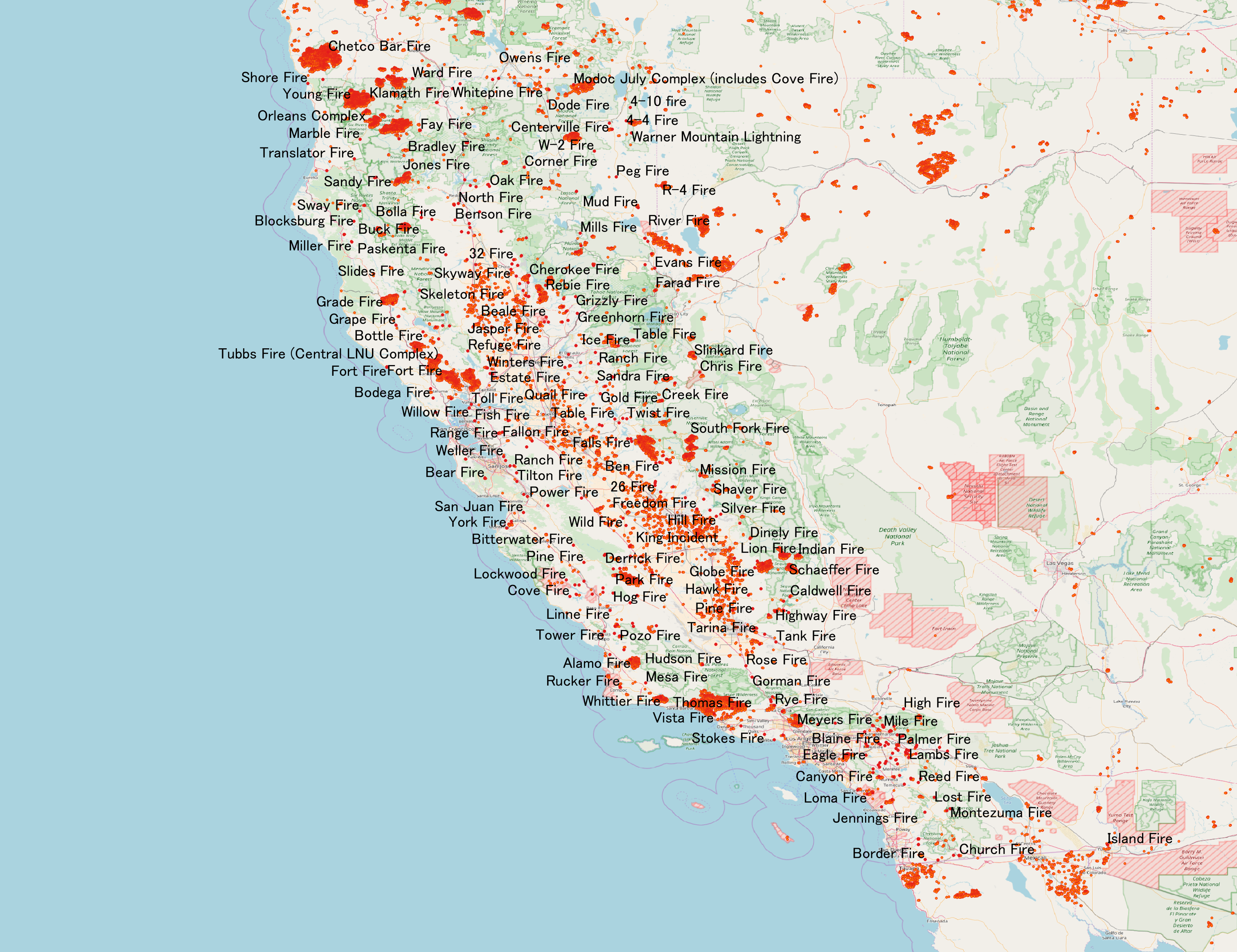
In terms of property damage, 2017 was the most destructive wildfire season on record in California at the time, surpassed by only the 2018 season and the 2020 season, with a total of 9,560 fires burning of land, according to the California Department of Forestry and Fire Protection, including five of the 20 most destructive wildland-urban interface fires in the state's history. Throughout 2017, the fires destroyed or damaged more than 10,000 structures in the state (destroyed 9,470, damaged 810), a higher tally than the previous nine years combined. State data showed that the large wildfires killed 47 people – 45 civilians and 2 firefighters – almost higher than the previous 10 years combined. The total property damage and total amount of burned land were both surpassed by the 2018 California wildfires. Throughout the early months of 2017, there was heavy rainfall over most of California, which triggered widespread flooding, thus temporarily mitigating the state's histor ... [...More Info...] [...Related Items...] OR: [Wikipedia] [Google] [Baidu] |
California State Route 41
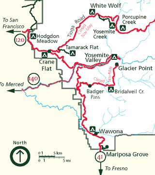
State Route 41 (SR 41) is a state highway in California, connecting the Central Coast with the San Joaquin Valley and the Sierra Nevada. Its western terminus is at the Cabrillo Highway ( SR 1) in Morro Bay, and its eastern terminus is at SR 140 in Yosemite National Park. It has been constructed as an expressway from near SR 198 in Lemoore north to the south part of Fresno, where the Yosemite Freeway begins, passing along the east side of downtown and extending north into Madera County. Route description The majority of Route 41 runs as either two-lane rural highway or four-lane divided highway. The only part of SR 41 that turns into a freeway itself is in Fresno County and parts of Madera. The southern end of the highway intersects SR 1 in Morro Bay. Between Morro Bay and Fresno, the highway intersects U.S. Route 101 in Atascadero, proceeds through the Coast Range and intersects SR 46. Actor James Dean died in an accident in 1955 at the intersection of SR 46 in Cholame. ... [...More Info...] [...Related Items...] OR: [Wikipedia] [Google] [Baidu] |
DC-10 Air Tanker
The DC-10 Air Tanker is a series of American wide-body jet air tankers, which have been in service as an aerial firefighting unit since 2006. The aircraft, operated by the joint technical venture 10 Tanker Air Carrier, are converted wide body McDonnell Douglas DC-10-30 passenger jetliners, and are primarily used to fight wildfires, typically in rural areas. The turbofan-powered aircraft carry up to 12,000 US gallons (45,000 Liters) of water or fire retardant in an exterior belly-mounted tank, the contents of which can be released in eight seconds. Four air tankers are currently in operation, all DC-10-30 aircraft, with the call-signs ''Tanker 910, 911, 912 and 914''. The original ''Tanker 910'', a DC-10-10, was retired in 2014. Development 10 Tanker Air Carrier, a New Mexico-based company, began researching the development of Next Generation airtankers in 2002. Company personnel were assembled with an extensive history of heavy jet operations, modifications and ownership. Aft ... [...More Info...] [...Related Items...] OR: [Wikipedia] [Google] [Baidu] |
Yosemite High School
Yosemite High School (YHS) is a secondary school in the Yosemite Unified School District in Oakhurst, California. YHS occupies of rolling, wooded hills and is located within the foothills of California's Sierra Nevada. Yosemite High School was recognized as a California Distinguished School in 2001 and 2005. The school opened in September 1976 and enrollment in 2020-2021 was 537 students. Campus Yosemite High School is located in the Sierra Nevada foothills in the rural community of Oakhurst, from the south entrance to Yosemite National Park in Central California. The campus is on a site with pines, oaks, and seasonal streams with views of the High Sierra. Academics Yosemite High School features an International Baccalaureate (IB) program and also offers Advanced Placement courses and a dual credit program with the State Center Community College District (SCCCD). In addition to a rigorous academic program, YHS also provides a comprehensive vocational program. Title I prog ... [...More Info...] [...Related Items...] OR: [Wikipedia] [Google] [Baidu] |
Wawona, California
Wawona (formerly Big Tree Station, Clark's Station, Clarks Station, Wah-wo-nah, and Clark's Ranch) is a census-designated place in Mariposa County, California, United States. The population was 111 at the 2020 census. It is located entirely within Yosemite National Park, as it preceded the founding of the park as a national recreation area. The number of inhabitants increases dramatically during peak tourist seasons, due to the large number of rental cabins in the town. It is located at , north of Oakhurst and south of the center of Yosemite Valley, at an elevation of . The ZIP Code is 95389. The community is inside area code 209. History It was known to the local Native American Miwok in their language as ''Pallachun'' ("a good place to stay"). The origin of the word ''Wawona'' is not known. A popular story claims ''Wawō'na'' was the Miwok word for "big tree", or for "hoot of the owl", a bird considered the sequoia trees' spiritual guardian. Galen Clark, who helped gai ... [...More Info...] [...Related Items...] OR: [Wikipedia] [Google] [Baidu] |
Complex Early Seral Forest
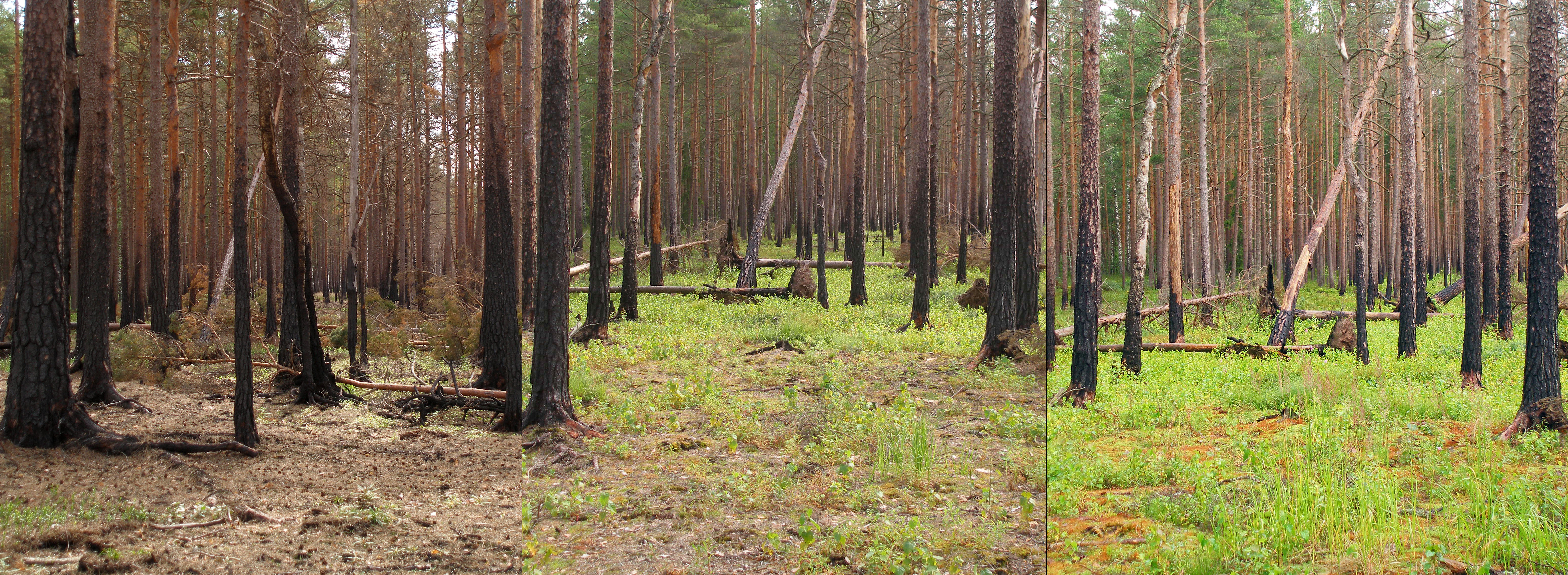
Complex early seral forests, or snag forests, are ecosystems that occupy potentially forested sites after a stand-replacement disturbance and before re-establishment of a closed forest canopy. They are generated by natural disturbances such as wildfire or insect outbreaks that reset ecological succession processes and follow a pathway that is influenced by biological legacies (e.g., large live trees and snags, downed logs, seed banks, resprout tissue, fungi, and other live and dead biomass) that were not removed during the initial disturbance. Complex early seral forests develop with rich biodiversity because the remaining biomass provides resources to many life forms and because of habitat heterogeneity provided by the disturbances that generated them. In this and other ways, complex early seral forests differ from simplified early successional forests created by logging. Complex early seral forest habitat is threatened from fire suppression, thinning, and post-fire or post-inse ... [...More Info...] [...Related Items...] OR: [Wikipedia] [Google] [Baidu] |


