|
Radan (mountain)
Radan (Serbian Cyrillic: Радан) is a mountain in southern Serbia, near the town of Kuršumlija. Its highest peak, Šopot, has an elevation of 1,408 meters above sea level. Radan separates the valleys of the Toplica and Jablanica rivers. It is well covered with deciduous and evergreen forests. The best known spot on Radan is the Devil's Town – a peculiar rock formation consisting of hundreds of mushroom-like posts, located on its southern slopes. Near the Devil's Town there are ruins of Ivanova kula – city of Ivan Kosančić, medieval military commander. Justiniana Prima (''Caričin grad''), a Byzantine city from the 6th century, is located on the southeast of the mountain, near Lebane. In summer 2010, Radan attracted media attention because of a " magnetic hill" located on a road near the village of Ivanje. After initial sensationalist articles about "anti-gravity", it soon turned out that it is just an optical illusion. Still, the hill is seen as an opportunity f ... [...More Info...] [...Related Items...] OR: [Wikipedia] [Google] [Baidu] |
Serbia
Serbia (, ; Serbian language, Serbian: , , ), officially the Republic of Serbia (Serbian language, Serbian: , , ), is a landlocked country in Southeast Europe, Southeastern and Central Europe, situated at the crossroads of the Pannonian Basin and the Balkans. It shares land borders with Hungary to the north, Romania to the northeast, Bulgaria to the southeast, North Macedonia to the south, Croatia and Bosnia and Herzegovina to the west, and Montenegro to the southwest, and claims a border with Albania through the Political status of Kosovo, disputed territory of Kosovo. Serbia without Kosovo has about 6.7 million inhabitants, about 8.4 million if Kosvo is included. Its capital Belgrade is also the List of cities in Serbia, largest city. Continuously inhabited since the Paleolithic Age, the territory of modern-day Serbia faced Slavs#Migrations, Slavic migrations in the 6th century, establishing several regional Principality of Serbia (early medieval), states in the early Mid ... [...More Info...] [...Related Items...] OR: [Wikipedia] [Google] [Baidu] |
Lebane
Lebane ( sr-cyr, Лебане) is a town and municipality located in Jablanica District of southern Serbia. According to the 2011 census, the town has a population of 10,062 inhabitants, while the municipality has 20,000 inhabitants. Geography The town is located at the Confluence (geography), confluence of the rivers Jablanica River, Jablanica and Šumanska Reka, in the alluvial plain created by the former. Just northeast of the town a larger plain called Leskovačko polje extends toward the town of Leskovac, which is the district seat. The elevation of the town of Lebane is between 275.2 and 420 Metres above sea level, MASL. History ;Prehistory and Medieval times The favorable location and the richness of nature made Jablanica valley important place since the earliest times. Traffic affordable and fertile, Leskovac valley has provided favorable conditions for the settlement of population. Archaeological findings, of which the most important are Hisar Hill, Hissar and Caričin gra ... [...More Info...] [...Related Items...] OR: [Wikipedia] [Google] [Baidu] |
Politika
''Politika'' ( sr-Cyrl, Политика; ''Politics'') is a Serbian daily newspaper, published in Belgrade. Founded in 1904 by Vladislav F. Ribnikar, it is the oldest daily newspaper still in circulation in the Balkans. Publishing and ownership ''Politika'' is published by Politika novine i magazini (PNM), a joint venture between Politika AD and ''East Media Group''. The current director of PNM is Mira Glišić Simić. PNM also publishes: *''Sportski žurnal'' *'' Politikin zabavnik'' *'' Svet kompjutera'' *''Ilustrovana politika'' *''Bazar'' Editorial history *Vladislav F. Ribnikar (1904–1915) *Miomir Milenović i Jovan Tanović (1915–1941) *Živorad Minović (1985–1991) *Aleksandar Prlja (1991–1994) *Boško Jakšić (1994) *Dragan Hadži Antić (1994–2000) *Vojin Partonić (2000–2001) *Milan Mišić (2001–2005) *Ljiljana Smajlović (2005–2008) *Radmilo Kljajić (2008) *Dragan Bujošević (2008–2013) *Ljiljana Smajlović (2013–2016) *Žarko Rakić (2016- ... [...More Info...] [...Related Items...] OR: [Wikipedia] [Google] [Baidu] |
IUCN Category I
IUCN protected area categories, or IUCN protected area management categories, are categories used to classify protected areas in a system developed by the International Union for Conservation of Nature (IUCN). The enlisting of such areas is part of a strategy being used toward the conservation of the world's natural environment and biodiversity. The IUCN has developed the protected area management categories system to define, record and classify the wide variety of specific aims and concerns when categorising protected areas and their objectives. This categorisation method is recognised on a global scale by national governments and international bodies such as the United Nations and the Convention on Biological Diversity. Categories Category Ia – strict nature reserve A strict nature reserve (IUCN Category Ia) is an area which is protected from all but light human use in order to protect its biodiversity and also possibly its geological/geomorphical features. These are ... [...More Info...] [...Related Items...] OR: [Wikipedia] [Google] [Baidu] |
Prokuplje
Prokuplje ( sr-cyrl, Прокупље, ) is a city and the administrative center of the Toplica District in southern Serbia. According to 2011 census, the city urban area has a population of 27,333 inhabitants, while the administrative area has 44,419 inhabitants. Prokuplje is one of the Roman sites of Serbia. The town was known as Ürgüp during Ottoman rule and was incorporated into the Kingdom of Serbia in 1878. Geography Prokuplje is located between municipalities of Blace, Kuršumlija, Bojnik, Žitorađa, Merošina, Aleksinac, and Kruševac. Climate Prokuplje has an warm-summer mediterranean climate (Köppen climate classification: ''Cwb'') that's close to a humid subtropical climate (Köppen climate classification: ''Cfa''). History and archaeology Neolithic and Copper Age The traces of early settlements can be found at Neolithic sites such as Macina (near Zitni Potok), Kavolak west of Prokuplje (village Donja Trnava) and settlements on the south slopes of Jast ... [...More Info...] [...Related Items...] OR: [Wikipedia] [Google] [Baidu] |
Medveđa
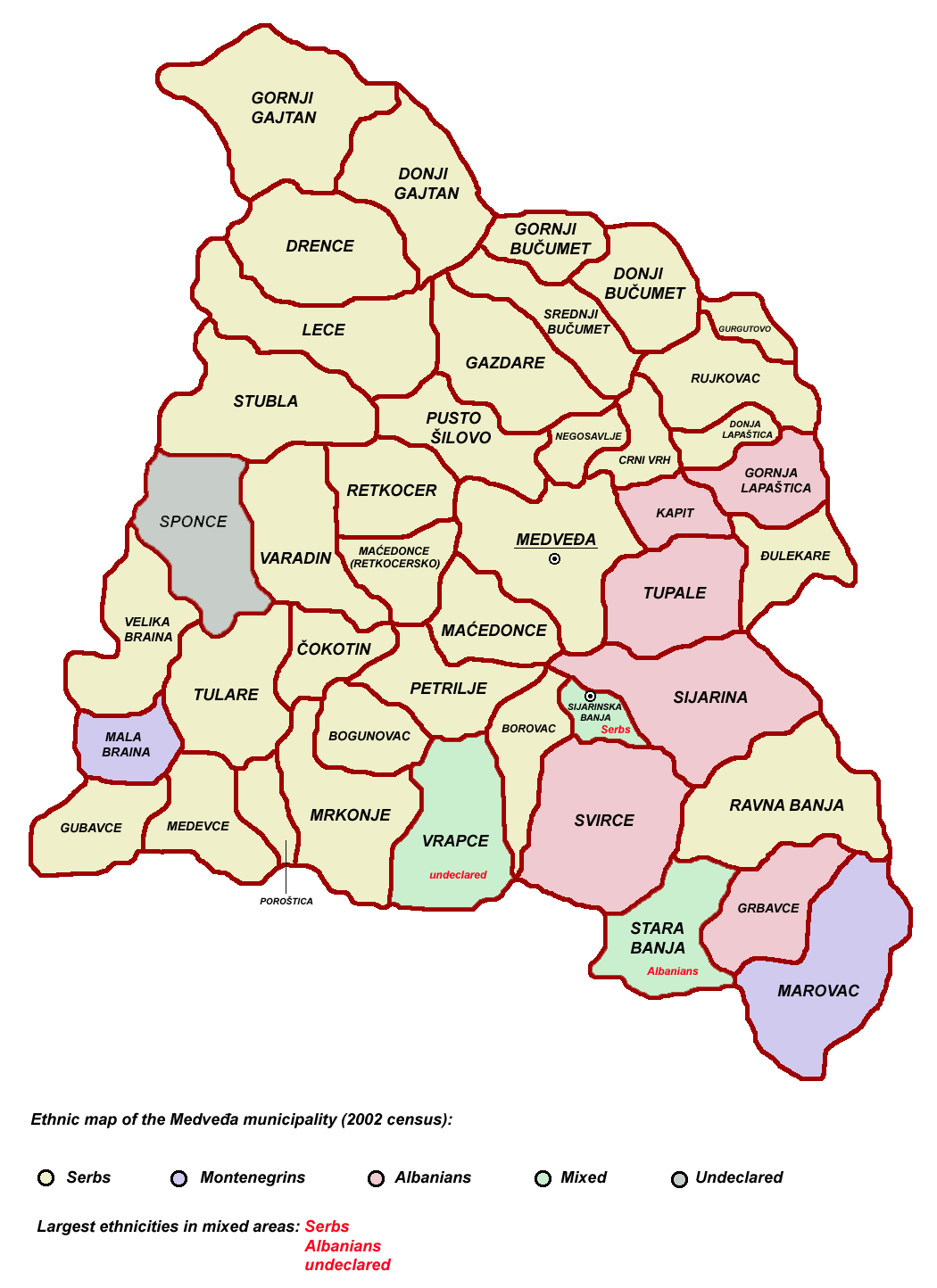
Medveđa ( sr-cyr, Медвеђа, ; sq, Medvegja, ) is a town and municipality located in the Jablanica District of southern Serbia. According to the 2011 census, the town has a population of 2,848 inhabitants, while the municipality has 7,438 inhabitants. Etymology The name is derived from the Serbian word ''medved'' (медвед), "bear", hence meaning "the place of the bears". History During the Roman period, there was a town (''mansia'') with the name Idimum located in the cadastral area of the modern town. Architectural debris dating to the 4th century AD lay at various locations of the town, as it was a transitory zone of Upper Moesia; travel and postal stations are among the finds. Toponyms such as ''Arbanaška'' and ''Đjake'' shows an Albanian presence in the Toplica and Southern Morava regions (located north-east of contemporary Kosovo) before the expulsion of Albanians during 1877–1878 period. The rural parts of Jablanica valley and adjoining semi-mountainous ... [...More Info...] [...Related Items...] OR: [Wikipedia] [Google] [Baidu] |
Bojnik
Bojnik ( sr-cyr, Бојник) is a town and municipality located in the Jablanica District of southern Serbia. According to 2011 census, the population of the town is 6,688 and population of the municipality was 11,073. History Much of the population settled in Bojnik after World War II. On 17 February 1942, Bulgarian occupation forces massacred all 476 inhabitants of Bojnik in response to the alleged sheltering of Partisans.Edward Palmer Thompson, ''Beyond the Frontier: The Politics of a Failed Mission, Bulgaria 1944'' (Stanford University Press, 1997), pg 23. Geography Bojnik municipality is located in southern Serbia and it is surrounded by municipality of Medveđa in the south-west, municipality of Lebane in the south, municipality of Leskovac in the east, and municipalities of Žitorađa and Prokuplje in the north. Settlements Aside from the town of Bojnik, the following villages consist the municipality of Bojnik: Demographics According to the 2011 census results, th ... [...More Info...] [...Related Items...] OR: [Wikipedia] [Google] [Baidu] |
Vreme
''Vreme'' ( Serbian for ''Time'') is a weekly news magazine based in Belgrade, Serbia. History Launch In 1990, dissatisfied with the media climate in SR Serbia, SFR Yugoslavia's largest constituent unit, a group of liberal Serbian intellectuals, including prominent lawyer Srđa Popović, decided to start a weekly newsmagazine. Following a seven-month preparation throughout the year, ''Vreme'' was launched with its first issue coming out on 29 October 1990, little over a month before the 1990 general election in SR Serbia as the entire country of SFR Yugoslavia was transforming its governance from a one-party system under the Yugoslav Communist League (SKJ) to a multi-party one. Most ''Vremes original staff were journalists from ''Politika'' and '' NIN''. It characterizes itself as "a magazine without lies, hatred, or prejudice" and has opposed nationalistic mobilization for the Yugoslav wars.Gordy, Eric D. (1999). ''The Culture of Power in Serbia: Nationalism and the Destructio ... [...More Info...] [...Related Items...] OR: [Wikipedia] [Google] [Baidu] |
Ivanje, Bojnik
Ivanje ( sr-cyrl, Ивање) is a village in the municipality of Bojnik, Serbia Serbia (, ; Serbian: , , ), officially the Republic of Serbia (Serbian: , , ), is a landlocked country in Southeastern and Central Europe, situated at the crossroads of the Pannonian Basin and the Balkans. It shares land borders with Hungar .... According to the 2002 census, the village has a population of 88 people.Popis stanovništva, domaćinstava i Stanova 2002. Knjiga 1: Nacionalna ili etnička pripadnost po naseljima. Republika Srbija, Republički zavod za statistiku Beograd 2003. References {{coord, 42, 59, 55, N, 21, 35, 11, E, type:city_source:kolossus-frwiki, display=title Populated places in Jablanica District Bojnik ... [...More Info...] [...Related Items...] OR: [Wikipedia] [Google] [Baidu] |
Magnetic Hill
A gravity hill, also known as a magnetic hill, mystery hill, mystery spot, gravity road, or anti-gravity hill, is a place where the layout of the surrounding land produces an optical illusion, making a slight downhill slope appear to be an uphill slope. Thus, a car left out of gear will appear to be rolling uphill against gravity. Hundreds of gravity hills are recognized worldwide. The slope of gravity hills is an optical illusion, although sites are often accompanied by claims that magnetic or supernatural forces are at work. The most important factor contributing to the illusion is a completely or mostly obstructed horizon. Without a horizon, it becomes difficult for a person to judge the slope of a surface, as a reliable reference is missing. Objects which one would normally assume to be more or less perpendicular to the ground, such as trees, may be leaning, offsetting the visual reference. A 2003 study looked into how the absence of a horizon can skew the perspective ... [...More Info...] [...Related Items...] OR: [Wikipedia] [Google] [Baidu] |
Justiniana Prima
Justiniana Prima (Latin: , sr, Јустинијана Прима, Justinijana Prima) was an Eastern Roman city that existed from 535 to 615, and currently an archaeological site, known as or ''Caričin Grad'' ( sr, Царичин Град), near modern Lebane in the Leskovac region, southern Serbia. It was founded by Emperor Justinian I (527-565) and served as the metropolitan seat of the then newly founded Archbishopric of Justiniana Prima, which became the main church administrative body of the central and western Balkans with jurisdiction from Praevalitana to Dacia Ripensis Justinian Prima was originally designed to become the capital of the prefecture of Illyricum, but for reasons likely related with its status near the Roman frontiers of the 6th century CE, Thessaloniki was preferred. It was abandoned less than 100 years after its foundation. In 1979, the archaeological site of Justiniana Prima (''Caričin Grad'') was added to the Archaeological Sites of Exceptional Importa ... [...More Info...] [...Related Items...] OR: [Wikipedia] [Google] [Baidu] |
Serbian Cyrillic
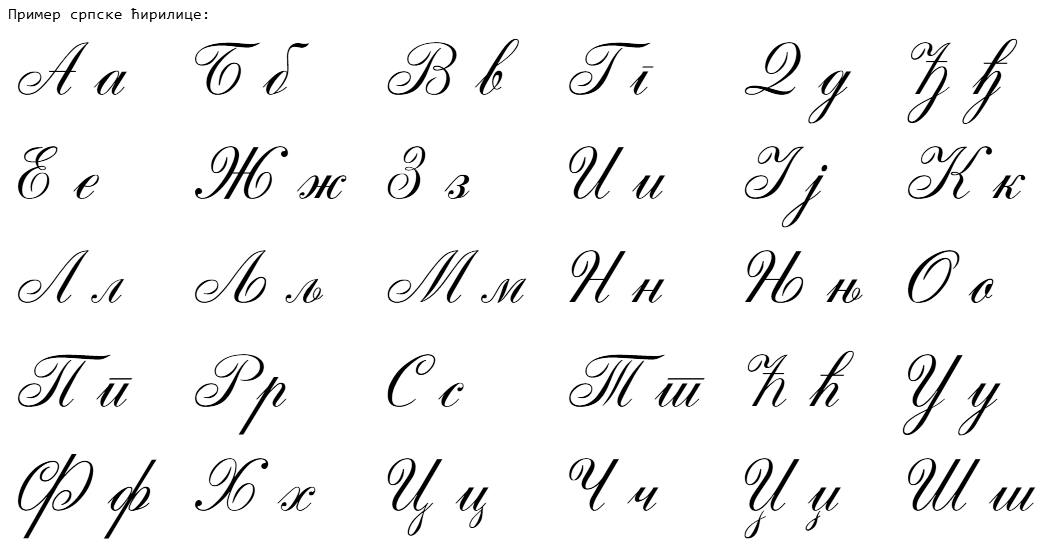
The Serbian Cyrillic alphabet ( sr, / , ) is a variation of the Cyrillic script used to write the Serbian language, updated in 1818 by Serbian linguist Vuk Karadžić. It is one of the two alphabets used to write standard modern Serbian, the other being Gaj's Latin alphabet. Karadžić based his alphabet on the previous Slavonic-Serbian script, following the principle of "write as you speak and read as it is written", removing obsolete letters and letters representing iotified vowels, introducing from the Latin alphabet instead, and adding several consonant letters for sounds specific to Serbian phonology. During the same period, linguists led by Ljudevit Gaj adapted the Latin alphabet, in use in western South Slavic areas, using the same principles. As a result of this joint effort, Serbian Cyrillic and Gaj's Latin alphabets for Serbian-Croatian have a complete one-to-one congruence, with the Latin digraphs Lj, Nj, and Dž counting as single letters. Karadžić's Cyril ... [...More Info...] [...Related Items...] OR: [Wikipedia] [Google] [Baidu] |


