|
R177 Road (Ireland)
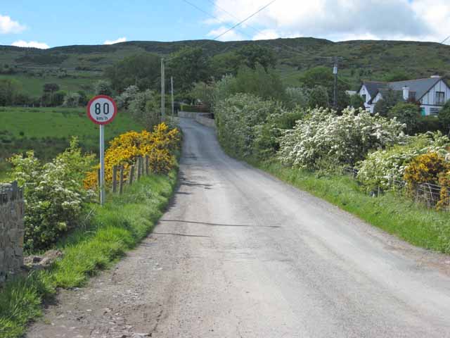
The R177 road is a regional road in Ireland linking Lisdoo and the Border with Northern Ireland in County Louth. The road continues as the A29 across the border in Northern Ireland Northern Ireland ( ga, Tuaisceart Éireann ; sco, label= Ulster-Scots, Norlin Airlann) is a part of the United Kingdom, situated in the north-east of the island of Ireland, that is variously described as a country, province or region. Nort .... The road is long. See also * Roads in Ireland * National primary road * National secondary road References {{Roads in Ireland Regional roads in the Republic of Ireland Roads in County Louth ... [...More Info...] [...Related Items...] OR: [Wikipedia] [Google] [Baidu] |
County Louth
County Louth ( ; ga, An Lú) is a coastal county in the Eastern and Midland Region of Ireland, within the province of Leinster. Louth is bordered by the counties of Meath to the south, Monaghan to the west, Armagh to the north and Down to the north-east, across Carlingford Lough. It is the smallest county in Ireland by land area and the 17th most populous, with just over 139,100 residents as of 2022. The county is named after the village of Louth. Louth County Council is the local authority for the county. History County Louth is named after the village of Louth, which in turn is named after Lugh, a god of the ancient Irish. Historically, the placename has had various spellings; , , and (see Historic Names List, for full listing). is the modern simplified spelling. The county is steeped in myth, legend and history, and is a setting in the epic. Later it saw the influence of the Vikings, as seen in the name of Carlingford Lough. They also established a longphort a ... [...More Info...] [...Related Items...] OR: [Wikipedia] [Google] [Baidu] |
R132 Road (Ireland)
The R132 road is one of Ireland's newest regional roads, having been classified following the opening M1 motorway which by-passes most of the old N1 route. The R132 is long. By-passed sections of the old N1 were reclassified R132. The route has a highly varying road quality, with some sections of dual carriageway such as the original Swords Bypass, and the original run-in to the M1 Balbriggan Bypass; much wide standard two-lane road, and some very poor segments. Some sections, such as that through Drogheda, are still signed "N1" though the town was bypassed in 2003. Route The official description of the R132 from the ''Roads Act 1993 (Classification of Regional Roads) Order 2012'' ''Irish Statu ... [...More Info...] [...Related Items...] OR: [Wikipedia] [Google] [Baidu] |
Lisdoo, County Louth
Lisdoo is a small townland north of Dundalk in County Louth, Ireland. The townland, which is approximately in area, is in the electoral division of Dundalk Rural. It is in the civil parish of Dundalk. The Castletown River The Castletown River () is a river which flows through the town of Dundalk, County Louth, Ireland. It rises near Newtownhamilton, County Armagh, Northern Ireland, and is known as the Creggan River in its upper reaches. Its two main tributaries ... flows to the south of Lisdoo. References {{Louth-geo-stub Townlands of County Louth ... [...More Info...] [...Related Items...] OR: [Wikipedia] [Google] [Baidu] |
M1 Motorway (Republic Of Ireland)
The M1 motorway ( ga, Mótarbhealach M1) is a motorway in Ireland. It forms the large majority of the N1 national primary road connecting Dublin towards Belfast along the east of the island of Ireland. The route heads north via Swords, Drogheda and Dundalk to the Northern Irish border just south of Newry in County Armagh, where it joins the A1 road and further on, the M1 motorway in Northern Ireland. It also forms a significant part of the road connection between Dublin and the Northern Irish cities of Newry, and Lisburn. The route is part of European route E01. Route Almost the entire length of the N1 has been upgraded to motorway standard and is designated the M1 motorway. It runs from the Junction 3 of the M50 ring road in Dublin, past Cloghran, Swords, Balbriggan, Drogheda and Dundalk before ending at Ballymascanlon north of Dundalk. It by-passes many towns through which the N1 travelled. The original N1 route now forms the R132. At Ballymascanlon, it becomes the N1 dual ... [...More Info...] [...Related Items...] OR: [Wikipedia] [Google] [Baidu] |
Carn More, County Louth
''Carn'' is the official magazine of the Celtic League. The name, a Celtic word which has been borrowed into English as 'cairn', was chosen for its symbolic value and because it can be found in each of the living Celtic languages. The subtitle is: 'A Link Between the Celtic Nations'. Overview Founded in 1973, ''Carn'' is dedicated to highlighting and furthering the aims of the Celtic League, including language preservation and self-determination for the Six Celtic Nations. The articles are published in English, with articles also in the six Celtic languages: Breton, Cornish, Irish, Manx, Scottish Gaelic, and Welsh, with translations and summaries in English. In the past, articles have also appeared in French. Notable contributors have included the Scottish Gaelic poet Sorley MacLean. The cover of the magazine for a number of years has been a map showing the various Celtic countries, notated with their names in their respective native languages. Editors The editor ... [...More Info...] [...Related Items...] OR: [Wikipedia] [Google] [Baidu] |
Republic Of Ireland–United Kingdom Border
The Republic of Ireland–United Kingdom border, sometimes referred to as the Irish border or British–Irish border, runs for Ordnance Survey of Northern Ireland, 1999MFPP Working Paper No. 2, "The Creation and Consolidation of the Irish Border" (PDF) by KJ Rankin and published in association with Institute for British-Irish Studies, University College Dublin and Institute for Governance, Queen's University, Belfast (also printed as IBIS working paper no. 48) from in the north-west of |


