|
Rudolf Von Bennigsen (governor)
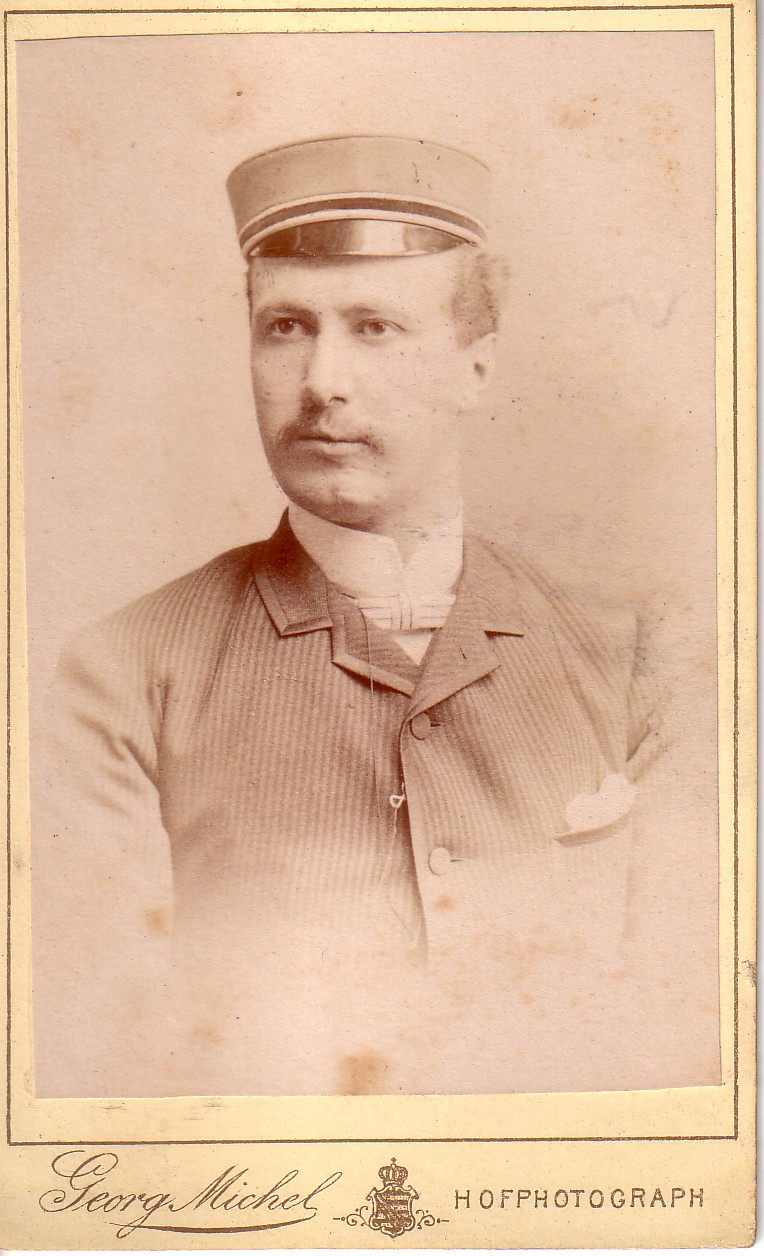
Rudolf von Bennigsen (Bennigsen near Springe, 12 May 1859 – Berlin, 3 May 1912) was a German colonial official. He was the governor of German New Guinea from 1 April 1899 to 10 July 1901. Biography Bennigsen was a son of the Reichstag member Rudolf von Bennigsen. He was descended from an old Hanoverian family, which was named after its Bennigsen estate near Springe. He studied law at the Kaiser Wilhelm University in Strasbourg and in 1878 became a member of the Corps Suevia there. When there was a crisis in the mid-1880s, he became active again and fought as an assessor for the First Batch. For this, Suevia later awarded him honorary membership. The SC-Comradeship of the Corps was named after him in 1941. Bennigsen was government assessor in the Imperial Territory of Alsace-Lorraine, then district administrator of the Prussian district of Peine. In 1893 he became financial director in the colony of German East Africa, where he also acted as deputy to the local ... [...More Info...] [...Related Items...] OR: [Wikipedia] [Google] [Baidu] |
List Of Colonial Governors Of Papua New Guinea
This article lists the colonial governors of Papua New Guinea, from the establishment of German New Guinea in 1884 until the independence of the Territory of Papua and New Guinea in 1975. List (Dates in italics indicate ''de facto'' continuation of office) New Guinea In 1945, the Territory of New Guinea was merged with the Territory of Papua to form the Territory of Papua and New Guinea. The merger was formalized with the passage of the Papua and New Guinea Act 1949. Papua In 1945, the Territory of Papua was merged with the Territory of New Guinea to form the Territory of Papua and New Guinea. The merger was formalized with the passage of the Papua and New Guinea Act 1949. Papua New Guinea On 16 September 1975, Papua New Guinea achieved independence following the passage of the Papua New Guinea Independence Act 1975. For a list of viceroys in Papua New Guinea after independence, see Governor-General of Papua New Guinea. See also * Papua New Guinea * ... [...More Info...] [...Related Items...] OR: [Wikipedia] [Google] [Baidu] |
Mariana Islands
The Mariana Islands (; also the Marianas; in Chamorro: ''Manislan Mariånas'') are a crescent-shaped archipelago comprising the summits of fifteen longitudinally oriented, mostly dormant volcanic mountains in the northwestern Pacific Ocean, between the 12th and 21st parallels north and along the 145th meridian east. They lie south-southeast of Japan, west-southwest of Hawaii, north of New Guinea and east of the Philippines, demarcating the Philippine Sea's eastern limit. They are found in the northern part of the western Oceanic sub-region of Micronesia, and are politically divided into two jurisdictions of the United States: the Commonwealth of the Northern Mariana Islands and, at the southern end of the chain, the territory of Guam. The islands were named after the influential Spanish queen Mariana of Austria following their colonization in the 17th century. The indigenous inhabitants are the Chamorro people. Archaeologists in 2013 reported findings which indicated that the ... [...More Info...] [...Related Items...] OR: [Wikipedia] [Google] [Baidu] |
Palau
Palau,, officially the Republic of Palau and historically ''Belau'', ''Palaos'' or ''Pelew'', is an island country and microstate in the western Pacific. The nation has approximately 340 islands and connects the western chain of the Caroline Islands with parts of the Federated States of Micronesia. It has a total area of . The most populous island is Koror, home to the country's most populous city of the same name. The capital Ngerulmud is located on the nearby island of Babeldaob, in Melekeok State. Palau shares maritime boundaries with international waters to the north, the Federated States of Micronesia to the east, Indonesia to the south, and the Philippines to the northwest. The country was originally settled approximately 3,000 years ago by migrants from Maritime Southeast Asia. Palau was first drawn on a European map by the Czech missionary Paul Klein based on a description given by a group of Palauans shipwrecked on the Philippine coast on Samar. Palau islands ... [...More Info...] [...Related Items...] OR: [Wikipedia] [Google] [Baidu] |
Caroline Islands
The Caroline Islands (or the Carolines) are a widely scattered archipelago of tiny islands in the western Pacific Ocean, to the north of New Guinea. Politically, they are divided between the Federated States of Micronesia (FSM) in the central and eastern parts of the group, and Palau at the extreme western end. Historically, this area was also called ''Nuevas Filipinas'' or New Philippines, because they were part of the Spanish East Indies and were governed from Manila in the Philippines. The Carolines are scattered across a distance of approximately 3,540 kilometers (2,200 miles), from the westernmost island, Tobi (island), Tobi, in Palau, to the easternmost island, Kosrae, a Administrative divisions of the Federated States of Micronesia, state of the FSM. Description The group consists of about 500 small coral islands, east of the Philippines, in the Pacific Ocean. The distance from Yap (one of the larger Caroline islands) to Manila is . Most of the islands are made up of ... [...More Info...] [...Related Items...] OR: [Wikipedia] [Google] [Baidu] |
Hut Tax
The hut tax was a form of taxation introduced by British in their African possessions on a "per hut" (or other forms of household) basis. It was variously payable in money, labour, grain or stock and benefited the colonial authorities in four interconnected ways, by raising money; supporting the economic value of the local currency; broadening the newly introduced cash-based economy, which aided economic development; and integrating local communities into the new economic system. Households which had primarily been rural ranchers or farmers proceeded to send members to work in the cities or on colonial government-sponsored construction projects to earn money to pay the tax. The new colonial economies in Africa were primarily reliant upon the construction of towns and infrastructure (such as railways), and in South Africa the rapidly expanding mining operations. Union of South Africa By 1908 the following hut taxes were introduced in the colony of South Africa: * In Natal, under La ... [...More Info...] [...Related Items...] OR: [Wikipedia] [Google] [Baidu] |
List Of Governors Of Tanganyika
The colony of German East Africa (german: Deutsch-Ostafrika) was founded in the 1880s, after the German explorer Carl Peters signed treaties with native chieftains on neighboring Zanzibar. On 3 March 1885, the government of the German Empire granted an imperial charter to the German East Africa Company, and a protectorate was established. German colonial rule in the region lasted until World War I, when the British occupied the colony during the East African campaign. The British territory of Tanganyika was established on 20 July 1922, when Britain acquired a mandate to administer the region as a result of Article 22 of the Covenant of the League of Nations. On 18 April 1946, the mandate was reorganized as a Trust Territory of the United Nations. Afterwards, the region remained under British administration until it gained independence on 9 December 1961 as Tanganyika. List (Dates in italics indicate ''de facto'' continuation of office) For continuation after indep ... [...More Info...] [...Related Items...] OR: [Wikipedia] [Google] [Baidu] |
German East Africa
German East Africa (GEA; german: Deutsch-Ostafrika) was a German colony in the African Great Lakes region, which included present-day Burundi, Rwanda, the Tanzania mainland, and the Kionga Triangle, a small region later incorporated into Mozambique. GEA's area was , which was nearly three times the area of present-day Germany and double the area of metropolitan Germany at the time. The colony was organised when the German military was asked in the late 1880s to put down a revolt against the activities of the German East Africa Company. It ended with Imperial Germany's defeat in World War I. Ultimately GEA was divided between Britain, Belgium and Portugal and was reorganised as a mandate of the League of Nations. History Like other colonial powers the Germans expanded their empire in the Africa Great Lakes region, ostensibly to fight slavery and the slave trade. Unlike other imperial powers, however they never formally abolished either slavery or the slave trade and preferre ... [...More Info...] [...Related Items...] OR: [Wikipedia] [Google] [Baidu] |
German Colonial Empire
The German colonial empire (german: Deutsches Kolonialreich) constituted the overseas colonies, dependencies and territories of the German Empire. Unified in the early 1870s, the chancellor of this time period was Otto von Bismarck. Short-lived attempts at colonization by individual German states had occurred in preceding centuries, but Bismarck resisted pressure to construct a colonial empire until the Scramble for Africa in 1884. Claiming much of the left-over uncolonized areas of Africa, Germany built the third-largest colonial empire at the time, after the British and French. The German Colonial Empire encompassed parts of several African countries, including parts of present-day Burundi, Rwanda, Tanzania, Namibia, Cameroon, Gabon, Congo, Central African Republic, Chad, Nigeria, Togo, Ghana, as well as northeastern New Guinea, Samoa and numerous Micronesian islands. Including mainland Germany, the empire had a total land area of 3,503,352 square kilometers and pop ... [...More Info...] [...Related Items...] OR: [Wikipedia] [Google] [Baidu] |
Peine (district)
Peine is a district in Lower Saxony, Germany. It is bounded by (from the south and clockwise) the districts of Hildesheim, Hanover and Gifhorn, and the cities of Brunswick and Salzgitter. History Until the early 19th century, the territory of the district belonged to Brunswick-Celle, Brunswick-Wolfenbüttel, and the Bishopric of Hildesheim. After 1815, both Brunswick-Celle and Hildesheim belonged to the Kingdom of Hanover. In 1866, Hanover fell to Prussia. The Prussian administration established districts (''Kreise'') in 1885, among them Peine. The region has a smelting tradition, the associated mining tradition lasted until 1976 when the last existing mine was closed. One of the best known events in local history was the mining disaster of Lengede in 1963, when 29 miners died and 11 miners were rescued two weeks after the incident. Geography The district comprises the space between the cities of Hanover and Brunswick. The Fuhse river enters the district in the south, runs ... [...More Info...] [...Related Items...] OR: [Wikipedia] [Google] [Baidu] |
Districts Of Prussia
Prussian districts (german: Kreise, literally "circles") were administrative units in the former Kingdom of Prussia, part of the German Empire from 1871 to 1918, and its successor state, the Free State of Prussia, similar to a county or a shire. They were established in the course of the Stein-Hardenberg Reforms from 1815 to 1818 at an intermediate level, between the higher provinces and the government districts (''Regierungsbezirke''), and the lower municipal governments ('' Gemeinden''). Then part of a modern and highly effective public administration structure, they served as a model for the present-day districts of Germany In the aftermath of World War I, the Prussian districts of Eupen and Malmedy (Belgium) were annexed by Belgium in 1925, thereby causing the presence of a German-speaking minority. Administration After the Napoleonic Wars and the 1815 Congress of Vienna, the Prussian lands were re-arranged into ten provinces, three of them—East Prussia, West Prussia and ... [...More Info...] [...Related Items...] OR: [Wikipedia] [Google] [Baidu] |


.jpg)