|
Ronalds Point
Ronalds Point is the rocky point on the north coast of Elephant Island in the South Shetland Islands, Antarctica situated just east of the terminus of Snellius Glacier. The area was visited by early 19th century sealers.A. Gurney. ''Below the Convergence: Voyages Toward Antarctica, 1699-1839.'' New York: Penguin Books, 1998. 315 pp. The feature is named after Francis Ronalds (1788-1873), a British scientist and inventor who modified the octant to create the surveying sector; in association with other names in the area deriving from the early development or use of geodetic instruments and methods. Location Ronalds Point is located at ,Bulgarian Antarctic Gazetteer. Antarctic Place-names Commission which is 22.4 km east-southeast of |
South Shetland Islands Map
South is one of the cardinal directions or Points of the compass, compass points. The direction is the opposite of north and is perpendicular to both east and west. Etymology The word ''south'' comes from Old English ''sūþ'', from earlier Proto-Germanic language, Proto-Germanic ''*sunþaz'' ("south"), possibly related to the same Proto-Indo-European language, Proto-Indo-European root that the word ''sun'' derived from. Some languages describe south in the same way, from the fact that it is the direction of the sun at noon (in the Northern Hemisphere), like Latin meridies 'noon, south' (from medius 'middle' + dies 'day', cf English meridional), while others describe south as the right-hand side of the rising sun, like Biblical Hebrew תֵּימָן teiman 'south' from יָמִין yamin 'right', Aramaic תַּימנַא taymna from יָמִין yamin 'right' and Syriac ܬܰܝܡܢܳܐ taymna from ܝܰܡܝܺܢܳܐ yamina (hence the name of Yemen, the land to the south/right of the ... [...More Info...] [...Related Items...] OR: [Wikipedia] [Google] [Baidu] |
Elephant Island (map-en)
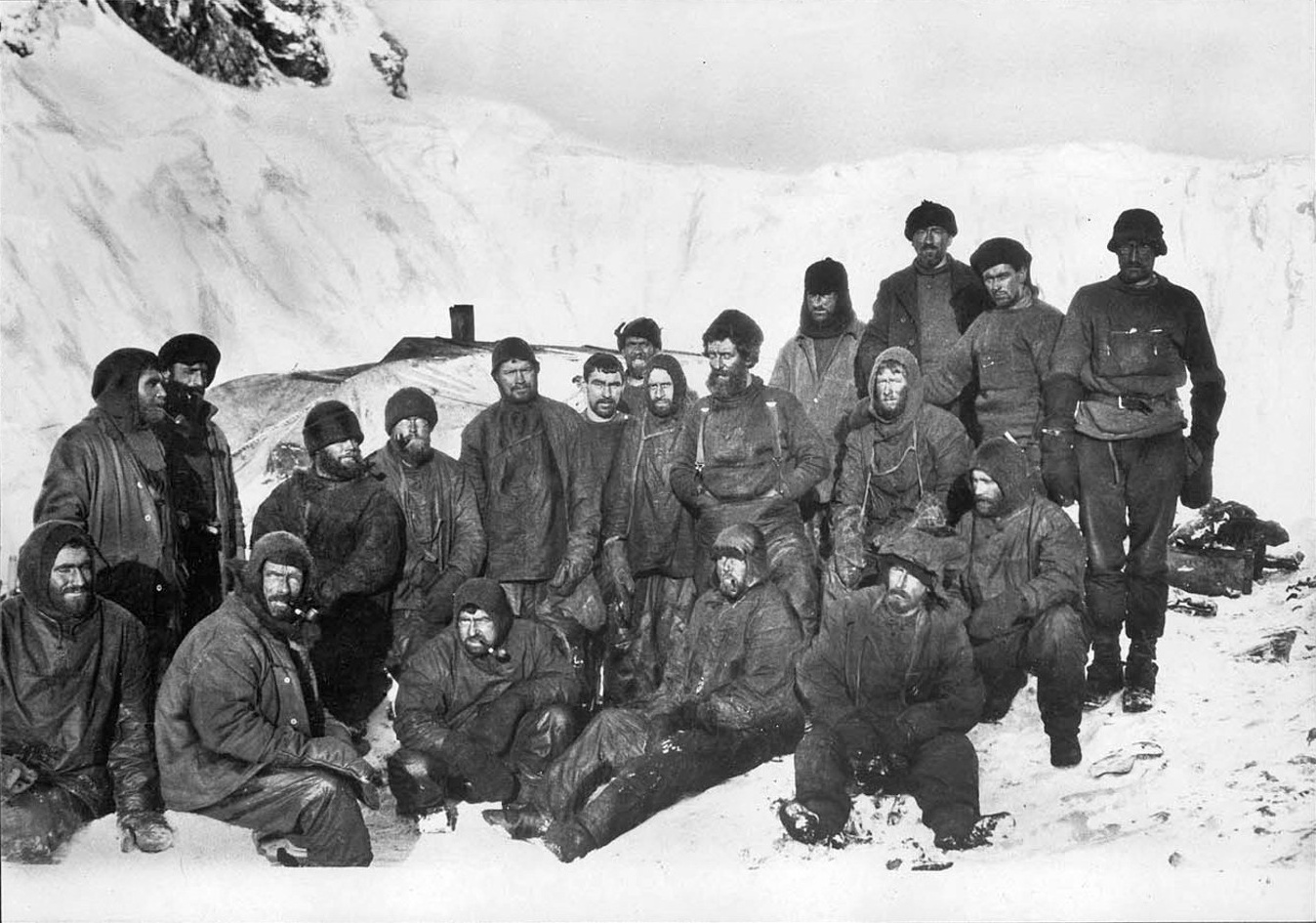
Elephant Island is an ice-covered, mountainous island off the coast of Antarctica in the outer reaches of the South Shetland Islands, in the Southern Ocean. The island is situated north-northeast of the tip of the Antarctic Peninsula, west-southwest of South Georgia, south of the Falkland Islands, and southeast of Cape Horn. It is within the Antarctic claims of Argentina, Chile and the United Kingdom. The Brazilian Antarctic Program maintains a shelter on the island, Goeldi, and formerly had another ( Wiltgen), which was dismantled in the summers of 1997 and 1998, supporting the work of up to six researchers each during the summer. Toponym Elephant Island's name is attributed to both its elephant head-like appearance and the sighting of elephant seals by Captain George Powell in 1821, one of the earliest sightings. However, in Russia it is still known under the name given by its discoverers in 1821 – Mordvinov Island. Geography Elephant Island marks the western end o ... [...More Info...] [...Related Items...] OR: [Wikipedia] [Google] [Baidu] |
Elephant Island
Elephant Island is an ice-covered, mountainous island off the coast of Antarctica in the outer reaches of the South Shetland Islands, in the Southern Ocean. The island is situated north-northeast of the tip of the Antarctic Peninsula, west-southwest of South Georgia, south of the Falkland Islands, and southeast of Cape Horn. It is within the Antarctic claims of Argentina, Chile and the United Kingdom. The Brazilian Antarctic Program maintains a shelter on the island, Goeldi, supporting the work of up to six researchers each during the summer, and formerly had another ( Wiltgen), which was dismantled in the summers of 1997 and 1998. Toponym Elephant Island's name is attributed to both its elephant head-like appearance and the sighting of elephant seals by Captain George Powell in 1821, one of the earliest sightings. However, in Russia it is still known under the name given by its discoverers in 1821 – Mordvinova Island. Geography The island is oriented approximately ... [...More Info...] [...Related Items...] OR: [Wikipedia] [Google] [Baidu] |
South Shetland Islands
The South Shetland Islands are a group of Antarctic islands with a total area of . They lie about north of the Antarctic Peninsula, and between southwest of the nearest point of the South Orkney Islands. By the Antarctic Treaty of 1959, the islands' sovereignty is neither recognized nor disputed by the signatories and they are free for use by any signatory for non-military purposes. The islands have been claimed by the United Kingdom since 1908 and as part of the British Antarctic Territory since 1962. They are also claimed by the governments of Chile (since 1940, as part of the Antártica Chilena province) and Argentina (since 1943, as part of Argentine Antarctica, Tierra del Fuego Province). Several countries maintain research stations on the islands. Most of them are situated on King George Island, benefitting from the airfield of the Chilean base Eduardo Frei. There are sixteen research stations in different parts of the islands, with Chilean stations being ... [...More Info...] [...Related Items...] OR: [Wikipedia] [Google] [Baidu] |
Antarctica
Antarctica () is Earth's southernmost and least-populated continent. Situated almost entirely south of the Antarctic Circle and surrounded by the Southern Ocean, it contains the geographic South Pole. Antarctica is the fifth-largest continent, being about 40% larger than Europe, and has an area of . Most of Antarctica is covered by the Antarctic ice sheet, with an average thickness of . Antarctica is, on average, the coldest, driest, and windiest of the continents, and it has the highest average elevation. It is mainly a polar desert, with annual precipitation of over along the coast and far less inland. About 70% of the world's freshwater reserves are frozen in Antarctica, which, if melted, would raise global sea levels by almost . Antarctica holds the record for the lowest measured temperature on Earth, . The coastal regions can reach temperatures over in summer. Native species of animals include mites, nematodes, penguins, seals and tardigrades. Where vegetation o ... [...More Info...] [...Related Items...] OR: [Wikipedia] [Google] [Baidu] |
Glacier Terminus
A glacier terminus, toe, or snout, is the end of a glacier at any given point in time. Although glaciers seem motionless to the observer, in reality glaciers are in endless motion and the glacier terminus is always either advancing or retreating. The location of the terminus is often directly related to glacier mass balance, which is based on the amount of snowfall which occurs in the accumulation zone of a glacier, as compared to the amount that is melted in the ablation zone. The position of a glacier terminus is also impacted by localized or regional temperature change over time. Tracking Tracking the change in location of a glacier terminus is a method of monitoring a glacier's movement. The end of the glacier terminus is measured from a fixed position in neighboring bedrock periodically over time. The difference in location of a glacier terminus as measured from this fixed position at different time intervals provides a record of the glacier's change. A similar way of trac ... [...More Info...] [...Related Items...] OR: [Wikipedia] [Google] [Baidu] |
Snellius Glacier
Snellius Glacier ( bg, ледник Снелий, lednik Snellius, ) is the glacier extending 7 km in west–east direction and 3 km in south–north direction on the north coast of Elephant Island in the South Shetland Islands, Antarctica draining the north slopes of Pardo Ridge and flowing northwards into Drake Passage between Eratosthenes Point and Ronalds Point. The area was visited by early 19th century sealers.A. Gurney. ''Below the Convergence: Voyages Toward Antarctica, 1699-1839.'' New York: Penguin Books, 1998. 315 pp. The feature is named after Willebrord Snellius (Willebrord Snel van Royen, 1580–1626), a Dutch astronomer and mathematician who was the first to survey distances by triangulation; in association with other names in the area deriving from the early development or use of geodetic instruments and methods. Location Snellius Glacier is centred at . [...More Info...] [...Related Items...] OR: [Wikipedia] [Google] [Baidu] |
Seal Hunting
Seal hunting, or sealing, is the personal or commercial hunting of seals. Seal hunting is currently practiced in ten countries: United States (above the Arctic Circle in Alaska), Canada, Namibia, Denmark (in self-governing Greenland only), Iceland, Norway, Russia, Finland and Sweden. Most of the world's seal hunting takes place in Canada and Greenland. The Canadian Department of Fisheries and Oceans (DFO) regulates the seal hunt in Canada. It sets quotas (total allowable catch – TAC), monitors the hunt, studies the seal population, works with the Canadian Sealers' Association to train sealers on new regulations, and promotes sealing through its website and spokespeople. The DFO set harvest quotas of over 90,000 seals in 2007; 275,000 in 2008; 280,000 in 2009; and 330,000 in 2010. The actual kills in recent years have been less than the quotas: 82,800 in 2007; 217,800 in 2008; 72,400 in 2009; and 67,000 in 2010. In 2007, Norway claimed that 29,000 harp seals were killed, Russ ... [...More Info...] [...Related Items...] OR: [Wikipedia] [Google] [Baidu] |
Francis Ronalds
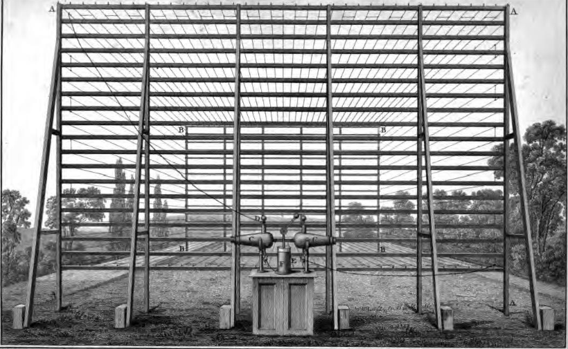
Sir Francis Ronalds FRS (21 February 17888 August 1873) was an English scientist and inventor, and arguably the first electrical engineer. He was knighted for creating the first working electric telegraph over a substantial distance. In 1816 he laid an eight-mile length of iron wire between wooden frames in his mother's garden and sent pulses using electrostatic generators. Upbringing and family Born to Francis Ronalds and Jane (née Field), wholesale cheesemongers, at their business premises in Upper Thames Street, London, he attended Unitarian minister Eliezer Cogan's school before being apprenticed to his father at the age of 14 through the Drapers' Company. He ran the large business for some years. The family later resided in Canonbury Place and Highbury Terrace, both in Islington, at Kelmscott House in Hammersmith, Queen Square in Bloomsbury, at Croydon, and on Chiswick Lane. Several of Ronalds' eleven brothers and sisters also led noteworthy lives. His younges ... [...More Info...] [...Related Items...] OR: [Wikipedia] [Google] [Baidu] |
Octant (instrument)
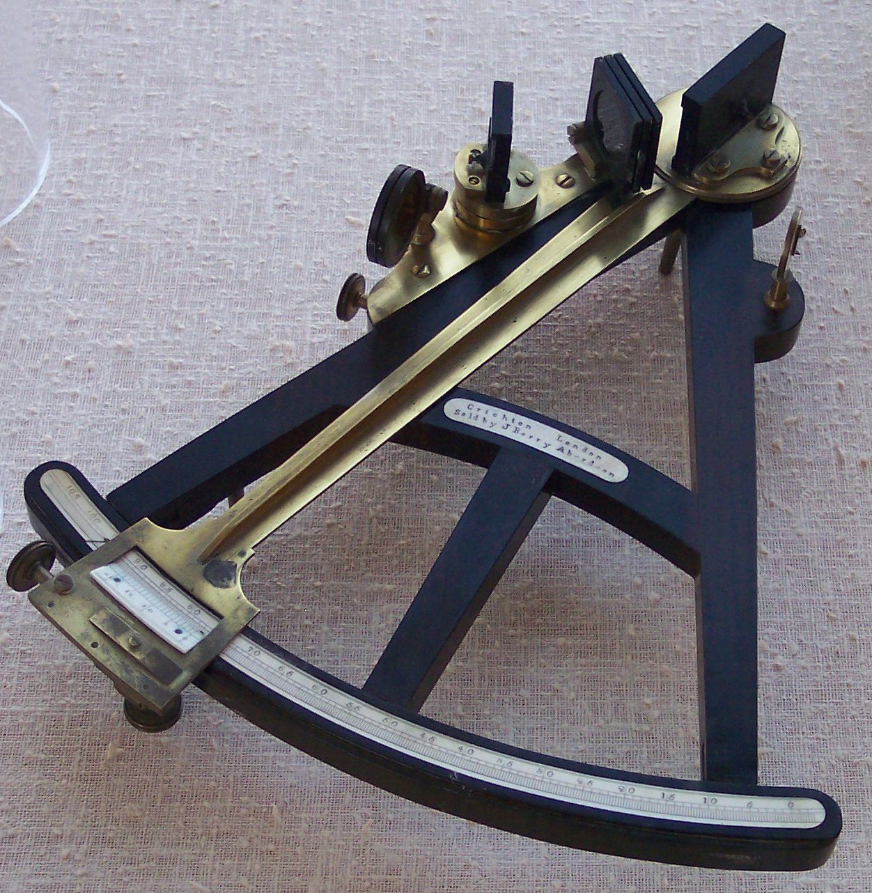
The octant, also called a reflecting quadrant (instrument), quadrant, is a reflecting instrument used in navigation. Etymology The name ''octant'' derives from the Latin ''octans'' meaning ''eighth part of a circle'', because the instrument's arc is one eighth of a circle. ''Reflecting quadrant'' derives from the instrument using mirrors to reflect the path of light to the observer and, in doing so, doubles the angle measured. This allows the instrument to use a one-eighth of a Turn (geometry), turn to measure a quarter-Turn (geometry), turn or Circular sector, quadrant. Origin of the octant Newton's reflecting quadrant Isaac Newton's reflecting quadrant was invented around 1699. A detailed description of the instrument was given to Edmond Halley, but the description was not published until after Halley's death in 1742. It is not known why Halley did not publish the information during his life, as this prevented Newton from getting the credit for the invention that is gene ... [...More Info...] [...Related Items...] OR: [Wikipedia] [Google] [Baidu] |
Reflecting Instrument
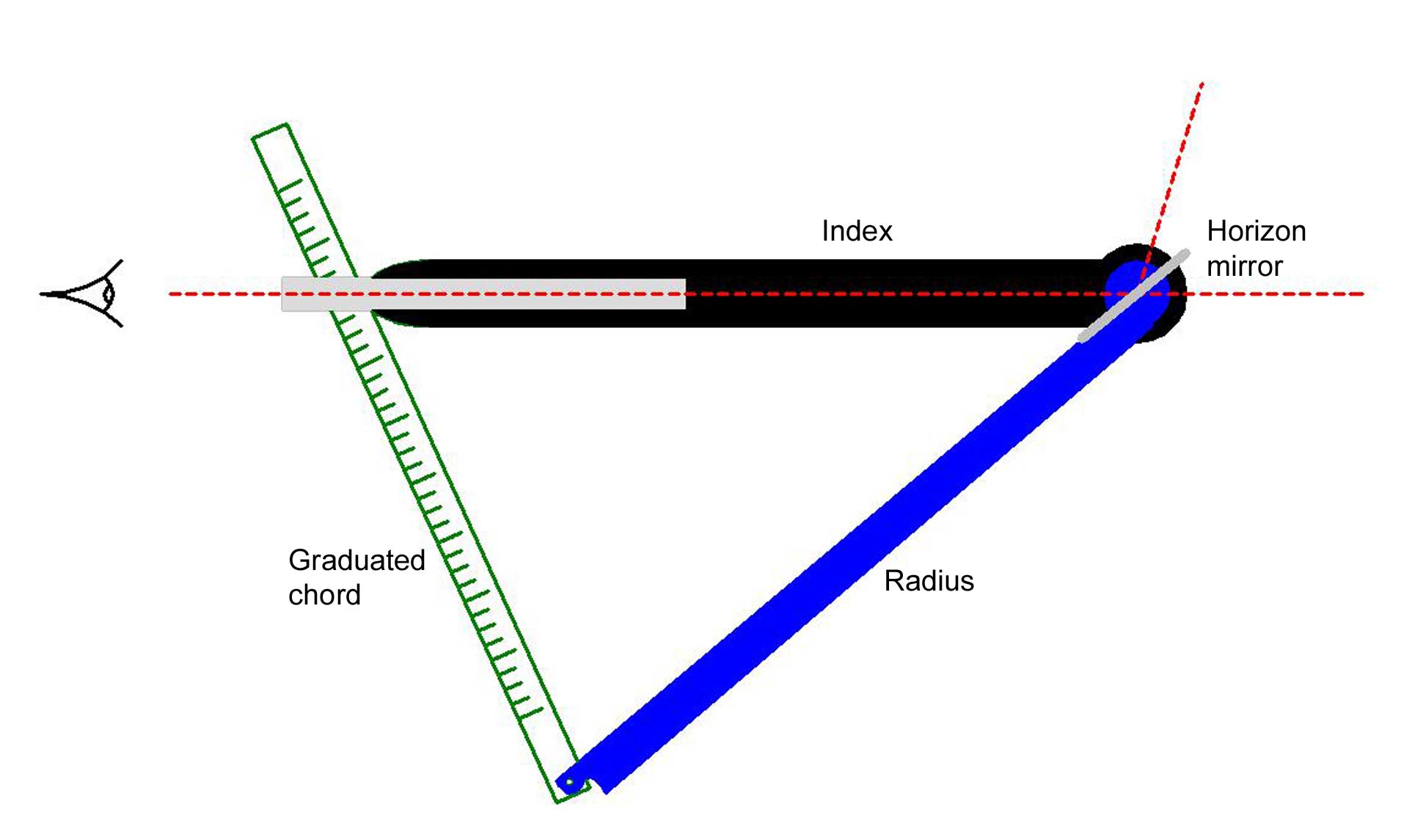
Reflecting instruments are those that use mirrors to enhance their ability to make measurements. In particular, the use of mirrors permits one to observe two objects simultaneously while measuring the angular distance between the objects. While reflecting instruments are used in many professions, they are primarily associated with celestial navigation as the need to solve navigation problems, in particular the problem of the longitude, was the primary motivation in their development. Objectives of the instruments The purpose of reflecting instruments is to allow an observer to measure the altitude of a celestial object or measure the angular distance between two objects. The driving force behind the developments discussed here was the solution to the problem of finding one's longitude at sea. The solution to this problem was seen to require an accurate means of measuring angles and the accuracy was seen to rely on the observer's ability to measure this angle by simultaneously ob ... [...More Info...] [...Related Items...] OR: [Wikipedia] [Google] [Baidu] |
Geodesy
Geodesy ( ) is the Earth science of accurately measuring and understanding Earth's figure (geometric shape and size), orientation in space, and gravity. The field also incorporates studies of how these properties change over time and equivalent measurements for other planets (known as '' planetary geodesy''). Geodynamical phenomena, including crustal motion, tides and polar motion, can be studied by designing global and national control networks, applying space geodesy and terrestrial geodetic techniques and relying on datums and coordinate systems. The job title is geodesist or geodetic surveyor. History Definition The word geodesy comes from the Ancient Greek word ''geodaisia'' (literally, "division of Earth"). It is primarily concerned with positioning within the temporally varying gravitational field. Geodesy in the German-speaking world is divided into "higher geodesy" ( or ), which is concerned with measuring Earth on the global scale, and "practical geodes ... [...More Info...] [...Related Items...] OR: [Wikipedia] [Google] [Baidu] |


.jpg)


