|
Rathenow Railway Station
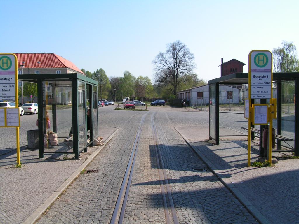
Rathenow (german: Bahnhof Rathenow) is a railway station on the Berlin–Lehrte railway located in Rathenow, in the Havelland, Germany. It is used by about 3,300 passengers daily. The station consists of the main building, located on the ''Dunckerplatz'' ("Duncker place"), later partly renamed as the ''Bahnhofsvorplatz'' (“station forecourt”), a disused water tower and the former entrance building for the German Emperor, which now serves as a tourist information office and a bike rental agency. The station also has a platform subway connecting to platform tracks 3 and 4, which are used by the Brandenburg Towns Railway (''Brandenburgische Städtebahn''), a parking area with 133 spaces and parking for 80 bicycles, 20 of which are covered. Rathenow station also included a terminus of the former 750 mm gauge Rathenow-Senzke-Nauen District Railway (''Kreisbahn Rathenow-Senzke-Nauen''). Outside the station there are still remnants of the tracks of the District Railway, which ar ... [...More Info...] [...Related Items...] OR: [Wikipedia] [Google] [Baidu] |
Rathenow
Rathenow () is a town in the district of Havelland in Brandenburg, Germany, with a population of 24,063 (2020). Overview The Protestant church of St. Marien Andreas, originally a basilica, and transformed to the Gothic style in 1517-1589, and the Roman Catholic Church of St. George, are noteworthy. Rathenow is known for being the former capital of eyewear manufacturing in East Germany. It is also known for its stones, called Rathenow stones. After the fall of the Soviet Union, it was revealed that the remains of Hitler and his assistants were secretly buried in graves near Rathenow.V.K. Vinogradov and others, ''Hitler's Death: Russia's Last Great Secret from the Files of the KGB'', Chaucer Press 2005, 111. This work reproduces a Soviet map showing that the bodies were buried in a field near the village of Neu Friedrichsdorf, approximately one kilometre east of Rathenow. Demography File:Bevölkerungsentwicklung Rathenow.pdf, Development of Population since 1875 within the Curre ... [...More Info...] [...Related Items...] OR: [Wikipedia] [Google] [Baidu] |
Neustadt (Dosse)
Neustadt (Dosse) is a town in the district of Ostprignitz-Ruppin, Brandenburg, Germany with a population of 3,575 (as of 2010). It has a total area of 75.43 km², and lies close to the river Dosse. History Neustadt was founded in 1407 by the Count of Ruppin. In 1788, the Prussian king Friedrich William II expanded the town and his stud. Until today, the national stud of Brandenburg (Brandenburgisches Haupt- und Landgestüt, i.e. Brandenburgian Main and State Stud) is located in Neustadt which is thus a principal place of the horse breeding in Brandenburg, especially for horses of the Brandenburger breed. Areas Babe, Helenenhof, Kampehl, Köritz, Leddin, Lindenau, Neuhof, Neuroddahn, Plänitz, Schönfeld, Spiegelberg, and Strubbergshof. Demography Mayor Sabine Ehrlich (SPD) was elected in May 2014 with 54,3 % of the votes for a term of five years. Sightseeing The mummy of Christian Friedrich von Kahlbutz is located in Kampehl, which is a locality of Neustadt (Do ... [...More Info...] [...Related Items...] OR: [Wikipedia] [Google] [Baidu] |
Buildings And Structures In Havelland (district)
A building, or edifice, is an enclosed structure with a roof and walls standing more or less permanently in one place, such as a house or factory (although there's also portable buildings). Buildings come in a variety of sizes, shapes, and functions, and have been adapted throughout history for a wide number of factors, from building materials available, to weather conditions, land prices, ground conditions, specific uses, prestige, and aesthetic reasons. To better understand the term ''building'' compare the list of nonbuilding structures. Buildings serve several societal needs – primarily as shelter from weather, security, living space, privacy, to store belongings, and to comfortably live and work. A building as a shelter represents a physical division of the human habitat (a place of comfort and safety) and the ''outside'' (a place that at times may be harsh and harmful). Ever since the first cave paintings, buildings have also become objects or canvasses of much artis ... [...More Info...] [...Related Items...] OR: [Wikipedia] [Google] [Baidu] |
Railway Stations In Brandenburg
Rail transport (also known as train transport) is a means of transport that transfers passengers and goods on wheeled vehicles running on rails, which are incorporated in Track (rail transport), tracks. In contrast to road transport, where the vehicles run on a prepared flat surface, rail vehicles (rolling stock) are directionally guided by the tracks on which they run. Tracks usually consist of steel rails, installed on Railroad tie, sleepers (ties) set in track ballast, ballast, on which the rolling stock, usually fitted with metal wheels, moves. Other variations are also possible, such as "slab track", in which the rails are fastened to a concrete foundation resting on a prepared subsurface. Rolling stock in a rail transport system generally encounters lower friction, frictional resistance than rubber-tyred road vehicles, so passenger and freight cars (carriages and wagons) can be coupled into longer trains. The rail transport operations, operation is carried out by a ... [...More Info...] [...Related Items...] OR: [Wikipedia] [Google] [Baidu] |
Regional-Express
In Germany, Luxembourg and Austria, the Regional-Express (RE, or in Austria: REX) is a type of regional train. It is similar to a semi-fast train, with average speed at about 70–90 km/h (top speed often 160 km/h) as it calls at fewer stations than '' Regionalbahn'' or S-Bahn trains, but stops more often than ''InterCity'' services. Operations The first Regional-Express services were operated by DB Regio, though since the liberalisation of the German rail market (''Bahnreform'') in the 1990s many operators have received franchise rights on lines from the federal states. Some private operators currently operate trains that are similar to a Regional-Express service, but have decided to use their own names for the sake of brand awareness instead. Regional-Express services are carried out with a variety of vehicles such as DMUs (of Class 612), EMUs (of Class 425 or 426) or, most commonly, electric or diesel locomotives with double-deck cars, the latter often with ... [...More Info...] [...Related Items...] OR: [Wikipedia] [Google] [Baidu] |
Stendal Station
The Hanseatic City of Stendal () is a town in Saxony-Anhalt, Germany. It is the capital of the Stendal District and the unofficial capital of the Altmark region. Geography Situated west of the Elbe valley, the Stendal town centre is located some west of Berlin, around east of Hanover, and north of the state capital Magdeburg. Stendal is the seat of a University of Applied Sciences ('' Fachhochschule'') and preserves a picturesque old town including a historic market and several churches. The nearby village Uchtspringe is home to a psychiatric rehabilitation clinic. Divisions The town Stendal consists of Stendal proper and the following 18 ''Ortschaften'' or municipal divisions:Hauptsatzung der Hansestadt Stendal November 2018. *Bindfelde *Borstel * [...More Info...] [...Related Items...] OR: [Wikipedia] [Google] [Baidu] |
Wustermark Station
Wustermark station is a railway station in the town of Wustermark in the Havelland region of the German state of Brandenburg, to the west of Berlin. The station is located on the Berlin–Lehrte railway and is connected with the Jüterbog–Nauen railway (originally built as part of a freight bypass), part of which became part of the Berlin outer ring in the 1950s. It is classified by Deutsche Bahn as a category 5 station. Location The station is located at the km 30.5 of the Berlin–Lehrte railway on the northern outskirts of Wustermark, about 500 metres north of the centre of the town. About two kilometres to its east the Berlin outer ring crosses the Lehrte railway. Four kilometres to the east, beyond the outer ring, is the Wustermark marshalling yard (''Rangierbahnhof''), which is often colloquially referred to as "Wustermark", but it is not to be confused with Wustermark station. History The station was opened in 1871 with the Lehrte railway. The section of the Jüter ... [...More Info...] [...Related Items...] OR: [Wikipedia] [Google] [Baidu] |
Berlin Outer Ring
The Berlin outer ring (german: Berliner Außenring, BAR) is a long double track electrified railway, originally built by the German Democratic Republic to bypass West Berlin in preparation for the building of the Berlin Wall during the division of Germany. It was developed by East Germany for economic, transport policy, and military reasons between 1951 and 1961 and included parts of some older lines (Outer Freight Ring, Jüterbog–Nauen railway, and Michendorf–Großbeeren railway). Without the completion of the outer ring it would not have been possible to build the Berlin Wall, sealing off West Berlin, without disrupting East Germany’s transport links. The Potsdam-Schönefeld Expressway was built for similar reasons. The term ''Outer ring'' is used to distinguish the line from the Ring line of inner Berlin. Route Starting at the Anhalt line in the south, the outer ring runs from Genshagener Heide to Schönefeld Airport, Grünau Cross, Wuhlheide, Schönfließ, Go ... [...More Info...] [...Related Items...] OR: [Wikipedia] [Google] [Baidu] |
East Berlin
East Berlin was the ''de facto'' capital city of East Germany from 1949 to 1990. Formally, it was the Allied occupation zones in Germany, Soviet sector of Berlin, established in 1945. The American, British, and French sectors were known as West Berlin. From 13 August 1961 until 9 November 1989, East Berlin was separated from West Berlin by the Berlin Wall. The Western Allied powers did not recognize East Berlin as the GDR's capital, nor the GDR's authority to govern East Berlin. On 3 October 1990, the day Germany was officially German reunification, reunified, East and West Berlin formally reunited as the city of Berlin. Overview With the London Protocol (1944), London Protocol of 1944 signed on 12 September 1944, the United States, the United Kingdom, and the Soviet Union decided to divide Germany into three occupation zones and to establish a special area of Berlin, which was occupied by the three Allied Forces together. In May 1945, the Soviet Union installed a city gove ... [...More Info...] [...Related Items...] OR: [Wikipedia] [Google] [Baidu] |
Berlin S-Bahn
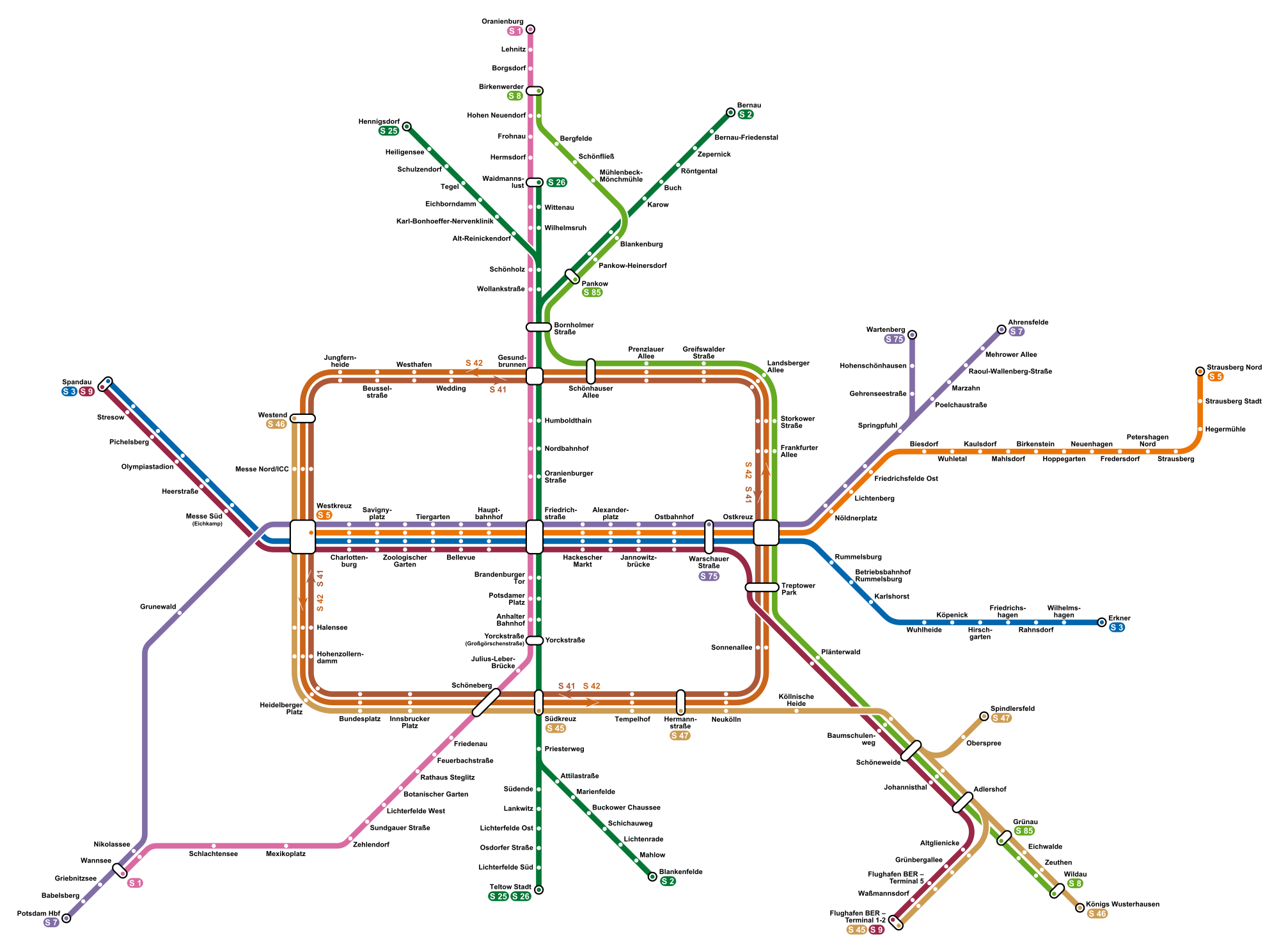
The Berlin S-Bahn () is a rapid transit railway system in and around Berlin, the capital city of Germany. It has been in operation under this name since December 1930, having been previously called the special tariff area ''Berliner Stadt-, Ring- und Vorortbahnen'' (Berlin city, orbital, and suburban railways). It complements the Berlin U-Bahn and is the link to many outer-Berlin areas, such as Berlin Brandenburg Airport. As such, the Berlin S-Bahn blends elements of a commuter rail service and a rapid transit system. In its first decades of operation, the trains were steam-drawn; even after the electrification of large parts of the network, a number of lines remained under steam. Today, the term ''S-Bahn'' is used in Berlin only for those lines and trains with third-rail electrical power transmission and the special Berlin S-Bahn loading gauge. The third unique technical feature of the Berlin S-Bahn, the , is being phased out and replaced by a communications-based train control ... [...More Info...] [...Related Items...] OR: [Wikipedia] [Google] [Baidu] |
West Berlin
West Berlin (german: Berlin (West) or , ) was a political enclave which comprised the western part of Berlin during the years of the Cold War. Although West Berlin was de jure not part of West Germany, lacked any sovereignty, and was under military occupation until German reunification in 1990, the territory was claimed by the West Germany, Federal Republic of Germany (FRG) which was heavily disputed by the Soviet Union and other Eastern Bloc countries. However, West Berlin de facto aligned itself politically with the FRG on 23 May 1949, was directly or indirectly represented in its federal institutions, and most of its residents were citizens of the FRG. West Berlin was formally controlled by the Western Allies and entirely surrounded by the Soviet Union, Soviet-controlled East Berlin and East Germany. West Berlin had great symbolic significance during the Cold War, as it was widely considered by westerners an "island of free world, freedom" and America's most loyal counterpa ... [...More Info...] [...Related Items...] OR: [Wikipedia] [Google] [Baidu] |


_(2).jpg)


.png)