|
Queenwood
Queenwood is a suburb in northern Hamilton in New Zealand. This place is separated by Chartwell Park from Chartwell. It is mostly a residential area, with the typical range of local shops. It is located between River Road and Hukanui Road. Demographics Queenwood statistical area, which also includes Harrowfield, covers and had an estimated population of as of with a population density of people per km2. Queenwood had a population of 2,382 at the 2018 New Zealand census, an increase of 117 people (5.2%) since the 2013 census, and an increase of 144 people (6.4%) since the 2006 census. There were 864 households, comprising 1,149 males and 1,233 females, giving a sex ratio of 0.93 males per female. The median age was 41.1 years (compared with 37.4 years nationally), with 456 people (19.1%) aged under 15 years, 450 (18.9%) aged 15 to 29, 1,062 (44.6%) aged 30 to 64, and 414 (17.4%) aged 65 or older. Ethnicities were 82.2% European/Pākehā, 12.8% Māori, 3.0% Pacific peop ... [...More Info...] [...Related Items...] OR: [Wikipedia] [Google] [Baidu] |
Harrowfield
Harrowfield is a suburb in eastern Hamilton in New Zealand. It was built in about 1991. Part of Tauhara Park borders the suburb. The park has a mini golf area, a playground, sports fields and walkway/cycleway paths, which connect Harrowfield to the Kirikiriroa Stream valley, Queenwood and Flagstaff. Some of the park, on the far side of Wairere Drive, covers the old Rototuna landfill. Since the late 1990s much of the leachate from the landfill has been collected for disposal at Pukete sewage works. However residents were expressing concerns about it in 2012. Christmas lights in the suburb attract many visitors. In 2017 development of a further 22 dwellings, including 8 duplexes, was approved. Previous developments were on plots of around , rather than the higher density of the new one, which backs on to Wairere Drive. Demographics Harrowfield is marked on the 1:50,000 map and is referred to as a suburb in its own right, but as a census area it is part of Queenwood. Harr ... [...More Info...] [...Related Items...] OR: [Wikipedia] [Google] [Baidu] |
List Of Streets In Hamilton, Waikato
Hamilton streets have been formed since the 1864 Invasion of the Waikato, after which the first crown grants were given to members of the occupying force, the 4th Waikato Militia, and plans made of the initial street layout. The tables below show the 1,782 streets listed by Hamilton City Council as at 3 August 2020. They also include information from Hamilton City Libraries Heritage street name index cards. As the dates of naming and the old maps (see External links below) show, the city has grown a lot since it was village in 1864. The shortest roads are small cul-de-sacs, the longest road reaching the centre of the city is River Road, which stretches to Ngāruawāhia. The list is not comprehensive, omitting streets such as Percival Road. The suburbs are as shown on the 2020 list, though there is some inconsistency, such as May and the adjoining June streets being shown in different suburbs. Bader Beerescourt Chartwell Chedworth Claudelands Deanwe ... [...More Info...] [...Related Items...] OR: [Wikipedia] [Google] [Baidu] |
Chartwell, Hamilton
Chartwell is a suburb in north-eastern Hamilton, New Zealand. The suburb was named after Chartwell, the country home of Sir Winston Churchill. The area became a part of Hamilton in June 1962 and was officially defined as a suburb in 1974. Most of the housing is private single or 2 level dwellings with little state housing. Streets near the square are used for parking. Private dwellings are being purchased by professionals to be used as business premises close to the square. The streets are well planted with trees. Features of Chartwell Lynden Court Chartwell's main shopping area is located on Lynden Court. Chartwell Shopping Centre is one of Hamilton's major malls. It has a 6 cinema multiplex as well as 126 retail shops, cafes and restaurants. The Chartwell Library and the Lynden Court Mall are located on the other side of the road. Lynden Court is one of Hamilton's major transport hubs, with bus routes heading into Hamilton Central, Rototuna and the city Orbiter route. Chart ... [...More Info...] [...Related Items...] OR: [Wikipedia] [Google] [Baidu] |
Chartwell Park
Chartwell is a suburb in north-eastern Hamilton, New Zealand. The suburb was named after Chartwell, the country home of Sir Winston Churchill. The area became a part of Hamilton in June 1962 and was officially defined as a suburb in 1974. Most of the housing is private single or 2 level dwellings with little state housing. Streets near the square are used for parking. Private dwellings are being purchased by professionals to be used as business premises close to the square. The streets are well planted with trees. Features of Chartwell Lynden Court Chartwell's main shopping area is located on Lynden Court. Chartwell Shopping Centre is one of Hamilton's major malls. It has a 6 cinema multiplex as well as 126 retail shops, cafes and restaurants. The Chartwell Library and the Lynden Court Mall are located on the other side of the road. Lynden Court is one of Hamilton's major transport hubs, with bus routes heading into Hamilton Central, Rototuna and the city Orbiter route. Chart ... [...More Info...] [...Related Items...] OR: [Wikipedia] [Google] [Baidu] |
Suburbs Of Hamilton, New Zealand
List of Hamilton suburbs. *Aberdeen *Ashmore *Bader * Beerescourt * Callum Brae *Chartwell *Chedworth Park *Claudelands * Crawshaw * Deanwell * Dinsdale *Enderley * Fairfield *Fairview Downs * Fitzroy * Flagstaff * Forest Lake * Frankton * Glenview * Grandview Heights *Hamilton Central * Hamilton East * Hamilton Lake * Hamilton North * Hamilton West * Harrowfield * Hillcrest * Huntington * Livingstone * Magellan Rise *Maeroa * Melville * Nawton * Peacocke *Pukete * Queenwood * River Road * Riverlea *Rotokauri *Rototuna *Ruakura * Silverdale * Stonebridge * St Andrews *St James Park * St Petersburg * Somerset Heights * Stonebridge * Te Rapa *Te Kowhai *Temple View * Thornton * Western Heights *Whitiora Whitiora is a suburb in central Hamilton in New Zealand. The suburb is home to Waikato Stadium, formerly ''Rugby Park''. It is a major sporting and cultural events venue in Hamilton with a total capacity of 25,800. The stadium is a multi-purpos ... {{div col end ... [...More Info...] [...Related Items...] OR: [Wikipedia] [Google] [Baidu] |
River Road, Hamilton
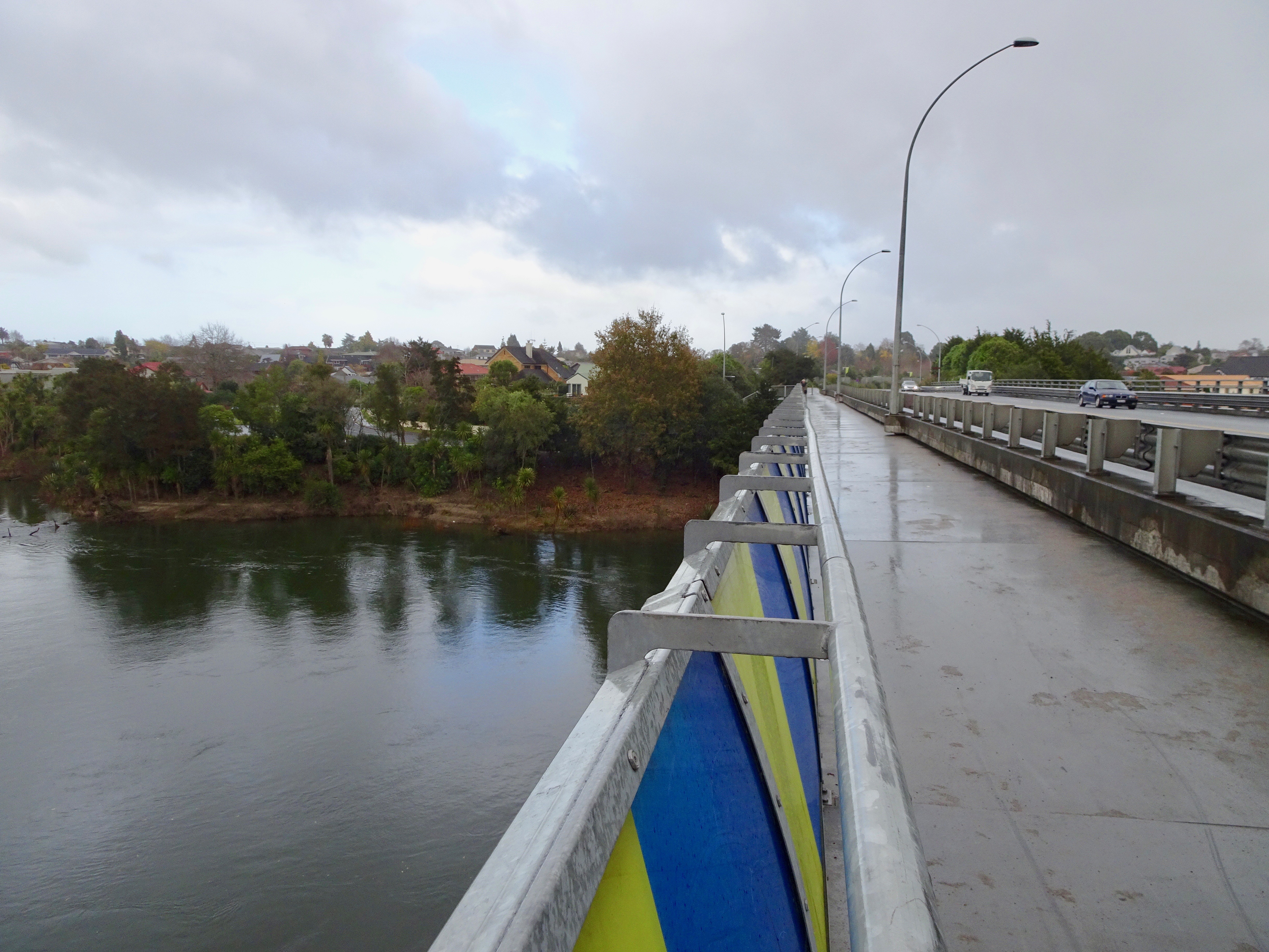
River Road is a residential suburb of Hamilton, sited on the eastern bank of the Waikato River. The namesake road runs from Claudelands Bridge north to Pukete Bridge and beyond, to Ngāruawāhia, but the main part of the suburb is between Boundary Road and Donny Park. Properties close to the river are much more expensive than those further away. Most of River Road was shown on an 1865 map, though it was some years later before it was built and, by 1866, only one bridge had been built. A walking path runs along the river bank, but it does not cover the entire length of the area. Demographics Miropiko statistical area, which corresponds to River Road, covers and had an estimated population of as of with a population density of people per km2. Miropiko had a population of 3,186 at the 2018 New Zealand census, an increase of 9 people (0.3%) since the 2013 census, and an increase of 195 people (6.5%) since the 2006 census. There were 1,185 households, comprising 1,530 males ... [...More Info...] [...Related Items...] OR: [Wikipedia] [Google] [Baidu] |
St Andrews, Hamilton
St Andrews is a suburb in north-western Hamilton in New Zealand. One of its main features is an 18-hole golf course built on an old flood plain on the west bank of the Waikato River. This area was regularly flooded before the construction of the Karapiro HEP dam further up river. Demographics Saint Andrews covers and had an estimated population of as of with a population density of people per km2. Saint Andrews had a population of 5,361 at the 2018 New Zealand census, an increase of 366 people (7.3%) since the 2013 census, and an increase of 210 people (4.1%) since the 2006 census. There were 1,929 households, comprising 2,562 males and 2,796 females, giving a sex ratio of 0.92 males per female, with 1,119 people (20.9%) aged under 15 years, 1,071 (20.0%) aged 15 to 29, 2,304 (43.0%) aged 30 to 64, and 870 (16.2%) aged 65 or older. Ethnicities were 73.5% European/Pākehā, 23.3% Māori, 5.0% Pacific peoples, 11.1% Asian, and 2.4% other ethnicities. People may identify w ... [...More Info...] [...Related Items...] OR: [Wikipedia] [Google] [Baidu] |
Pukete
Pukete is a 1970s riverside suburb in northwestern Hamilton in New Zealand. The cobblestoned walk in the park has a grass dog exercise area. The riverside walkway, which includes many pedestrian bridges, can be used by walkers or cyclists, but the lower sections are subject to flooding in winter. A pedestrian bridge links Braithwaite Park to Flagstaff on the eastern side of the Waikato River. A 2015 River Plan proposed it become 'a flower garden bridge'. There is a small beach on the west side of the river at Braithwaite park often used in summer by water skiers and picnickers. To the north of the residential area is the Pukete Mountain Bike track, an Equestrian centre, and a two-lane launching ramp into the Waikato River, all on the Pukete Farm Park. A concreted riverside track, for bikes and pedestrians, runs north from Mountain View Lane starting by the southeast side of the Fonterra Te Rapa Milk powder factory. The eastern part of Pukete and neighbouring St Andrews is bu ... [...More Info...] [...Related Items...] OR: [Wikipedia] [Google] [Baidu] |
Hamilton, New Zealand
Hamilton ( mi, Kirikiriroa) is an inland city in the North Island of New Zealand. Located on the banks of the Waikato River, it is the seat and most populous city of the Waikato region. With a territorial population of , it is the country's fourth most-populous city. Encompassing a land area of about , Hamilton is part of the wider Hamilton Urban Area, which also encompasses the nearby towns of Ngāruawāhia, Te Awamutu and Cambridge. In 2020, Hamilton was awarded the title of most beautiful large city in New Zealand. The area now covered by the city was originally the site of several Māori villages, including Kirikiriroa, from which the city takes its Māori name. By the time English settlers arrived, most of these villages, which sat beside the Waikato River, were abandoned as a result of the Invasion of Waikato and land confiscation (''Raupatu'') by the Crown. Initially an agricultural service centre, Hamilton now has a diverse economy and is the third fastest growin ... [...More Info...] [...Related Items...] OR: [Wikipedia] [Google] [Baidu] |
Pasifika New Zealanders
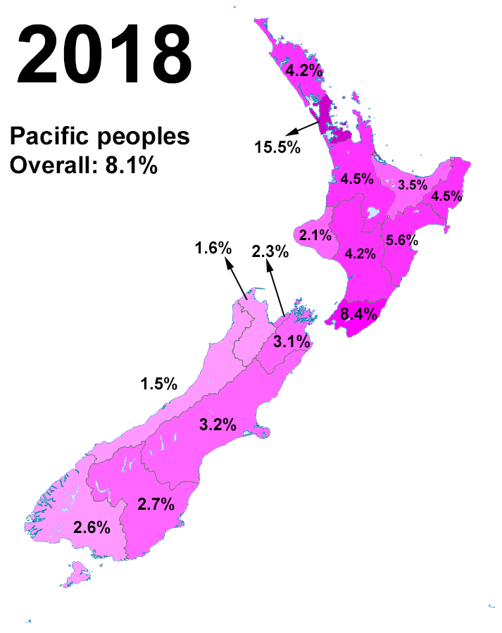
Pasifika New Zealanders are a pan-ethnic group of New Zealanders associated with, and descended from, the indigenous peoples of the Pacific Islands outside of New Zealand itself (also known as Pacific Islanders). They form the fourth-largest ethnic grouping in the country, after European-descended Pākehā, indigenous Māori, and Asian New Zealanders. There are over 380,000 Pasifika people in New Zealand, with the majority living in Auckland. 8% of the population of New Zealand identifies as being of Pacific origin. History Prior to the Second World War Pasifika in New Zealand numbered only a few hundred. Wide-scale Pasifika migration to New Zealand began in the 1950s and 1960s, typically from countries associated with the Commonwealth and the Realm of New Zealand, including Western Samoa (modern-day Samoa), the Cook Islands and Niue. In the 1970s, governments (both Labour and National), migration officials, and special police squads targeted Pasifika illegal overstayers. ... [...More Info...] [...Related Items...] OR: [Wikipedia] [Google] [Baidu] |
Buddhism In New Zealand
Buddhism is New Zealand's third-largest religion after Christianity and Hinduism standing at 1.5% of the population of New Zealand. Buddhism originates in Asia and was introduced to New Zealand by immigrants from East Asia. History The first Buddhists in New Zealand were Chinese diggers in the Otago goldfields in the 1860s. Their numbers were small, and the 1926 census, the first to include Buddhism, recorded only 169. In the 1970s travel to Asian countries and visits by Buddhist teachers sparked an interest in the religious traditions of Asia, and significant numbers of New Zealanders adopted Buddhist practices and teachings. Since the 1980s Asian migrants and refugees have established their varied forms of Buddhism in New Zealand. In the 2010s more than 50 groups, mostly in the Auckland region, offered different Buddhist traditions at temples, centres, monasteries and retreat centres. Many migrant communities brought priests or religious specialists from their own countries an ... [...More Info...] [...Related Items...] OR: [Wikipedia] [Google] [Baidu] |
Islam In New Zealand
Islam in New Zealand is a religious affiliation representing about 1.3% of the total population. Small numbers of Muslim immigrants from South Asia and eastern Europe settled in New Zealand from the early 1900s until the 1960s. Large-scale Muslim immigration began in the 1970s with the arrival of Fiji Indians, followed in the 1990s by refugees from various war-torn countries. The first Islamic centre in New Zealand opened in 1959 and there are now several mosques and two Islamic schools. The majority of Muslims in New Zealand are Sunni, with significant Shia and Ahmadiyya minorities. The Ahmadiyya Community has translated the Qur'an into the Māori language. History Early migration, 19th century The earliest Muslim presence in New Zealand dates back to the late 19th century. The first Muslims in New Zealand were an Indian family who settled in Cashmere, Christchurch, in the 1850s. The 1874 government census reported 15 Chinese Muslim gold diggers working in the Dunstan gold ... [...More Info...] [...Related Items...] OR: [Wikipedia] [Google] [Baidu] |


