|
Purfleet
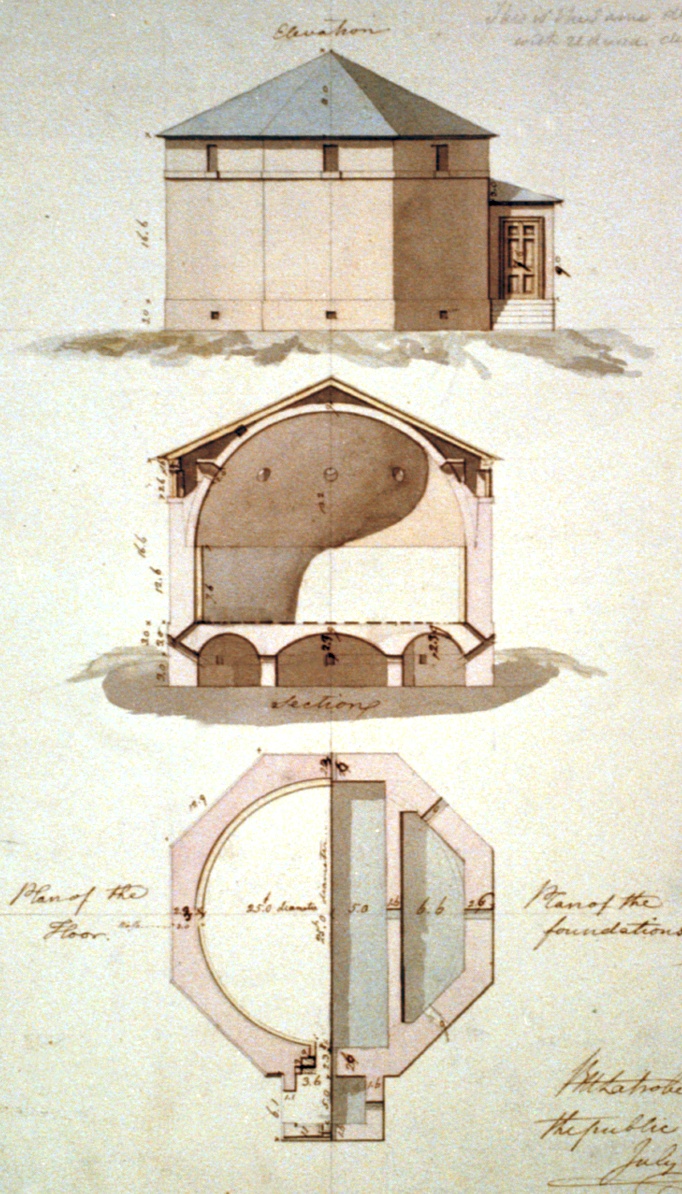
Purfleet-on-Thames is a town in the Thurrock unitary authority, Essex, England. It is bordered by the A13 road to the north and the River Thames to the south and is within the easternmost part of the M25 motorway but just outside the Greater London boundary. It was within the traditional Church of England parish of West Thurrock. Some industry is located to the south and the area forms part of the Thames Gateway redevelopment area. Purfleet is one of seven conservation areas in Thurrock. History The place-name "Purfleet" is first attested in 1285, where it appears as ''Purteflyete''. It is recorded as ''Pourteflet'' in the Close Roll for 1312. The name means "Purta's stream or tidal inlet". In the 18th century, Purfleet Royal Gunpowder Magazine was established as a location for the storage of gunpowder together with a garrison to protect it. A constant danger of explosion as a result of lightning strikes existed. Benjamin Franklin was asked for advice on the design of a lightn ... [...More Info...] [...Related Items...] OR: [Wikipedia] [Google] [Baidu] |
Thurrock
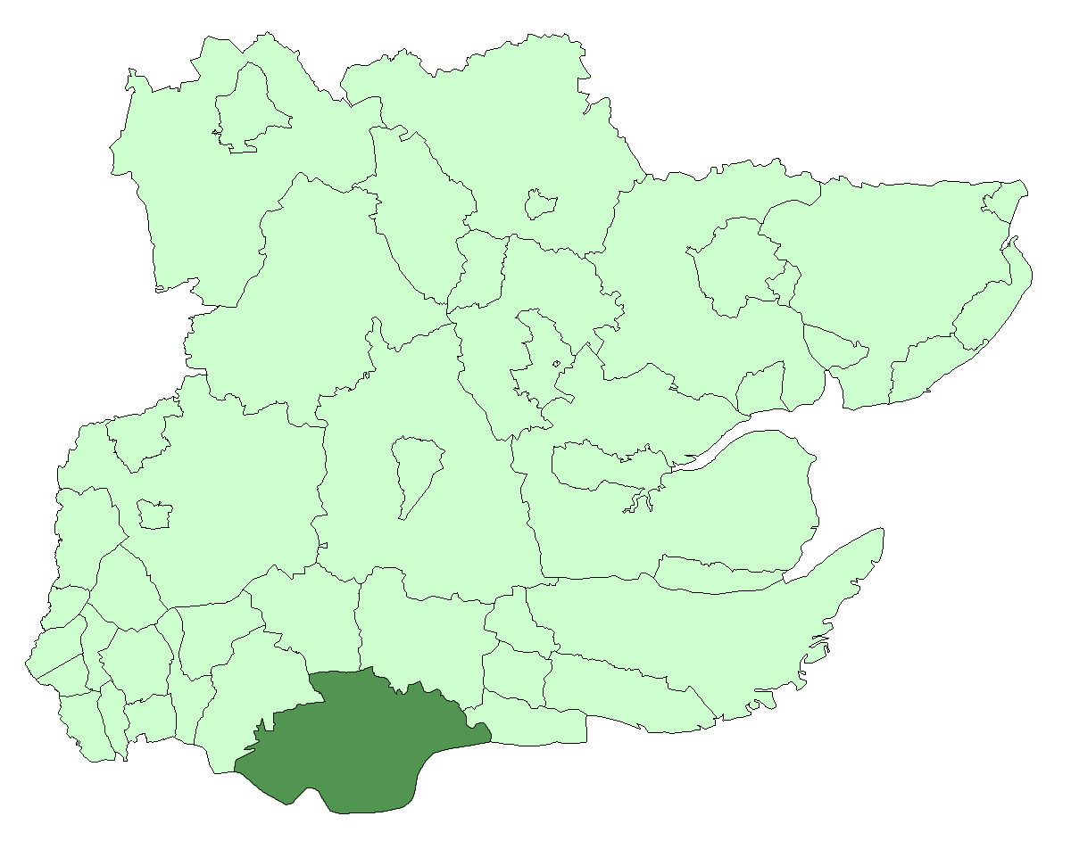
Thurrock () is a unitary authority area with borough status and unparished area in the ceremonial county of Essex, England. It is part of the London commuter belt and an area of regeneration within the Thames Gateway redevelopment zone. The local authority is Thurrock Council. The borough It lies on the River Thames just to the east of London. With over of riverfront it covers an area of , with more than half defined as Green Belt. With Greater London to the west and the river to the south, the county of Essex abuts the Borough to the north and east, and across the river lies Kent. Politics The local authority is Thurrock Council. Elections are held 3 out of every 5 years. In 2021, the Conservative Party took overall control of the council, having been a minority-party administration since 2016. Thurrock is covered by two parliamentary constituencies. Thurrock includes most of the borough while South Basildon and East Thurrock includes some wards in the east of the borough ... [...More Info...] [...Related Items...] OR: [Wikipedia] [Google] [Baidu] |
Gunpowder Magazine
A gunpowder magazine is a magazine (building) designed to store the explosive gunpowder in wooden barrels for safety. Gunpowder, until superseded, was a universal explosive used in the military and for civil engineering: both applications required storage magazines. Most magazines were purely functional and tended to be in remote and secure locations. They are the successor to the earlier powder towers and powder houses. In Australia Historic magazines were at the following locations, among others: *Jack's Magazine, Saltwater River, Victoria * Goat Island, Sydney *Spectacle Island (Port Jackson) *North Arm Powder Magazine *Dry Creek explosives depot In Canada There are magazines at: *Citadel Hill (Fort George) *Citadel of Quebec, Quebec City, Quebec *Parc de l'Esplanade, Quebec City, QuebecCole Island Esquimalt, British Columbia *Fort Lennox, Île-aux-Noix, Quebec *Fort William Historical Park, Thunder Bay, Ontario *Fort York, Toronto In Ireland Ballincollig, County Cork ... [...More Info...] [...Related Items...] OR: [Wikipedia] [Google] [Baidu] |
A13 Road (England)
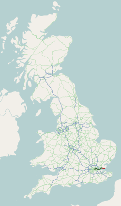
The A13 is a major road in England linking Central London with east London and south Essex. Its route is similar to that of the London, Tilbury and Southend line via Rainham, Grays, Tilbury & Stanford-Le-Hope, and runs the entire length of the northern Thames Gateway area, terminating on the Thames Estuary at Shoeburyness. It is a trunk road between London and the Tilbury junction, a primary route between there and Sadlers Hall Farm near South Benfleet, and a non-primary route between there and Shoeburyness. Route London The A13 used to start at Aldgate Pump; but now begins at the junction with the A11 at what used to be the Aldgate one way system in east London and heads eastwards through the boroughs of Tower Hamlets, Newham, Barking & Dagenham and Havering before reaching the Greater London boundary. Commercial Road and East India Dock Road At the cental London end, Commercial Road and East India Dock Road form one of two main arteries through the historic East End (th ... [...More Info...] [...Related Items...] OR: [Wikipedia] [Google] [Baidu] |
Aveley
Aveley is a town and former civil parish in the unitary authority of Thurrock in Essex, England, and forms one of the traditional Church of England parishes. Aveley is 16 miles (26.2 km) east of Charing Cross. In the 2021 United Kingdom census it had a population of 9,801. In 1931 the parish had a population of 2,003. Position Aveley is located on the very edge of Greater London and is roughly bounded to the north and west by the London Borough of Havering, to the south by the A13 road and to the east by the M25 motorway. The nearest places are Purfleet, South Ockendon, Wennington and Rainham. Prehistory and history Aveley has given its name to the Aveley Interglacial period around 200,000 years ago. Important evidence of the local flora and fauna of the period and some signs of occupation by Neanderthal humans have been found there. In Domesday the name has various spellings – Alvithelea, Alvileia and Alvilea. The name means Aelfgyth's wood clearing. A variation, ... [...More Info...] [...Related Items...] OR: [Wikipedia] [Google] [Baidu] |
South Ockendon
South Ockendon is a town, former civil parish and Church of England parish within the Thurrock borough in Essex in the East of England, United Kingdom. It is located on the border with Greater London, just outside the M25 motorway. The area to the north is North Ockendon. In 2019 it had an estimated population of 22,303 and in the 2021 United Kingdom census it had a population of 22,442 In 1931 the parish had a population of 1355. History South Ockendon is an ancient parish. It was a village before the Norman Conquest, had a priest in 1085.Cyril Hart ''The Early Charters of Essex'' (Leicester University Press, 1971) is listed in the Domesday Book''DB32 Essex'', location=Chichester , publisher=Phillimore, year=1983, section 57b & section 58a as "Wocheduna", conjecturally named after a Saxon chief, Wocca, whose tribe allegedly lived on a hill. The suffix "don" in Old English means a low hill in open country. Until the late 1940s, the village centred on The Village Green, with its N ... [...More Info...] [...Related Items...] OR: [Wikipedia] [Google] [Baidu] |
Zeppelin
A Zeppelin is a type of rigid airship named after the German inventor Count Ferdinand von Zeppelin () who pioneered rigid airship development at the beginning of the 20th century. Zeppelin's notions were first formulated in 1874Eckener 1938, pp. 155–157. and developed in detail in 1893.Dooley 2004, p. A.187. They were patented in Germany in 1895 and in the United States in 1899. After the outstanding success of the Zeppelin design, the word ''zeppelin'' came to be commonly used to refer to all rigid airships. Zeppelins were first flown commercially in 1910 by Deutsche Luftschiffahrts-AG (DELAG), the world's first airline in revenue service. By mid-1914, DELAG had carried over 10,000 fare-paying passengers on over 1,500 flights. During World War I, the German military made extensive use of Zeppelins as bombers and as scouts, resulting in over 500 deaths in bombing raids in Britain. The defeat of Germany in 1918 temporarily slowed the airship business. Although DELAG establish ... [...More Info...] [...Related Items...] OR: [Wikipedia] [Google] [Baidu] |
RAF Hornchurch
Royal Air Force Hornchurch or RAF Hornchurch is a former Royal Air Force sector station in the parish of Hornchurch, Essex (now the London Borough of Havering in Greater London), located to the southeast of Romford. The airfield was known as Sutton's Farm during the First World War, when it occupied of the farm of the same name. It was used for the protection of London, being east north-east of Charing Cross. Although the airfield closed shortly after the end of the war, the land was requisitioned in 1923 because of the expansion of the Royal Air Force and it re-opened as a much larger fighter station in 1928. The airfield was ideally to cover both London and the Thames corridor from German air attacks. It was a key air force installation between both wars and into the jet age, closing in 1962. History In 1915 the London Air Defence Area (LADA) was established and airfields were built around London to defend the capital from the growing threat from German airships. Sutton's ... [...More Info...] [...Related Items...] OR: [Wikipedia] [Google] [Baidu] |
Thurrock Urban District
Thurrock was a local government district and civil parish in south Essex, England from 1936 to 1974. The parish and urban district was formed from the former area of the following civil parishes which had been abolished in 1936: *From Grays Thurrock Urban District: **Grays Thurrock *From Orsett Rural District: **Bulphan ** Corringham **East Tilbury **Fobbing **Horndon-on-the-Hill **Langdon Hills **Little Thurrock **Mucking **North Ockendon (part) **Orsett ** Stanford-le-Hope **Stifford **West Tilbury *From Purfleet Urban District: **Aveley **South Ockendon **West Thurrock *From Tilbury Urban District: **Chadwell St Mary The district was enlarged in 1938 by gaining part of the former Little Burstead parish from Billericay Urban District. The district was abolished in 1974. The part within Basildon New Town became part of Basildon District, while the remainder became the present-day Borough of Thurrock. It has since become a unitary authority A unitary authority is a loca ... [...More Info...] [...Related Items...] OR: [Wikipedia] [Google] [Baidu] |
West Thurrock
West Thurrock is an area, former civil parish and traditional Church of England parish in Thurrock, Essex, England, located 17.5 miles (28.1 km) east south-east of Charing Cross, London. In 1931 the parish had a population of 5,153. On 1 April 1936, the parish was abolished to form Thurrock. Location West Thurrock is part of the unitary authority of Thurrock located on the north bank of the River Thames about from Charing Cross, London. Nearest places: * Aveley * Chafford Hundred * Grays * South Ockendon Nearest stations: * Chafford Hundred railway station * Grays railway station * Purfleet railway station Industry Industry along the Thames includes a Unilever chilled distribution centre for all its chilled food products including Flora, Bertolli, I Can't Believe It's Not Butter, Stork, Peperami and AdeZ. A Procter & Gamble (originally Hedley's) plant manufactures detergents and soaps. The large coal-burning West Thurrock Power Station closed in 1993, and was replaced ... [...More Info...] [...Related Items...] OR: [Wikipedia] [Google] [Baidu] |
Thurrock (UK Parliament Constituency)
Thurrock is a constituency represented in the House of Commons of the UK Parliament since 2010 by Jackie Doyle-Price, a Conservative. History History of boundaries The seat was created from South East Essex as a result of the interim redistribution carried out for the 1945 general election. It remained unchanged until the redistribution following the reorganisation of local authorities under the Local Government Act 1972 (not coming into force until the 1983 general election), when it lost northern parts to the new constituency of Billericay. There was a small change for the 2010 general election, when East Tilbury was included in the new constituency of South Basildon and East Thurrock. ;History of results All campaigns since the seat's 1945 inception have resulted in a minimum of 26.8% of votes at each election for the main two parties, with Labour or the Conservatives alternating between first and second place. The third-placed party's share of the vote has fluctuate ... [...More Info...] [...Related Items...] OR: [Wikipedia] [Google] [Baidu] |
River Thames
The River Thames ( ), known alternatively in parts as the The Isis, River Isis, is a river that flows through southern England including London. At , it is the longest river entirely in England and the Longest rivers of the United Kingdom, second-longest in the United Kingdom, after the River Severn. The river rises at Thames Head in Gloucestershire, and flows into the North Sea near Tilbury, Essex and Gravesend, Kent, via the Thames Estuary. From the west it flows through Oxford (where it is sometimes called the Isis), Reading, Berkshire, Reading, Henley-on-Thames and Windsor, Berkshire, Windsor. The Thames also drains the whole of Greater London. In August 2022, the source of the river moved five miles to beyond Somerford Keynes due to the heatwave in July 2022. The lower reaches of the river are called the Tideway, derived from its long tidal reach up to Teddington Lock. Its tidal section includes most of its London stretch and has a rise and fall of . From Oxford to th ... [...More Info...] [...Related Items...] OR: [Wikipedia] [Google] [Baidu] |
M25 Motorway
The M25 or London Orbital Motorway is a major road encircling most of Greater London. The motorway is one of the most important roads in the UK and one of the busiest. Margaret Thatcher opened the final section in 1986, making the M25 the longest ring road in Europe upon opening. The Dartford Crossing completes the orbital route but is not classed as motorway; it is classed as a trunk road and designated as the A282. In some cases, including notable legal contexts such as the Communications Act 2003, the M25 is used as a ''de facto'' alternative boundary for Greater London. In the 1944 ''Greater London Plan'', Patrick Abercrombie proposed an orbital motorway around London. This evolved into the London Ringways project in the early 1960s, and by 1966, planning had started on two projects, London Ringways#Ringway 3, Ringway 3 to the north and London Ringways#Ringway 4, Ringway 4 to the south. By the time the first sections opened in 1975, it was decided the ringways would be com ... [...More Info...] [...Related Items...] OR: [Wikipedia] [Google] [Baidu] |


