|
Punta De La Orchilla
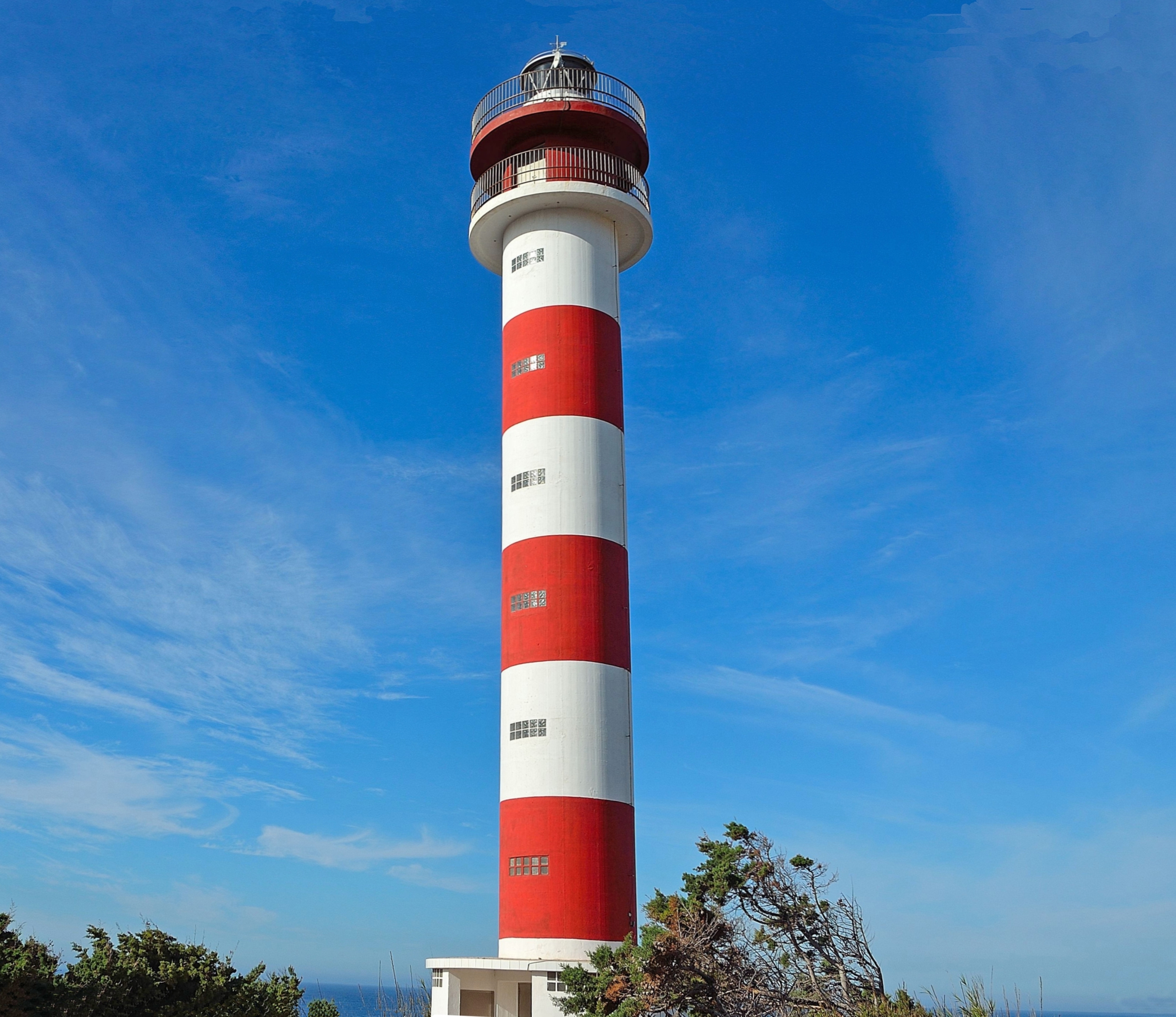
The Punta Orchilla Lighthouse ( es, Faro de Punta Orchilla) is an active lighthouse on the Canary island of El Hierro in the municipality of El Pinar. The need for a lighthouse on the island was highlighted in the second maritime lighting plan for the Canaries, and it first became operational in 1933. Punta de la Orchilla Punta de la Orchilla on the south-western side of El Hierro, is a significant location in terms of the Canaries, as it is one of the most westerly points in the archipelago. A meridian memorial close to the lighthouse, is a reminder that historically it was considered to be a prime meridian for early map makers, and was known as the Ferro Meridian, at the western extremity of the known world. The name comes from the Orchil lichen that grows on the rocky lava slopes in the area, inland from the point is a 238 m peak called Orchilla. The isolated locality of the Punta de la Orchilla means that it has been described as "probably Spain's most remote lig ... [...More Info...] [...Related Items...] OR: [Wikipedia] [Google] [Baidu] |
El Pinar, Canary Islands
El Pinar (Spanish: ''El Pinar de El Hierro'') is a Spanish municipality on the island of El Hierro (nicknamed ''Isla del Meridiano'', the "Meridian Island"), Canary Islands. It was created in 2007. Sites of interest At the western end of El Pinar is the Punta Orchilla lighthouse which was completed in 1933. See also *Pico de Malpaso Pico de Malpaso (English: "difficult step peak") is the highest point on the island of El Hierro in the Canary Islands, Spain. Geography The summit rises at the centre of the island on the border between Frontera and El Pinar de El Hierro mu ... References Municipalities in El Hierro {{Spain-stub ... [...More Info...] [...Related Items...] OR: [Wikipedia] [Google] [Baidu] |
Orchil
Orcein, also archil, orchil, lacmus and C.I. Natural Red 28, are names for dyes extracted from several species of lichen, commonly known as "orchella weeds", found in various parts of the world. A major source is the archil lichen, ''Roccella tinctoria''. Orcinol is extracted from such lichens. It is then converted to orcein by ammonia and air. In traditional dye-making methods, urine was used as the ammonia source. If the conversion is carried out in the presence of potassium carbonate, calcium hydroxide, and calcium sulfate (in the form of potash, lime, and gypsum in traditional dye-making methods), the result is litmus, a more complex molecule. The manufacture was described by Cocq in 1812 and in the UK in 1874. Edmund Roberts noted orchilla as a principal export of the Cape Verde islands, superior to the same kind of "moss" found in Italy or the Canary Islands, that in 1832 was yielding an annual revenue of $200,000. Commercial archil is either a powder (called cudbear) or a p ... [...More Info...] [...Related Items...] OR: [Wikipedia] [Google] [Baidu] |
Bien De Interés Cultural Landmarks In The Province Of Santa Cruz De Tenerife
Bien may refer to: * Bien (newspaper) * Basic Income Earth Network BASIC (Beginners' All-purpose Symbolic Instruction Code) is a family of general-purpose, high-level programming languages designed for ease of use. The original version was created by John G. Kemeny and Thomas E. Kurtz at Dartmouth College ... * Bień, Poland {{disambiguation ... [...More Info...] [...Related Items...] OR: [Wikipedia] [Google] [Baidu] |
OpenStreetMap
OpenStreetMap (OSM) is a free, open geographic database updated and maintained by a community of volunteers via open collaboration. Contributors collect data from surveys, trace from aerial imagery and also import from other freely licensed geodata sources. OpenStreetMap is freely licensed under the Open Database License and as a result commonly used to make electronic maps, inform turn-by-turn navigation, assist in humanitarian aid and data visualisation. OpenStreetMap uses its own topology to store geographical features which can then be exported into other GIS file formats. The OpenStreetMap website itself is an online map, geodata search engine and editor. In 2004, OpenStreetMap was created by Steve Coast in response to the Ordnance Survey, the United Kingdom's national mapping agency, failing to release its data to the public and under free licences. Initially, maps were created only via GPS traces, but it was quickly populated by importing public domain geographical ... [...More Info...] [...Related Items...] OR: [Wikipedia] [Google] [Baidu] |
List Of Lighthouses In The Canary Islands ...
This is a list of lighthouses in the Canary Islands. The Spanish archipelago lies to the west of Africa, in the Atlantic Ocean. Lighthouses Map See also * List of lighthouses in Spain * List of lighthouses in the Balearic Islands References External links * {{DEFAULTSORT:Canary Islands * Lists of lighthouses in Spain Lighthouses A lighthouse is a tower, building, or other type of physical structure designed to emit light from a system of lamps and lenses and to serve as a beacon for navigational aid, for maritime pilots at sea or on inland waterways. Lighthouses mar ... [...More Info...] [...Related Items...] OR: [Wikipedia] [Google] [Baidu] |
List Of Lighthouses In Spain
This is a list of lighthouses in Spain. Lighthouses By autonomous communities * List of lighthouses in the Balearic Islands * List of lighthouses in the Canary Islands See also * Lists of lighthouses and lightvessels * List of tallest lighthouses References External links {{Architecture of Spain Lists of lighthouses in Spain, ... [...More Info...] [...Related Items...] OR: [Wikipedia] [Google] [Baidu] |
Correos
Sociedad Estatal de Correos y Telégrafos, S.A., trading as Correos (literally "Mails"), is a state-owned company responsible for providing postal service in Spain and, due to bilateral agreements, it has responsibility for mail services in Andorra alongside the French company La Poste. The origins of Correos dates back to 1716. The change of dynasty in Spain ended the tradition of giving to some relevant families the duty to take care of the postal services and, on July 8, 1716, King Philip V appointed Juan Tomás de Goyeneche as Chief Superintendent and General Administrator of the Postal Offices, making the postal service responsibility of the State. The company is 100% state owned, through the State Society for Industrial Participations (SEPI). With more than 53,000 employees and 5.4 billion pieces of mail sent each year, Correos is one of the largest postal services in the world. Based in Madrid, it has over 10,000 postal centres all over Spain. The Correos Group is cur ... [...More Info...] [...Related Items...] OR: [Wikipedia] [Google] [Baidu] |
Fresnel Lens
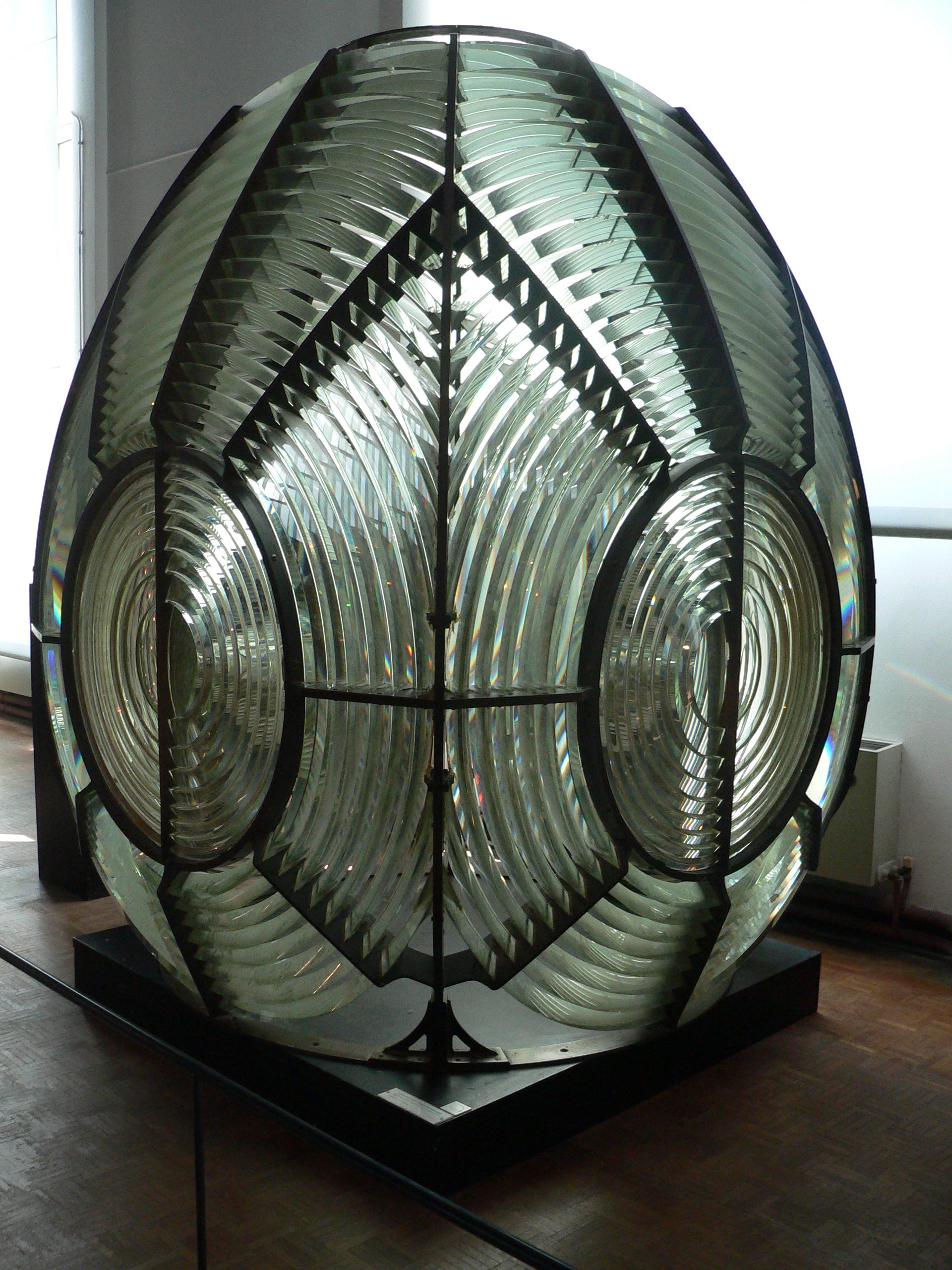
A Fresnel lens ( ; ; or ) is a type of composite compact lens developed by the French physicist Augustin-Jean Fresnel (1788–1827) for use in lighthouses. It has been called "the invention that saved a million ships." The design allows the construction of lenses of large aperture and short focal length without the mass and volume of material that would be required by a lens of conventional design. A Fresnel lens can be made much thinner than a comparable conventional lens, in some cases taking the form of a flat sheet. The simpler dioptric (purely refractive) form of the lens was first proposed by Count Buffon and independently reinvented by Fresnel. The ''catadioptric'' form of the lens, entirely invented by Fresnel, has outer elements that use total internal reflection as well as refraction; it can capture more oblique light from a light source and add it to the beam of a lighthouse, making the light visible from greater distances. Description The Fresnel lens redu ... [...More Info...] [...Related Items...] OR: [Wikipedia] [Google] [Baidu] |
Atlantic Ocean
The Atlantic Ocean is the second-largest of the world's five oceans, with an area of about . It covers approximately 20% of Earth's surface and about 29% of its water surface area. It is known to separate the " Old World" of Africa, Europe and Asia from the "New World" of the Americas in the European perception of the World. The Atlantic Ocean occupies an elongated, S-shaped basin extending longitudinally between Europe and Africa to the east, and North and South America to the west. As one component of the interconnected World Ocean, it is connected in the north to the Arctic Ocean, to the Pacific Ocean in the southwest, the Indian Ocean in the southeast, and the Southern Ocean in the south (other definitions describe the Atlantic as extending southward to Antarctica). The Atlantic Ocean is divided in two parts, by the Equatorial Counter Current, with the North(ern) Atlantic Ocean and the South(ern) Atlantic Ocean split at about 8°N. Scientific explorations of the A ... [...More Info...] [...Related Items...] OR: [Wikipedia] [Google] [Baidu] |
El Hierro
El Hierro, nicknamed ''Isla del Meridiano'' (the "Meridian Island"), is the second-smallest and farthest-south and -west of the Canary Islands (an autonomous community of Spain), in the Atlantic Ocean off the coast of Africa, with a population of 10,968 (2019). Its capital is Valverde. At , it is the second-smallest of the eight main islands of the Canaries. Name The name ''El Hierro'', although spelled like the Spanish word for 'iron', is not related to that word. The ''H'' in the name of the metal is derived from the ''F'' of Latin ''ferrum'' (compare ''higo'' for 'fig'), a phonetic mutation that was complete by the end of the Middle Ages. The confusion with the name of the metal had effects on the international naming of the island. As early as the 16th century, maps and texts called the island after the word for 'iron' in other languages: Portuguese ''Ferro'', French ''l'île de Fer'', and Latin '' Insula Ferri''. Nevertheless, the origin of the name ''ero'' or ''er ... [...More Info...] [...Related Items...] OR: [Wikipedia] [Google] [Baidu] |
Prime Meridian
A prime meridian is an arbitrary meridian (a line of longitude) in a geographic coordinate system at which longitude is defined to be 0°. Together, a prime meridian and its anti-meridian (the 180th meridian in a 360°-system) form a great circle. This great circle divides a spheroid, like the Earth, into two hemispheres: the Eastern Hemisphere and the Western Hemisphere (for an east-west notational system). For Earth's prime meridian, various conventions have been used or advocated in different regions throughout history. The Earth's current international standard prime meridian is the IERS Reference Meridian. It is derived, but differs slightly, from the Greenwich Meridian, the previous standard. A prime meridian for a planetary body not tidally locked (or at least not in synchronous rotation) is entirely arbitrary, unlike an equator, which is determined by the axis of rotation. However, for celestial objects that are tidally locked (more specifically, synchronous), th ... [...More Info...] [...Related Items...] OR: [Wikipedia] [Google] [Baidu] |


_033.jpg)