|
Pumapunku
Pumapunku or Puma Punku (Aymara language, Aymara and Quechua language, Quechua which literally means 'Gate of the Puma') is a 6th-century T-shaped and strategically aligned Artificiality, man-made terraced platform mound with a Sunken courtyard, sunken court and monumental structure on top that is part of the Pumapunku complex, at the Tiwanaku Site near Tiwanacu, in western Bolivia. The Pumapunku complex is an alignment of plazas and ramps centered on the Pumapunku platform mound. Today the monumental complex on top of the platform mound lies in ruins. It is believed to date to AD 536. After Akapana, which is believed to be "Pumapunku's twin", Pumapunku was the second most important construction in Tiwanaku. Among all the names for the areas in Tiwanaku only the names "Akapana" and "Pumapunku" have historical relevance. At Pumapunku several miniature gates which are perfect replicas of once standing full-size gateways were found. Additionally to these miniature gateways, like ... [...More Info...] [...Related Items...] OR: [Wikipedia] [Google] [Baidu] |
Tiwanaku
Tiwanaku ( es, Tiahuanaco or ) is a Pre-Columbian archaeological site in western Bolivia near Lake Titicaca, about 70 kilometers from La Paz, and it is one of the largest sites in South America. Surface remains currently cover around 4 square kilometers and include decorated ceramics, monumental structures, and megalithic blocks. The site's population probably peaked around AD 800 with 10,000 to 20,000 people. The site was first recorded in written history in 1549 by Spanish conquistador Pedro Cieza de León while searching for the southern Inca capital of Qullasuyu. Jesuit chronicler of Peru Bernabé Cobo reported that Tiwanaku's name once was ''taypiqala'', which is Aymara meaning "stone in the center", alluding to the belief that it lay at the center of the world. The name by which Tiwanaku was known to its inhabitants may have been lost as they had no written language. Heggarty and Beresford-Jones suggest that the Puquina language is most likely to have been the language of T ... [...More Info...] [...Related Items...] OR: [Wikipedia] [Google] [Baidu] |
Puma Punku Landscape
Puma or PUMA may refer to: Animals * ''Puma'' (genus), a genus in the family Felidae ** Puma (species) or cougar, a large cat Businesses and organisations * Puma (brand), a multinational shoe and sportswear company * Puma Energy, a mid- and downstream oil company * People United Means Action, originally named "Party Unity My Ass", a political action committee during the 2008 U.S. presidential election Languages * Puma language, a language of Nepal * Teanu language or Puma, a language of the Solomon Islands People * Carlos Landín Martínez, El Puma, Mexican drug lord * José Luis Rodríguez (born 1943), El Puma, Venezuelan singer and actor * Puma King (born 1990), Puma, Mexican wrestler * Puma Swede (born 1976), Swedish pornographic actress * Ricochet (wrestler) (born 1988), Puma, American wrestler * T. J. Perkins (born 1984), Puma, American wrestler * Puma Jones member of Black Uhuru Places * Puma (village), Solomon Islands * Puma (Tanzanian ward) Sports * Pumas (Curr ... [...More Info...] [...Related Items...] OR: [Wikipedia] [Google] [Baidu] |
Bernabé Cobo
Padre Bernabé Cobo (born at Lopera in Spain, 1582; died at Lima, Peru, 9 October 1657) was a Spanish Jesuit missionary and writer. He played a part in the early history of quinine by his description of cinchona bark; he brought some to Europe on a visit in 1632. He was a thorough student of nature and man in Spanish America. His long residence (61 years), his position as a priest and, several times, as a missionary, gave him unusual opportunities for obtaining reliable information. The Spanish botanist Cavanilles gave the name of ''Cobaea'' to a genus of plants belonging to the Polemoniaceae of Mexico, '' Cobaea scandens'' being its most striking representative. Life He went to America in 1596, visiting the Antilles and Venezuela and landing at Lima in 1599. Entering the Society of Jesus, 14 October 1601, he was sent by his superiors in 1615 to the mission of Juli, where, and at Potosí, Cochabamba, Oruro, and La Paz, he laboured until 1618. He was rector of the college of ... [...More Info...] [...Related Items...] OR: [Wikipedia] [Google] [Baidu] |
Before Present
Before Present (BP) years, or "years before present", is a time scale used mainly in archaeology, geology and other scientific disciplines to specify when events occurred relative to the origin of practical radiocarbon dating in the 1950s. Because the "present" time changes, standard practice is to use 1 January 1950 as the commencement date (epoch) of the age scale. The abbreviation "BP" has been interpreted retrospectively as "Before Physics", which refers to the time before nuclear weapons testing artificially altered the proportion of the carbon isotopes in the atmosphere, which scientists must now account for. In a convention that is not always observed, many sources restrict the use of BP dates to those produced with radiocarbon dating; the alternative notation RCYBP stands for the explicit "radio carbon years before present". Usage The BP scale is sometimes used for dates established by means other than radiocarbon dating, such as stratigraphy. This usage differs from t ... [...More Info...] [...Related Items...] OR: [Wikipedia] [Google] [Baidu] |
Radiocarbon Dating
Radiocarbon dating (also referred to as carbon dating or carbon-14 dating) is a method for determining the age of an object containing organic material by using the properties of radiocarbon, a radioactive isotope of carbon. The method was developed in the late 1940s at the University of Chicago by Willard Libby. It is based on the fact that radiocarbon () is constantly being created in the Earth's atmosphere by the interaction of cosmic rays with atmospheric nitrogen. The resulting combines with atmospheric oxygen to form radioactive carbon dioxide, which is incorporated into plants by photosynthesis; animals then acquire by eating the plants. When the animal or plant dies, it stops exchanging carbon with its environment, and thereafter the amount of it contains begins to decrease as the undergoes radioactive decay. Measuring the amount of in a sample from a dead plant or animal, such as a piece of wood or a fragment of bone, provides information that can be used to calc ... [...More Info...] [...Related Items...] OR: [Wikipedia] [Google] [Baidu] |
Binghamton University
The State University of New York at Binghamton (Binghamton University or SUNY Binghamton) is a public university, public research university with campuses in Binghamton, New York, Binghamton, Vestal, New York, Vestal, and Johnson City, New York. It is one of the four university centers in the State University of New York (SUNY) system. As of Fall 2020, 18,128 undergraduate and graduate students attended the university. Since its establishment in 1946, the school has evolved from a small liberal arts college to a large research university. It is Carnegie Classification of Institutions of Higher Education, classified among "R1: Doctoral Universities – Very high research activity". Binghamton's athletic teams are the Binghamton Bearcats, Bearcats and they compete in NCAA Division I, Division I of the National Collegiate Athletic Association (NCAA). The Bearcats are members of the America East Conference. History Establishment Binghamton University was established in 1946 ... [...More Info...] [...Related Items...] OR: [Wikipedia] [Google] [Baidu] |
Revetment
A revetment in stream restoration, river engineering or coastal engineering is a facing of impact-resistant material (such as stone, concrete, sandbags, or wooden piles) applied to a bank or wall in order to absorb the energy of incoming water Water (chemical formula ) is an inorganic, transparent, tasteless, odorless, and nearly colorless chemical substance, which is the main constituent of Earth's hydrosphere and the fluids of all known living organisms (in which it acts as a ... and protect it from erosion. River or coastal revetments are usually built to preserve the existing uses of the shoreline and to protect the slope. In military engineering it is a sloped structure formed to secure an area from artillery, bombing, or stored explosives. Freshwater revetments Many revetments are used to line the banks of freshwater rivers, lakes, and man-made reservoirs, especially to prevent damage during periods of floods or heavy seasonal rains (see riprap). Many mater ... [...More Info...] [...Related Items...] OR: [Wikipedia] [Google] [Baidu] |
Magnetic Susceptibility
In electromagnetism, the magnetic susceptibility (Latin: , "receptive"; denoted ) is a measure of how much a material will become magnetized in an applied magnetic field. It is the ratio of magnetization (magnetic moment per unit volume) to the applied magnetizing field intensity . This allows a simple classification, into two categories, of most materials' responses to an applied magnetic field: an alignment with the magnetic field, , called paramagnetism, or an alignment against the field, , called diamagnetism. Magnetic susceptibility indicates whether a material is attracted into or repelled out of a magnetic field. Paramagnetic materials align with the applied field and are attracted to regions of greater magnetic field. Diamagnetic materials are anti-aligned and are pushed away, toward regions of lower magnetic fields. On top of the applied field, the magnetization of the material adds its own magnetic field, causing the field lines to concentrate in paramagnetism, or be excl ... [...More Info...] [...Related Items...] OR: [Wikipedia] [Google] [Baidu] |
Electrical Conductivity
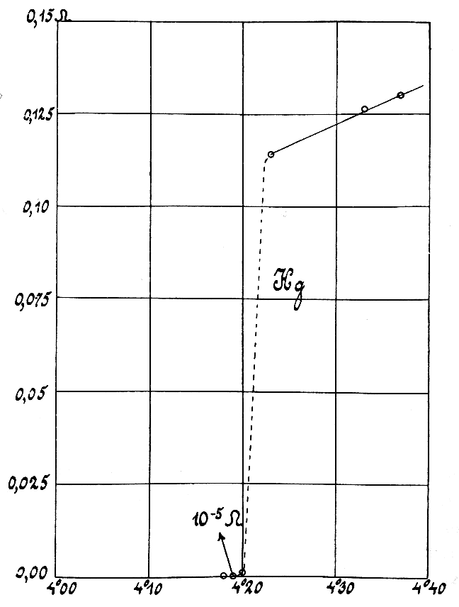
Electrical resistivity (also called specific electrical resistance or volume resistivity) is a fundamental property of a material that measures how strongly it resists electric current. A low resistivity indicates a material that readily allows electric current. Resistivity is commonly represented by the Greek letter (rho). The SI unit of electrical resistivity is the ohm-meter (Ω⋅m). For example, if a solid cube of material has sheet contacts on two opposite faces, and the resistance between these contacts is , then the resistivity of the material is . Electrical conductivity or specific conductance is the reciprocal of electrical resistivity. It represents a material's ability to conduct electric current. It is commonly signified by the Greek letter ( sigma), but ( kappa) (especially in electrical engineering) and ( gamma) are sometimes used. The SI unit of electrical conductivity is siemens per metre (S/m). Resistivity and conductivity are inte ... [...More Info...] [...Related Items...] OR: [Wikipedia] [Google] [Baidu] |
Magnetometry
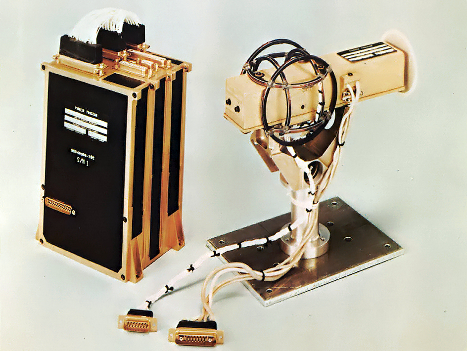
A magnetometer is a device that measures magnetic field or magnetic dipole moment. Different types of magnetometers measure the direction, strength, or relative change of a magnetic field at a particular location. A compass is one such device, one that measures the direction of an ambient magnetic field, in this case, the Earth's magnetic field. Other magnetometers measure the magnetic dipole moment of a magnetic material such as a ferromagnet, for example by recording the effect of this magnetic dipole on the induced current in a coil. The first magnetometer capable of measuring the absolute magnetic intensity at a point in space was invented by Carl Friedrich Gauss in 1833 and notable developments in the 19th century included the Hall effect, which is still widely used. Magnetometers are widely used for measuring the Earth's magnetic field, in geophysical surveys, to detect magnetic anomalies of various types, and to determine the dipole moment of magnetic materials. In an air ... [...More Info...] [...Related Items...] OR: [Wikipedia] [Google] [Baidu] |
Ground-penetrating Radar
Ground-penetrating radar (GPR) is a geophysical method that uses radar pulses to image the subsurface. It is a non-intrusive method of surveying the sub-surface to investigate underground utilities such as concrete, asphalt, metals, pipes, cables or masonry. This nondestructive method uses electromagnetic radiation in the microwave band ( UHF/ VHF frequencies) of the radio spectrum, and detects the reflected signals from subsurface structures. GPR can have applications in a variety of media, including rock, soil, ice, fresh water, pavements and structures. In the right conditions, practitioners can use GPR to detect subsurface objects, changes in material properties, and voids and cracks. GPR uses high-frequency (usually polarized) radio waves, usually in the range 10 MHz to 2.6 GHz. A GPR transmitter and antenna emits electromagnetic energy into the ground. When the energy encounters a buried object or a boundary between materials having different permittivities, it ma ... [...More Info...] [...Related Items...] OR: [Wikipedia] [Google] [Baidu] |


