|
Pulpit Rock Tower
Pulpit Rock Tower, also known as Pulpit Rock Base-End Station (N. 142), is a historic military observation tower at 9 Davis Road in Rye, New Hampshire. Built in 1943 as part of the Harbor Defenses of Portsmouth, a series of military defenses around Portsmouth, it is the only one of fourteen World War II-era observation posts to survive. Now owned by the state, it is periodically open to the public, and maintained by a local non-profit organization. It was listed on the National Register of Historic Places in 2010. Description and history The Pulpit Rock Tower is located in northern Rye, on a small state-owned parcel of land between Neptune Drive and Pulpit Rock Road. It is accessed via a footpath from Neptune Drive. It is a concrete structure of eight stories, and stands in height. Its walls are thick, and its floors are thick. The interior has a six-level spiral concrete staircase, and the tower's top two levels are accessed by wooden ladders. An observation platform ... [...More Info...] [...Related Items...] OR: [Wikipedia] [Google] [Baidu] |
Rye, New Hampshire
Rye is a town in Rockingham County, New Hampshire, United States. The population was 5,543 at the 2020 census. The town is home to several state parks along the Atlantic coastline. History The first settlement in New Hampshire, originally named Pannaway Plantation, was established in 1623 at Odiorne's Point by a group of fishermen led by David Thompson. The settlement was abandoned in favor of Strawbery Banke, which became Portsmouth. The first settler in present-day Rye was probably William Berry. Prior to its incorporation in 1726 as a parish of New Castle, Rye was called "Sandy Beach" and its lands were once parts of New Castle, Portsmouth, Greenland and Hampton. In 1726, the town of New Castle set off a parish for Sandy Beach called "Rye", for Rye in Sussex, England, the ancestral lands of the Jenness family who continue to live in the town to this day and even have a beach named after them. The town was incorporated in 1785. In 2013, a researcher pointed out that the to ... [...More Info...] [...Related Items...] OR: [Wikipedia] [Google] [Baidu] |
Harbor Defenses Of Portsmouth
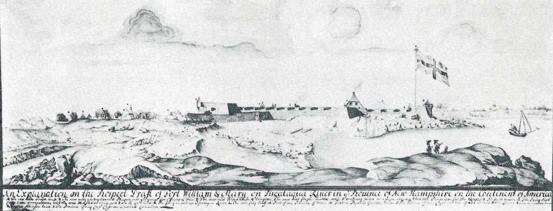
The Harbor Defenses of Portsmouth was a United States Army Coast Artillery Corps harbor defense command. It coordinated the coast defenses of Portsmouth, New Hampshire and the nearby Portsmouth Naval Shipyard in Kittery, Maine from 1900 to 1950, both on the Piscataqua River, beginning with the Endicott program. These included both coast artillery forts and underwater minefields. The command originated circa 1900 as the Portsmouth Artillery District, was renamed Coast Defenses of Portsmouth in 1913, and again renamed Harbor Defenses of Portsmouth in 1925.Stanton, pp. 455-481Rinaldi, pp. 165-166Berhow, p. 430-434 History Early Portsmouth forts The first fort in the Portsmouth area was Fort William and Mary (called The Castle until circa 1692) in New Castle,Roberts, pp. 498-499 initially garrisoned before 1632 and perhaps the oldest continuously fortified site in the British colonies that later became the United States. In 1680 another small fort was established on the site of ... [...More Info...] [...Related Items...] OR: [Wikipedia] [Google] [Baidu] |
Portsmouth, New Hampshire
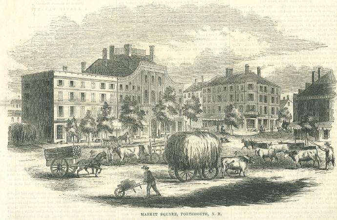
Portsmouth is a city in Rockingham County, New Hampshire, United States. At the 2020 census it had a population of 21,956. A historic seaport and popular summer tourist destination on the Piscataqua River bordering the state of Maine, Portsmouth was formerly the home of the Strategic Air Command's Pease Air Force Base, since converted to Portsmouth International Airport at Pease. History American Indians of the Abenaki and other Algonquian languages-speaking nations, and their predecessors, inhabited the territory of coastal New Hampshire for thousands of years before European contact. The first known European to explore and write about the area was Martin Pring in 1603. The Piscataqua River is a tidal estuary with a swift current, but forms a good natural harbor. The west bank of the harbor was settled by European colonists in 1630 and named Strawbery Banke, after the many wild strawberries growing there. The village was protected by Fort William and Mary on what is now ... [...More Info...] [...Related Items...] OR: [Wikipedia] [Google] [Baidu] |
World War II
World War II or the Second World War, often abbreviated as WWII or WW2, was a world war that lasted from 1939 to 1945. It involved the vast majority of the world's countries—including all of the great powers—forming two opposing military alliances: the Allies and the Axis powers. World War II was a total war that directly involved more than 100 million personnel from more than 30 countries. The major participants in the war threw their entire economic, industrial, and scientific capabilities behind the war effort, blurring the distinction between civilian and military resources. Aircraft played a major role in the conflict, enabling the strategic bombing of population centres and deploying the only two nuclear weapons ever used in war. World War II was by far the deadliest conflict in human history; it resulted in 70 to 85 million fatalities, mostly among civilians. Tens of millions died due to genocides (including the Holocaust), starvation, ma ... [...More Info...] [...Related Items...] OR: [Wikipedia] [Google] [Baidu] |
National Register Of Historic Places
The National Register of Historic Places (NRHP) is the United States federal government's official list of districts, sites, buildings, structures and objects deemed worthy of preservation for their historical significance or "great artistic value". A property listed in the National Register, or located within a National Register Historic District, may qualify for tax incentives derived from the total value of expenses incurred in preserving the property. The passage of the National Historic Preservation Act (NHPA) in 1966 established the National Register and the process for adding properties to it. Of the more than one and a half million properties on the National Register, 95,000 are listed individually. The remainder are contributing resources within historic districts. For most of its history, the National Register has been administered by the National Park Service (NPS), an agency within the U.S. Department of the Interior. Its goals are to help property owners and inte ... [...More Info...] [...Related Items...] OR: [Wikipedia] [Google] [Baidu] |
United States Army Corps Of Engineers
, colors = , anniversaries = 16 June (Organization Day) , battles = , battles_label = Wars , website = , commander1 = LTG Scott A. Spellmon , commander1_label = Chief of Engineers and Commanding General of the U.S. Army Corps of Engineers , commander2 = MGbr>Richard J. Heitkamp, commander2_label = Deputy Chief of Engineers and Deputy Commanding General , commander3 = MGKimberly M. Colloton, commander3_label = Deputy Commanding General for Military and International Operations , commander4 = MGbr>William H. Graham, commander4_label = Deputy Commanding General for Civil and Emergency Operations , commander5 = COLbr>James J. Handura, commander5_label = Chief of Staff for the U.S. Army Corps of Engi ... [...More Info...] [...Related Items...] OR: [Wikipedia] [Google] [Baidu] |
Second World War
World War II or the Second World War, often abbreviated as WWII or WW2, was a world war that lasted from 1939 to 1945. It involved the vast majority of the world's countries—including all of the great powers—forming two opposing military alliances: the Allies and the Axis powers. World War II was a total war that directly involved more than 100 million personnel from more than 30 countries. The major participants in the war threw their entire economic, industrial, and scientific capabilities behind the war effort, blurring the distinction between civilian and military resources. Aircraft played a major role in the conflict, enabling the strategic bombing of population centres and deploying the only two nuclear weapons ever used in war. World War II was by far the deadliest conflict in human history; it resulted in 70 to 85 million fatalities, mostly among civilians. Tens of millions died due to genocides (including the Holocaust), starvation, ma ... [...More Info...] [...Related Items...] OR: [Wikipedia] [Google] [Baidu] |
Fort Dearborn (New Hampshire)
Odiorne Point State Park is a public recreation area located on the Atlantic seacoast in the town of Rye near Portsmouth, New Hampshire. Among the park's features are the Seacoast Science Center and the remains of the World War II Fort Dearborn. The park offers opportunities for hiking, cycling, picnicking, fishing, and boating.Odiorne Point State Park (official website)Seacoast Science Center (official website) History Odiorne Point is the site of one of the Sunken Forests of New Hampshire.[...More Info...] [...Related Items...] OR: [Wikipedia] [Google] [Baidu] |
National Register Of Historic Places Listings In Rockingham County, New Hampshire
This is a list of the National Register of Historic Places listings in Rockingham County, New Hampshire. This is intended to be a complete list of the properties and districts on the National Register of Historic Places in Rockingham County, New Hampshire, United States. Latitude and longitude coordinates are provided for many National Register properties and districts; these locations may be seen together in a map. There are 131 properties and districts listed on the National Register in the county, including 12 National Historic Landmarks. Current listings Former listings Two properties in the county have been de-listed from the register: See also * List of National Historic Landmarks in New Hampshire * National Register of Historic Places listings in New Hampshire This is a directory of properties and districts listed on the N ... [...More Info...] [...Related Items...] OR: [Wikipedia] [Google] [Baidu] |
Military Facilities On The National Register Of Historic Places In New Hampshire
A military, also known collectively as armed forces, is a heavily armed, highly organized force primarily intended for warfare. It is typically authorized and maintained by a sovereign state, with its members identifiable by their distinct military uniform. It may consist of one or more military branches such as an army, navy, air force, space force, marines, or coast guard. The main task of the military is usually defined as defence of the state and its interests against external armed threats. In broad usage, the terms ''armed forces'' and ''military'' are often treated as synonymous, although in technical usage a distinction is sometimes made in which a country's armed forces may include both its military and other paramilitary forces. There are various forms of irregular military forces, not belonging to a recognized state; though they share many attributes with regular military forces, they are less often referred to as simply ''military''. A nation's milit ... [...More Info...] [...Related Items...] OR: [Wikipedia] [Google] [Baidu] |


