|
Public Buses In Sofia
The Sofia public bus system ( bg, Автобусен транспорт София) forms part of the public transport network of Sofia, the capital city of Bulgaria. In operation since 1935, the system presently comprises 98 routes. History The public bus transport in Sofia developed relatively late compared to the other types of transport in the city. The first operational line was opened on 20 April 1935. Soon after that six more lines were opened, bringing the total network length to 23 km. During the communist era, the bus fleet consisted mainly of Ikarus and Bulgarian-made Chavdar buses. After the political changes in 1989, however, the fleet has gradually been modernised. Lines As of September 2022, the following bus lines in Sofia are in service: Night bus A night bus service was launched in Sofia by Sofia Urban Mobility Center on an experimental basis from 7 April 2018 until 31 December 2018. Four routes were included (N1, N2, N3 and N4) and operated from 00: ... [...More Info...] [...Related Items...] OR: [Wikipedia] [Google] [Baidu] |
Stolichna Municipality
The Stolichna Municipality ( bg, Столична община, lit=Capital Municipality, translit=Stolichna obshtina (also transcribed as Stolična obština)) is an obshtina (''municipality'') in Sofia City Province, Western Bulgaria. It is named after its administrative centre - the city of Sofia, which is also the capital of Sofia City Province and Sofia Province and the capital of Bulgaria as well. The municipality is located mainly in the Sofia Valley, and also in the foots and lower parts of the mountains of Stara planina and Vitosha, Plana, Lozen, Rila. It is home to 1,500,927 inhabitants from which 1.400 million live in Sofia (as of 2016). Settlements Sofia Capital Municipality includes the following 38 places (cities are shown in bold): Balsha, Bankya, Bistritsa, Buhovo, Busmantsi, Chepintsi, Dobroslavtsi, Dolni Bogrov, Dolni Pasarel, German, Gorni Bogrov, Ivanyane, Jeleznitsa, Jelyava, Jiten, Kazichene, Klisura, Kokalyane, Krivina, Kubratovo, Katina, L ... [...More Info...] [...Related Items...] OR: [Wikipedia] [Google] [Baidu] |
Sofia Airport
Sofia Airport ( bg, Летище София, translit=Letishte Sofiya) is the main international airport of Bulgaria, located east of the centre of the capital Sofia. In 2019 the airport surpassed 7 million passengers for the first time. The airport serves as the home base for BH Air, Bulgaria Air, European Air Charter and GullivAir, and as a base for both Ryanair and Wizz Air. The airport also houses the Bulgarian Air Force's Vrazhdebna Air Base. History Early years On 16 September 1937, Tsar Boris III signed a decree which declared land within the Village of Vrazhdebna be allocated for the construction of an airport. Construction then began on the site, which was from the city centre. Two years later in 1939, Sofia Airport opened its first passenger waiting room, and after another two years was followed by a fully constructed airfield with a fully paved runway. From June through September 1938, Yugoslav airline Aeroput connected Sofia with Belgrade thrice weekly using ... [...More Info...] [...Related Items...] OR: [Wikipedia] [Google] [Baidu] |
National Historic Museum
National may refer to: Common uses * Nation or country ** Nationality – a ''national'' is a person who is subject to a nation, regardless of whether the person has full rights as a citizen Places in the United States * National, Maryland, census-designated place * National, Nevada, ghost town * National, Utah, ghost town * National, West Virginia, unincorporated community Commerce * National (brand), a brand name of electronic goods from Panasonic * National Benzole (or simply known as National), former petrol station chain in the UK, merged with BP * National Car Rental, an American rental car company * National Energy Systems, a former name of Eco Marine Power * National Entertainment Commission, a former name of the Media Rating Council * National Motor Vehicle Company, Indianapolis, Indiana, USA 1900-1924 * National Supermarkets, a defunct American grocery store chain * National String Instrument Corporation, a guitar company formed to manufacture the first resonator gui ... [...More Info...] [...Related Items...] OR: [Wikipedia] [Google] [Baidu] |
Boyana Church
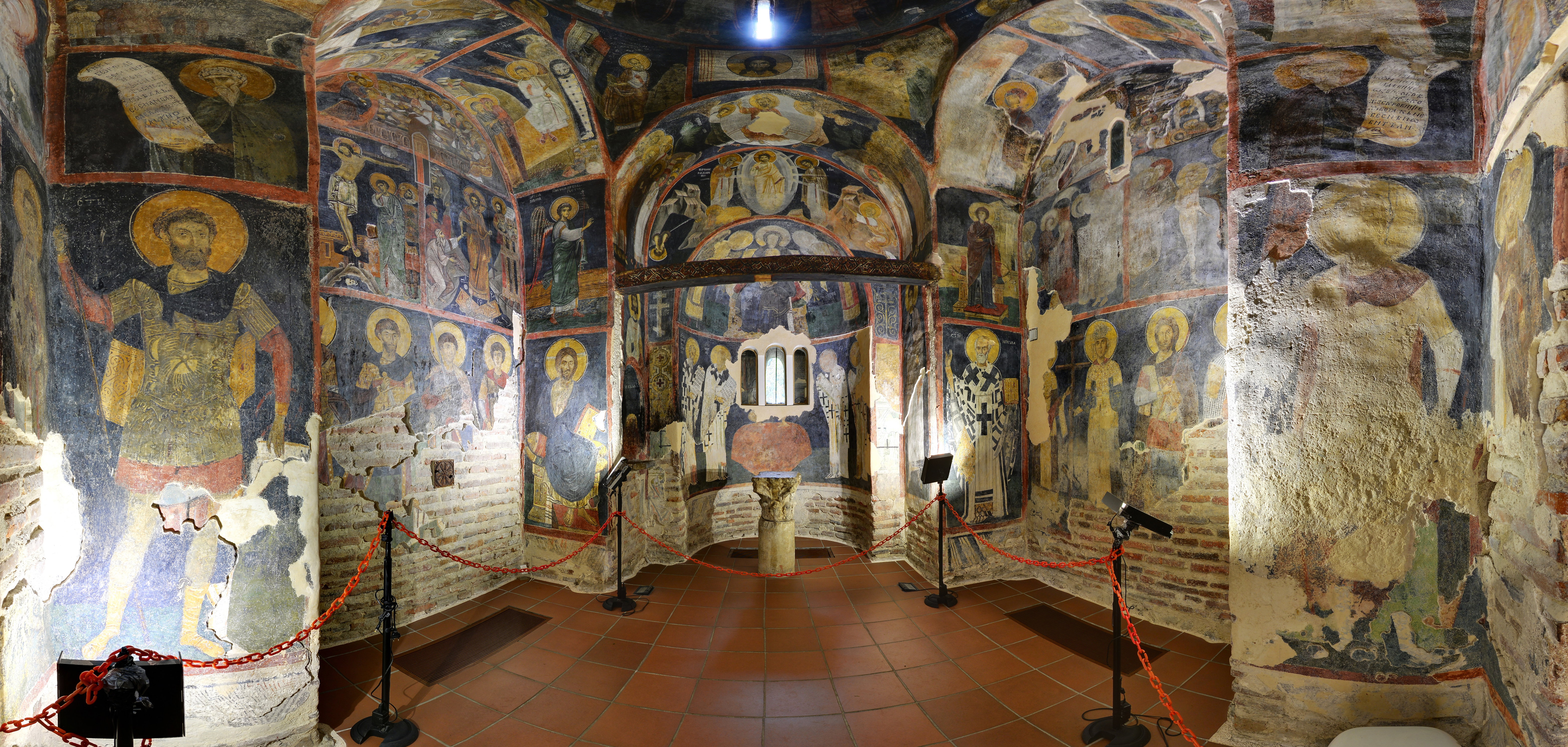
The Boyana Church ( bg, Боянска църква, ''Boyanska tsărkva'') is a medieval Bulgarian Orthodox church situated on the outskirts of Sofia, the capital of Bulgaria, in the Boyana quarter. In 1979, the building was added to the UNESCO World Heritage List. The east wing of the two-story church was originally constructed in the late 10th or early 11th century, then the central wing was added in the 13th century under the Second Bulgarian Empire, the whole building being finished with a further expansion to the west in the middle of the 19th century. A total of 89 scenes with 240 human images are depicted on the walls of the church. History and architecture The Boyana Church was built in three stages: in the late 10th to early 11th, the mid-13th, and the mid-19th centuries. The oldest section (the eastern church) is a small one-apse cross-vaulted church with inbuilt cruciform supports. It was built in the late 10th or the early 11th century. The second section, whi ... [...More Info...] [...Related Items...] OR: [Wikipedia] [Google] [Baidu] |
Ovcha Kupel
Ovcha kupel ( bg, Овча купел ) is a district (''rayon'') of the Stolichna Municipality of Sofia City Province, Bulgaria. The name of the neighborhood is applied to the thermal water that comes out on the earth's surface: shepherds who led their flocks there knew that the sheep willingly walk in the swampy meadows. After an earthquake in 1858, hot water gushed out and the sheep did not avoid it and were like bathed, hence the name, literally means "sheep bath" (''ovcha kupel''). On that place in 1933 was opened the Ovcha kupel Mineral Bath, built in 1925-1928 by architect . it has 47,380 inhabitants. It is located starting at 6 km to the south-west of the city centre of Sofia, including the eastern part of the Lyulin Mountain. The district includes some neighborhoods of Sofia – Ovcha kupel, Gorna banya, Suhodol, Karpuzitsa, and the village of Malo Buchino. In the district are situated 3 institutions of higher education: * Specialized Establishment of the Francophoni ... [...More Info...] [...Related Items...] OR: [Wikipedia] [Google] [Baidu] |
Sofia University
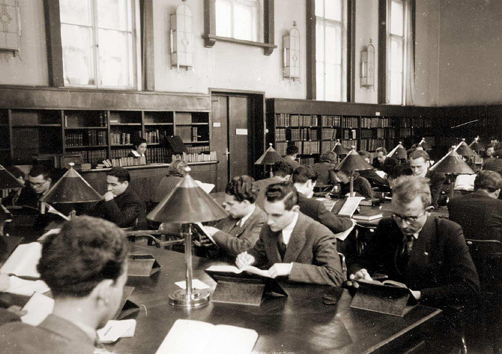
Sofia University, "St. Kliment Ohridski" at the University of Sofia, ( bg, Софийски университет „Св. Климент Охридски“, ''Sofijski universitet „Sv. Kliment Ohridski“'') is the oldest higher education institution in Bulgaria. Founded on 1 October 1888, the edifice of the university was constructed between 1924 and 1934 with the financial support of the brothers Evlogi Georgiev and Hristo Georgiev (whose sculptures are now featured on its façade) and has an area of 18,624 m2 and a total of 324 premises. The university has 16 faculties and three departments, where over 21,000 students receive their education. The current rector is Anastas Gerdzhikov. It has been consistently ranked as the top university in Bulgaria according to national and international rankings, being constantly among the best four percent of world universities according to ''QS World University Rankings''. History The university was founded on 1 October 1888— ... [...More Info...] [...Related Items...] OR: [Wikipedia] [Google] [Baidu] |
Buhovo
Buhovo ( bg, Бухово ) is a town in western Bulgaria and a district within the Sofia Capital Municipality. Buhovo is located 15 km southeast of the center of the capital Sofia. History In prehistory, during the middle and late Neolithic (New Stone Age), Buhovo was located 1.5 kilometers east of its current location. Evidence of its previous occupants remains (potsherds, hammers, axes and awls), through which the event is dated. Back then the name of Buhovo was ''Ursul''. In 1928 the "St. Nicholas" church was built. In 1938, with help from Germany, uranium deposits were developed. The village of Buhovo was declared a town with ''Decree 1942'' of the State Council of the PRB of 09.04.1974 (Prom. SG. 72 of 17.09.1974). Landmarks * Stadium "Minior" * A big sports hall * Monument to the plane of the regiment "Nikola Bonev" * "St. Maria Magdalena" monastery * "St. Arhangel Mihail" monastery * Miraculous icon "Truly Meet" from Mount Athos * Carting "Buhovo" (formerly ... [...More Info...] [...Related Items...] OR: [Wikipedia] [Google] [Baidu] |
Vrabnitsa, Sofia
Vrabnitsa ( bg, Връбница ) is a district of Sofia, located in the western part of the Sofia municipality. It has a population of 47,417. It consists of the following neighbourhoods – Moderno Predgradie (meaning Modern Suburb) (Модерно Предградие), Vrabnitsa (Връбница) & Obelya (Обеля). References Districts of Sofia {{Bulgaria-geo-stub ... [...More Info...] [...Related Items...] OR: [Wikipedia] [Google] [Baidu] |
Lyulin, Sofia
Lyulin ( bg, Люлин, pronounced ) is the largest residential complex both in the capital of Bulgaria - Sofia and in the whole country. It is located in the western outskirts of city and is divided into 10 microdistricts. The complex has a population of 114,813 and is at the disposal of all means of public transport. Lyulin is a relatively new district. The infrastructural work on the complex began in 1971 and the first condominium was constructed in 1973. The complex is named after the nearby Lyulin Mountain. It is a popular place to live, as transportation is favourable and the real estate is somewhat inexpensive. Transportation There are several bus and tram lines (8), two Trolleybus lines (6 and 7), and Sofia Metro ( Lyulin, Slivnitsa, and Zapaden park). Three main boulevards - "Tsaritsa Yoanna", "Pancho Vladigerov" and "Slivnitsa" transect the district. The bus, tram, and the trolleys go only to the center. The subway has limited overall coverage, but it is very effec ... [...More Info...] [...Related Items...] OR: [Wikipedia] [Google] [Baidu] |
Mladost, Sofia
Mladost ( bg, Младост, meaning "Youth") is a district of Sofia. It is one of the most modern and fast developing areas in the city. it has 114,887 inhabitants which makes it the second-most-populous district in the capital, situated in the south-east end of Sofia, between and Vitosha mountain. The largest business complex in Bulgaria is situated in the south end: Business Park Sofia. Mladost is among the safest and cleanest districts of Sofia. In May 2011 it became one of the first neighbourhoods of Sofia to have a complete cycling route of more than 8 km. Economy The district has a flourishing economy. There are two industrial and scientific zones, "Iztok" and "Gorublyane". "Iztok" has an area of 201 ha and specialises in the production of electronics, machinery and press industry. There are a number of important scientific institutes including the Institute of Hydrology and Meteorology; Library Institute; Institute of Electronics; Institute of Astronomy; Institute of ... [...More Info...] [...Related Items...] OR: [Wikipedia] [Google] [Baidu] |
Eagles' Bridge, Sofia
Eagles' Bridge ( bg, Орлов мост, ''Orlov most'' ) is a bridge over the Perlovska River in downtown Sofia, capital of Bulgaria.''Travel Sofia: Illustrated Guide, Phrasebook and Maps'', MobileReference, 2010 The bridge and junction where it is located, sometimes referred to as ''Ploshtad Orlov Most'' (Orlov Most Square) are usually referred simply as Eagles' Bridge (''Orlov most''). The name of the bridge itself comes from the four statues of eagles on it, which are, symbolically, its protectors and patrons. Eagles' Bridge and the junction are located in the immediate proximity of the Vasil Levski National Stadium, the Monument to the Soviet Army, the Borisova gradina park and Lake Ariana, and near Sofia University. Two main boulevards cross there – Evlogi Georgiev Boulevard, which follows the Perlovska river, and Tsarigradsko Shose, and Tsar Ivan Asen II Street terminates there. For the traffic entering Sofia from the southeast by Tsarigradsko shose, Eagles' Bridge is ... [...More Info...] [...Related Items...] OR: [Wikipedia] [Google] [Baidu] |


