|
Prussian Column
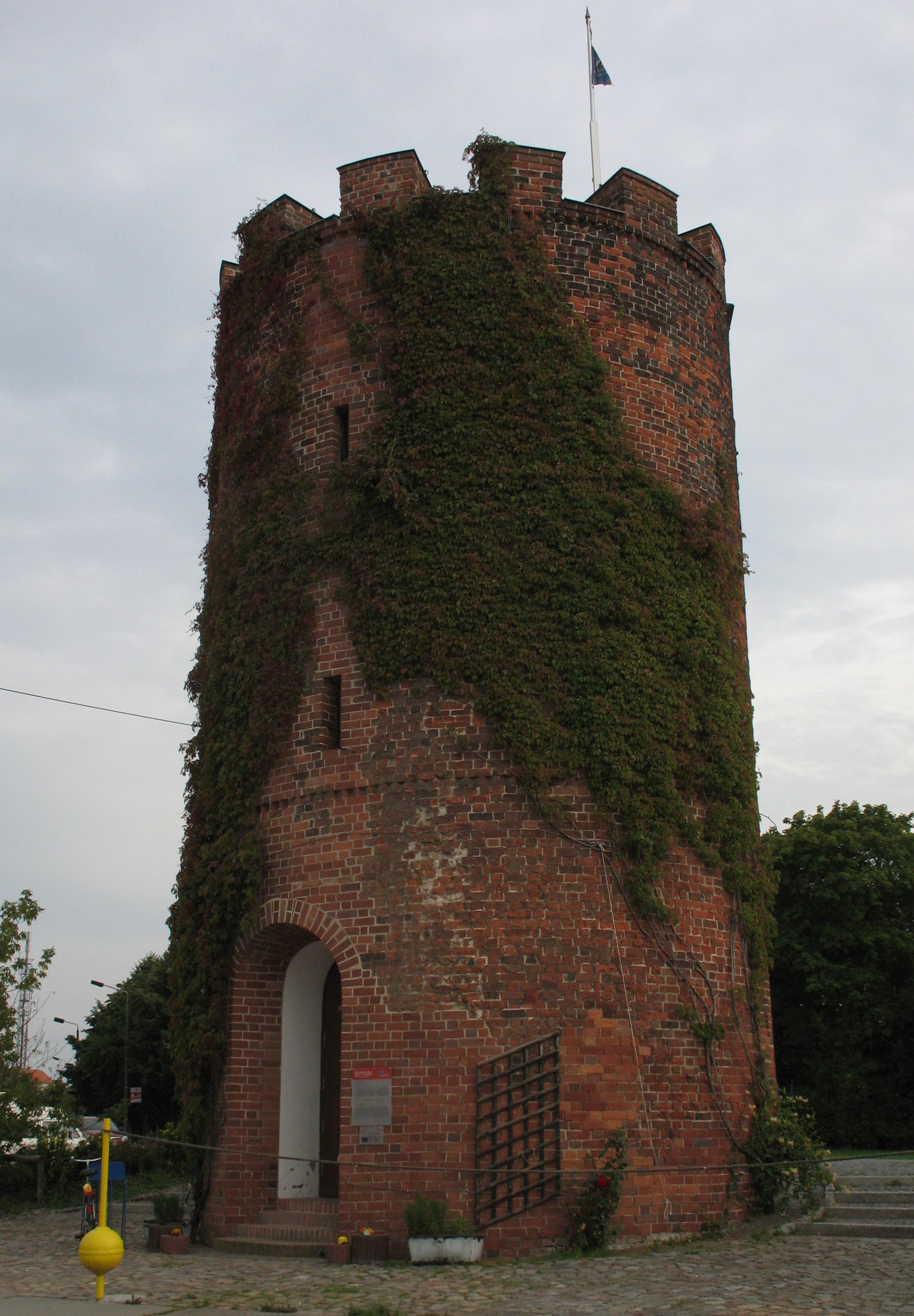
The Prussia Columns (german: Preußensäulen) are two monuments, over high, that were erected in the years 1854 and 1855 by order of the Prussian king, Frederick William IV on the southeast coast of the German island of Rügen near Neukamp and Groß Stresow. Both villages are today part of the municipality of Putbus. The monument near Neukamp was inaugurated on 15 October 1854 and the one near Groß Stresow exactly one year later, on the 60th birthday of Frederick William IV. The drums and parts of the pedestal were carved from one of the largest glacial erratics on and around Rügen, the Great Rock near Nardevitz on Rügen's Jasmund peninsula. Most of the rock was destroyed as a result of being quarried for the columns. Nevertheless, it is still impressive today, and sticks 3 metres out of the ground. The monuments were intended to commemorate the landings of the Brandenburg and later, Prussian troops on the island in the years 1678 and 1715 and to demonstrate Prussia's cl ... [...More Info...] [...Related Items...] OR: [Wikipedia] [Google] [Baidu] |
Invasion Of Rügen (1678)
The invasion of Rügen of 22 to 24 September 1678 was a military operation in the Swedish-Brandenburg War, or Scanian War, that ended with the annexation of the Swedish-ruled island of Rügen by the Allies – Brandenburg-Prussia and Denmark – for just under a year before it was restored by treaty to Sweden. The operation was a prelude to the long-planned Siege of Stralsund that followed shortly thereafter. Background The first invasion of Rügen in this war took place on 17 September 1677, when the Danes landed and succeeded, after the Battle of Bergen, in expelling the Swedes from the entire island. Soon after, the Swedes under the command of Field Marshal Otto Wilhelm von Konigsmark began moves to recapture the island, which proved successful when they won the Battle of Warksow on 18 January 1678. The island was not safe for long in spite of this Swedish victory, mainly because the Danes made several raids on Rügen over the summer. The possession of the island of ... [...More Info...] [...Related Items...] OR: [Wikipedia] [Google] [Baidu] |
Treaty Of Saint-Germain (1679)
The Treaty or Peace of Saint-Germain-en-Laye of 19 June (OS) or 29 June (NS) 1679 was a peace treaty between France and the Electorate of Brandenburg.Asmus (2003), p.211 It restored to France's ally Sweden her dominions Bremen-Verden and Swedish Pomerania, lost to Brandenburg in the Scanian War. Sweden ratified the treaty on 28 July 1679. The treaty is by some considered "the worst political defeat" of Elector Frederick William I.MacKay (1997), p.213, referring to Opgenoorth, ''Friedrich Wilhelm'' Volume II, p.194 He was forced by France to give away the Swedish portion of what he considered his rightful Pomeranian inheritance, despite having conquered it in a four-year campaign. Background Sweden had entered an alliance with France in April 1672.Arnold-Baker (2001), p.97 At this time, Great Britain, the Electorate of Brandenburg, the Netherlands and Denmark were hostile towards Sweden. Leopold I, Holy Roman Emperor entered an alliance with the Netherlands and Spain ... [...More Info...] [...Related Items...] OR: [Wikipedia] [Google] [Baidu] |
Stralsund
Stralsund (; Swedish: ''Strålsund''), officially the Hanseatic City of Stralsund (German: ''Hansestadt Stralsund''), is the fifth-largest city in the northeastern German federal state of Mecklenburg-Western Pomerania after Rostock, Schwerin, Neubrandenburg and Greifswald, and the second-largest city in the Pomeranian part of the state. It is located at the southern coast of the Strelasund, a sound of the Baltic Sea separating the island of Rügen from the Pomeranian mainland.'' Britannica Online Encyclopedia'', "Stralsund" (city), 2007, webpageEB-Stralsund The Strelasund Crossing with its two bridges and several ferry services connects Stralsund with Rügen, the largest island of Germany and Pomerania. The Western Pomeranian city is the seat of the Vorpommern-Rügen district and, together with Greifswald, Stralsund forms one of four high-level urban centres of the region. The city's name as well as that of the Strelasund are compounds of the Slavic ( Polabian) ''stral'' and ''s ... [...More Info...] [...Related Items...] OR: [Wikipedia] [Google] [Baidu] |
Altefähr
Altefähr is a municipality in the Vorpommern-Rügen district, in Mecklenburg-Vorpommern, Germany. Transport * Altefähr railway station is served by local services between Rostock, Stralsund and Sassnitz Sassnitz (, before 1993 in german: Saßnitz) is a town on the Jasmund peninsula, Rügen Island, in the state of Mecklenburg-Vorpommern, Germany. The population as of 2012 was 9,498. Sassnitz is a well-known seaside resort and port town, and is .... References External links Official website of Altefähr Towns and villages on Rügen {{VorpommernRügen-geo-stub ... [...More Info...] [...Related Items...] OR: [Wikipedia] [Google] [Baidu] |
Greifswalder Bodden
The Bay of Greifswald''Utrata Fachwörterbuch: Geographie - Englisch-Deutsch/Deutsch-Englisch'' by Jürgen Utrata (2014). Retrieved 10 Apr 2014. or Greifswald Bodden (german: Greifswalder Bodden) is a basin in the southwestern , off the shores of in the |
Greifswald
Greifswald (), officially the University and Hanseatic City of Greifswald (german: Universitäts- und Hansestadt Greifswald, Low German: ''Griepswoold'') is the fourth-largest city in the German state of Mecklenburg-Western Pomerania after Rostock, Schwerin and Neubrandenburg. In 2021 it surpassed Stralsund for the first time, and became the largest city in the Pomeranian part of the state. It sits on the River Ryck, at its mouth into the Danish Wiek (''Dänische Wiek''), a sub-bay of the Bay of Greifswald (''Greifswalder Bodden''), which is itself a sub-bay of the Bay of Pomerania (''Pommersche Bucht'') of the Baltic Sea. It is the seat of the district of Western Pomerania-Greifswald, and is located roughly in the middle between the two largest Pomeranian islands of Rugia (''Rügen'') and Usedom. The closest larger cities are Stralsund, Rostock, Szczecin and Schwerin. It lies west of the River Zarow, the historical cultural and linguistic boundary between West (west of the r ... [...More Info...] [...Related Items...] OR: [Wikipedia] [Google] [Baidu] |
Georg Von Derfflinger
Georg von Derfflinger (20 March 1606 – 14 February 1695) was a field marshal in the army of Brandenburg-Prussia during and after the Thirty Years' War (1618–1648). Early years Born 1606 at Neuhofen an der Krems in Austria, into a family of poor Protestant peasants, Derfflinger had to leave his home due to religious persecution under the Catholic Habsburg dynasty in the course of the Counter-Reformation. He probably fought side-by-side with insurgent Bohemian nobles led by Jindřich Matyáš Thurn and served in the armed forces of various Protestant combatant powers, at first in the Saxon army, but most of the time in that of Sweden Sweden, formally the Kingdom of Sweden,The United Nations Group of Experts on Geographical Names states that the country's formal name is the Kingdom of SwedenUNGEGN World Geographical Names, Sweden./ref> is a Nordic country located on .... Until the 1648 Peace of Westphalia he distinguished himself as an able and daring cavalr ... [...More Info...] [...Related Items...] OR: [Wikipedia] [Google] [Baidu] |
Earthworks (engineering)
Earthworks are engineering works created through the processing of parts of the earth's surface involving quantities of soil or unformed rock. Shoring structures An incomplete list of possible temporary or permanent geotechnical shoring structures that may be designed and utilised as part of earthworks: *Mechanically stabilized earth *Earth anchor * Cliff stabilization *Grout curtain *Retaining wall *Slurry wall *Soil nailing *Tieback (geotechnical) *Trench shoring * Caisson *Dam *Gabion *Ground freezing Gallery File:Mechanically stabilized earth diagram.gif, Mechanically stabilized earth File:GroutCurtain.gif, Grout curtain File:Retaining Wall Type Function.jpg, Retaining wall types File:Soil Nail.jpg, Soil nailing File:FEMA - 6044 - Photograph by Larry Lerner taken on 03-15-2002 in New York.jpg, Tieback File:Sbh s600.JPG, Trench shoring File:Caisson Schematic.svg, Caisson File:Vyrnwy dam.JPG, Dam File:Gabion 040.jpg, Gabions File:Cross section of a ground freezing pipe as u ... [...More Info...] [...Related Items...] OR: [Wikipedia] [Google] [Baidu] |
Juliusruh
Juliusruh is a village on the northern coast of the island of Rügen in northeastern Germany. Juliusruh is part of the municipality of Breege. Juliusruh and Breege combined have 821 inhabitants in an area of 15,99 km² (approx. 6 sq miles). Tourism is Juliusruh's economic mainstay. A facility for atmospheric research, the Ionosonde Juliusruh The Ionosonde Juliusruh is a facility of the institute for atmospheric physics near Juliusruh in northeastern Germany for sounding the ionosphere with radar systems in the short wave range (frequencies between 1 MHz and 30 MHz). The land ... is located nearby. Villages in Mecklenburg-Western Pomerania Towns and villages on Rügen Wittow {{VorpommernRügen-geo-stub ... [...More Info...] [...Related Items...] OR: [Wikipedia] [Google] [Baidu] |
Schaabe
The Schaabe is a bar, almost twelve kilometres long, on the German Baltic Sea island of Rügen. It joins the peninsulas of Jasmund and Wittow. Washed up and shaped by the sea, it forms a sickle-shaped shoreline on the bay of Tromper Wiek and separates the lagoons of the Großer Jasmunder Bodden and ''Breeger Bodden'' from the Baltic. The fine, washed up sand forms a giant natural bathing bay, that is bordered by the villages of Glowe and Juliusruh (a village in the municipality of Breege). Unlike the second largest bar on the island of Rügen, the Schmale Heide between Jasmund and the Granitz, which is dominated by the construction of the former Nazi " Strength Through Joy" resort of Prora and decades of military use and its associated infrastructure, the Schaabe between Glowe and Juliusruh is undeveloped apart from a managed forest, the only through road and its accompanying cycle path. Formation The Schaabe began to form about 4,500 years ago, when Rügen was st ... [...More Info...] [...Related Items...] OR: [Wikipedia] [Google] [Baidu] |


