|
Provincial Highway 63 (Taiwan)
Provincial Highway 63 () is a limited-access highway, which begins in Taichung at the intersection of Guoguang Road (Provincial Highway No. 3) and Zhongming South Road and ends in Caotun, Nantou on Bixing Road (Provincial Road 14B). It is commonly known as Zhongtou (Taichung-Nantou) Highway. Length The total length of the highway is 19.023 km. However, the viaduct actually begins at 1.8 km (on Wuquan South Road). Exit list {, class="plainrowheaders wikitable" , - !scope=col, City !scope=col, Location !scope=col, km !scope=col, Mile !scope=col, Exit !scope=col, Name !scope=col, Destinations !scope=col, Notes , - , colspan=8 style="text-align:center;" , Begin Viaduct , colspan=8 style="text-align:center;" , End Viaduct Major Cities Along the Route * Taichung * Caotun, Nantou Intersections with other Freeways and Expressways *None. However, it crosses National Highway No. 3 near Zhongtou IC. in Wufeng, Taichung. To access National Highway ... [...More Info...] [...Related Items...] OR: [Wikipedia] [Google] [Baidu] |
South District, Taichung
South District () is an urban district in Taichung, Taiwan. History The district used to be part of Taichung provincial city before the merger with Taichung County to form Taichung special municipality on 25 December 2010. Administrative divisions Zhangchun, Zhangrong, Chenghuang, Guoguang, Nanmen, Deyi, Jishan, Jiangchuan, Xinrong, Fuxing, Fuping, Fushun, Heping, Pinghe, Nanhe, Yongxing, Yonghe, Shuyi, Gongxue, Shude, Xichuan and Chonglun Village. Education * National Chung Hsing University * Chung Shan Medical University * YiNing High School (宜寧高中) * National Taichung Industrial High School (台中高工) * MingDer Girls' Senior High School (明德女中) * Chung Lun Junior High School (崇倫國中) * Sz-Yu Junior High School (四育國中) * XinYi Elementary School (信義國小) * Kuo-Kuang Elementary School (國光國小) * He Ping Elementary School (和平國小) * Shu Yi Elementary School (樹義國小) Tourist attractions * Taichung Cultural and Creativ ... [...More Info...] [...Related Items...] OR: [Wikipedia] [Google] [Baidu] |
Taichung
Taichung (, Wade–Giles: ''Tʻai²-chung¹'', pinyin: ''Táizhōng''), officially Taichung City, is a special municipality located in central Taiwan. Taichung has approximately 2.8 million residents and is the second most populous city of Taiwan, as well as the most populous city in Central Taiwan. It serves as the core of the Taichung–Changhua metropolitan area, the second largest metropolitan area in Taiwan. Located in the Taichung Basin, the city was initially developed from several scattered hamlets helmed by the Taiwanese indigenous peoples. It was constructed to be the new capital of Taiwan Province and renamed as " Taiwan-fu" in the late Qing dynastic era between 1887 and 1894. During the Japanese era from 1895, the urban planning of present-day city of Taichung was performed and developed by the Japanese. From the start of ROC rule in 1945, the urban area of Taichung was organized as a provincial city up until 25 December 2010, when the original provincial city and ... [...More Info...] [...Related Items...] OR: [Wikipedia] [Google] [Baidu] |
Wufeng District
Wufeng District () is a suburban district in southern Taichung, Taiwan. It is the location of Taiwan Provincial Consultative Council. Wufeng is a mainly agricultural town. It was heavily damaged by the Jiji earthquake on 21 September 1999, which caused around 100 deaths in the town. The 921 Earthquake Museum of Taiwan, which commemorates the giant quake, is built at what was formerly Guangfu Junior High School, which was destroyed when part of the school was uplifted by the Chelungpu Fault during the quake. The two major geographical features of this town are the Wu Xi (Wu Stream), which forms the town's southern border, and Xiangbi Shan (Elephant Trunk Mountain), which lies in the eastern part of the township. History Formerly called ''Atabu'' (). Administrative divisions Tonglin, Jifeng, Jiayin, Benxiang, Zhongzheng, Jinrong, Laiyuan, Bentang, Beiliu, Nanliu, Side, Wufu, Dingtai, Beishi, Nanshi, Wanfeng, Jiuzheng, Kengkou, Fenggu Liugu Village. Geography * Area: 98.0 ... [...More Info...] [...Related Items...] OR: [Wikipedia] [Google] [Baidu] |
Caotun, Nantou
Caotun Township, formerly transliterated as Tsaotun Township, is an urban township in the northwest of Nantou County, Taiwan. It is the largest township in Taiwan by population. History The area was historically known as ''Chháu-ê-tun'' () with the present name adopted under Japanese rule in 1920. Administrative divisions The township comprises 27 villages: Beishi, Beitou, Bifeng, Bizhou, Duihe, Fuliao, Fuxing, Heping, Jialao, Mingzheng, Nanpu, Pingding, Pinglin, Shanglin, Shanjiao, Shichuan, Shuangdong, Tucheng, Xincuo, Xinfeng, Xinzhuang, Yanfeng, Yufeng, Yushi, Zhongshan, Zhongyuan and Zhongzheng. Education * Nan Kai University of Technology Tourist attractions * Caotun Night Market * Jiujiufeng * Taiwan Times Village * Yu-hsiu Museum of Art Transportation The nearest train station to Caotun is the Yuanlin Station of the Taiwan Railway Administration in Changhua County. Taichung City Bus route 108 have reach Nan Kai University of Technology, however 10km+10 TWD prom ... [...More Info...] [...Related Items...] OR: [Wikipedia] [Google] [Baidu] |
Nantou County
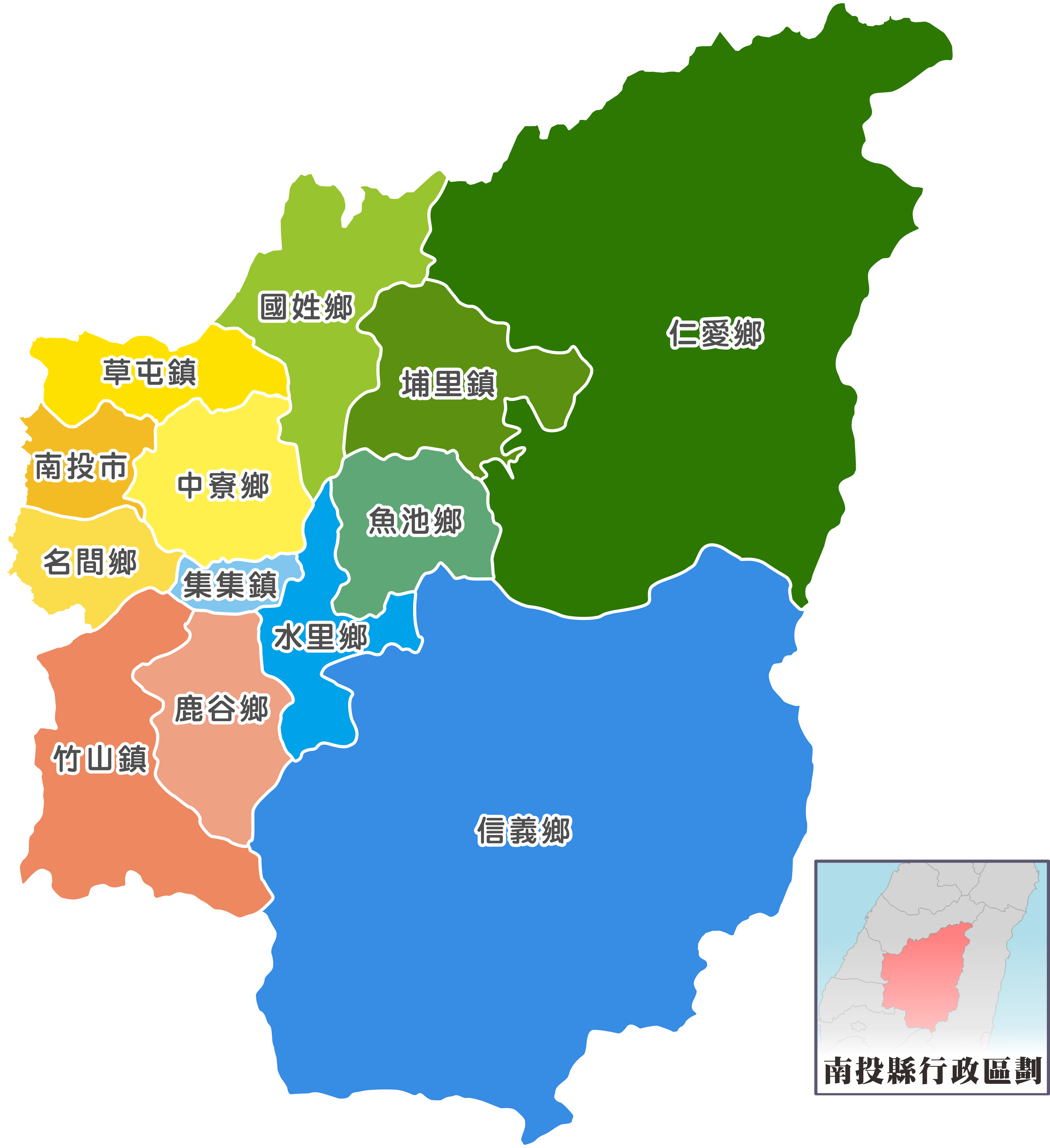
Nantou County (; Hokkien POJ: ''Lâm-tâu-koān''; Hakka PFS: ''Nàm-thèu-yen'') is the second largest county of Taiwan by area, located in the central part of the country. It is also the only non-coastal county in Taiwan. Its name derives from the Hoanya Taiwanese aboriginal word ''Ramtau''. Its mountainous area makes it a tourist destination; Sun Moon Lake is located in this county. Other well-known sightseeing of the county including Aowanda, Formosan Aboriginal Culture Village, Hehuanshan, Paper Dome, Qingjing Farm, Shanlinxi, Shuiyuan Suspension Bridge and Xitou. Notable cities in Nantou are Nantou City and Puli Town. The official butterfly of Nantou County is the broad-tailed swallowtail butterfly (''Agehana maraho''). Nantou's tung-ting tea is one of the most famous and high-quality oolong teas grown in Taiwan. History Early history Before the arrival of Han Chinese to Nantou, the Atayal, Bunun and Tsou tribes were distributed throughout the northern and ce ... [...More Info...] [...Related Items...] OR: [Wikipedia] [Google] [Baidu] |
Limited-access Road
A limited-access road, known by various terms worldwide, including limited-access highway, dual-carriageway, expressway, limited access freeway, and partial controlled access highway, is a highway or arterial road for high-speed traffic which has many or most characteristics of a controlled-access highway (also known as a ''freeway'' or ''motorway''), including limited or no access to adjacent property, some degree of Dual carriageway, separation of opposing traffic flow, use of grade separated Interchange (road), interchanges to some extent, prohibition of slow modes of transport, such as bicycles, Working animal, (draught) horses, or self-propelled agricultural machines; and very few or no intersection (road), intersecting cross-streets or level crossings. The degree of isolation from local traffic allowed varies between countries and regions. The precise definition of these terms varies by jurisdiction.''Manual on Uniform Traffic Control Devices''Section 1A.13 Definitions of ... [...More Info...] [...Related Items...] OR: [Wikipedia] [Google] [Baidu] |
Taichung City
Taichung (, Wade–Giles: ''Tʻai²-chung¹'', pinyin: ''Táizhōng''), officially Taichung City, is a special municipality located in central Taiwan. Taichung has approximately 2.8 million residents and is the second most populous city of Taiwan, as well as the most populous city in Central Taiwan. It serves as the core of the Taichung–Changhua metropolitan area, the second largest metropolitan area in Taiwan. Located in the Taichung Basin, the city was initially developed from several scattered hamlets helmed by the Taiwanese indigenous peoples. It was constructed to be the new capital of Taiwan Province and renamed as " Taiwan-fu" in the late Qing dynastic era between 1887 and 1894. During the Japanese era from 1895, the urban planning of present-day city of Taichung was performed and developed by the Japanese. From the start of ROC rule in 1945, the urban area of Taichung was organized as a provincial city up until 25 December 2010, when the original provincial city and ... [...More Info...] [...Related Items...] OR: [Wikipedia] [Google] [Baidu] |
Dali District
Dali District () is an inner city district in Taichung, Taiwan. Name The name "Dali" originates from ''Tai-li-khit'' (), where ''Tai-li'' refers to the Hoanya aborigines and ''khit'' refers to a bamboo raft's toon. History After the handover of Taiwan from Japan to the Republic of China in 1945, Dali was organized as a rural township of Taichung County. On 1 November 1993, Dali was upgraded to a county-administered city due to its population. On 25 December 2010, Taichung County was merged with Taichung City and Dali was upgraded to a district of the city. Administrative divisions Tunghu, Xihu, Dali, Xinli, Guoguang, Shuwang, Xiangxing, Neixin, Zhongxin, Tungsheng, Dayuan, Jiatian, Renhua, Rende, Jianmin, Tucheng, Tungxing, Daming, Yonglong, Rixin, Xirong, Zhangrong, Jincheng, Liren, Lide, Xinren and Ruicheng Village. Education Universities * Hsiuping University of Science and Technology Junior high schoolsCheng Kong Junior High School Senior high schools *The Affiliated ... [...More Info...] [...Related Items...] OR: [Wikipedia] [Google] [Baidu] |
Nantun District
Nantun District () is an urban district in Taichung, Taiwan. It was a part of Taichung before the City and County were amalgamated in 2010. History The district used to be part of Taichung provincial city before the merger with Taichung County to form Taichung special municipality on 25 December 2010. Nantun is home to Liming New Village, a planned community containing multiple government offices. Administrative divisions Nantun, Fengle, Fengshu, Zhonghe, Zengping, Chunshe, Chunan, Wenshan, Baoshan, Xinsheng, Yongding, Sancuo, Sanyi, Sanhe, Liming, Gouqi, Daye, Huizhong, Tianxin, Xiangxin, Wenxin, Tongxin, Datong, Daxing and Dacheng Village. Government institutions * National Land Surveying and Mapping Center * Water Resources Agency Education * Ling Tung University Tourist attractions * Fengle Sculpture Park * Fulfillment Amphitheater * Ling Tung Numismatic Museum * Rainbow Village * Taichung Mosque Transportation * Feng-le Park, Jiuzhangli, Nantun, Shui'an Temple and ... [...More Info...] [...Related Items...] OR: [Wikipedia] [Google] [Baidu] |
Wuri District
Wuri District () is a suburban district in southern Taichung, Taiwan. Both of the two north–south freeways (National Freeway 1 and National Freeway 3) pass through Wuri. Wuri is also home to a large military training centre, Chengkungling, as well as Taichung HSR station. Administrative divisions Wuri, Huri, Sanhe, Rongquan, Xuetian, Jiude, Rende, Qianzhu, Wuguang, Guangming, Tungyuan, Xiju, Luotan, Beili, Nanli and Xiwei Village.http://vote2014.nat.gov.tw/en/TV/nm400000900000000.html Geography * Area: 43.4032 km2 * Population: 77,468 people (August 2022) Wuri District borders Dadu, Nantun, South, Dali, and Wufeng districts of Taichung City, as well as Changhua City and Fenyuan Township of Changhua County. Education Senior high schools * Mingdao Senior High School Junior high schools * Wurih Junior High School * Guangde Junior High School * Shinan Junior High School * Mingdao Senior High School Junior High Department Elementary schools * Wurih Elementary ... [...More Info...] [...Related Items...] OR: [Wikipedia] [Google] [Baidu] |
Puli, Nantou
Puli Township () is an urban township in Nantou County, Taiwan. The township is located within the Puli Basin. It is the geographic center of Taiwan. Name In the 19th century the city was known as Posia () or Po-li-sia (). The Atayal name of the settlement was Sabaha Bakalas, meaning "house of stars". From 1920, during the Japanese era, the town was administered as , , Taichū Prefecture. History Spread of Christianity In 1870, a native of Po-li-sia named Khai-san received treatment for a medical issue in a missionary hospital in Taiwan-fu (present-day Tainan) and learned about Christianity. When he returned home, he spread information about Christianity to the people of the area. In July 1871, two native preachers were sent to the area after reports concerning the spread of Christianity in Po-li-sia were heard of in Taiwan-fu. They reported back that "a movement, favourable to Christianity, had really taken place" in the area. Members of the Canada Presbyterian Mission vi ... [...More Info...] [...Related Items...] OR: [Wikipedia] [Google] [Baidu] |


