|
Provincial Highway 12 (Taiwan)
Provincial Highway 12, named as Taiwan Boulevard (台灣大道) for its entire length, is a 23.2 km east–west highway that connects Port of Taichung in Wuqi with downtown Taichung City. Highway 12 is one of the major thoroughfares of Taichung, connecting the historic downtown at Central District with its newer central business district in Xitun District. The road is also one of three that connect to National freeway 1 in Xitun. Between 2014 and 2015, the Taichung BRT ran on Highway 12 between Taichung railway station and Providence University in Shalu District, and there are plans to build a metro line at the BRT system's former course. Route description Highway 12 begins with additional separated motorcycle lanes on each side at the intersection with Highway 17 in Wuqi District, near the gate of the Port of Taichung. The route runs southeast, crossing Highway 61 and Highway 1, before being elevated over the Western Trunk railway line via the Shalu Overpass (沙� ... [...More Info...] [...Related Items...] OR: [Wikipedia] [Google] [Baidu] |
Port Of Taichung
The Port of Taichung (), also Taichung Port, is a port located in Wuqi District, Taichung, Taiwan. It is the second-largest port in Taiwan after Kaohsiung Port and operated by Taiwan International Ports Corporation, Taiwan's state-owned harbor management company. Overview The port covers an area of , and includes industrial, fishing, and business ports. It is -long and 2.5 to 4.5 km wide. It can accommodate vessels of up to 60,000 tons, and in June 2000 earned an ISO-9001 rating. The port still has hundreds of hectares left of undeveloped space. The harbor is located 110 nautical miles from Keelung Port and 120 nautical miles from Kaohsiung Port. In 2010, the harbor surpassed Keelung Port to become the second-largest port in Taiwan. Total investment has topped NT$457.5 billion (US$15.3 billion) by 59 companies, while thirty firms have established operations within its free-trade zone. Compared to 2010, total cargo processed has grown 21% while containers handled grew 13. ... [...More Info...] [...Related Items...] OR: [Wikipedia] [Google] [Baidu] |
Motorcycle Lanes
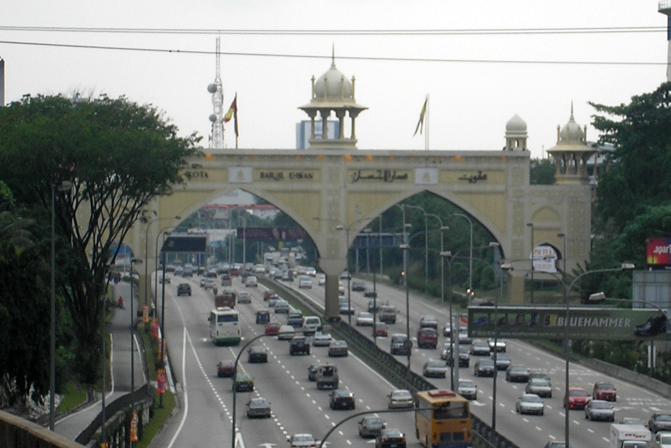
Motorcycle lane is a term used for the special lane on a roadway that is designated for small vehicles such as motorcycles, scooters, bicycles and trishaw. It's usually situated between the other lanes, marked by 2 parallel yellow lines. Due to the popularity of such vehicles in several Asian countries, motorcycle lanes are commonly found there. Motorcycles lanes by country Malaysia In some parts of the expressways and highways in Malaysia, there is an additional lane designated for motorcycles. These lanes are usually about half the width of a normal lane on the North–South Expressway and are positioned on the extreme left side of the main carriageway for each direction of travel. These special lanes are found in Shah Alam Expressway, Butterworth–Kulim Expressway, Federal Highway, Guthrie Corridor Expressway, Putrajaya–Cyberjaya Expressway, Port of Tanjung Pelepas Highway, Sultan Mahmud Bridge Highway, Sultan Ismail Bridge and all major highways in Putrajaya. Mo ... [...More Info...] [...Related Items...] OR: [Wikipedia] [Google] [Baidu] |
West District, Taichung
West District () is a district of Taichung, Taiwan. It is the second smallest district in Taichung City after Central District. Former Taichung City Hall and part of Taichung City Government offices are located in this district. History The district used to be part of Taichung provincial city before the merger with Taichung County to form Taichung special municipality on 25 December 2010. Division The West District of Taichung is divided into 25 Li (里): Education * National Taichung University of Education Tourism Historic sites * Shenji New Village * Taichung Shiyakusho * Taichung Prefectural Hall * Taichung City Hall * Datun Region Hall * Taichung Takenori Hall * National Taichung University of Education Administrative Building * Datung Elementary School Administrative Building * Sun Li-jen Former Residence * Lin Chih-Chu Studio Museums and arts * National Museum of Natural Science * National Taiwan Museum of Fine Arts * Taichung City Dadun Cultural Center ... [...More Info...] [...Related Items...] OR: [Wikipedia] [Google] [Baidu] |
Provincial Highway 74 (Taiwan)
Provincial Highway 74 (), also known as the Kuaiguan-Wufeng Expressway (快官烏日線) or Taichung Ring Expressway (台中環線), is an expressway around Taichung City. It starts at Kuaiguan Interchange on Freeway No. 3 in Changhua City and ends at Wufeng Interchange on Freeway No. 3 in Wufeng District. Length Main line The total length of main line is 37.841 km. The route between Kuaiguan Interchange and Zhongqing Rd. was opened to the public on May 5, 2002. During this time it was known as the Taichung-Changhua Expressway (中彰快速道路). Afterwards, the east section between Songzhu Rd. and Wufeng Interchange was opened to the public on December 31, 2011. The route between Zhongqing Rd. and Chongde Rd. was opened to traffic on December 31, 2013. Branch Line The branch line (Provincial Highway No. 74A, ) which starts at the western end of Provincial Highway No. 74 (Kuaiguan Interchange) and ends at Provincial Highway No. 1 in Huatan, Changhua. Its length is 10 ... [...More Info...] [...Related Items...] OR: [Wikipedia] [Google] [Baidu] |
National Freeway 1
National Freeway 1 (), also known as Sun Yat-sen Freeway (), is a freeway in Taiwan, the first freeway built in Taiwan. It begins in Keelung at the intersection of Xiao 2nd Road and Zhong 4th Road and ends in Kaohsiung at the intersection of Zhongshan 4th Road and Yugang Road, giving it a total length of . Naming The Republic of China government named the freeway Sun Yat-sen Freeway in honor of Sun Yat-sen, the country's founding father. National Freeway 1 is a tollway where the amount charged varies by distance traveled, with vehicles being fitted with an electronic tag to facilitate toll calculation; the term "freeway" refers to "free of signal", and not free from charge. History The construction began in 1971. The north section between Keelung and Zhongli (now Zhongli District, Taoyuan) was completed in 1974, and the entire highway was opened in 1978. A viaduct on top of the freeway between Xizhi and Wugu was completed in 1997 in order to expand the capacity of the ... [...More Info...] [...Related Items...] OR: [Wikipedia] [Google] [Baidu] |
National Freeway 3
National Freeway 3 (), also known as Formosa Freeway (), is a freeway in Taiwan. It is the second north–south freeway in Taiwan, beginning in Keelung City at Jijin Interchange on the provincial highway 2 (Jijin Road) and ending in Linbian, Pingtung on the provincial highway 17. It is the longest freeway in Taiwan with a total length of . The freeway is also the only one in Taiwan to have a spur route, Freeway 3A. The highway has 58 interchanges, 15 junctions, 7 service areas and 3 rest areas en route. Aside from the 58 public interchanges, there are also some interchanges reserved for governmental usage. Route Description This freeway mostly serves as a bypass to major cities in Western Taiwan, traveling through suburban and rural areas. However, Freeway 3 is also the primary freeway in the counties of Nantou and Pingtung, as well as the first ever being built in these counties. Various expressways and east-west freeways link Freeway 3 with urban areas typically served by ... [...More Info...] [...Related Items...] OR: [Wikipedia] [Google] [Baidu] |
Longjing District
Longjing District () is a coastal suburban district in western Taichung, Taiwan. Geography Longjing shares borders with Wuqi and Shalu to the north, Xitun to the east, the Pacific Ocean to the west, Dadu and Shengang in Changhua County to the south. The eastern part of Longjing is located on the Dadu Plateau. Name and history The area was originally occupied by the aboriginal Papora people. The term ''Longjing'' (龍井) means "Dragon Well"; a well is located in the area. Prior to Japanese rule, the district was called "Chie Tou Village" (茄投庄). During Japanese rule over Taiwan the district was renamed to Longjing (龍井), taken from the name of a famous well in the area named Dragon Eye Well (龍目井) Dragon Eye Well is located in Longquan Village, under an old camphor tree. One of the Qing governors of Changhua recorded that the well's water was cool and refreshing, and the atmosphere was serene around the well. The name "Dragon Eye" comes from the two roc ... [...More Info...] [...Related Items...] OR: [Wikipedia] [Google] [Baidu] |
Bus Lane
A bus lane or bus-only lane is a lane restricted to buses, often on certain days and times, and generally used to speed up public transport that would be otherwise held up by traffic congestion. The related term busway describes a roadway completely dedicated for use by buses. Bus lanes are a key component of a high-quality bus rapid transit (BRT) network, improving bus travel speeds and reliability by reducing delay caused by other traffic. A dedicated bus lane may occupy only part of a roadway which also has lanes serving general automotive traffic; in contrast to a transit mall which is a pedestrianized roadway also served by transit. History The first bus lane is often erroneously attributed to Chicago, where in 1939 Sheridan Road was installed with reversible lanes north of Foster Avenue. The setup consisted of three-lanes towards the peak direction (south in the morning; north in the evening), and one contraflow lane. None of the lanes exclusively carried buses, b ... [...More Info...] [...Related Items...] OR: [Wikipedia] [Google] [Baidu] |
Dadu Plateau
The Dadu Plateau (), also known as Dadu Mountain or Dadushan (), is a plateau that stretches across Taichung, Taiwan. It borders the Taichung Basin in the east and the seacoast of Taichung in the west, and lies between the Dajia River and the Dadu River. The plateau is long and narrow, with a length of about 20 km and a width of about 5 to 7 km. Its average elevation is about 151 m above sea level, with its highest peak at 310 m. See also * Dadu, Taichung * Kingdom of Middag The Kingdom of Middag (), also known as the Kingdom of Dadu (), was a supra-tribal alliance located in the central-western plains of Taiwan in the 17th century. This polity was established by the Taiwanese indigenous peoples of Papora, Babuza, ... Plateaus of Taiwan Landforms of Taichung {{Taiwan-geo-stub ... [...More Info...] [...Related Items...] OR: [Wikipedia] [Google] [Baidu] |
Western Trunk Line
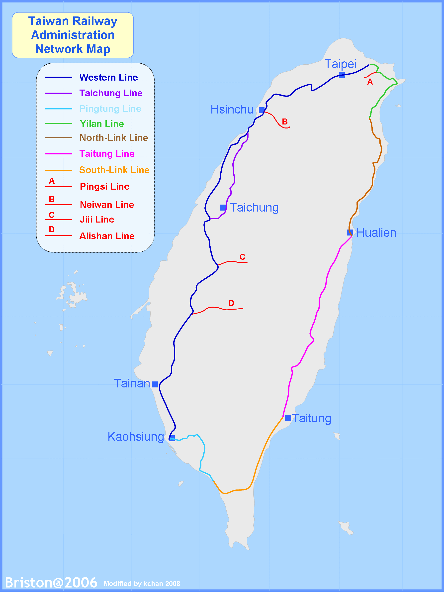
Western Trunk line () is a railway line of the Taiwan Railways Administration in western Taiwan. It is by far the busiest line, having served over 171 million passengers in 2016. The total length of the line is 404.5 km. The line is an official classification of physical tracks and does not correspond to particular services. It is connected to Taichung line (''mountain line''; ) at Zhunan and Changhua. Many services turn inland to take the Taichung route, then reconnect back to the main line (West Coast line). Train schedules and departure boards mark either ''mountain'' or ''coastal'' () line to indicate the route taken. History The original railroad between Keelung and Twatutia was completed in 1891. The section between Twatutia and Hsinchu was finished in 1893. However, in the Japanese era, these sections were all rebuilt by the Government-General of Taiwan as part of its Taiwan Trunk Railway (, ''Jūkan Tetsudō'') project. The Taiwan Trunk Railway was completed in ... [...More Info...] [...Related Items...] OR: [Wikipedia] [Google] [Baidu] |
Provincial Highway 1 (Taiwan)
Provincial Highway 1 () is a -long Taiwanese provincial highway that starts in the north of the country near Taipei Main Station and ends in the south at Fangshan, Pingtung County. It intersects with Provincial Highway 9 and Provincial Highway 26. Before the freeway system was built in Taiwan, this was the primary north-south highway for the island. The highway connects most of the major cities in Taiwan. In most parts of Taiwan, the road is known as The North-South Highway (縱貫公路). Kilometre posts on the highway count south from Taipei. Route Description Taipei and New Taipei Cities Provincial Highway 1 begins in front of Executive Yuan in Taipei. The highway follows Zhongxiao West Road (忠孝西路) in Taipei, and crosses into Sanchong, New Taipei City via Zhongxiao Bridge (忠孝橋). The highway is known as Xinbei Blvd (新北大道) as it passes through Sanchong, Xinzhuang, and Taishan. PH 1 continues through Shulin and enters Taoyuan City. Taoyuan, Hsinchu, ... [...More Info...] [...Related Items...] OR: [Wikipedia] [Google] [Baidu] |
.jpg)


