|
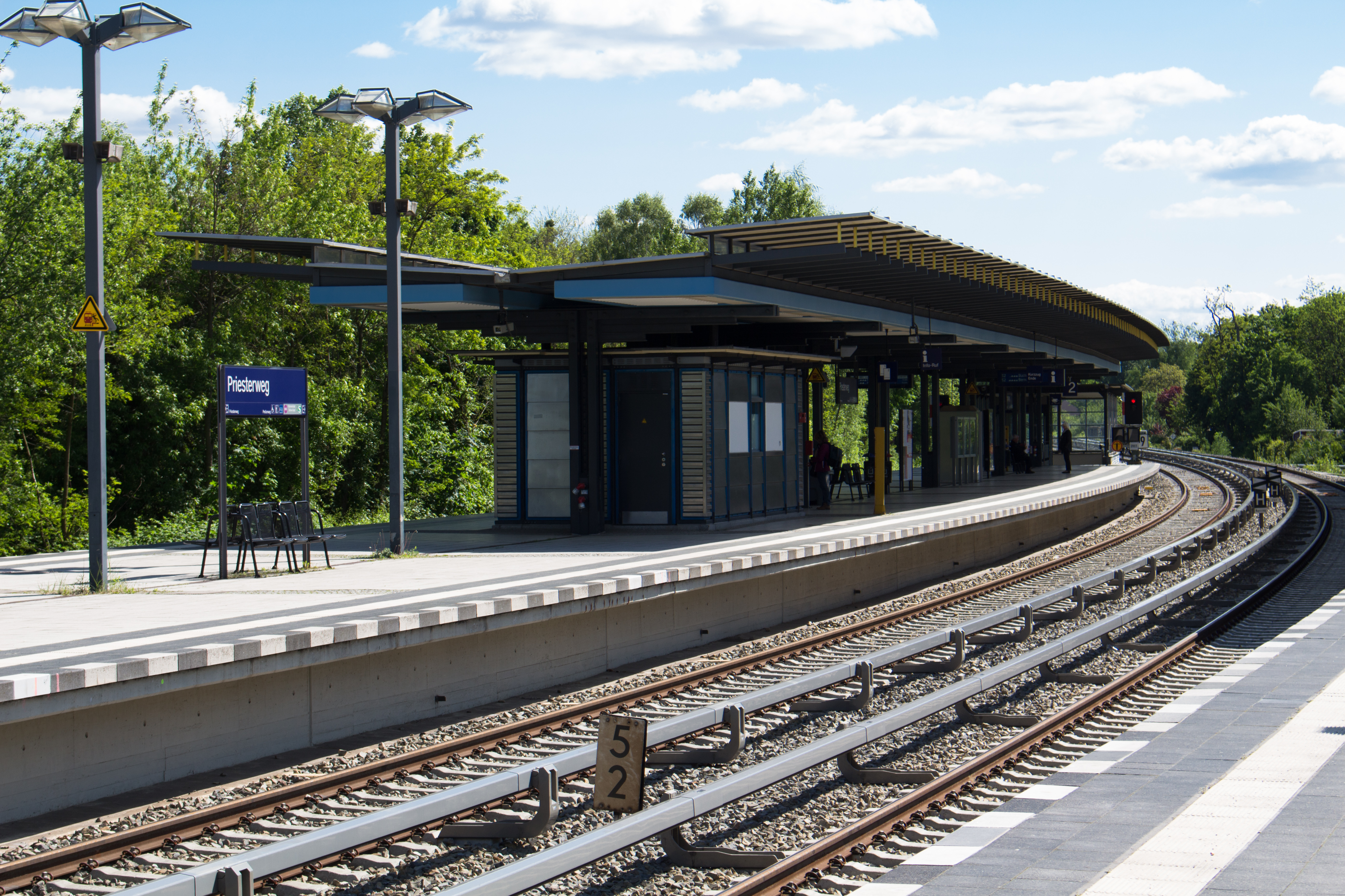
Priesterweg Railway Station
Priesterweg station is on the Anhalt Suburban Line in the district of Schöneberg in the Berlin borough of Tempelhof-Schöneberg. It is served by Berlin S-Bahn lines S2, S25, and S26. Location The station is located in the district of Schöneberg in Tempelhof-Schöneberg. The Berlin city center lies 8 km to the northeast. It fronts onto the streets of Priesterweg and Prellerweg to the west. Located east of the station on former rail yards is the ''Natur-Park Schöneberger Südgelände'' (South Grounds Nature Park). Southwest is the ''Insulaner'' (literally “islanders”, which was derived from the name of a cabaret program broadcast on Rundfunk im amerikanischen Sektor during the Berlin Blockade), a hill formed of rubble created by Second World War bombing raids, which the Wilhelm-Foerster Observatory is located on. Südkreuz station is located about 1.8 kilometres to the north, Attilastraße station is about 1.3 km to the south and Südende station is about 1.4&n ... [...More Info...] [...Related Items...] OR: [Wikipedia] [Google] [Baidu] |
Schöneberg
Schöneberg () is a locality of Berlin, Germany. Until Berlin's 2001 administrative reform it was a separate borough including the locality of Friedenau. Together with the former borough of Tempelhof it is now part of the new borough of Tempelhof-Schöneberg. History The village was first documented in a 1264 deed issued by Margrave Otto III of Brandenburg. In 1751, Bohemian weavers founded Neu-Schöneberg also known as Böhmisch-Schöneberg along northern Hauptstraße. During the Seven Years' War on 7 October 1760 Schöneberg and its village church were completely destroyed by a fire due to the joint attack on Berlin by Habsburg and Russian troops. Both Alt-Schöneberg and Neu-Schöneberg were in an area developed in the course of industrialization and incorporated in a street network laid out in the Hobrecht-Plan in an area that came to be known architecturally as the Wilhelmine Ring. The two villages were not combined as one entity until 1874 and received town privileg ... [...More Info...] [...Related Items...] OR: [Wikipedia] [Google] [Baidu] |
Berlin Südkreuz
Berlin ( , ) is the capital and largest city of Germany by both area and population. Its 3.7 million inhabitants make it the European Union's most populous city, according to population within city limits. One of Germany's sixteen constituent states, Berlin is surrounded by the State of Brandenburg and contiguous with Potsdam, Brandenburg's capital. Berlin's urban area, which has a population of around 4.5 million, is the second most populous urban area in Germany after the Ruhr. The Berlin-Brandenburg capital region has around 6.2 million inhabitants and is Germany's third-largest metropolitan region after the Rhine-Ruhr and Rhine-Main regions. Berlin straddles the banks of the Spree, which flows into the Havel (a tributary of the Elbe) in the western borough of Spandau. Among the city's main topographical features are the many lakes in the western and southeastern boroughs formed by the Spree, Havel and Dahme, the largest of which is Lake Müggelsee. Due to its location ... [...More Info...] [...Related Items...] OR: [Wikipedia] [Google] [Baidu] |
Berlin S-Bahn Stations
Berlin ( , ) is the capital and largest city of Germany by both area and population. Its 3.7 million inhabitants make it the European Union's most populous city, according to population within city limits. One of Germany's sixteen constituent states, Berlin is surrounded by the State of Brandenburg and contiguous with Potsdam, Brandenburg's capital. Berlin's urban area, which has a population of around 4.5 million, is the second most populous urban area in Germany after the Ruhr. The Berlin-Brandenburg capital region has around 6.2 million inhabitants and is Germany's third-largest metropolitan region after the Rhine-Ruhr and Rhine-Main regions. Berlin straddles the banks of the Spree, which flows into the Havel (a tributary of the Elbe) in the western borough of Spandau. Among the city's main topographical features are the many lakes in the western and southeastern boroughs formed by the Spree, Havel and Dahme, the largest of which is Lake Müggelsee. Due to its location ... [...More Info...] [...Related Items...] OR: [Wikipedia] [Google] [Baidu] |
List Of Railway Stations In Berlin
This list covers the railway stations in the Berlin area. These include both passenger stations and marshalling yards, but not goods stations. Because the Berlin S-Bahn network has expanded to include stations in the state of Brandenburg, the table shows only those stations lying within the Verkehrsverbund Berlin-Brandenburg's present-day Berlin ABC fare zones (i.e. those up to about 15 kilometres from the Berlin city boundary), and those formerly served by Berlin's suburban services. The latter ran out beyond the capital's boundaries to the next largest towns along the main and branch lines. The farthest towns on the lines covered here are listed below: Rüdnitz ( Stettin Railway) – Werneuchen (Wriezen Railway) – Strausberg (Prussian Eastern Railway) – Fürstenwalde (Lower Silesian-Märkisch Railway) – Kablow ( Königs Wusterhausen–Grunow) – Königs Wusterhausen ( Görlitz Railway) – Mittenwalde ( Neukölln–Mittenwalde railway) – Wünsdorf ( Dresden ... [...More Info...] [...Related Items...] OR: [Wikipedia] [Google] [Baidu] |
Friedrich-Wilhelm-Platz (Berlin U-Bahn)
Friedrich-Wilhelm-Platz is a Berlin U-Bahn The Berlin U-Bahn (; short for , "underground railway") is a rapid transit system in Berlin, the capital and largest city of Germany, and a major part of the city's public transport system. Together with the S-Bahn, a network of suburban train li ... station located on the . It opened for service in 1971. The station was built adjacent to "Zum Guten Hirten" church (1893) on Friedrich-Wilhelm-Platz, which was named after Friedrich Wilhelm of Prussia, who became emperor under the name Friedrich III, and died after only 99 days' reign. In 1946 there was a proposal to rename the station to Engelsplatz, which was not carried out.J. Meyer-Kronthaler: Berlins U-Bahnhöfe. be.bra Verlag (1996) Notes U9 (Berlin U-Bahn) stations Buildings and structures in Tempelhof-Schöneberg Railway stations in Germany opened in 1971 {{Berlin-railstation-stub ... [...More Info...] [...Related Items...] OR: [Wikipedia] [Google] [Baidu] |
Berlin Hermannstraße Station
Berlin Hermannstraße is a railway station in the Neukölln district of Berlin. It is served by the S-Bahn lines , , , and and the U-Bahn line , of which it is the southern terminus. It was formerly also possible to transfer there to the Neukölln-Mittenwalde railway line, which is now only used for goods traffic. S-Bahn station Berlin Ringbahn Hermannstraße was on the route of the first segment of the Berlin Ringbahn which opened on 15 November 1877 (with passenger service beginning on 1 January 1878). At that time the closest station was Rixdorf, which today is called Berlin-Neukölln because the locality changed its name in 1912. The Hermannstraße station opened on 1 February 1899, as one of several suburban stations added during the enlargement of the ring line to 4 tracks. Initially the only access was at the east end of the station, via a small building with a red-tiled roof. In 1910 a second entrance on Siegfriedstraße was added. For 29 years the station was served b ... [...More Info...] [...Related Items...] OR: [Wikipedia] [Google] [Baidu] |
Berlin Rathaus Steglitz Station
Berlin Rathaus Steglitz (in German Bahnhof Berlin Rathaus Steglitz, meaning ''Steglitz Town Hall Station'') is the name of both a railway station on the Wannsee Railway and a U-Bahn station in the district of Steglitz in Berlin, Germany, which are close together. It is served by the Berlin S-Bahn, Berlin U-Bahn The Berlin U-Bahn (; short for , "underground railway") is a rapid transit system in Berlin, the capital and largest city of Germany, and a major part of the city's public transport system. Together with the S-Bahn, a network of suburban train li ... and numerous local bus lines. The subway station was built in 1974 by R. G. Rümmler. A platform for the planned U10 subway line was built also; however, it is unlikely that it will be constructed (planned to Lankwitz).J. Meyer-Kronthaler, ''Berlins U-Bahnhöfe'', Berlin: be.bra, 1996 Gallery S-Bahn 60813-Berlin-Rathaus-Steglitz-2.JPG, 2006 120518-S-Bahnhof-Rathaus-Steglitz.JPG, 2012 130707-S-Bahnhof Rathaus Steglitz (nörd ... [...More Info...] [...Related Items...] OR: [Wikipedia] [Google] [Baidu] |
Walther-Schreiber-Platz (Berlin U-Bahn)
Walther-Schreiber-Platz is a Berlin U-Bahn station located on the line in Steglitz-Zehlendorf. Built from 1967 to 1969, the station is located completely under the Bundesallee, which flows into Walther-Schreiber-Platz. The station was opened on 29 January 1971, and until September 1974 was the southern terminus of the former Line 9. Overview The station is located in Friedenau, close to the borders with Steglitz Steglitz () is a locality of the Steglitz-Zehlendorf borough in Southwestern Berlin, the capital of Germany. is a Slavic name for the European goldfinch, similar to the German . Steglitz was also a borough from 1920 to 2000. It contained the .... The Schloss-Straßen-Center (SSC) and the Forum Steglitz are located in the immediate vicinity. References External links * U9 (Berlin U-Bahn) stations Berlin U-Bahn stations located underground Buildings and structures in Tempelhof-Schöneberg Railway stations in Germany opened in 1971 {{Berlin-rai ... [...More Info...] [...Related Items...] OR: [Wikipedia] [Google] [Baidu] |
Berlin-Lichtenrade Station
Berlin-Lichtenrade station is a station on the Berlin–Dresden railway in the locality of Lichtenrade in the Berlin Berlin ( , ) is the capital and List of cities in Germany by population, largest city of Germany by both area and population. Its 3.7 million inhabitants make it the European Union's List of cities in the European Union by population within ci ... borough of Tempelhof-Schöneberg. It is served by Berlin S-Bahn line S2 (Berlin), S2. History The railway line from Berlin to Dresden was opened on 17 June 1875. Eight years later, a station was built the still single-track line at the village of Lichtenrade, which was opened on 1 June 1883. The 30 metre-long gravel platform was located south of today's Bahnhofstrasse (“station street”). The Royal Prussian Military Railway ran on its western edge from 1875, but it was dismantled after the First World War in 1919. In 1892, a second track was built and the two-storey, yellow brick station building was built north o ... [...More Info...] [...Related Items...] OR: [Wikipedia] [Google] [Baidu] |
Lichterfelde Süd Station
Berlin-Lichterfelde Süd station is a Berlin S-Bahn station on the Anhalt Suburban Line in Lichterfelde (Berlin), Lichterfelde in the Berlin borough of Steglitz-Zehlendorf. The station was the southern terminus for S-Bahn trains on the Anhalt Suburban Line between 1943 and 1951, between 1961 and 1984 and between 1998 and 2005. From 1951 until the building of the Berlin Wall, services continued past the city limits to nearby Teltow railway station, Teltow. The station was closed between 1984 and 1998. Since 2005, the trains have run to Teltow Stadt station, Teltow Stadt. Together with Osdorfer Straße station, this connects the Thermometersiedlung high-rise housing estate to the Berlin S-Bahn network. History Lichterfelde experienced a construction boom in the Gründerzeit (in the late 19th century) and new estates extended to Giesensdorf (now part of Lichterfelde Süd). At the beginning of the 1890s, it was proposed to build another ''Villenviertel'' (villa estate) next to the Be ... [...More Info...] [...Related Items...] OR: [Wikipedia] [Google] [Baidu] |


