|
Pragyan (rover)
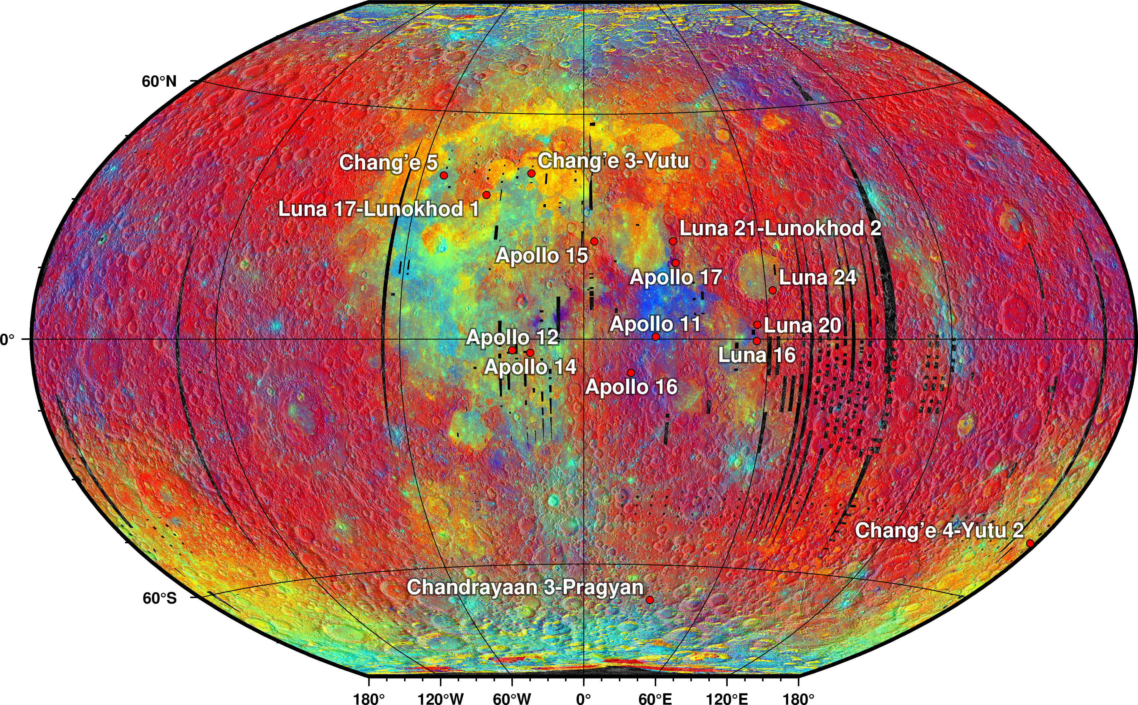
''Pragyan'' ( sa, प्रज्ञान, translit=prajñana, lit=wisdom ) was the rover of Chandrayaan-2, a lunar mission developed by the Indian Space Research Organisation (ISRO), that launched in July 2019. ''Pragyan'' was destroyed along with its lander, ''Vikram'', when it crash-landed on the Moon in September 2019 and never got the chance to deploy.Vikram lander located on lunar surface, wasn't a soft landing: Isro. ''Times of India''. 8 September 2019. Overview The rover's mass was about and was designed to operate on solar power. The rover was to move on 6 wheels traversing 500 meters on the lunar surfac ...[...More Info...] [...Related Items...] OR: [Wikipedia] [Google] [Baidu] |
Lunar Rover
A lunar rover or Moon rover is a space exploration vehicle designed to move across the surface of the Moon. The Apollo Program's Lunar Roving Vehicle was driven on the Moon by members of three American crews, Apollo 15, 16, and 17. Other rovers have been partially or fully autonomous robots, such as the Soviet Union's Lunokhods and the Chinese '' Yutus''. Three countries have had operating rovers on the Moon: the Soviet Union, the United States and China. An Indian mission failed while Japan and Greece currently have planned missions. Past missions Lunokhod 1 Lunokhod 1 (Луноход) was the first of two polycrystalline-panel-powered robotic lunar rovers landed on the Moon by the Soviet Union as part of its Lunokhod program after a previous unsuccessful attempt of a launch probe with Lunokhod 0 (No.201) in 1969. The spacecraft which carried Lunokhod 1 was named Luna 17. The spacecraft soft-landed on the Moon in the Sea of Rains on November 1970. Lunokhod was the first ... [...More Info...] [...Related Items...] OR: [Wikipedia] [Google] [Baidu] |
Digital Elevation Model
A digital elevation model (DEM) or digital surface model (DSM) is a 3D computer graphics representation of elevation data to represent terrain or overlaying objects, commonly of a planet, moon, or asteroid. A "global DEM" refers to a discrete global grid. DEMs are used often in geographic information systems (GIS), and are the most common basis for digitally produced relief maps. A digital terrain model (DTM) represents specifically the ground surface while DEM and DSM may represent tree top canopy or building roofs. While a DSM may be useful for landscape modeling, city modeling and visualization applications, a DTM is often required for flood or drainage modeling, land-use studies, geological applications, and other applications, and in planetary science. Terminology There is no universal usage of the terms ''digital elevation model'' (DEM), ''digital terrain model'' (DTM) and ''digital surface model'' (DSM) in scientific literature. In most cases the term ''digital ... [...More Info...] [...Related Items...] OR: [Wikipedia] [Google] [Baidu] |
Silicate Mineral
Silicate minerals are rock-forming minerals made up of silicate groups. They are the largest and most important class of minerals and make up approximately 90 percent of Earth's crust. In mineralogy, silica (silicon dioxide, ) is usually considered a silicate mineral. Silica is found in nature as the mineral quartz, and its polymorphism (materials science), polymorphs. On Earth, a wide variety of silicate minerals occur in an even wider range of combinations as a result of the processes that have been forming and re-working the crust for billions of years. These processes include partial melting, crystallization, fractionation, metamorphism, weathering, and diagenesis. Living organisms also contribute to this carbonate–silicate cycle, geologic cycle. For example, a type of plankton known as diatoms construct their exoskeletons ("frustules") from silica extracted from seawater. The frustules of dead diatoms are a major constituent of deep ocean sediment, and of diatomaceous e ... [...More Info...] [...Related Items...] OR: [Wikipedia] [Google] [Baidu] |
Mafic
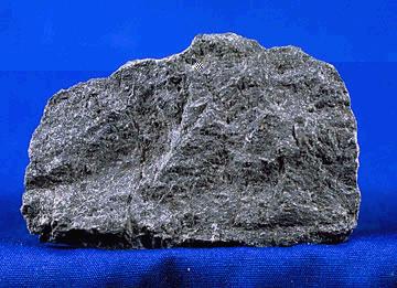
A mafic mineral or rock is a silicate mineral or igneous rock rich in magnesium and iron. Most mafic minerals are dark in color, and common rock-forming mafic minerals include olivine, pyroxene, amphibole, and biotite. Common mafic rocks include basalt, diabase and gabbro. Mafic rocks often also contain calcium-rich varieties of plagioclase feldspar. Mafic materials can also be described as ferromagnesian. History The term ''mafic'' is a portmanteau of "magnesium" and "ferric" and was coined by Charles Whitman Cross, Joseph P. Iddings, Louis Valentine Pirsson, and Henry Stephens Washington in 1912. Cross' group had previously divided the major rock-forming minerals found in igneous rocks into ''salic'' minerals, such as quartz, feldspars, or feldspathoids, and ''femic'' minerals, such as olivine and pyroxene. However, micas and aluminium-rich amphiboles were excluded, while some calcium minerals containing little iron or magnesium, such as wollastonite or apatite, were included ... [...More Info...] [...Related Items...] OR: [Wikipedia] [Google] [Baidu] |
South Pole–Aitken Basin
The South Pole–Aitken basin (SPA Basin, ) is an immense impact crater on the far side of the Moon. At roughly in diameter and between deep, it is one of the largest known impact craters in the Solar System. It is the largest, oldest, and deepest basin recognized on the Moon. It is estimated that it was formed 4.2 to 4.3 billion years ago, during the Pre-Nectarian epoch. It was named for two features on opposite sides of the basin: the lunar South Pole at one end and the crater Aitken on the northern end. The outer rim of this basin can be seen from Earth as a huge mountain chain located on the Moon's southern limb, sometimes informally called "Leibnitz mountains". On 3 January 2019, the Chang'e 4, a Chinese spacecraft, landed in the basin, specifically within a crater called Von Kármán. [...More Info...] [...Related Items...] OR: [Wikipedia] [Google] [Baidu] |
List Of Quadrangles On The Moon
The Moon has been divided into 30 quadrangles by the United States Geological Survey at the 1:2,500,000 map scale. At the 1:1,000,000 scale it's divided into 144 quadrangles. The quadrangles are numbered in bands from north to south. Each band is then divided into a latitude-dependent number of quadrangles. At the poles, the bands consist of a single quadrangle, so LQ01 is a circle around the north pole. At the 1:1,000,000 scale, there are 12 latitude bands, 6 in each hemisphere. The bands nearest the equator are 16° high, and the first and last bands are 10° radius circles around the poles. The bands are then divided into quadrangles, but unlike the 1:2,500,000 system, the seam is placed at +10° longitude (so 0° longitude is in the middle of a quadrangle), and the numbering within a band starts between −80° and −90°: * (±90° to ±80°) 1 quadrangle of 360°, beginning at −80° * (±80° to ±64°) 8 quadrangles of 45°, beginning at −80° * (±64° to ± ... [...More Info...] [...Related Items...] OR: [Wikipedia] [Google] [Baidu] |
Near Side Of The Moon
The near side of the Moon is the lunar hemisphere that always faces towards Earth, opposite to the far side. Only one side of the Moon is visible from Earth because the Moon rotates on its axis at the same rate that the Moon orbits the Earth—a situation known as tidal locking. The Moon is directly illuminated by the Sun, and the cyclically varying viewing conditions cause the lunar phases. Sometimes the dark portion of the Moon is faintly visible due to earthshine, which is indirect sunlight reflected from the surface of Earth and onto the Moon. Since the Moon's orbit is both somewhat elliptical and inclined to its equatorial plane, libration allows up to 59% of the Moon's surface to be viewed from Earth (though only half at any moment from any point). Orientation The image of the Moon here is drawn as is normally shown on maps, that is with north on top and west to the left. Astronomers traditionally turn the map to have south on top to correspond with the northern-hemisp ... [...More Info...] [...Related Items...] OR: [Wikipedia] [Google] [Baidu] |
Simpelius (crater)
Simpelius is an impact crater that lies in the southern part of the Moon The Moon is Earth's only natural satellite. It is the fifth largest satellite in the Solar System and the largest and most massive relative to its parent planet, with a diameter about one-quarter that of Earth (comparable to the width of .... It lies to the north-northwest of the somewhat larger crater Schomberger, and east-southeast of the prominent Moretus. The most distinctive aspect of this crater is the asymmetry of the inner wall, with the side being nearly twice as wide at the southern end as it is to the north. As a result, the level interior floor is offset to the north of the crater interior. The rim and inner wall are less sharply defined than those of Schomberger or Moretus, having been softened and smoothed by impacts. The rim is uneven, with peaks to the north, west, east, and south-southeast, and low sections in between. There are also a number of small crater pits along the inner ... [...More Info...] [...Related Items...] OR: [Wikipedia] [Google] [Baidu] |


.gif)