|
Pouto Peninsula
The Pouto Peninsula is a landform on the northern Kaipara Harbour in Northland, New Zealand. The Peninsula runs in the north west to south east direction and is approximately 55 km long. The width varies from about 5.4 km to about 14 km, with the widest part of the peninsula near its southern end. The Tasman Sea is to the west, and the Kaipara Harbour is to the south. The Wairoa River and Kaipara Harbour are to the east. Dargaville and State Highway 12 lie directly to the north east of the peninsula. The mouth of the Kaipara Harbour separates the peninsula from the smaller Te Korowai-o-Te-Tonga Peninsula to the south. The most substantial settlement on the peninsula is Te Kōpuru. The locality of Pouto, originally a Māori village, is in the south east of the peninsula. Geography and conservation Much of Pouto – over 600 ha – is covered by sand dunes, which are one of the largest unmodified dune systems in New Zealand. Many of the dunes rise over 100 m abo ... [...More Info...] [...Related Items...] OR: [Wikipedia] [Google] [Baidu] |
Peninsula
A peninsula (; ) is a landform that extends from a mainland and is surrounded by water on most, but not all of its borders. A peninsula is also sometimes defined as a piece of land bordered by water on three of its sides. Peninsulas exist on all continents. The size of a peninsula can range from tiny to very large. The largest peninsula in the world is the Arabian Peninsula. Peninsulas form due to a variety of causes. Etymology Peninsula derives , which is translated as 'peninsula'. itself was derived , or together, 'almost an island'. The word entered English in the 16th century. Definitions A peninsula is usually defined as a piece of land surrounded on most, but not all sides, but is sometimes instead defined as a piece of land bordered by water on three of its sides. A peninsula may be bordered by more than one body of water, and the body of water does not have to be an ocean or a sea. A piece of land on a very tight river bend or one between two rivers is sometimes s ... [...More Info...] [...Related Items...] OR: [Wikipedia] [Google] [Baidu] |
Aotea (canoe)
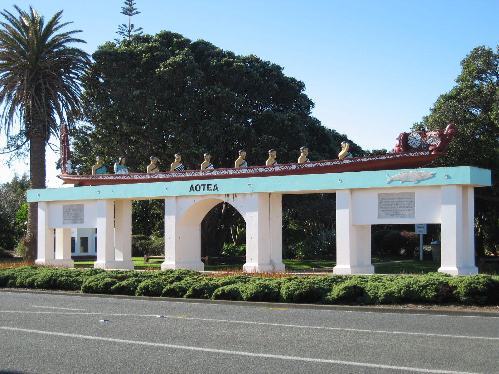
In Māori mythology, Māori tradition, ''Aotea'' is one of the canoes () in which Māori migrated to New Zealand; it is particularly associated with the tribes of Taranaki and Whanganui, including Ngāti Ruanui, Ngāruahine, Ngā Rauru and other tribal groups. History ''Aotea'' was a double canoe built by Toto from half of a great tree from Hawaiki, the other half being used for the canoe ''Matahourua''. Toto gave ''Aotea'' to his daughter Rongorongo (wife of Turi), Rongorongo, who was married to Turi (Māori ancestor), Turi. In strife with the chief Uenuku, Turi killed the chief's son and thereafter had to flee for New Zealand with 33 passengers. During the voyage, they stopped at Rangitahua and encountered some of the crew from the ''Kurahaupō'' canoe (Craig 1989:24). The ''Aotea'' canoe arrived at Aotea Harbour on the west coast of the North Island, and its people eventually settled in the Taranaki region. Aircraft 'Aotea' was the name given to the first Jumbo Jet (a Boe ... [...More Info...] [...Related Items...] OR: [Wikipedia] [Google] [Baidu] |
Metal (pavement)
A gravel road is a type of unpaved road surfaced with gravel that has been brought to the site from a quarry or stream bed. They are common in less-developed nations, and also in the rural areas of developed nations such as Canada and the United States. In New Zealand, and other Commonwealth countries, they may be known as metal roads. They may be referred to as "dirt roads" in common speech, but that term is used more for unimproved roads with no surface material added. If well constructed and maintained, a gravel road is an all-weather road. Characteristics Construction Compared to sealed roads, which require large machinery to work and pour concrete or to lay and smooth a bitumen-based surface, gravel roads are easy and cheap to build. However, compared to dirt roads, all-weather gravel highways are quite expensive to build, as they require front loaders, dump trucks, graders, and roadrollers to provide a base course of compacted earth or other material, sometimes macada ... [...More Info...] [...Related Items...] OR: [Wikipedia] [Google] [Baidu] |
Waitākere Ranges
The Waitākere Ranges is a mountain range in New Zealand. Located in West Auckland between metropolitan Auckland and the Tasman Sea, the ranges and its foothills and coasts comprise some of public and private land. The area, traditionally known to Māori as ''Te Wao Nui o Tiriwa'' (The Great Forest of Tiriwa), is of local, regional, and national significance. The Waitākere Ranges includes a chain of hills in the Auckland Region, generally running approximately from north to south, 25 km west of central Auckland. The ranges are part of the Waitākere Ranges Regional Park. From 1 May 2018 the forested areas of the Waitākere Ranges Regional Park were closed, with some exceptions, while Auckland Council upgraded the tracks to dry foot standard protect the roots and to prevent the spread of kauri dieback, bacteria that affect kauri trees and prevents them from getting nutrients, effectively killing them. There is no cure. But Etymology The name ''Wai-tākere'' origina ... [...More Info...] [...Related Items...] OR: [Wikipedia] [Google] [Baidu] |
Agathis Australis
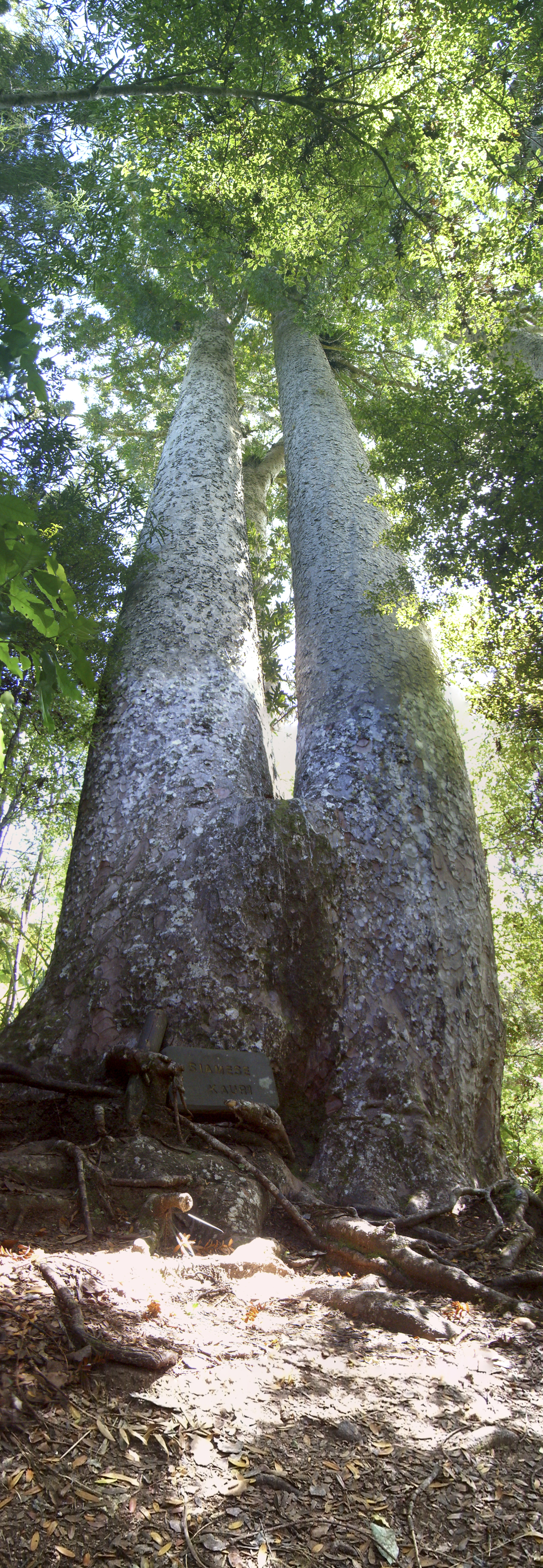
''Agathis australis'', commonly known by its Māori name kauri (), is a coniferous tree in the family ''Araucariaceae'', found north of 38°S in the northern regions of New Zealand's North Island. It is the largest (by volume) but not tallest species of tree in New Zealand, standing up to 50 m tall in the emergent layer above the forest's main canopy. The tree has smooth bark and small narrow leaves. Other common names to distinguish ''A. australis'' from other members of '' Agathis'' are southern kauri and New Zealand kauri. With its novel soil interaction and regeneration pattern it can compete with faster growing angiosperms. Because it is such a conspicuous species, forest containing kauri is generally known as kauri forest, although kauri need not be the most abundant tree. In the warmer northern climate, kauri forests have a higher species richness than those found further south. Kauri even act as a foundation species that modify the soil under their canopy to cre ... [...More Info...] [...Related Items...] OR: [Wikipedia] [Google] [Baidu] |
Pilot Station
Pilot Station ( esu, Tuutalgaq) is a city in Kusilvak Census Area, Alaska, United States. The population was 568 at the 2010 census, up from 550 in 2000. Geography Pilot Station is located at (61.936050, -162.883403), on the northern bank of the lower Yukon River, approximately eighty miles ('as the crow flies') from the Bering Sea. According to the United States Census Bureau, the city has a total area of , of which is land and (25.55%) is water. Demographics Pilot Station first appeared on the 1890 U.S. Census as the unincorporated Inuit village of "Ankahchagmiut." It did not report again until 1920, then as Pilot Station. It formally incorporated in 1969. At the 2000 census, there were 550 people, 109 households and 92 families residing in the city. The population density was . There were 126 housing units at an average density of . The racial makeup was 96.91% Native American, 2.36% White and 0.73% from two or more races. There were 109 households, of which 61.5% had ... [...More Info...] [...Related Items...] OR: [Wikipedia] [Google] [Baidu] |
Musket Wars
The Musket Wars were a series of as many as 3,000 battles and raids fought throughout New Zealand (including the Chatham Islands) among Māori between 1807 and 1837, after Māori first obtained muskets and then engaged in an intertribal arms race in order to gain territory or seek revenge for past defeats. The battles resulted in the deaths of between 20,000 and 40,000 people and the enslavement of tens of thousands of Māori and significantly altered the ''rohe'', or tribal territorial boundaries, before the signing of the Treaty of Waitangi in 1840. The increased use of muskets in intertribal warfare led to changes in the design of pā fortifications, which later benefited Māori when engaged in battles with colonial forces during the New Zealand Wars. Ngāpuhi chief Hongi Hika in 1818 used newly acquired muskets to launch devastating raids from his Northland base into the Bay of Plenty, where local Māori were still relying on traditional weapons of wood and stone. In the ... [...More Info...] [...Related Items...] OR: [Wikipedia] [Google] [Baidu] |
Ngāti Whātua
Ngāti Whātua is a Māori iwi (tribe) of the lower Northland Peninsula of New Zealand's North Island. It comprises a confederation of four hapū (subtribes) interconnected both by ancestry and by association over time: Te Uri-o-Hau, Te Roroa, Te Taoū, and Ngāti Whātua-o-Ōrākei. The four hapū can act together or separately as independent tribes. Ngāti Whātua's territory or ''rohe'' is traditionally expressed as, "''Tāmaki ki Maunganui i te Tai Hauauru''" and "''Tāmaki ki Manaia i te Rawhiti''". The northern boundary is expressed as, "''Manaia titiro ki Whatitiri, Whatitiri titiro ki Tutamoe, Tutamoe titiro ki Maunganui''". The southern boundary is expressed as, "''Te awa o Tāmaki''". The area runs from Tāmaki River in the south to Maunganui Bluff (at the northern end of Aranga Beach on the west coast) in the north, and to Whangarei Harbour on the east coast. By the time of European settlement in New Zealand, Ngāti Whātua's territory was around the Kaipara Harbour an ... [...More Info...] [...Related Items...] OR: [Wikipedia] [Google] [Baidu] |
Māori Language
Māori (), or ('the Māori language'), also known as ('the language'), is an Eastern Polynesian language spoken by the Māori people, the indigenous population of mainland New Zealand. Closely related to Cook Islands Māori, Tuamotuan, and Tahitian, it gained recognition as one of New Zealand's official languages in 1987. The number of speakers of the language has declined sharply since 1945, but a Māori-language revitalisation effort has slowed the decline. The 2018 New Zealand census reported that about 186,000 people, or 4.0% of the New Zealand population, could hold a conversation in Māori about everyday things. , 55% of Māori adults reported some knowledge of the language; of these, 64% use Māori at home and around 50,000 people can speak the language "very well" or "well". The Māori language did not have an indigenous writing system. Missionaries arriving from about 1814, such as Thomas Kendall, learned to speak Māori, and introduced the Latin alphabet. In 1 ... [...More Info...] [...Related Items...] OR: [Wikipedia] [Google] [Baidu] |
Marattia Salicina
''Ptisana salicina'', or king fern, is a species of fern native to Norfolk Island, New Zealand and the South Pacific. Large and robust with a distinctive tropical appearance, it has fronds up to 5 metres (16 feet +/-) tall that arise from a starchy base that was a traditional food for the Maori. It has several other common names including para, tawhiti-para, and horseshoe fern. Distribution King fern is indigenous to Norfolk Island (the type locality), New Zealand, New Caledonia, Cook Islands, Austral Islands, Society Islands and the Marquesas. It is closely related to ''Ptisana smithii'' of Vanuatu, Fiji, the Solomon Islands, Samoa and Tonga. In New Zealand it is found in lowland areas on the north-western half of the North Island from inland Wanganui northwards. It is most abundant in the western Waikato, where it is found in forests and forest remnants. It prefers limestone-rich soils, including the entrances to caves and shady stream sides. It often grows in New Zealand ass ... [...More Info...] [...Related Items...] OR: [Wikipedia] [Google] [Baidu] |


