|
Potentia (ancient City)
Potentia was a Roman town along the central Adriatic Italian coast, near the modern town of Porto Recanati, in the province of Macerata. Its original position was just north of the main Roman bed of the River Potenza (the ancient Flosis), which now flows more than to the north. History In 268 BC the central Adriatic homeland of the local Picene peoples was military dominated and incorporated by the Romans. Later, under emperor Augustus, it was organized as Regio V Picenum. The installation of a series of mostly maritime Latin and Roman colonies during the second part of the 3rd and the 2nd centuries BC was a major impulse for the Romanization of a region that knew no real urbanized society before. In 184 BC with the foundation of Potentia, a coastal colony for Roman citizens (mentioned by Livy), the lower Potenza valley, and with it the whole area of northern Picenum, entered its first phase of real urbanization. By 174 BC the colony probably received a circuit wall with three ... [...More Info...] [...Related Items...] OR: [Wikipedia] [Google] [Baidu] |
Porto Recanati
Porto Recanati () is a town with some 12,500 inhabitants in the province of Macerata, in the Marche region. of central Italy. It is the northeast coastal town of the province. It was made an independent town on 15 January 1893, when, due to a Decree signed by King Umberto I of Italy, Porto Recanati's coastal hamlets were separated from Recanati. The communal territory is completely plain, and it is located near the Mount Conero. The town's seabord, defined north by the mouth of Musone river, extends itself for about two km south, beyond the mouth of Potenza river. The central part of Porto Recanati's is basically formed by gravel beaches and steep sea with deep bottom also a few steps from sea shore, unlike nearby towns Potenza Picena and Civitanova Marche. History The area seem to have been inhabited since Bronze Age, as findings on the top of Montarice's hill, hailing from period called Apennine Medium Bronze and dating from the 15th-14th centuries BC have confirmed. In the ... [...More Info...] [...Related Items...] OR: [Wikipedia] [Google] [Baidu] |
Soprintendenza Per I Beni Archeologici Delle Marche
The Ministry of Culture ( it, Ministero della Cultura - MiC) is the ministry of the Government of Italy in charge of national museums and the '' monuments historiques''. MiC's headquarters are located in the historic Collegio Romano Palace (via del Collegio Romano 27, in central Rome) and the current Minister of Culture is Gennaro Sangiuliano. History It was set up in 1974 as the Ministry for Cultural Assets and Environments ( it, Ministero per i Beni Culturali ed Ambientali) by the Moro IV Cabinet through the decree read on 14 December 1974, n. 657, converted (with changes) from the law of 29 January 1975, n° 5. The new ministry (defined as — that is ''for'' cultural assets, showing the wish to create a mainly technical organ) largely has the remit and functions previously under the Ministry of Public Education (specifically its Antiquity and Fine Arts, and Academies and Libraries, sections). To this remit and functions it some of those of the Ministry of the Inter ... [...More Info...] [...Related Items...] OR: [Wikipedia] [Google] [Baidu] |
Archaeological Park Of Urbs Salvia
The Archaeological Park of Urbs Salvia is situated in the ''comune'' of Urbisaglia (Province of Macerata), in the Marches, Italy. It is the largest archaeological park in the region. History The city, located in the V Regio Picenum, was founded as a '' colonia'' during the 2nd century BC. It was the birthplace of some leading figures of the Roman Empire, such as the consul Gaius Fufius Geminus and Lucius Flavius Silva Nonius Bassus. Urbs Salvia was sacked by the Visigoths in 408–10 AD, and suffered destruction over the years from earthquakes and plundering. The decadence of the town is described by the poet Dante Alighieri (1265–1321) in his ''Divine Comedy'' (Paradiso, XVI, 73-78): If Luni thou regard, and Urbisaglia, How they have passed away, and how are passing Chiusi and Senigallia after them, To hear how races waste themselves away Will seem to thee no novel thing nor hard Seeing that even cities have an end. Archaeological Park The Archaeological Park of ... [...More Info...] [...Related Items...] OR: [Wikipedia] [Google] [Baidu] |
Ancient Ostra
Ancient Ostra is a Roman era town situated between the modern town of Ostra Vetere the Roman town was inhabited from the 3rd century BC until the 6th century AD. History Pliny the Elder mentions Ostra with another ancient town, Suasa, west.Pliny the Elder ''Natural History'' (Mayhoff) 3.114.2 http://latin.packhum.org/loc/978/1/253/1119-1124 Neither town survived beyond the classical period. Though Ostra is little mentioned by ancient authors, excavations there have brought to light remains of various buildings and several inscriptions. See also * Archaeological Park of Urbs Salvia * Potentia (ancient city) * Ricina * Sentinum * Suasa * Septempeda Septempeda was a Roman town in Picenum, now in the Italian region Marche. It became today's San Severino Marche after the fall of the Roman Empire. Geography The original Roman town Septempeda is located in the province of Macerata. The town was ... External links References {{reflist Roman towns and cities in Italy Roman site ... [...More Info...] [...Related Items...] OR: [Wikipedia] [Google] [Baidu] |
Crisis Of The 3rd Century
The Crisis of the Third Century, also known as the Military Anarchy or the Imperial Crisis (AD 235–284), was a period in which the Roman Empire nearly collapsed. The crisis ended due to the military victories of Aurelian and with the ascension of Diocletian and his implementation of reforms in 284, including the Tetrarchy. The crisis began in 235 with the assassination of Emperor Severus Alexander by his own troops. During the following 50-year period, the Empire saw the combined pressures of barbarian invasions and migrations into the Roman territory, civil wars, peasant rebellions and political instability, with multiple usurpers competing for power. This led to the debasement of currency and economic collapse, with the Plague of Cyprian contributing to the disorder. Roman troops became more reliant over time on the growing influence of the barbarian mercenaries known as foederati. Roman commanders in the field, although nominally working for Rome, became increasingly ... [...More Info...] [...Related Items...] OR: [Wikipedia] [Google] [Baidu] |
Tabernae
A ''taberna'' (plural ''tabernae'') was a type of shop or stall in Ancient Rome. Originally meaning a single-room shop for the sale of goods and services, ''tabernae'' were often incorporated into domestic dwellings on the ground level flanking the fauces, the main entrance to a home, but with one side open to the street. As the Roman Empire became more prosperous, tabernae were established within great indoor markets and were often covered by a barrel vault. Each taberna within a market had a window above it to let light into a wooden attic for storage and had a wide doorway. A famous example of such an indoor market is the Markets of Trajan in Rome, built in the early 1st century by Apollodorus of Damascus. According to the ''Cambridge Ancient History'', a taberna was a "retail unit" within the Roman Empire and was where many economic activities and many service industries were provided, including the sale of cooked food, wine, and bread. The plural form ''tabernae'' was also ... [...More Info...] [...Related Items...] OR: [Wikipedia] [Google] [Baidu] |
Macellum
A macellum (plural: ''macella''; ''makellon'') is an ancient Roman indoor market building that sold mostly provisions (especially meat and fish). The building normally sat alongside the forum and basilica, providing a place in which a market could be held. Each macellum sold different kinds of produce, depending on local availability, but it was not uncommon to import these comestibles, especially at ports like Pompeii. History The macellum was a food market, particularly for meat, fish and delicatessen. Plautus mentioned such a macellum in the second half of the 3rd century BC. The macellum was modeled after the agora of Greek and Hellenistic cities, except that there was no wholesale trade. The last macella were still in operation in Constantinople in the sixth century AD. Physical features A macellum is a fairly easy building to identify from its design. A macellum provides shops arranged around a courtyard which contains a central tholos. The tholos is a round structure, usu ... [...More Info...] [...Related Items...] OR: [Wikipedia] [Google] [Baidu] |
Curia
Curia (Latin plural curiae) in ancient Rome referred to one of the original groupings of the citizenry, eventually numbering 30, and later every Roman citizen was presumed to belong to one. While they originally likely had wider powers, they came to meet for only a few purposes by the end of the Republic: to confirm the election of magistrates with imperium, to witness the installation of priests, the making of wills, and to carry out certain adoptions. The term is more broadly used to designate an assembly, council, or court, in which public, official, or religious issues are discussed and decided. Lesser curiae existed for other purposes. The word ''curia'' also came to denote the places of assembly, especially of the senate. Similar institutions existed in other towns and cities of Italy. In medieval times, a king's council was often referred to as a ''curia''. Today, the most famous curia is the Curia Curia (Latin plural curiae) in ancient Rome referred to one of the or ... [...More Info...] [...Related Items...] OR: [Wikipedia] [Google] [Baidu] |
Basilica
In Ancient Roman architecture, a basilica is a large public building with multiple functions, typically built alongside the town's forum. The basilica was in the Latin West equivalent to a stoa in the Greek East. The building gave its name to the architectural form of the basilica. Originally, a basilica was an ancient Roman public building, where courts were held, as well as serving other official and public functions. Basilicas are typically rectangular buildings with a central nave flanked by two or more longitudinal aisles, with the roof at two levels, being higher in the centre over the nave to admit a clerestory and lower over the side-aisles. An apse at one end, or less frequently at both ends or on the side, usually contained the raised tribunal occupied by the Roman magistrates. The basilica was centrally located in every Roman town, usually adjacent to the forum and often opposite a temple in imperial-era forums. Basilicas were also built in private residences an ... [...More Info...] [...Related Items...] OR: [Wikipedia] [Google] [Baidu] |
Decumanus Maximus
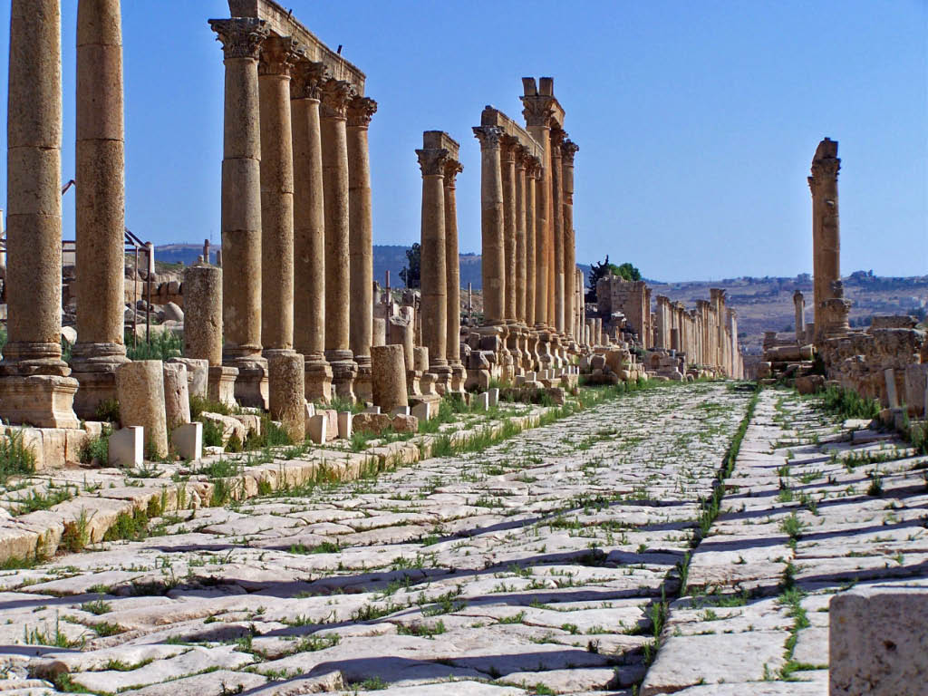
In Roman urban planning, a decumanus was an east–west-oriented road in a Roman city or castrum (military camp). The main decumanus of a particular city was the Decumanus Maximus, or most often simply "the Decumanus". In the rectangular street grid of the typical Roman city plan, the decumanus was crossed by the perpendicular cardo, a north–south street. In a military camp, the decumanus connected the Porta Praetoria (closest to the enemy) to the Porta Decumana (away from the enemy). In the center – called '' groma'' – of a city or castrum, the Decumanus Maximus crossed the perpendicular ''Cardo Maximus'', the primary north–south road. The Forum was normally located close to this intersection of the Decumanus Maximus and the Cardo Maximus. Etymology ''Decumanus'' or ''decimanus'' was the Latin word for 'tenth'. This name is said to come from the fact that the ''via decumana'' or ''decimana'' (the ''tenth'') separated the Tenth Cohort from the Ninth in the legionary enc ... [...More Info...] [...Related Items...] OR: [Wikipedia] [Google] [Baidu] |
Cardo Maximus
A cardo (plural ''cardines'') was a north–south street in Ancient Roman cities and military castra, camps as an integral component of city planning. The cardo maximus, or most often the ''cardo'', was the main or central north–south-oriented street. Etymology The ''cardo maximus'' was the "hinge" or axis of the city, derived from Greek καρδίᾱ, kardia ("heart") and as such was generally lined with shops and vendors, and served as a hub of economic life. Most Roman cities also had a Decumanus Maximus, an east–west street that served as a secondary main street. Due to varying geography, in some cities the Decumanus is the main street and the Cardo is secondary, but in general the Cardo maximus served as the primary street. The Forum (Roman), Forum was normally located at, or close to, the intersection of the Decumanus and the Cardo. Examples Apamea, Syria The Cardo Maximus of Apamea (Syria), Apamea, Syria ran through the centre of the city directly from North to S ... [...More Info...] [...Related Items...] OR: [Wikipedia] [Google] [Baidu] |


