|
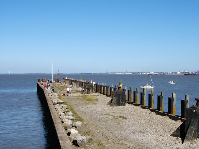
Portishead Docks
Portishead () is a coastal village on the Severn Estuary, 8 miles (12 km) to the west of Bristol, but within the unitary district of North Somerset, which falls within the ceremonial county of Somerset, England. It has a population of around 25,000, with a growth rate considerably in excess of surrounding towns. Portishead has a long history as a fishing port. As a Royal Manor it expanded rapidly during the early 19th century around the docks, with supporting transport infrastructure. A power station and chemical works were added in the 20th century, but the dock and industrial facilities have since closed and been redeveloped into a marina and residential areas. Portishead was also the telephone control centre used by British Telecom (BT) for non-direct dialled calls to maritime vessels, a service known as Portishead Radio. The town's population is expanding, and Portishead is now primarily a dormitory town for Bristol and its environs, although a range of service industrie ... [...More Info...] [...Related Items...] OR: [Wikipedia] [Google] [Baidu] |
Portishead And North Weston
Portishead or Portishead and North Weston is a civil parish in North Somerset, England. The parish includes the coastal town of Portishead along with the village of North Weston. The 2011 census gave the population as 23,699. As of 2017 however, the population number is estimated to be well over 25,000 with another 8,000 people expected by 2026. Governance The town council has responsibility for local issues, including setting an annual precept (local rate) to cover the council's operating costs and producing annual accounts for public scrutiny. The parish council evaluates local planning applications and works with the local police, district council officers, and neighbourhood watch groups on matters of crime, security, and traffic. The parish council's role also includes initiating projects for the maintenance and repair of parish facilities, such as the village hall or community centre, playing fields and playgrounds, as well as consulting with the district council on the m ... [...More Info...] [...Related Items...] OR: [Wikipedia] [Google] [Baidu] |
Cadbury Camp
Cadbury Camp is an Iron Age hill fort in Somerset, England, near the village of Tickenham. It is a scheduled monument. Although primarily known as a fort during the Iron Age it is likely, from artefacts, including a bronze spear or axe head, discovered at the site, that it was first used in the Bronze Age and still occupied through the Roman Britain, Roman era into the sub-Roman period when the area became part of a Celts, Celtic kingdom. The name may mean "Fort of Cador" - Cado(r) being possibly the regional king or warlord controlling Somerset, Bristol, and South Gloucestershire, in the middle to late 5th century. Cador has been associated with King Arthur, Arthurian England, though the only evidence for this is the reference in the Life of St. Carantoc to Arthur and Cador ruling from Dindraithou (perhaps the hillfort at Dundry) and having the power over western Somerset to grant Carantoc's plea to build a church at Carhampton. Geoffrey of Monmouth invented the title 'Duke of C ... [...More Info...] [...Related Items...] OR: [Wikipedia] [Google] [Baidu] |
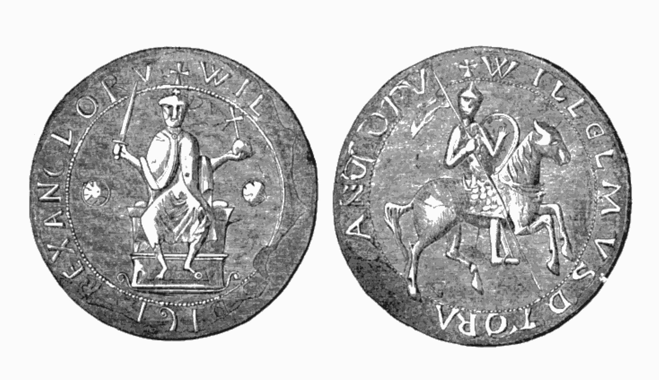
William II Of England
William II ( xno, Williame; – 2 August 1100) was King of England from 26 September 1087 until his death in 1100, with powers over Normandy and influence in Scotland. He was less successful in extending control into Wales. The third son of William the Conqueror, he is commonly referred to as William Rufus ( being Latin for "the Red"), perhaps because of his ruddy appearance or, more likely, due to having red hair as a child that grew out in later life. William was a figure of complex temperament, capable of both bellicosity and flamboyance. He did not marry nor have children, which – along with contemporary accounts – has led historians to speculate on homosexuality or bisexuality. He died after being hit by an arrow while hunting, under circumstances that remain unclear. Circumstantial evidence in the behaviour of those around him raises strong, but unproven, suspicions of murder. His younger brother Henry I hurriedly succeeded him as king. Historian Frank Barlow ... [...More Info...] [...Related Items...] OR: [Wikipedia] [Google] [Baidu] |
Roman Catholic Diocese Of Coutances
The Roman Catholic Diocese of Coutances (–Avranches) (Latin: ''Dioecesis Constantiensis (–Abrincensis)''; French language, French: ''Diocèse de Coutances (–Avranches)'') is a diocese of the Roman Catholic Church in France. Its Cathedral, mother church is the Coutances Cathedral, Cathedral of Coutance in the commune of Coutances in France. The diocese is suffragan of the Archbishop of Rouen and comprises the entire department of Manche. It was enlarged in 1802 by the addition of the former Diocese of Avranches and of two archdeaconries from the Diocese of Bayeux. Since 1854 its bishops have held the title of Bishop of Coutances (–Avranches). The Bishop of Coutances exercised ecclesiastical jurisdiction over the Channel Islands, mostly in Alderney where the Bishop also held partial authority over the Leader of Alderney, until the Protestant Reformation, Reformation, despite the secular division of Normandy in 1204. The final rupture occurred definitively in 1569 when Quee ... [...More Info...] [...Related Items...] OR: [Wikipedia] [Google] [Baidu] |
Norman Conquest Of England
The Norman Conquest (or the Conquest) was the 11th-century invasion and occupation of England by an army made up of thousands of Normans, Norman, Duchy of Brittany, Breton, County of Flanders, Flemish, and Kingdom of France, French troops, all led by the Duke of Normandy, later styled William the Conqueror. William's claim to the English throne derived from his familial relationship with the childless Anglo-Saxon king Edward the Confessor, who may have encouraged William's hopes for the throne. Edward died in January 1066 and was succeeded by his brother-in-law Harold Godwinson. The Norwegian king Harald Hardrada invaded northern England in September 1066 and was victorious at the Battle of Fulford on 20 September, but Godwinson's army defeated and killed Hardrada at the Battle of Stamford Bridge on 25 September. Three days later on 28 September, William's invasion force of thousands of men and hundreds of ships landed at Pevensey in Sussex in southern England. Harold march ... [...More Info...] [...Related Items...] OR: [Wikipedia] [Google] [Baidu] |
Wiltshire
Wiltshire (; abbreviated Wilts) is a historic and ceremonial county in South West England with an area of . It is landlocked and borders the counties of Dorset to the southwest, Somerset to the west, Hampshire to the southeast, Gloucestershire to the north, Oxfordshire to the northeast and Berkshire to the east. The county town was originally Wilton, after which the county is named, but Wiltshire Council is now based in the county town of Trowbridge. Within the county's boundary are two unitary authority areas, Wiltshire and Swindon, governed respectively by Wiltshire Council and Swindon Borough Council. Wiltshire is characterised by its high downland and wide valleys. Salisbury Plain is noted for being the location of the Stonehenge and Avebury stone circles (which together are a UNESCO Cultural and World Heritage site) and other ancient landmarks, and as a training area for the British Army. The city of Salisbury is notable for its medieval cathedral. Swindon is the ... [...More Info...] [...Related Items...] OR: [Wikipedia] [Google] [Baidu] |
Marlborough, Wiltshire
Marlborough ( , ) is a market town and Civil parishes in England, civil parish in the England, English Counties of England, county of Wiltshire on the A4 road (England), Old Bath Road, the old main road from London to Bath, Somerset, Bath. The town is on the River Kennet, 24 miles (39 km) north of Salisbury and 10 miles (16 km) southeast of Swindon. History The earliest sign of human habitation is the Marlborough Mound, a prehistoric tumulus in the grounds of Marlborough College. Recent radiocarbon dating has found it to date from about 2400 BC. It is of similar age to the larger Silbury Hill about west of the town. Legend has it that the Mound is the burial site of Merlin (wizard), Merlin and that the name of the town comes from Merlin's Tumulus, Barrow. More plausibly, the town's name possibly derives from the medieval term for chalky ground "marl"—thus, "town on chalk". However more recent research, from geographer John Everett-Heath, identifies the original O ... [...More Info...] [...Related Items...] OR: [Wikipedia] [Google] [Baidu] |
Savernake Forest
Savernake Forest stands on a Cretaceous chalk plateau between Marlborough and Great Bedwyn in Wiltshire, England. Its area is approximately . Most of the forest lies within the civil parish of Savernake. It is privately owned by the Earl of Cardigan and his son Viscount Savernake, and is administered by trustees. Since 1939 the timber of the forest has been managed by Forestry England on a 999-year lease. The private status of Savernake Forest is maintained by shutting the forest to the public one day per year. Geography Savernake's landform is rolling downland, dissected by both dry and wet valleys. The valleys within the forest, of which there are four, are all dry, and the presence of Cretaceous deposits of Clay-with-Flints creates the damp, heavy soils suited to dense cover of oak and beech. There are patches of poor drainage and wet soil. History First mention of a woodland ''"Safernoc"'' was made in AD 934 in the written records of the King Athelstan, but the land pa ... [...More Info...] [...Related Items...] OR: [Wikipedia] [Google] [Baidu] |
Earthworks (Archaeology)
In archaeology, earthworks are artificial changes in land level, typically made from piles of artificially placed or sculpted rocks and soil. Earthworks can themselves be archaeological features, or they can show features beneath the surface. Types Earthworks of interest to archaeologists include hill forts, henges, mounds, platform mounds, effigy mounds, enclosures, long barrows, tumuli, ridge and furrow, mottes, round barrows, and other tombs. * Hill forts, a type of fort made out of mostly earth and other natural materials including sand, straw, and water, were built as early as the late Stone Age and were built more frequently during the Bronze Age and Iron Age as a means of protection. See also Oppidum. * Henge earthworks are those that consist of a flat area of earth in a circular shape that are encircled by a ditch, or several circular ditches, with a bank on the outside of the ditch built with the earth from inside the ditch. They are believed to have been used as mo ... [...More Info...] [...Related Items...] OR: [Wikipedia] [Google] [Baidu] |
Ancient Rome
In modern historiography, ancient Rome refers to Roman civilisation from the founding of the city of Rome in the 8th century BC to the collapse of the Western Roman Empire in the 5th century AD. It encompasses the Roman Kingdom (753–509 BC), Roman Republic (509–27 BC) and Roman Empire (27 BC–476 AD) until the fall of the western empire. Ancient Rome began as an Italic settlement, traditionally dated to 753 BC, beside the River Tiber in the Italian Peninsula. The settlement grew into the city and polity of Rome, and came to control its neighbours through a combination of treaties and military strength. It eventually dominated the Italian Peninsula, assimilated the Greek culture of southern Italy ( Magna Grecia) and the Etruscan culture and acquired an Empire that took in much of Europe and the lands and peoples surrounding the Mediterranean Sea. It was among the largest empires in the ancient world, with an estimated 50 to 90 million inhabitants, roughly 20% of t ... [...More Info...] [...Related Items...] OR: [Wikipedia] [Google] [Baidu] |
Early Middle Ages
The Early Middle Ages (or early medieval period), sometimes controversially referred to as the Dark Ages, is typically regarded by historians as lasting from the late 5th or early 6th century to the 10th century. They marked the start of the Middle Ages of European history, following the decline of the Western Roman Empire, and preceding the High Middle Ages ( 11th to 13th centuries). The alternative term ''late antiquity'', for the early part of the period, emphasizes elements of continuity with the Roman Empire, while ''Early Middle Ages'' is used to emphasize developments characteristic of the earlier medieval period. The period saw a continuation of trends evident since late classical antiquity, including population decline, especially in urban centres, a decline of trade, a small rise in average temperatures in the North Atlantic region and increased migration. In the 19th century the Early Middle Ages were often labelled the ''Dark Ages'', a characterization based on t ... [...More Info...] [...Related Items...] OR: [Wikipedia] [Google] [Baidu] |
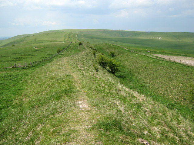
Wansdyke (earthwork)
Wansdyke (from ''Woden's Dyke'') is a series of early medieval defensive linear earthworks in the West Country of England, consisting of a ditch and a running embankment from the ditch spoil, with the ditching facing north. There are two main parts: an eastern dyke which runs between Savernake Forest, West Woods and Morgan's Hill in Wiltshire, and a western dyke which runs from Monkton Combe to the ancient hill fort of Maes Knoll in historic Somerset. Between these two dykes there is a middle section formed by the remains of the London to Bath Roman road. There is also some evidence in charters that it extended west from Maes Knoll to the coast of the Severn Estuary but this is uncertain. It may possibly define a post-Roman boundary. Usage Wansdyke consists of two sections, long with some gaps in between. East Wansdyke is an impressive linear earthwork, consisting of a ditch and bank running approximately east–west, between Savernake Forest and Morgan's Hill. West Wansd ... [...More Info...] [...Related Items...] OR: [Wikipedia] [Google] [Baidu] |


.jpg)


