|
Port Of Huntington Tri-State
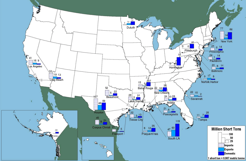
The Port of Huntington Tri-State, centered on the Ohio River in Huntington, West Virginia, is the second-largest inland port in the United States, and was formerly the largest. It is the largest river port in the state of West Virginia and the 15th-largest in the United States as of 2012. Included in the port's area is 100 miles of the Ohio River from the mouth of the Scioto River in Portsmouth, Ohio to the northern border of Gallia County, Ohio, 9 miles of the Big Sandy River, and 90 miles of the Kanawha River. The United States Army Corps of Engineers' 1953 Ohio River Navigation Modernization Program sited the Greenup Locks and Dam project as an early priority so that its pool could serve the Port of Huntington Tri-State. It exceeded Pittsburgh in 1953 as the busiest port on the waterway. In 2014, it was exceeded by the Port of Cincinnati-Northern Kentucky in annual cargo tonnage, making it the second-largest inland port in the United States. See also *List of ports in the U ... [...More Info...] [...Related Items...] OR: [Wikipedia] [Google] [Baidu] |
Huntington, West Virginia
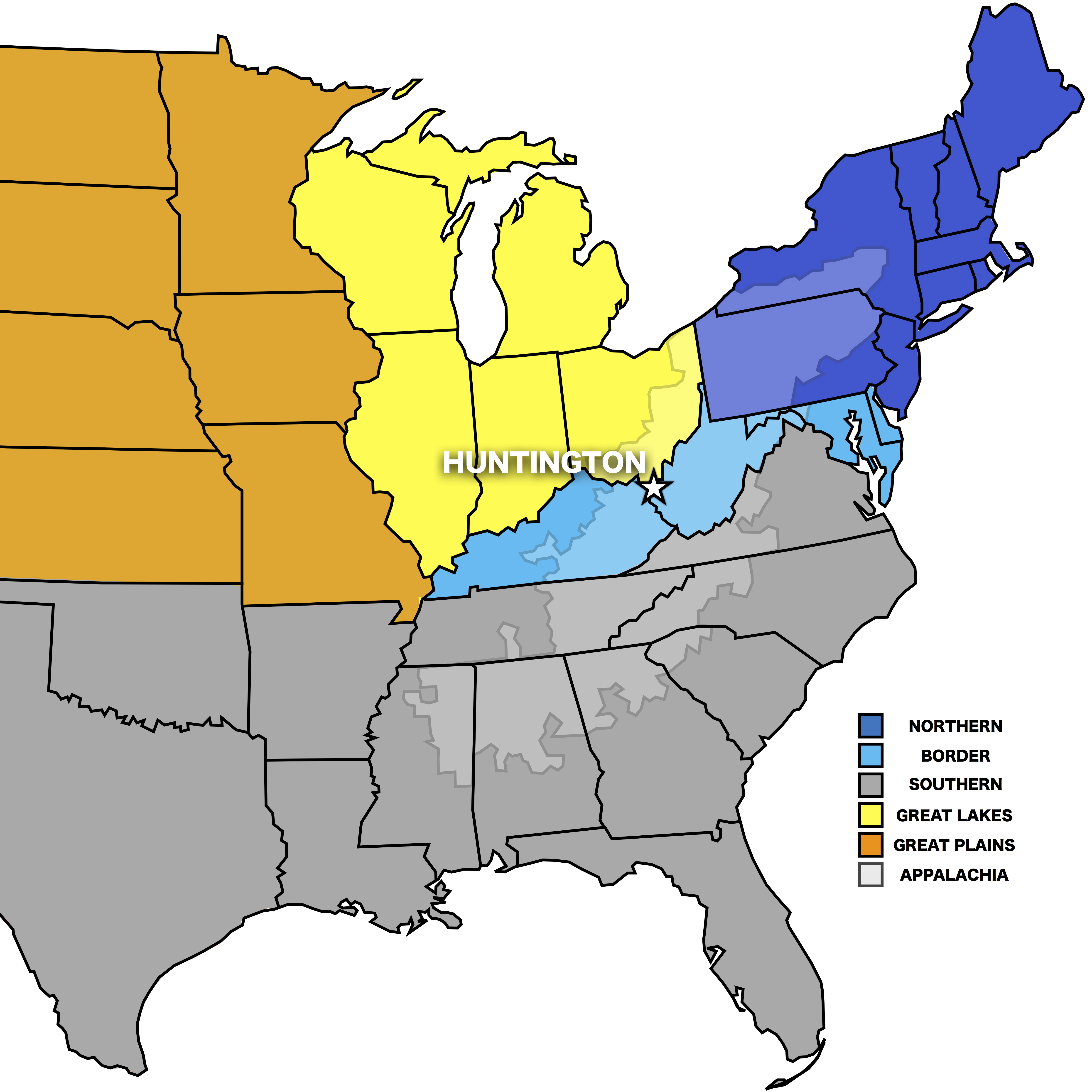
Huntington is a city in Cabell and Wayne counties in the U.S. state of West Virginia. It is the county seat of Cabell County, and the largest city in the Huntington–Ashland metropolitan area, sometimes referred to as the Tri-State Area. A historic and bustling city of commerce and heavy industry, Huntington has benefited from its location on the Ohio River at the mouth of the Guyandotte River. It is home to the Port of Huntington Tri-State, the second-busiest inland port in the United States. As of the 2020 census, its metro area is the largest in West Virginia, spanning seven counties across three states and having a population of 359,862. Huntington is the second-largest city in West Virginia, with a population of 46,842 at the 2020 census. Both the city and metropolitan area declined in population from the 2010 census, a trend that has been ongoing for six decades as Huntington has lost over 40,000 residents in that time frame. Surrounded by extensive natural resources, ... [...More Info...] [...Related Items...] OR: [Wikipedia] [Google] [Baidu] |
Ohio River
The Ohio River is a long river in the United States. It is located at the boundary of the Midwestern and Southern United States, flowing southwesterly from western Pennsylvania to its mouth on the Mississippi River at the southern tip of Illinois. It is the third largest river by discharge volume in the United States and the largest tributary by volume of the north-south flowing Mississippi River that divides the eastern from western United States. It is also the 6th oldest river on the North American continent. The river flows through or along the border of six states, and its drainage basin includes parts of 14 states. Through its largest tributary, the Tennessee River, the basin includes several states of the southeastern U.S. It is the source of drinking water for five million people. The lower Ohio River just below Louisville is obstructed by rapids known as the Falls of the Ohio where the elevation falls in restricting larger commercial navigation, although in the 18th ... [...More Info...] [...Related Items...] OR: [Wikipedia] [Google] [Baidu] |
West Virginia
West Virginia is a state in the Appalachian, Mid-Atlantic and Southeastern regions of the United States.The Census Bureau and the Association of American Geographers classify West Virginia as part of the Southern United States while the Bureau of Labor Statistics classifies the state as a part of the Mid-Atlantic regionMid-Atlantic Home : Mid-Atlantic Information Office: U.S. Bureau of Labor Statistics" www.bls.gov. Archived. It is bordered by Pennsylvania to the north and east, Maryland to the east and northeast, Virginia to the southeast, Kentucky to the southwest, and Ohio to the northwest. West Virginia is the 10th-smallest state by area and ranks as the 12th-least populous state, with a population of 1,793,716 residents. The capital and largest city is Charleston. West Virginia was admitted to the Union on June 20, 1863, and was a key border state during the American Civil War. It was the only state to form by separating from a Confederate state, the second to sepa ... [...More Info...] [...Related Items...] OR: [Wikipedia] [Google] [Baidu] |
List Of Ports In The United States
This is a list of ports of the United States, ranked by tonnage. See the articles on individual ports for more information, including geography, ownership, and link to official website. List by 2022 figures Not ranked * Alpena, Michigan * Aransas Pass, Texas * Biloxi, Mississippi * Bridgeport, Connecticut * Buffalo, New York * Buffington, Indiana * Chattanooga, Tennessee * Port of CatoosaTulsa Ports, Tulsa,Oklahoma * Port of Chester, Pennsylvania * Port of Davisville, Rhode Island * Drummond Island, Michigan * Elvis Stahr Harbor, Kentucky * Exxon Terminal, East Providence, Rhode Island * Eureka, California * Everett, Washington * Fairport Harbor, Ohio * Fall River, Massachusetts * Grand Haven, Michigan * Grays Harbor, Washington * Green Bay, Wisconsin * Gulfport, Mississippi * Guntersville, Alabama * Helena, Arkansas * Town of Hempstead, New York * Hilo, Hawaii * Hopewell, Virginia * Iliuliuk Harbor, Alaska * Intracoastal City, Louisiana * Joliet, Illinois * Juneau, Al ... [...More Info...] [...Related Items...] OR: [Wikipedia] [Google] [Baidu] |
Scioto River
The Scioto River ( ) is a river in central and southern Ohio more than in length. It rises in Hardin County just north of Roundhead, Ohio, flows through Columbus, Ohio, where it collects its largest tributary, the Olentangy River, and meets the Ohio River at Portsmouth. Early settlers and Native Americans used the river for shipping,"Scioto River – Ohio History Central" but it is now too small for modern commercial craft. The primary economic importance for the river now is for recreation and drinking water. It is the longest river that is entirely within Ohio. Geography and geology The lower Scioto River valley is large compared to the width of the river and is extensively farmed. Meltwaters from retreating glaciers carved the valley exceptionally wide. Valley bottoms are smooth, and flood deposits created during and since the most recent Glacial period cause floodplain soils to be very productive. As a result, farms line much of the lower Scioto where it flows through lo ... [...More Info...] [...Related Items...] OR: [Wikipedia] [Google] [Baidu] |
Portsmouth, Ohio
Portsmouth is a city in and the county seat of Scioto County, Ohio, United States. Located in southern Ohio south of Chillicothe, it lies on the north bank of the Ohio River, across from Kentucky, just east of the mouth of the Scioto River. The population was 20,226 at the 2010 census. Portsmouth also stands as the state's 88th most populated city. History Foundation The area was occupied by Native Americans as early as 100 BC, as indicated by the Portsmouth Earthworks, a ceremonial center built by the Ohio Hopewell culture between 100 and 500 AD. According to early 20th-century historian Charles Augustus Hanna, a Shawnee village was founded at the site of modern-day Portsmouth in late 1758, following the destruction of Lower Shawneetown by floods. European-Americans began to settle in the 1790s after the American Revolutionary War, and the small town of Alexandria was founded. Located at the confluence, Alexandria was flooded numerous times by the Ohio and the Scioto r ... [...More Info...] [...Related Items...] OR: [Wikipedia] [Google] [Baidu] |
Gallia County, Ohio
Gallia County (pronunciation: ''GAL-yuh'') is a county located in the U.S. state of Ohio. As of the 2020 census, the population was 29,220. Its county seat is Gallipolis. Named after the French people who originally settled there, its name “Gallia” is the Latin word for Gaul, the ancient region of Western Europe that included present day France. Gallia County is part of the Point Pleasant, WV-OH Micropolitan Statistical Area. History Gallia County was formed on March 25, 1803, from portions of Adams and Washington counties. Gallia County had originally been settled by French immigrants, who named the county “Gallia,” the Latin name for Gaul, the ancient region of Western Europe which included present day France. In the 19th century, the county was settled by numerous migrants from the Upper South, who traveled to the territory by the Ohio River. In the antebellum years, some of its towns became centers of settlement by African Americans, both free blacks (some also fr ... [...More Info...] [...Related Items...] OR: [Wikipedia] [Google] [Baidu] |
Big Sandy River (Ohio River)
The Big Sandy River is a tributary of the Ohio River, approximately long,U.S. Geological Survey. National Hydrography Dataset high-resolution flowline dataThe National Map, accessed June 13, 2011 in western West Virginia and northeastern Kentucky in the United States. The river forms part of the boundary between the two states along its entire course. Via the Ohio River, it is part of the Mississippi River watershed. It is formed between Louisa, Kentucky, and Fort Gay, West Virginia, by the confluence of the Tug Fork and Levisa Fork. It flows generally northwardly in a highly meandering course, between Lawrence and Boyd counties in Kentucky and Wayne County in West Virginia. It joins the Ohio between Catlettsburg, Kentucky and Kenova, West Virginia, west of Huntington, West Virginia, at the common boundary between West Virginia, Kentucky, and Ohio. The river is navigable and carries commercial shipping, primarily coal mined in the immediate region. The name of the river ... [...More Info...] [...Related Items...] OR: [Wikipedia] [Google] [Baidu] |
Kanawha River
The Kanawha River ( ) is a tributary of the Ohio River, approximately 97 mi (156 km) long, in the U.S. state of West Virginia. The largest inland waterway in West Virginia, its valley has been a significant industrial region of the state since early in the 19th century. It is formed at the town of Gauley Bridge, West Virginia, Gauley Bridge in northwestern Fayette County, West Virginia, Fayette County, approximately 35 mi (56 km) SE of Charleston, West Virginia, Charleston, by the Confluence (geography), confluence of the New River (Kanawha River), New and Gauley River, Gauley rivers. It flows generally northwest, in a winding course on the unglaciated Allegheny Plateau, through Fayette, Kanawha County, West Virginia, Kanawha, Putnam County, West Virginia, Putnam, and Mason County, West Virginia, Mason counties, past the cities of Charleston and St. Albans, West Virginia, St. Albans, and numerous smaller communities. It joins the Ohio at Point Pleasant, West Vi ... [...More Info...] [...Related Items...] OR: [Wikipedia] [Google] [Baidu] |
Greenup Lock And Dam
Greenup Lock and Dam is the 11th Lock and dam on the Ohio River, located 341 miles downstream of Pittsburgh. There are 2 locks, one for commercial barge traffic that's 1,200 feet long by 110 feet wide, and the auxiliary lock is 600 feet long by 110 feet wide. Gallery File:Ohio River Flood.jpg, The Dam from the Ohio side with the Ohio River at 58 feet See also * List of locks and dams of the Ohio River * List of locks and dams of the Upper Mississippi River * Jesse Stuart Memorial Bridge, viaduct highway bridge that crosses over the Greenup Lock and Dam References External linksU.S. Army Corps of Engineers, Pittsburgh District [...More Info...] [...Related Items...] OR: [Wikipedia] [Google] [Baidu] |
Port Of Pittsburgh
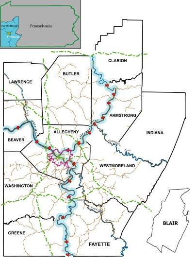
The Port of Pittsburgh is a vast river traffic region in southwestern Pennsylvania. It spans a twelve-county area including Allegheny, Armstrong, Beaver, Blair, Butler, Clarion, Fayette, Greene, Indiana, Lawrence, Washington, and Westmoreland Counties. It encompasses essentially all 200 miles of commercially navigable waterways in southwestern Pennsylvania, including the three major rivers in this region: the Allegheny, the Monongahela, and the Ohio. These waterways are made navigable by a system of seventeen locks and dams. The Port of Pittsburgh supports over 200 river terminals and barge industry service suppliers, including privately owned public river terminals. The port complex is served by the CSX and Norfolk Southern railroads and by four interstate highways. The Port of Pittsburgh Commission acts as a comprehensive service for shippers and industries seeking information on the river system. Unlike the Port of Miami, for example, the Port of Pittsburgh does not re ... [...More Info...] [...Related Items...] OR: [Wikipedia] [Google] [Baidu] |
List Of North American Ports
Lists of ports cover ports of various types, maritime facilities with one or more wharves where ships may dock to load and discharge passengers and cargo. Most are on the sea coast or an estuary, but some are many miles inland, with access to the sea via river or canal. The lists are organized by shipping volume, by ocean or sea, by nation or sub-region, and by other characteristics. Lists of busiest ports * Lists of the world's busiest ports – list of ports that claim to be the world's busiest by various measures * List of busiest container ports – by number of twenty-foot equivalent units (TEUs) transported through the port * List of busiest ports by cargo tonnage – by weight of cargo transported through the port * List of busiest ports in Europe – by several measures including number of twenty-foot equivalent units (TEUs) handled, by cargo tonnage and percentage transshipment * List of busiest cruise ports by passengers Lists by ocean or sea * List of ports and ha ... [...More Info...] [...Related Items...] OR: [Wikipedia] [Google] [Baidu] |


.jpg)